Davenport to Low Head
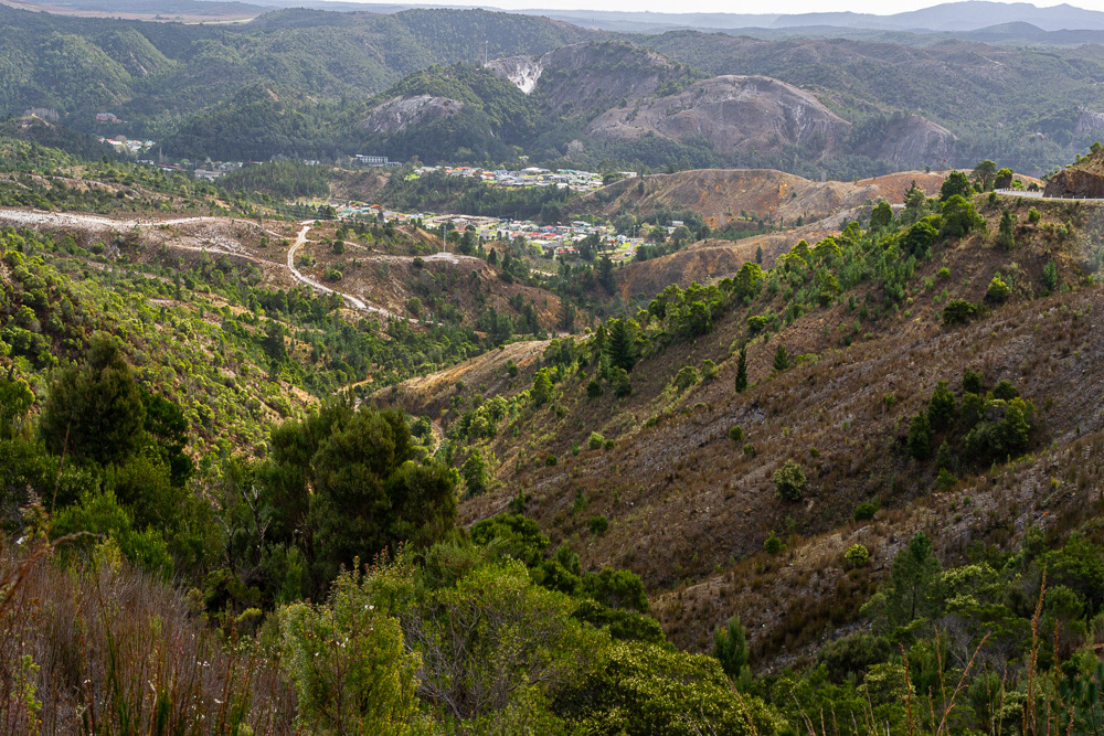
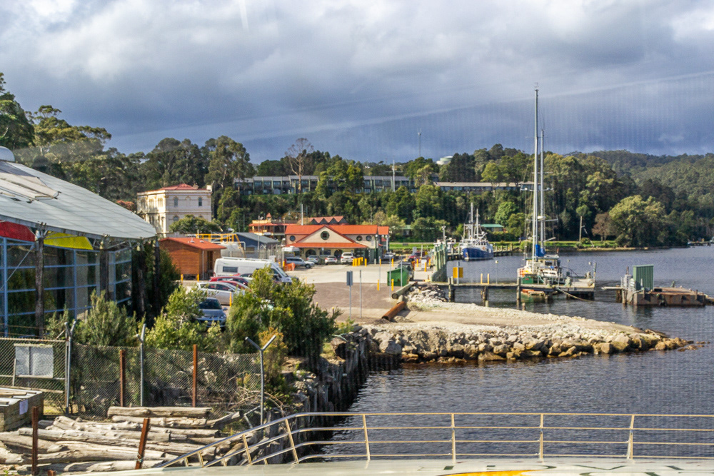
Day one after departing the ferry at Devonport we head towards the east coast following the Tamar Valley and passing through the historic gold mining town of Beaconsfield before arriving at Low Head at the mouth of the Tamar River.
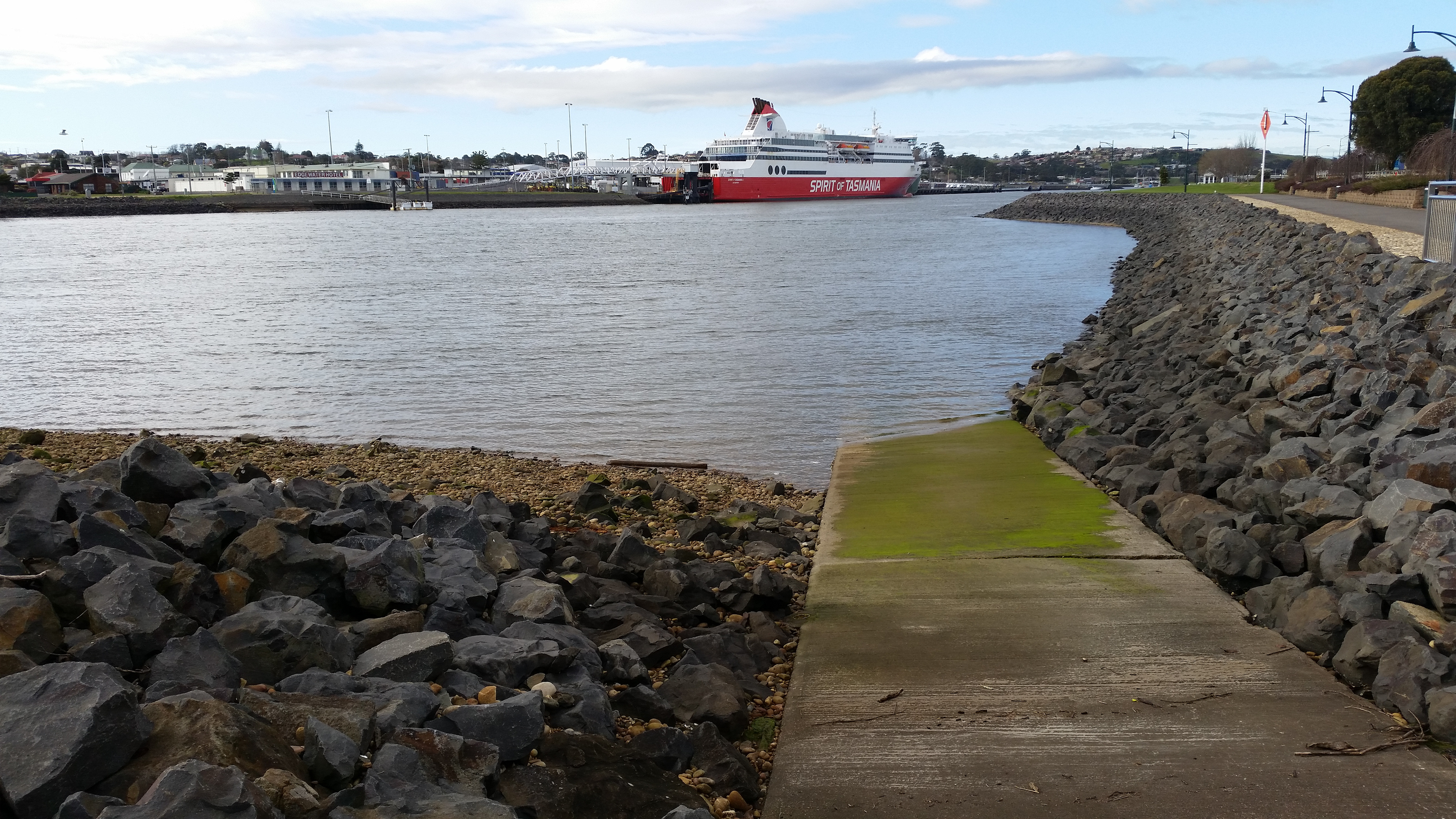
We say farewell to the Spirit of Tasmania as we start our tour of Tassie.

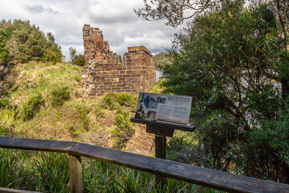
Beaconsfield's historic gold mine buildings.
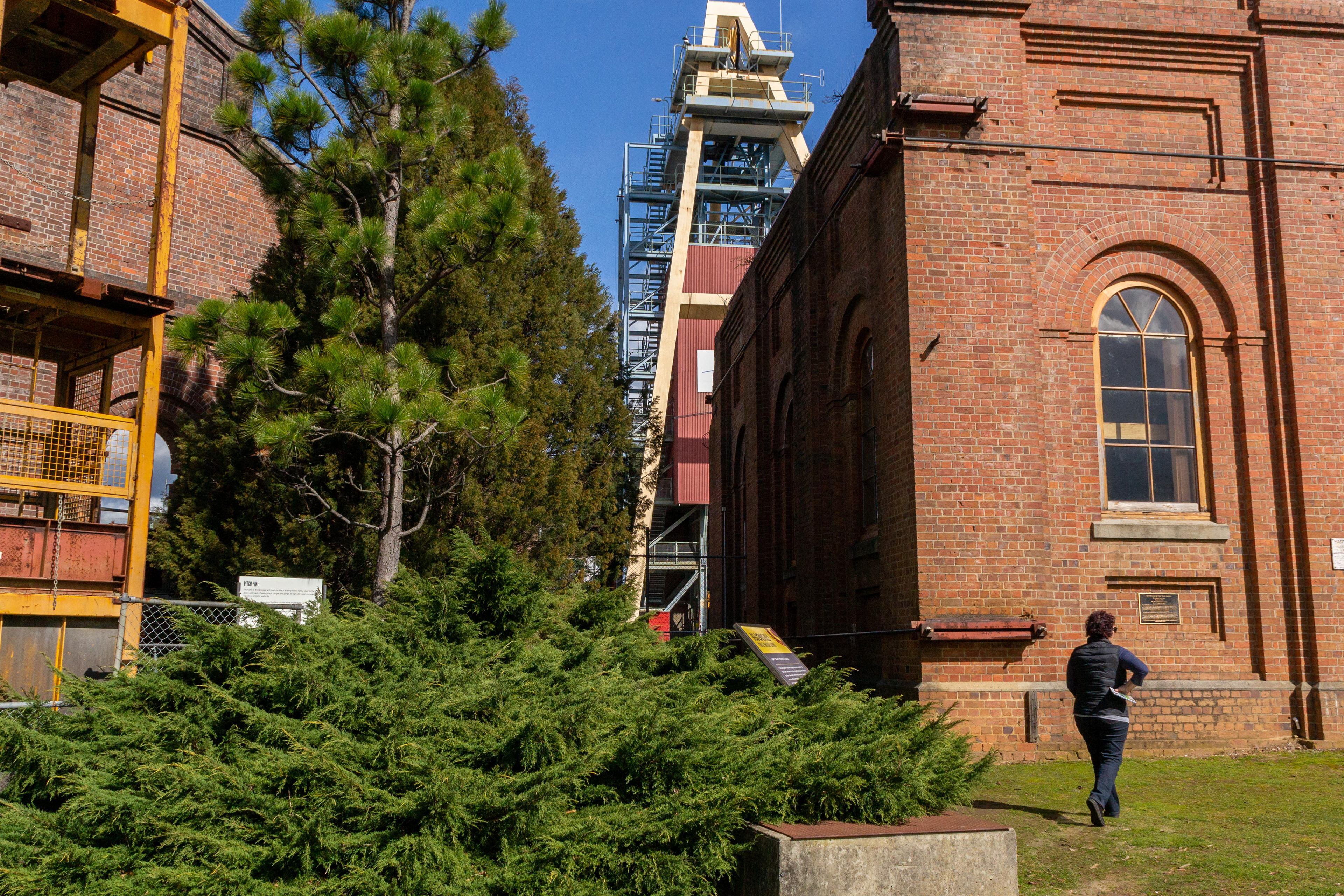
Cheryl checks out the information plaque.
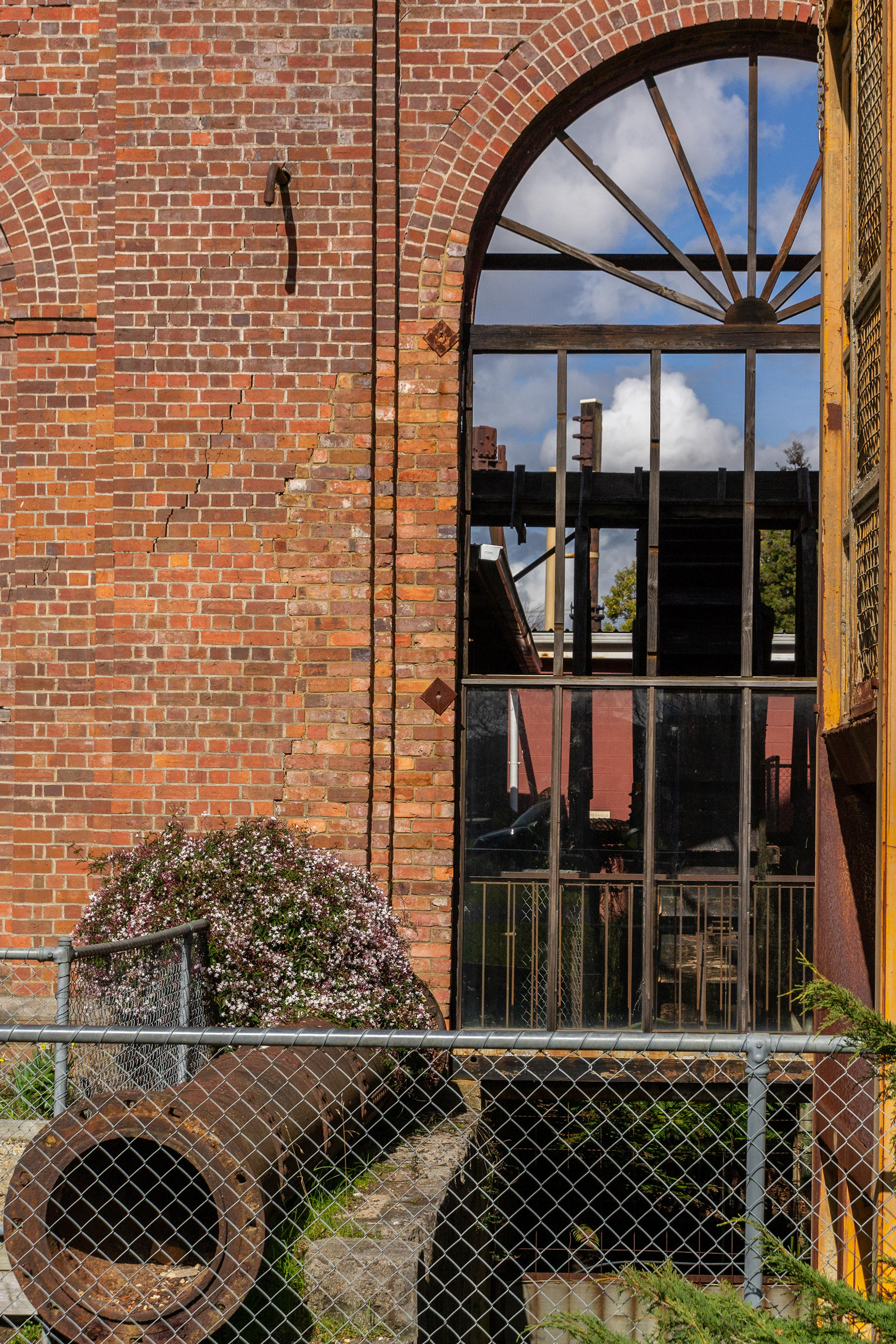
A glimpse inside the historic workings now preserved as a museum.
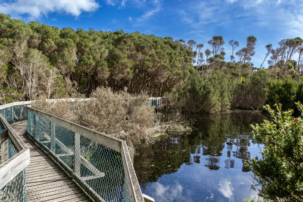
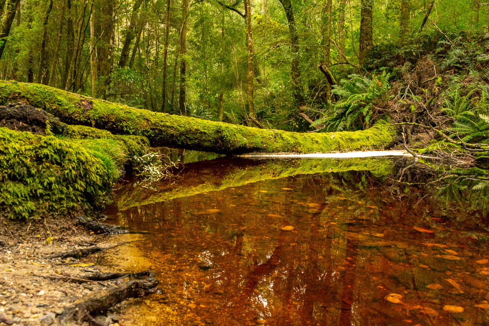
Boardwalk through the wetlands of Narawntapu National Park
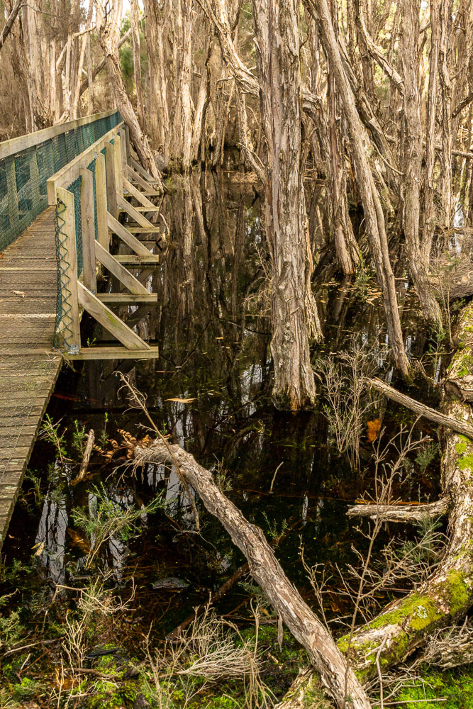
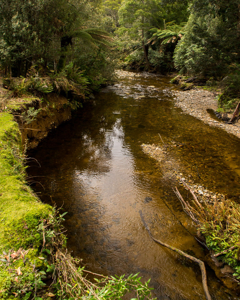
Tannin stained waters submerge the roots of the tea-trees in the forest.
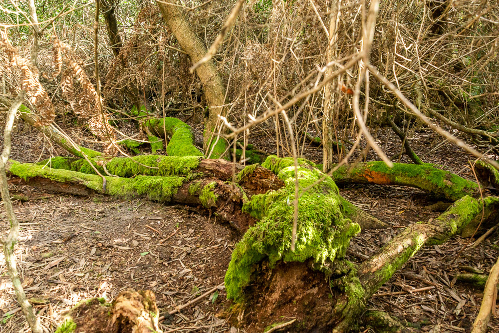
Moss and lichen covered tree trunks slowly decay into the environment.
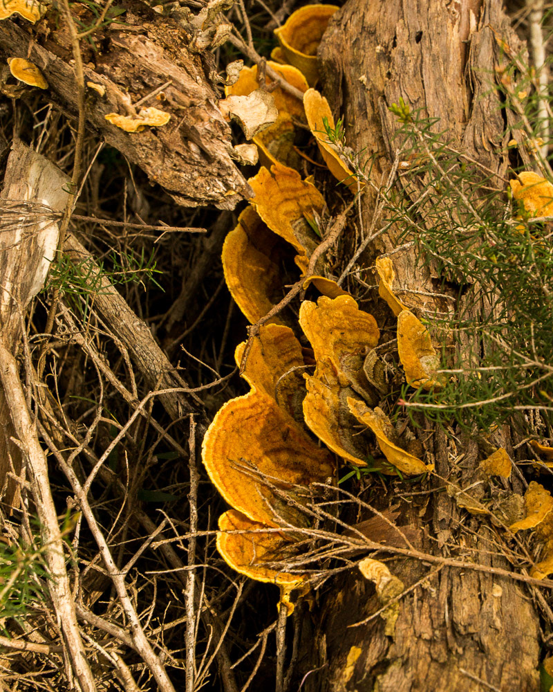
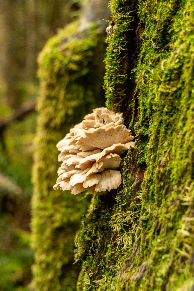
A splash of colourful fungi sprout from a tree-trunk.

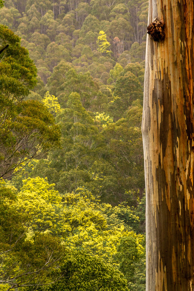
Green and gold wattle blooms remind that it's still Australia.
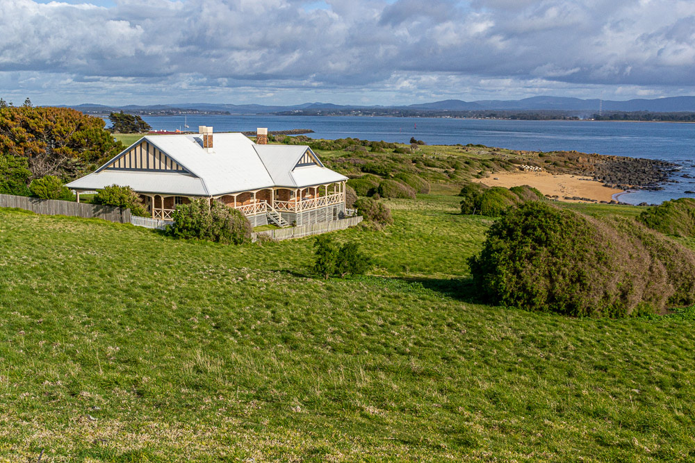
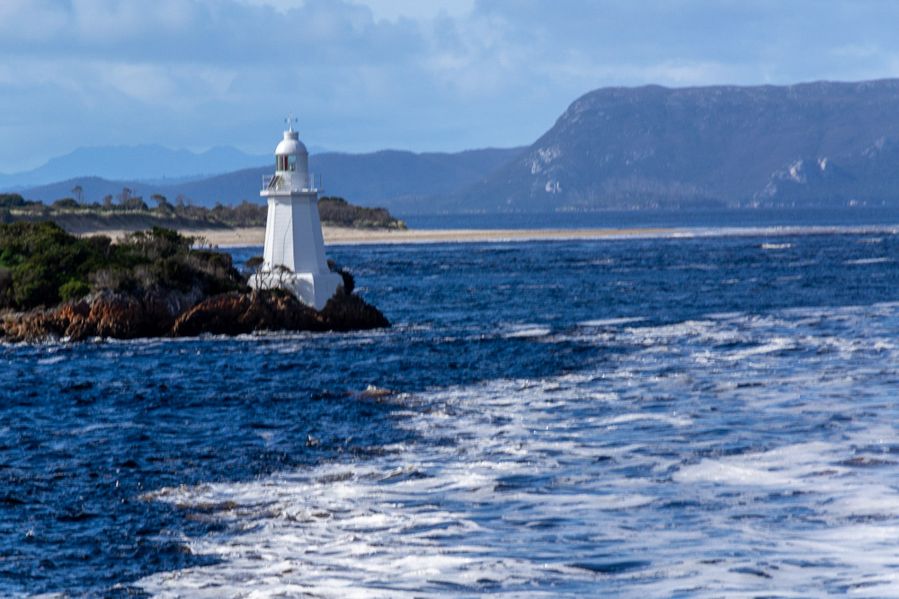
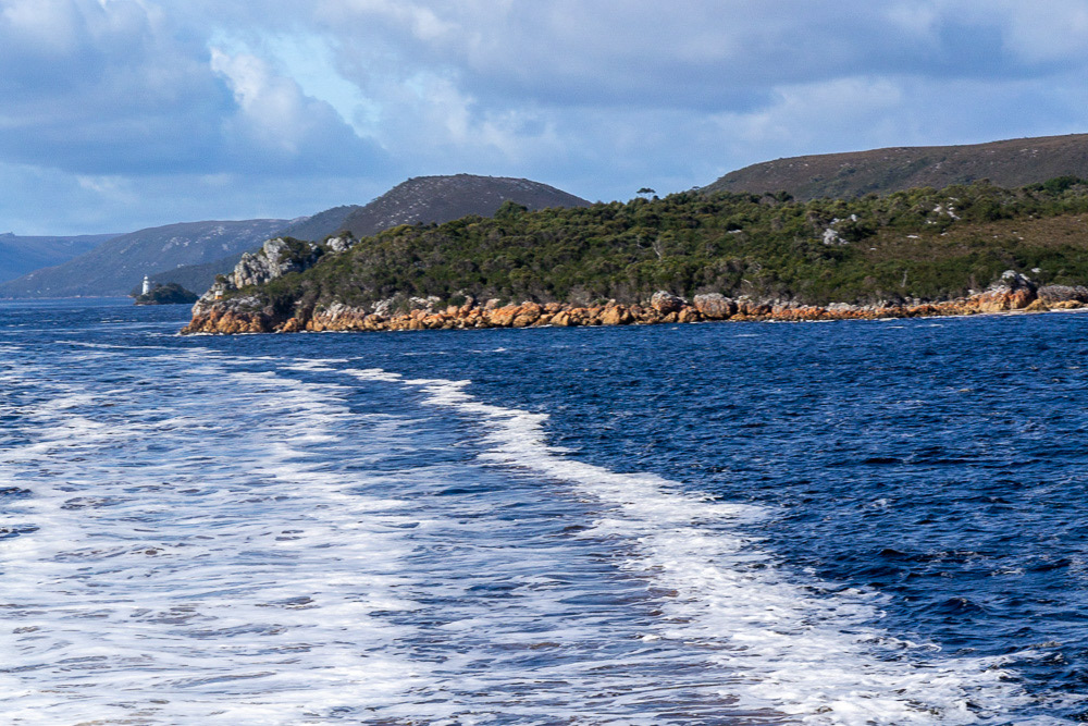
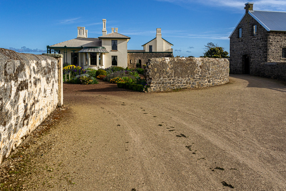
Low Head - spectacular views over the Tamar River from the Lighthouse Keepers' residence.
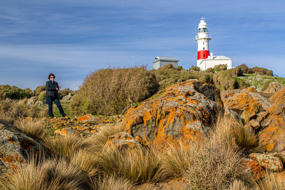
Cheryl stands in front of the Low Head Lighthouse. Commecned operating in 1833 it became Tasmania's second and the third one to be built in Australia.
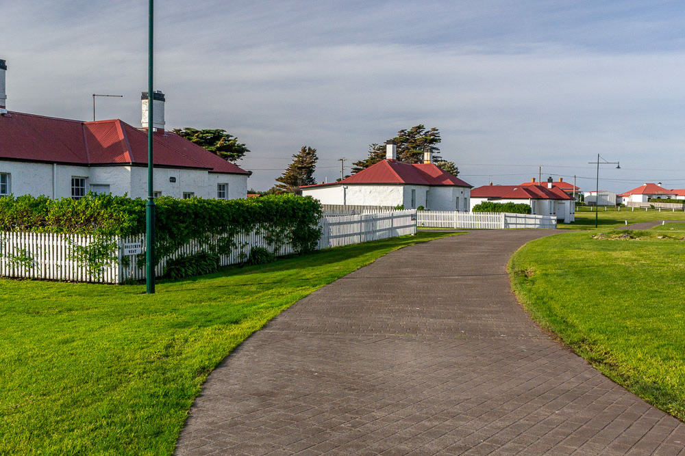
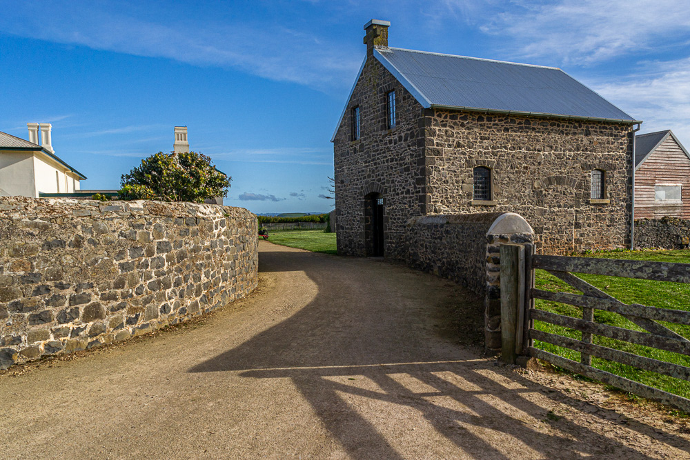
Low Head Pilot Station is Australia's oldest continuously used pilot station.
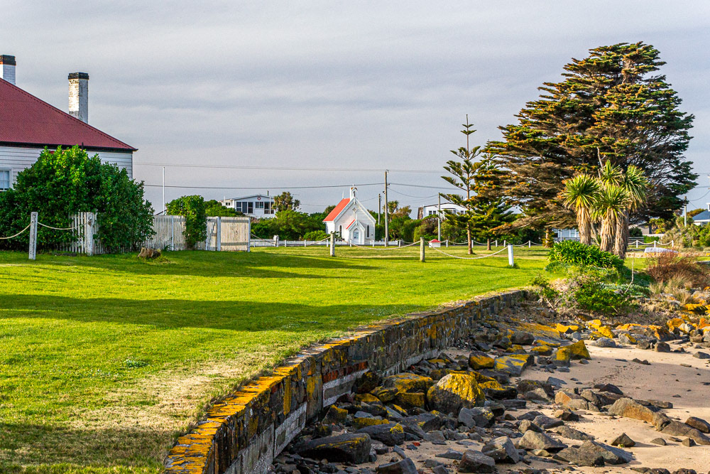
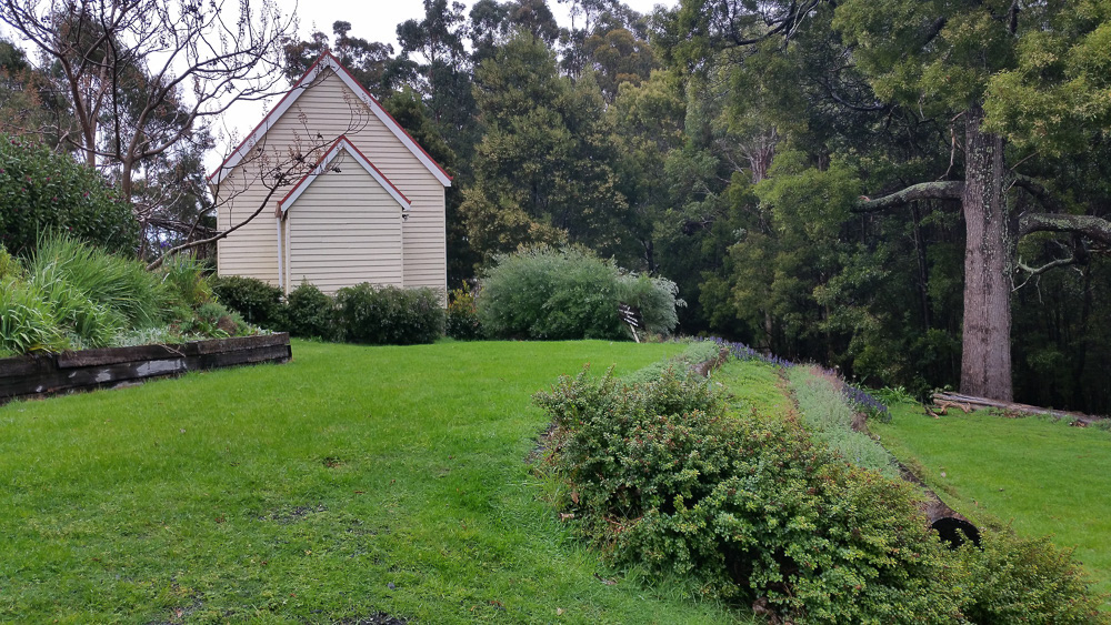
Low Head Pilot Station grounds. In the background is a little church is the oldest church building in the George Town municipality.
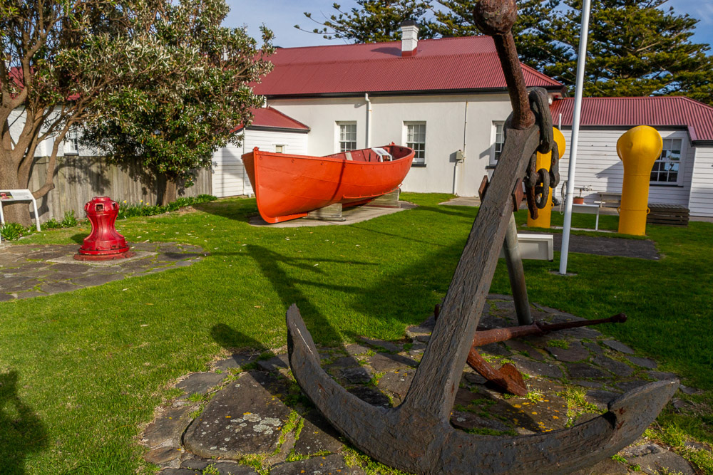
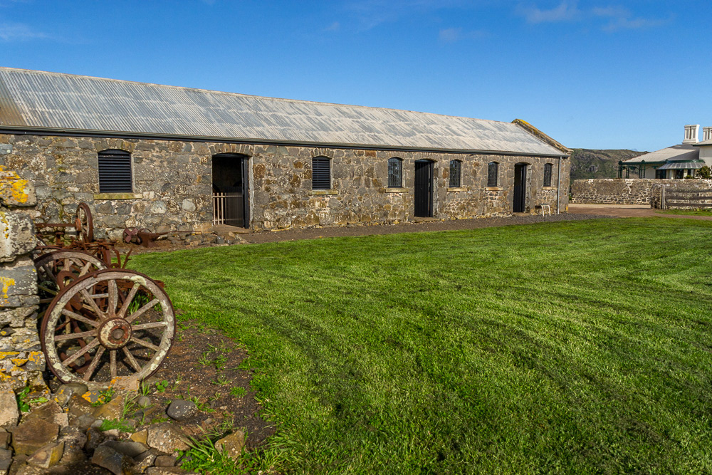
Historic maritime pieces in the museum of the Pilot Station, Low Head.
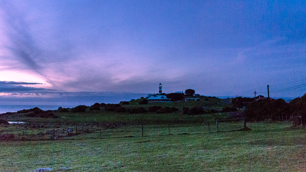
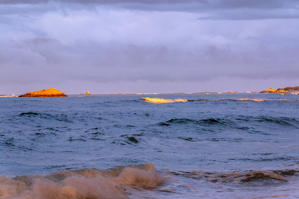
Sunset over Low Head Lighthouse.
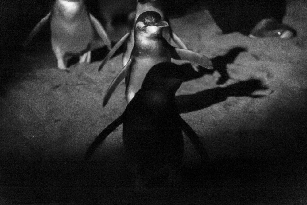
Fairy Penguins emerge from the waters of Bass Strait after sundown making their way back to burrows.
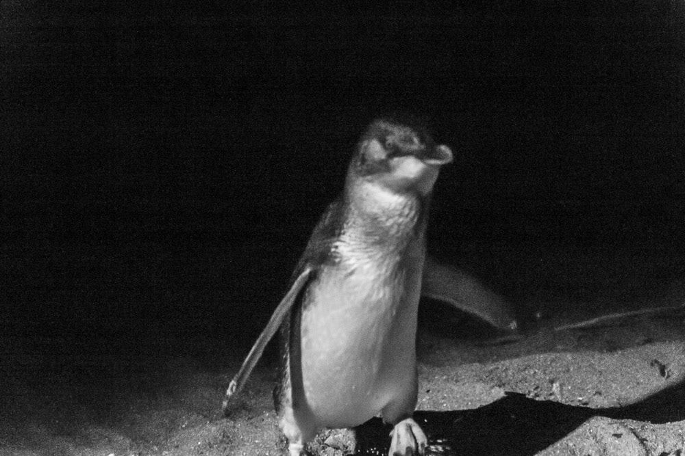
Fairy Penguin, Low Head.
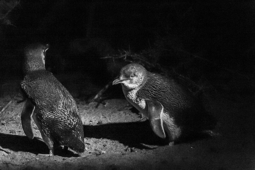
Fairy Penguins, Low Head.
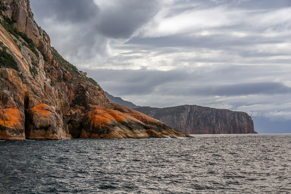
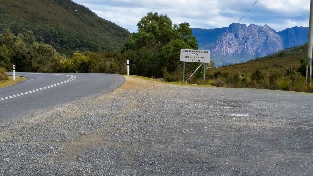
Mt William National Park
Leaving Low Head we continue our way east to the village of Gladstone (the namesake of our hometown), here we discover the Wilderness Beaches of the north-east and make our way to Mount William National Park for a couple of days and explore the beaches between Big Musselroe Bay and Eddystone Point.
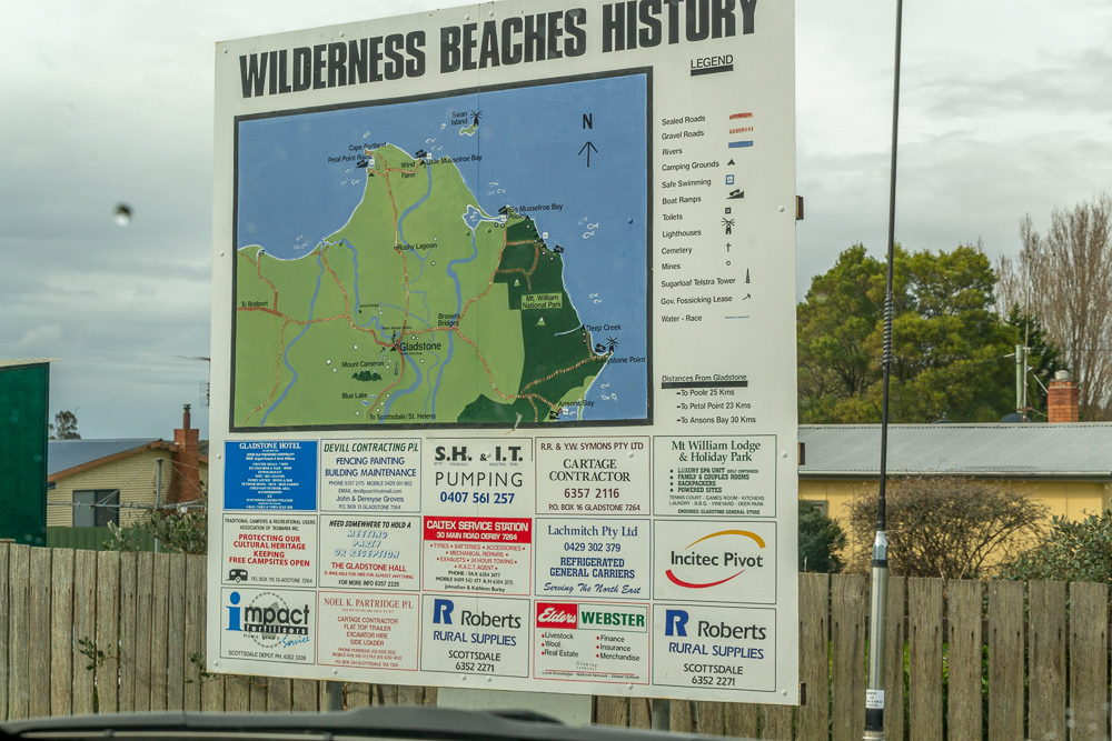
We drive into the village of Gladstone and discover the Wilderness Beaches.
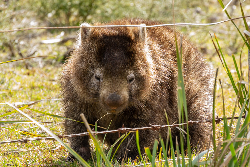
"Don't fence me in" - this Wombat casually strolls on the side of the road into Mt William National Park.
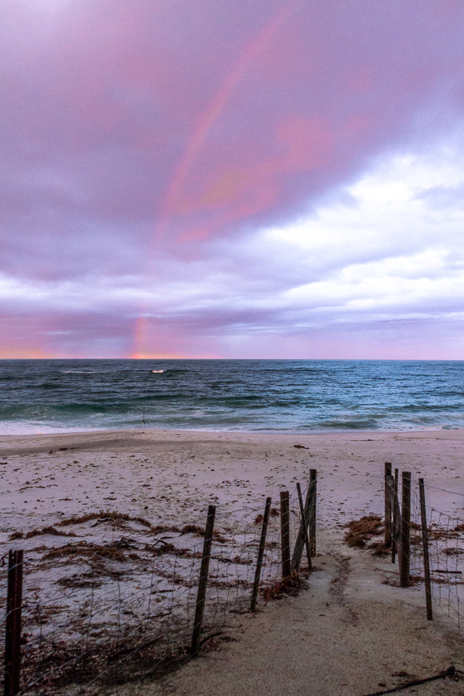
"After the storm" - a rainbow meets the horizon east of Big Musselroe Bay.
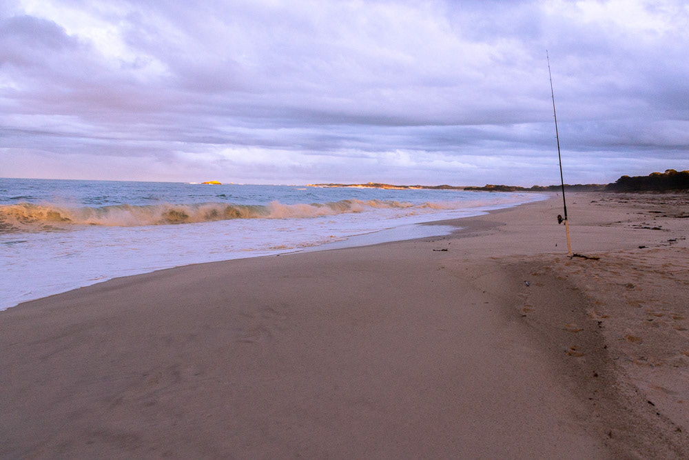
Deserted, apart from the fishing rod not a sole on the beach - Mt William National Park
Rocky outcrops, reefs and white caps are highlighted in the afternoon sunlight.
The pristine beach at Mt William National Park.

A tea-coloured freshwater stream breaks through the white sands.
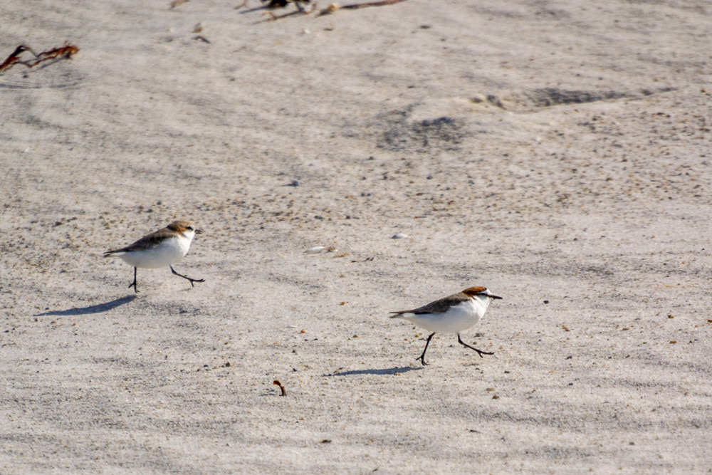
A male Red-capped Plover with a female in the background.

A juvenile Pacific Gull wind-surfs along the crest of a breaking wave.

"Golden hour" at Mt William National Park.
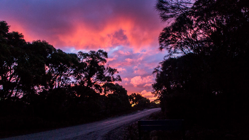
Much later the "blue-hour" colours change to hues of pink and mauve.
St. Colombia Falls
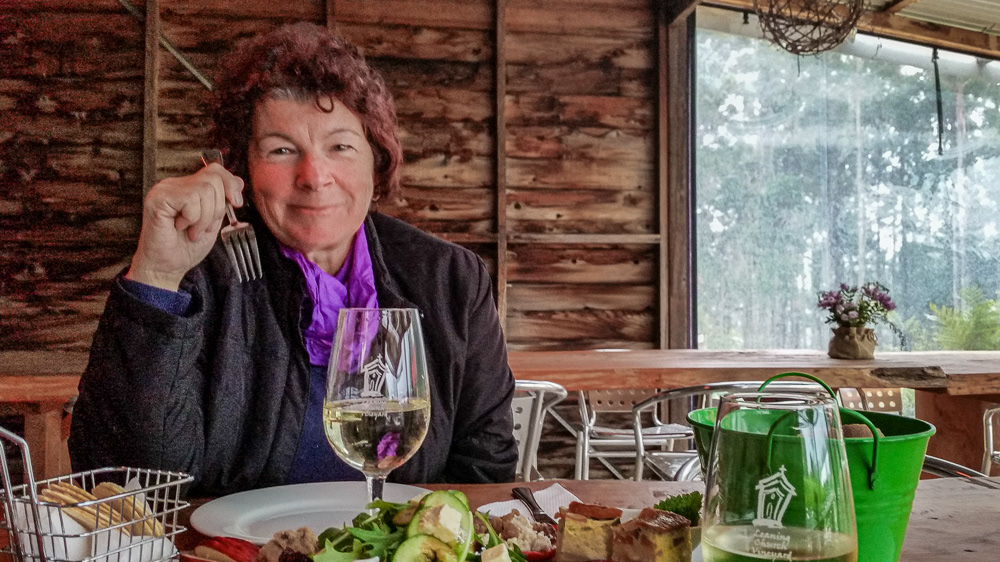
On our way to St Helens after leaving Mt William we explored several places, some off the well-beaten track. One of the more interesting being "The Pub in the Paddock" where we stopped for a beer and lunch.
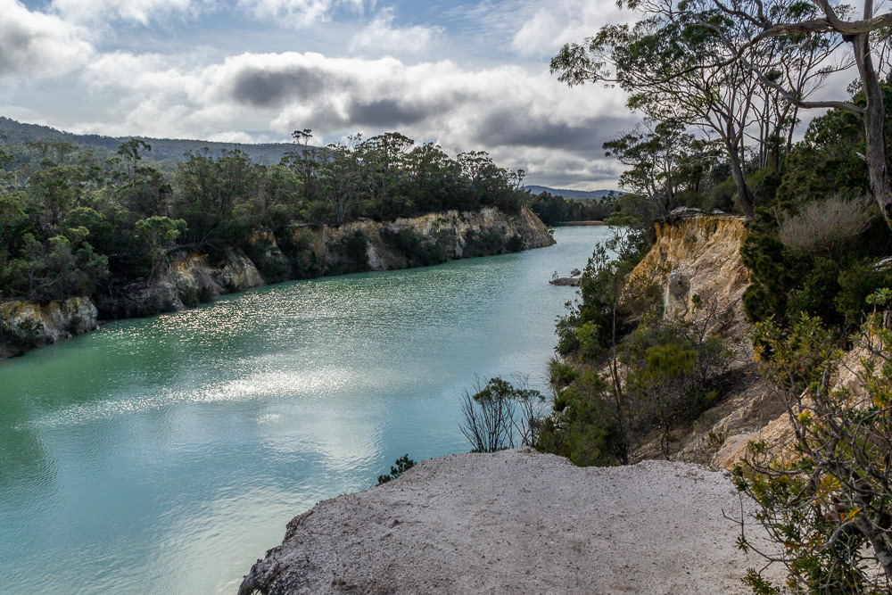
The rich blue of Little Blue Lake was formed from high levels of minerals in the soil, caused from previous mining.
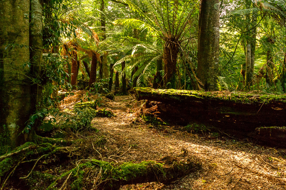
Giant Tree-ferns line this forest walk off the road to St Columbia.
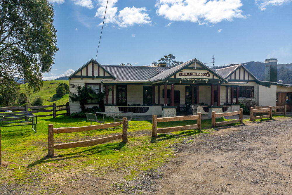
St Columbia Falls Hotel also called the "Pub in the Paddock" is one of Tasmania's oldest pubs, licensed since 1880.
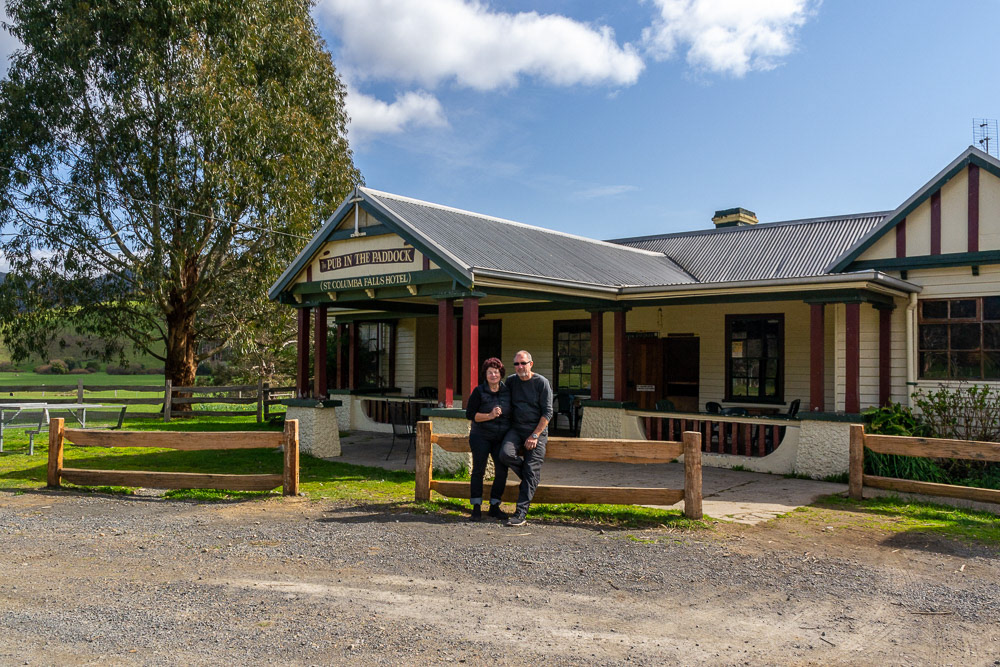
"Pub in the Paddock" we arrive in time for lunch.
Priscilla the beer swilling attraction at the Pub in the Paddock farmyard.

Priscilla downs the contents of her fav drop "Boarex".

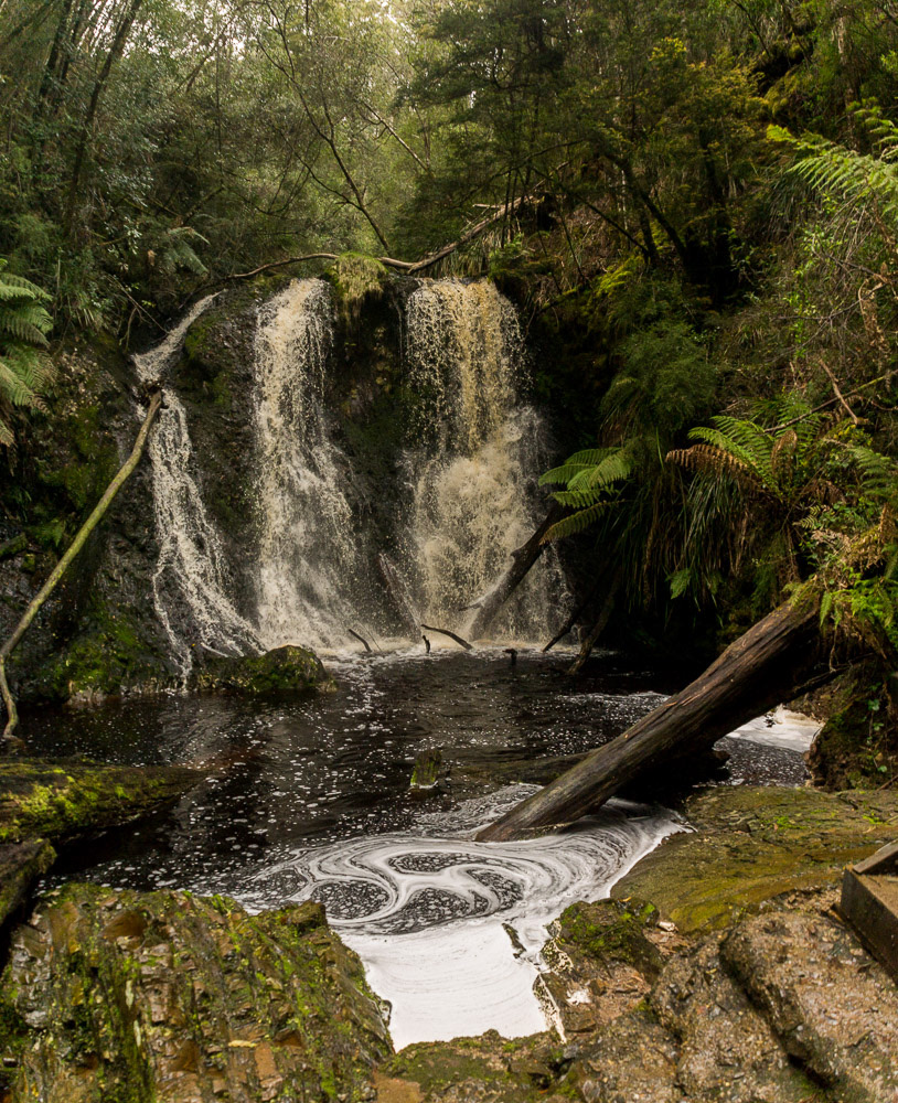
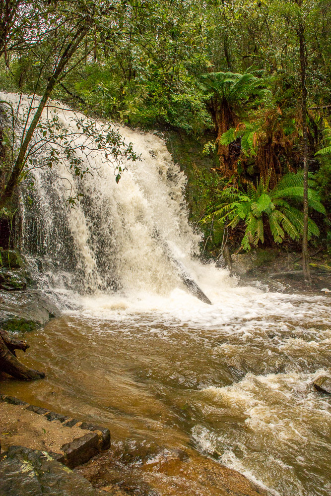
St. Columba Falls is one of Tasmania's tallest waterfalls, with a drop of over 90 metres.
Tree-ferns line the stream banks we make our way to the base of St Columbia falls.
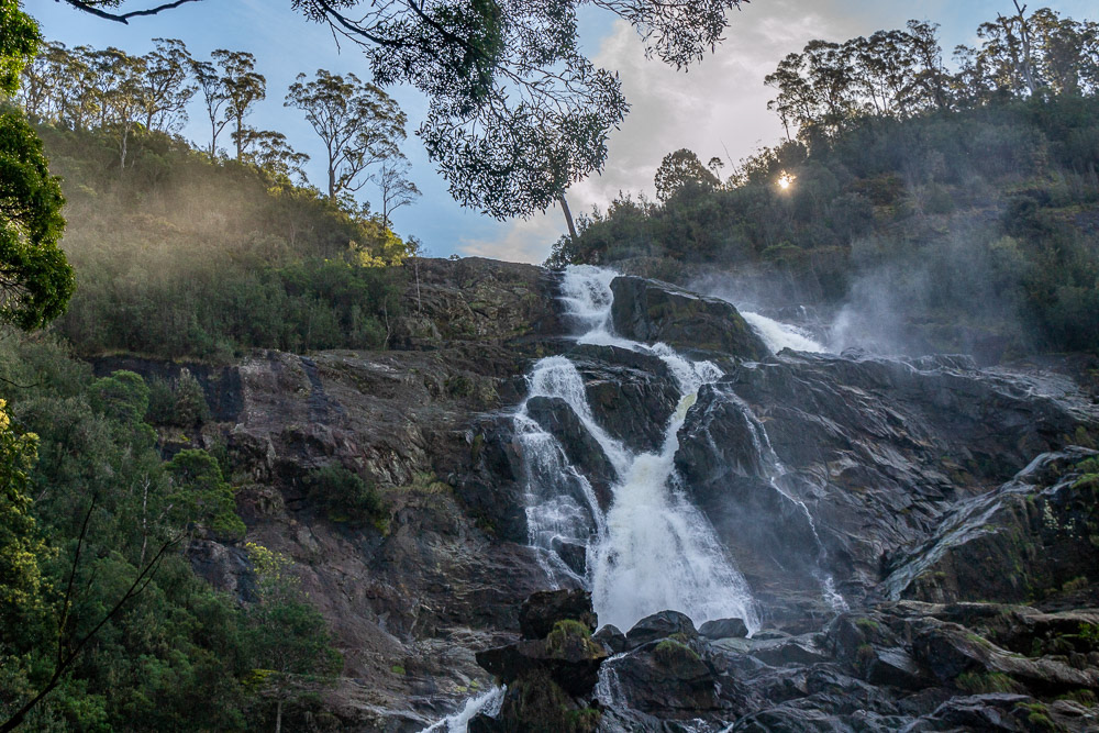
Mist rising from cascading water of St Columbia Falls is accentuated by the afternoon sun.
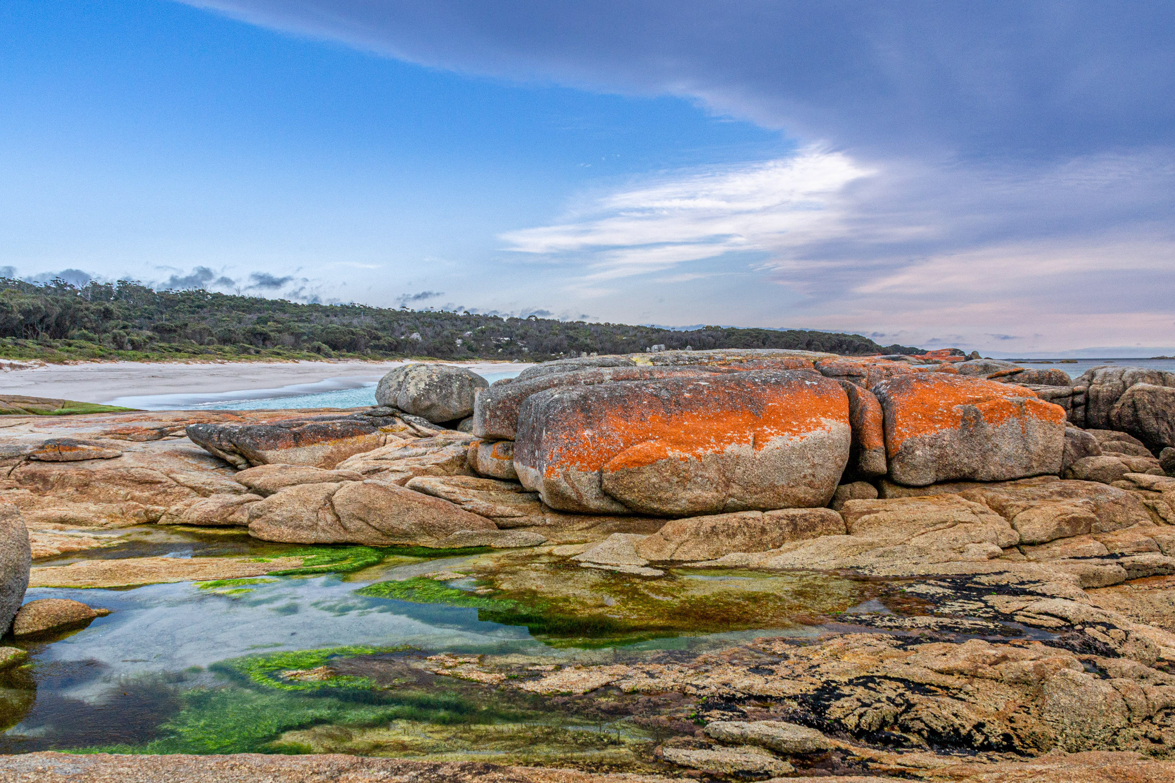
"Bay of Fires" - St Helens
After leaving Pyengana despite arriving late in the afternoon we found a beachside camp at Cosy Corner, Binalong Bay which is about 20 minutes north of St Helens and made this our base for the next couple of days.
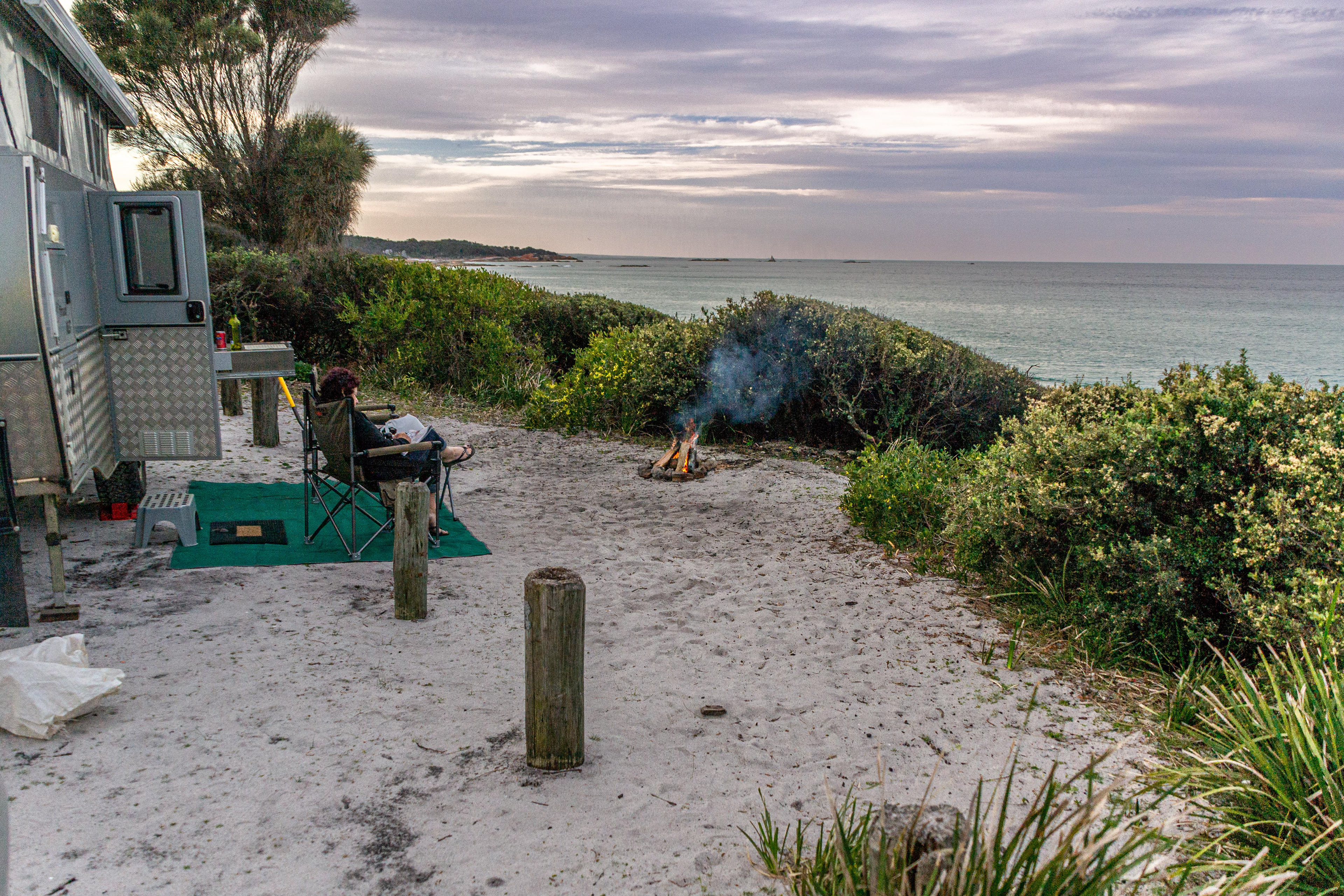
A top campsite right on the beach at Cosy Corner, St Helens - however as the fire suggests the weather is not too cosy.
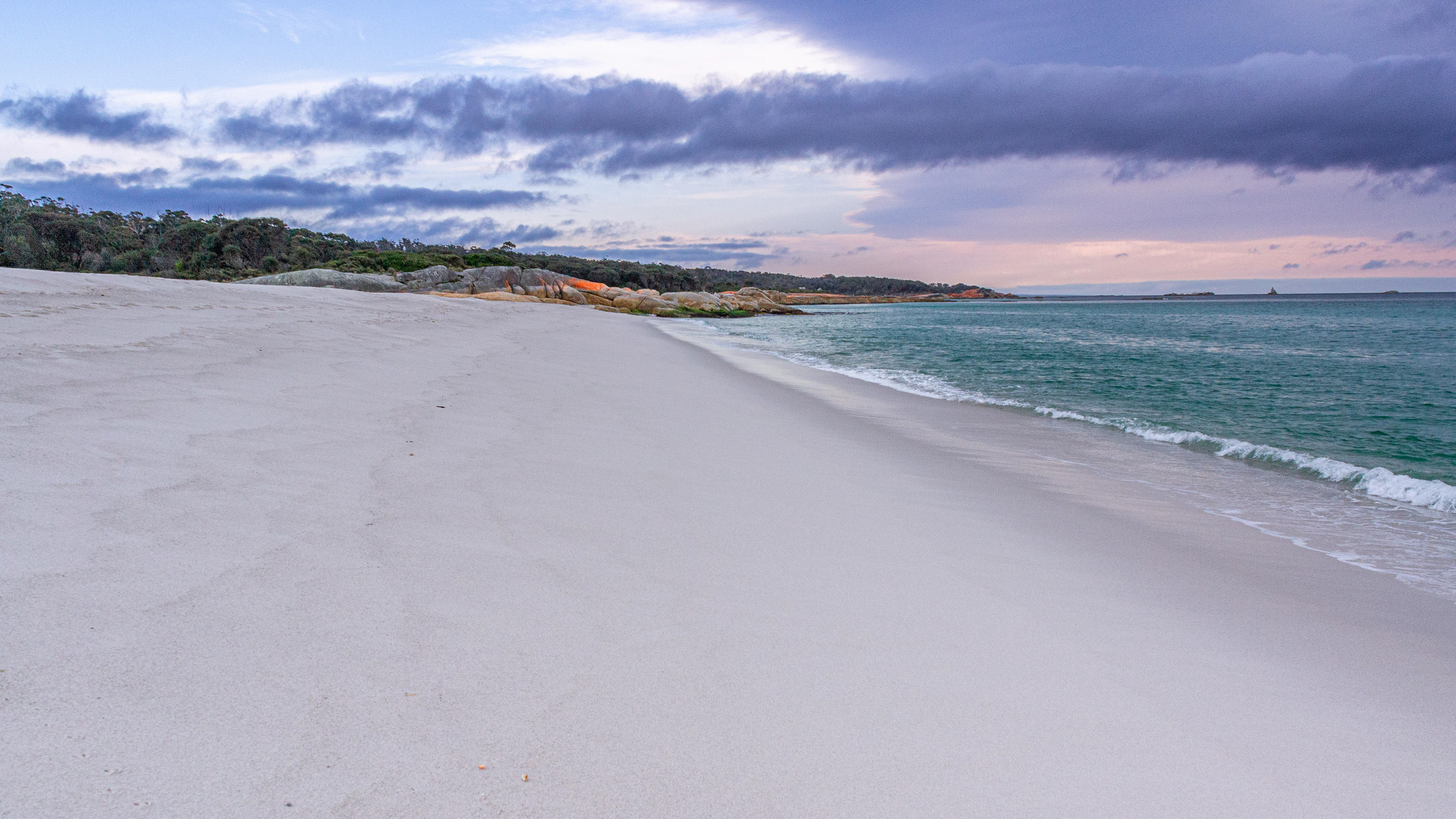
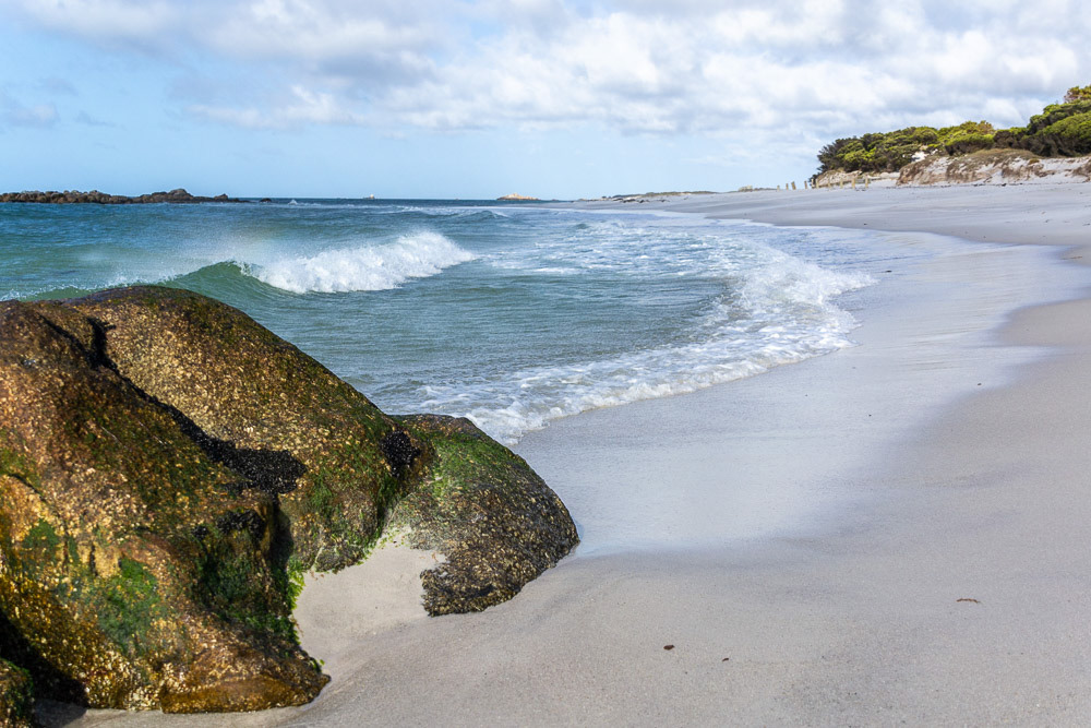
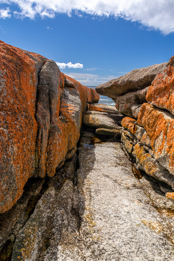
White sands, clear blue water and orange-hued granite rocks are synonymous with the Bay of Fires region which stretches from Binalong Bay up to Eddystone Point.

Tannin stained ponds attract wildlife from the adjacent bushlands.
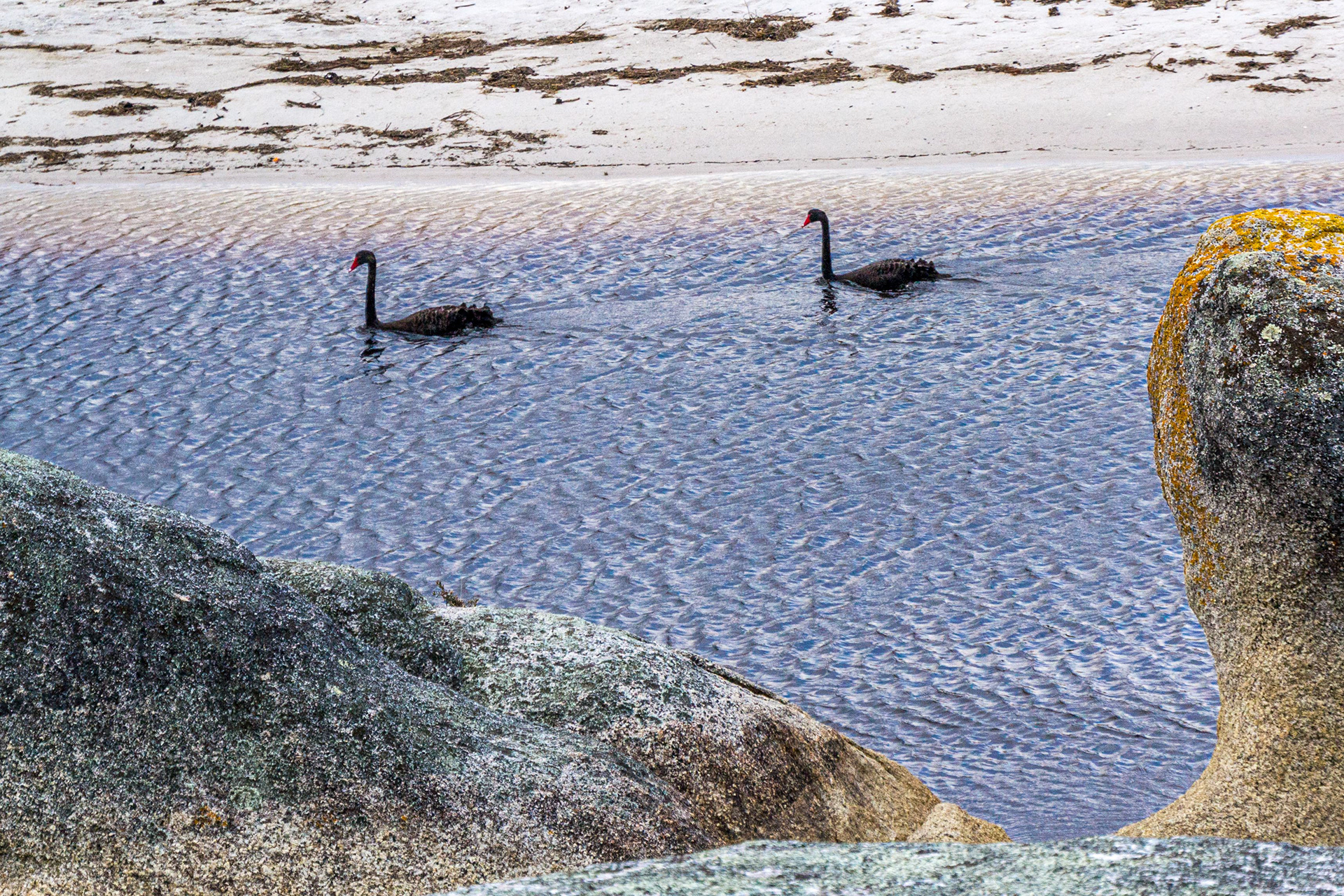
A pair of black swans enjoy an early morning paddle.

A Mountain Dragon having a day on the beach.
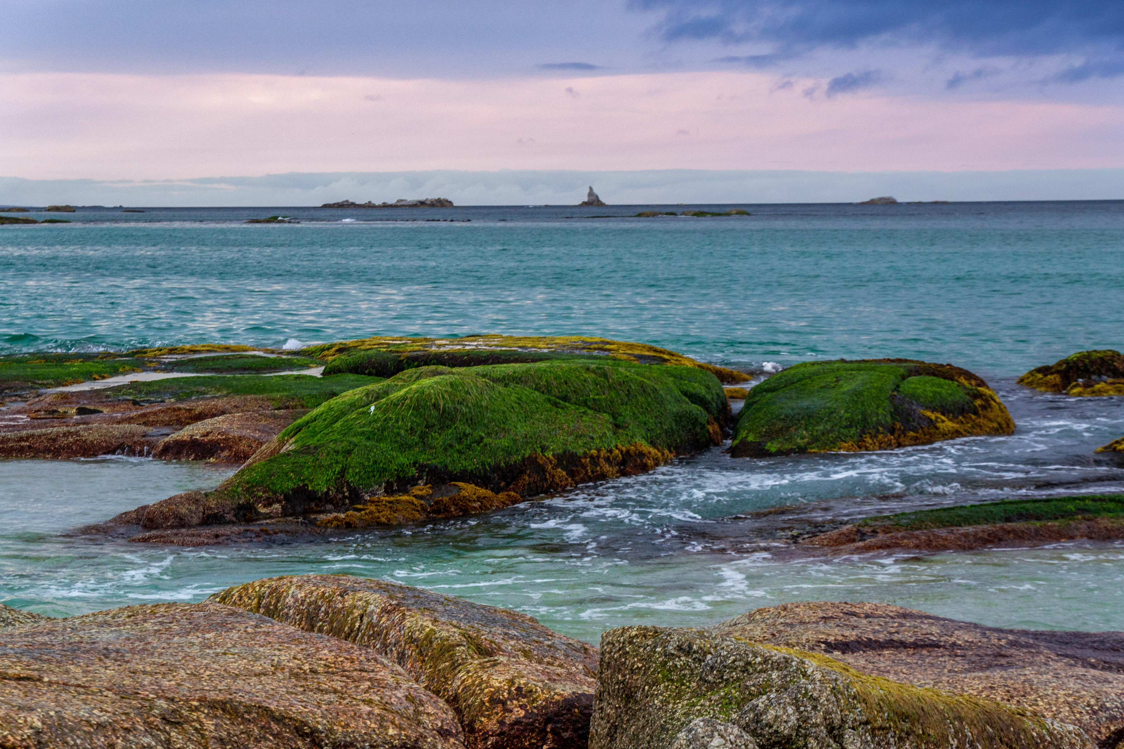
Verdant moss cover adds a different colour and texture to the granite boulders.
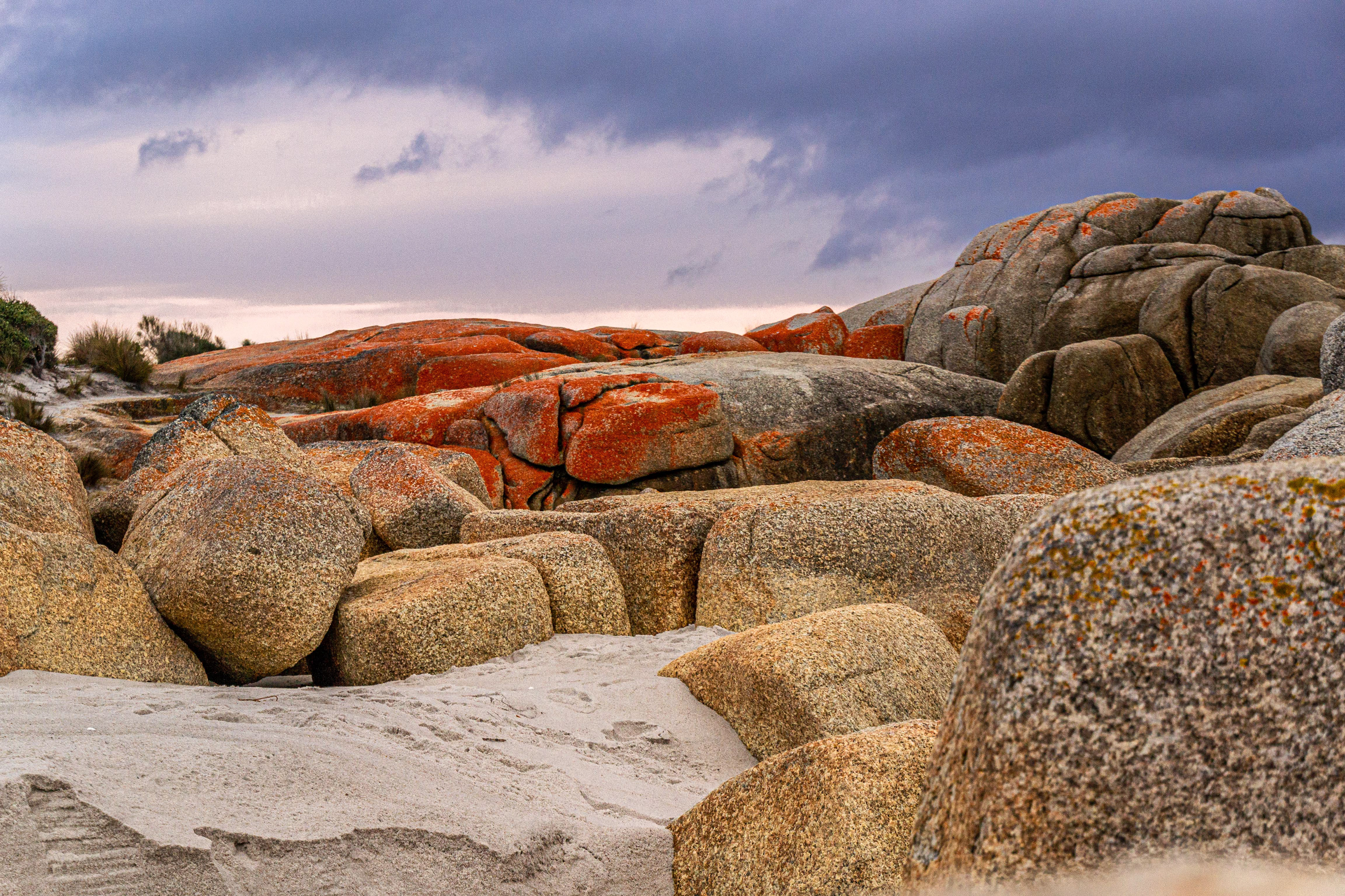
Firey capped granite boulders contrast the moody grey clouds above.

Granite boulders capped with fiery lichen.

Rock garden foliage of varying shape and colours colours establish a foothold in the rock crevices.
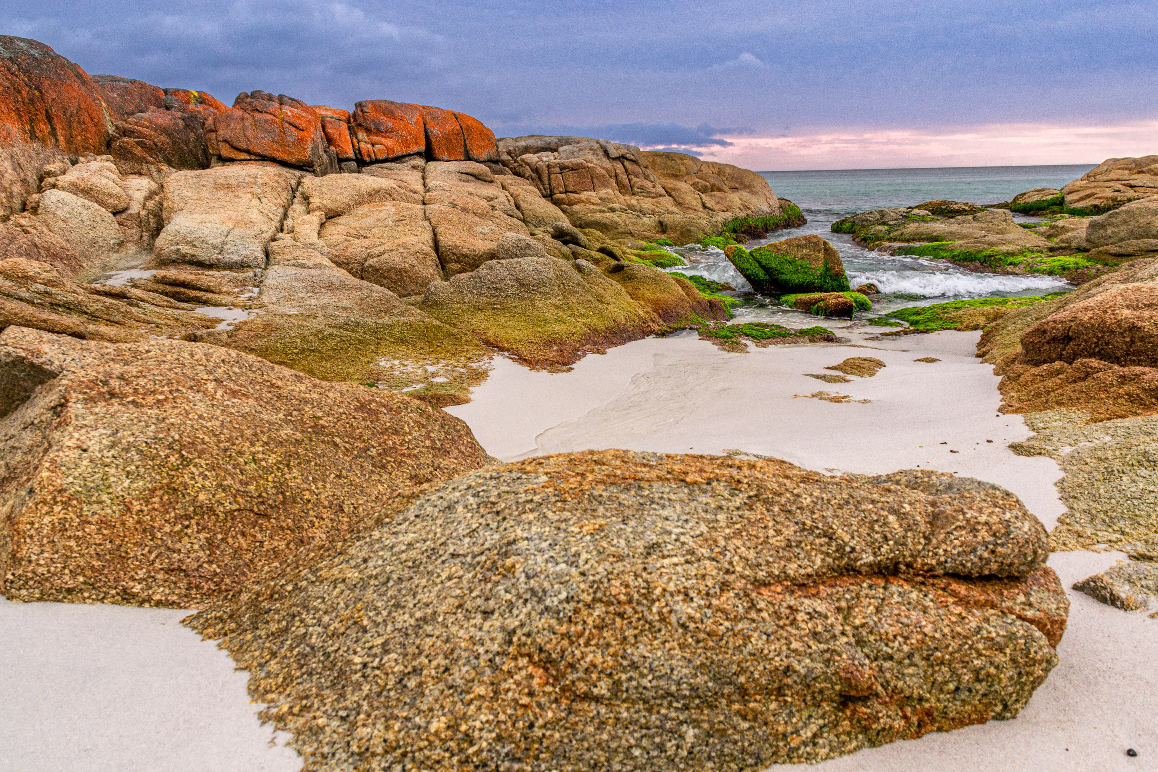
Granite boulders display the full colour palate of the Bay of Fires in the early morning light.
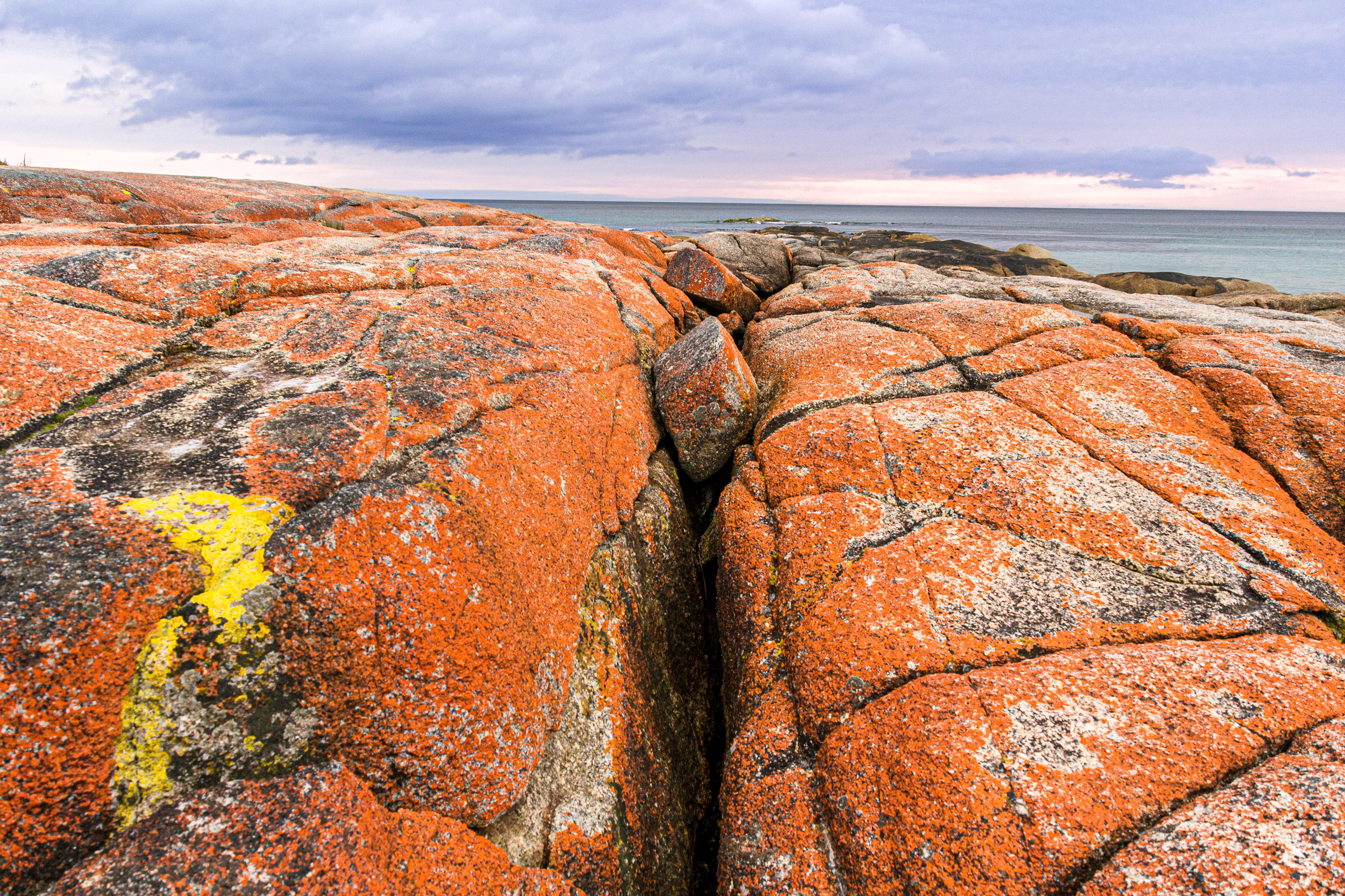
Fire on the rocks, orange and yellow lichen covers the granite.
Rock pool gardens framed by fiery granite boulders.
While at Cosy Corner, we took a drive to visit Evercreech Forest Reserve near Mathinna where there are a couple of easy circuit walks. The steeper of the two leads to the ‘White Knights’, a magnificent stand of eucalypt forest giants. Standing at over 91 metres, they are the tallest White Gums in the world. Evercreech Falls can be accessed from the Forest Reserve.
Evercreech Forest
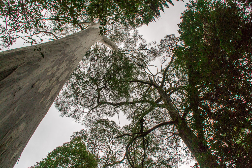
Evercreech Forest in Tasmania is home these majestic white gums, claimed to be the tallest of their speciesin Australia. Referred to as the White Knights.

Cheryl is dwarfed by the girth of one of these forest giants.
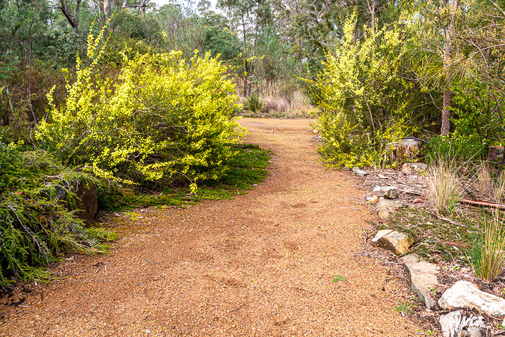
Golden blossoms of the wattle provide a splash of colour in the forest canopy below.

Moss and lichen cover any fallen trees to continue the circle of life.
Fungii joins the moss and lichen eking out a life on this tree-trunk.
A crystal clear stream flows over a bed of time-rounded gravel.

The varying shades of green and gold in the Evercreech forest.
We head onto Hobart ahead of schedule and while there we explore some of the city's attractions.
Hobart
On our drive to Hobart we encounter this "Spikey Bridge", built by convicts in the mid-19th century near the town of Swansea. The bridge is made from field stones laid without mortar or cement and the upright stones of the parapet allude to its name.
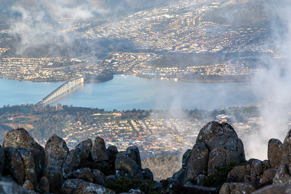
Hobart and the Derwent River from the misty heights of Mt Wellington.
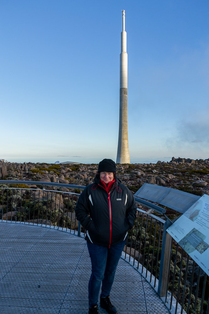
Cher rugged up against the cold at the lookout, Mt Wellington
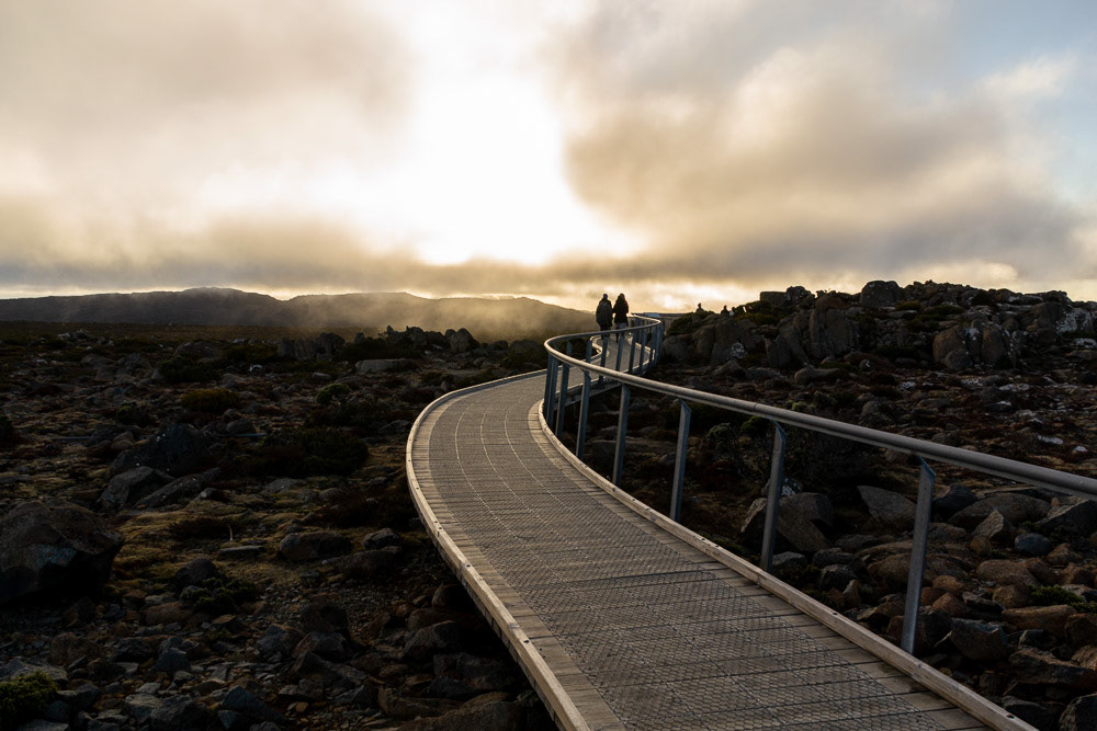
Walking into the sunset, Mt Wellington
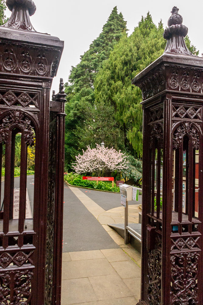
Wrought Iron entry gates to the Hobart Botanic Gardens.
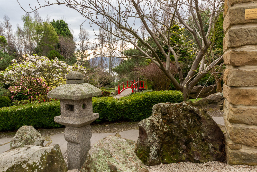
A stroll through the tranquil section of the Japanese gardens.
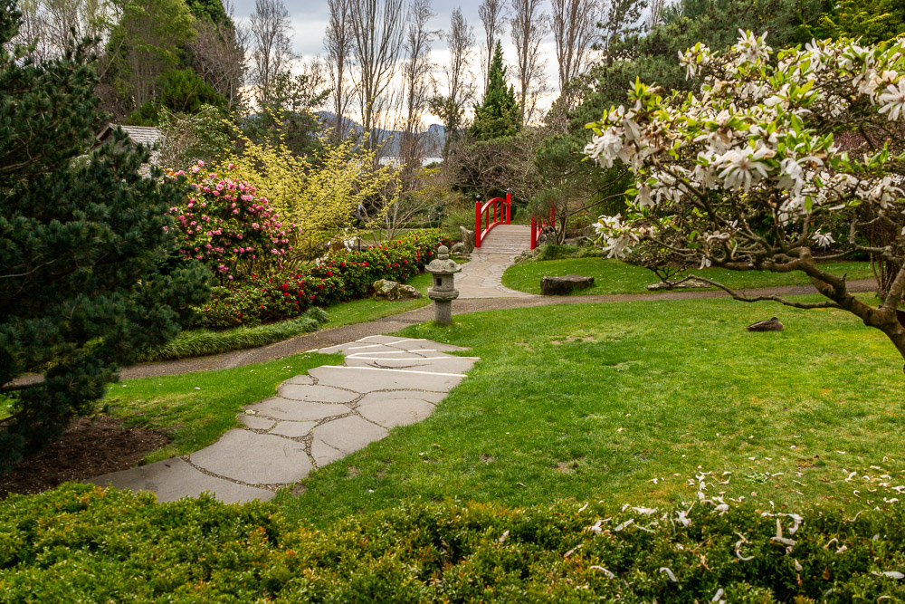
The red bridge beckons....
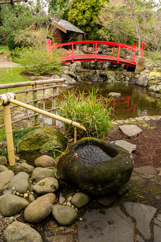
Water features lead into distant vistas...
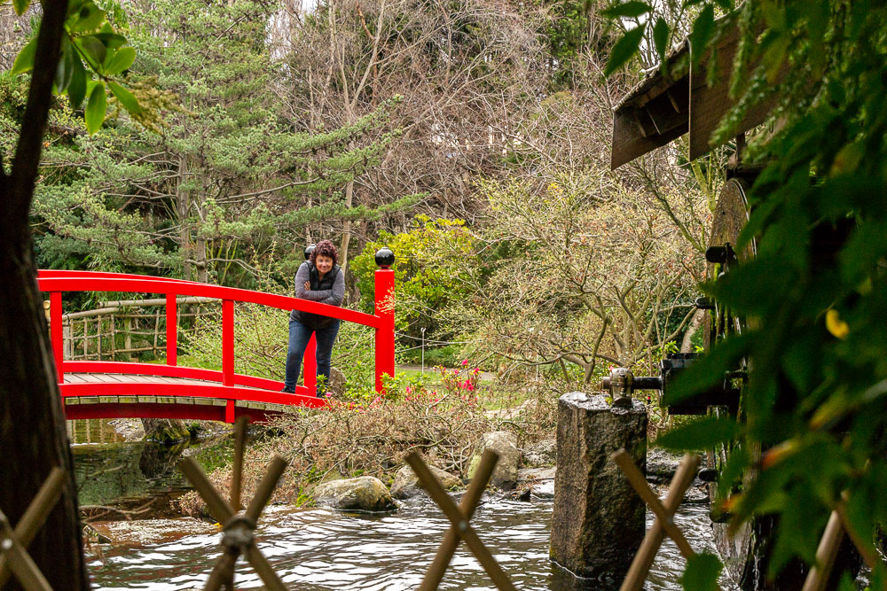
Cheryl on the Red Bridge.
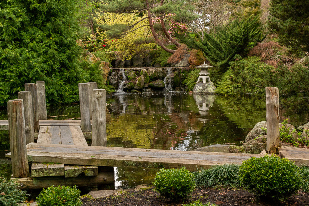
Pond reflections enhance the lanscape...
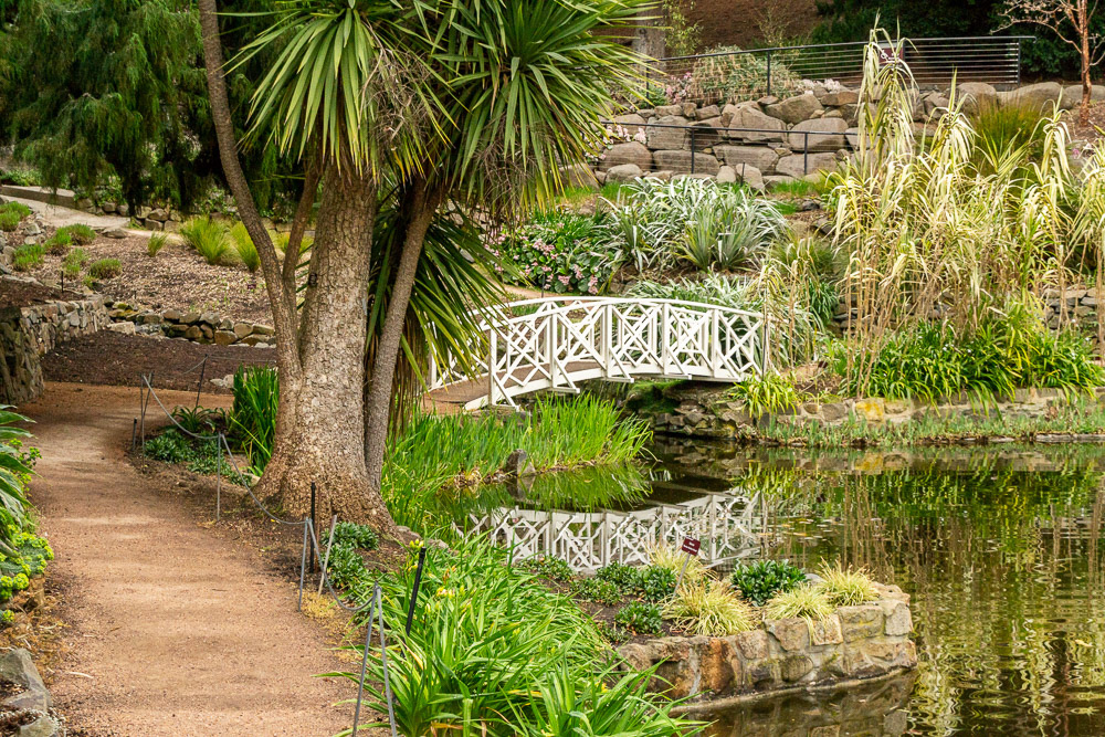
A white bridge leads out of the Japanese section.
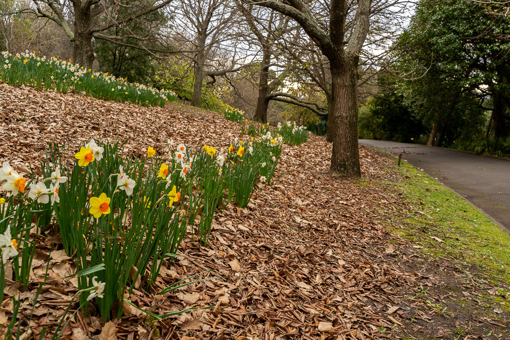
Daffodils all in a row....
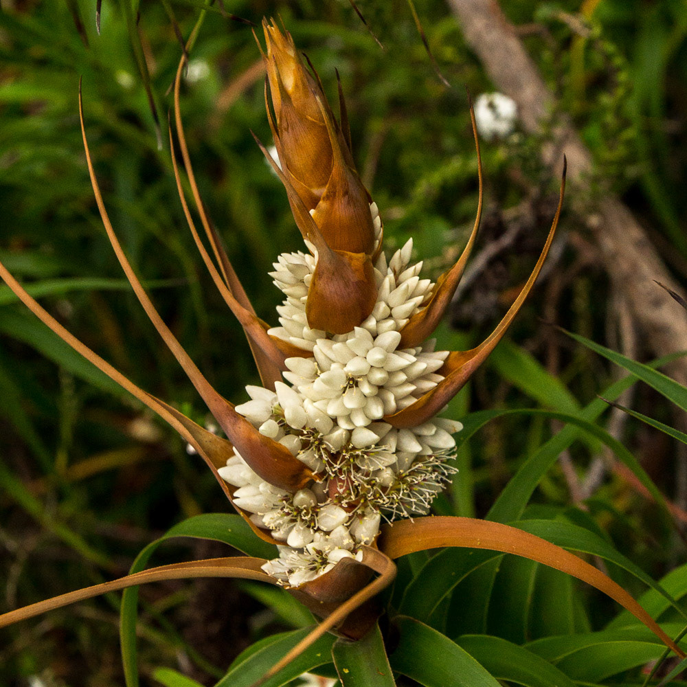
A striking bloom with architectural qualities.
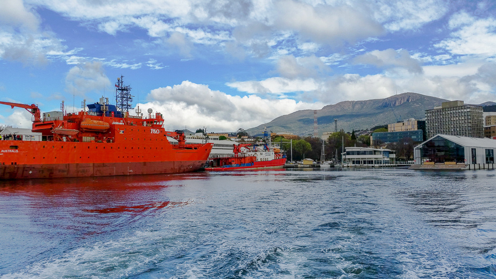
Research ships at the Battery Point Wharves adjacent the Antarctic .Cooperative Research Centre.
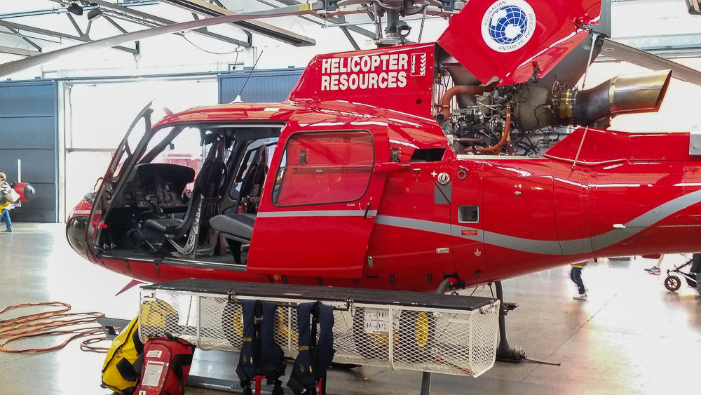
Antarctic bound equipment on display
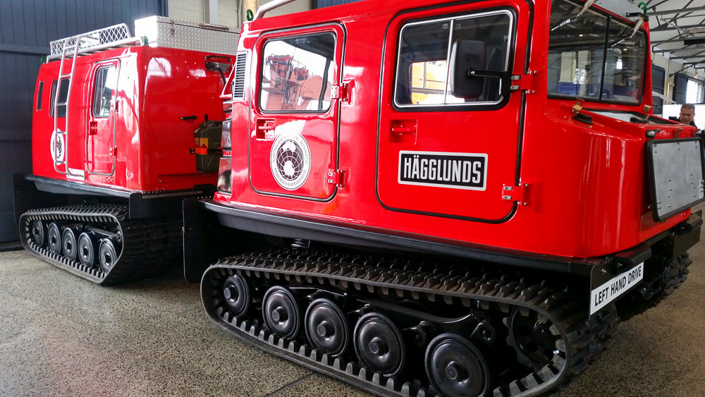
An articulated transport vehicle
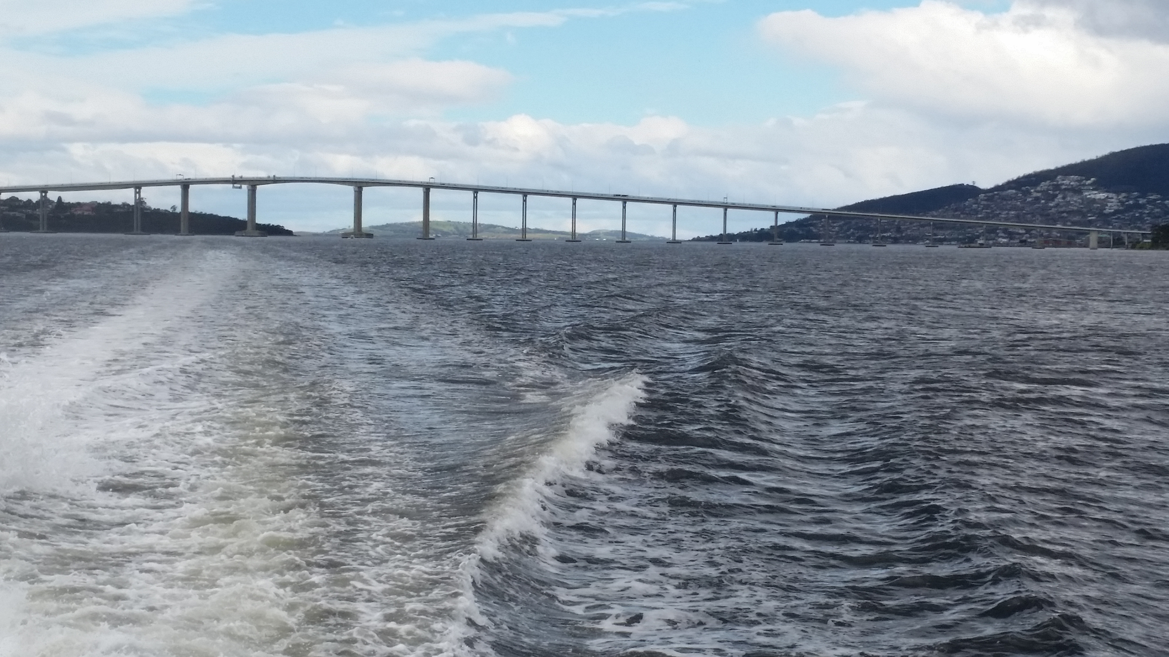
Cruising the Derwent River on our way to MONA
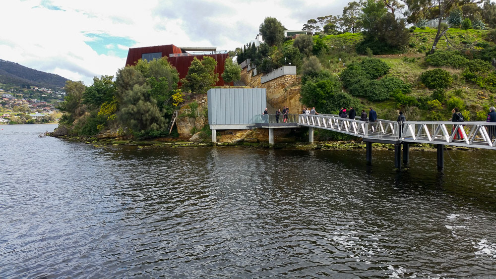
Approaching MONA from the river pontoon.
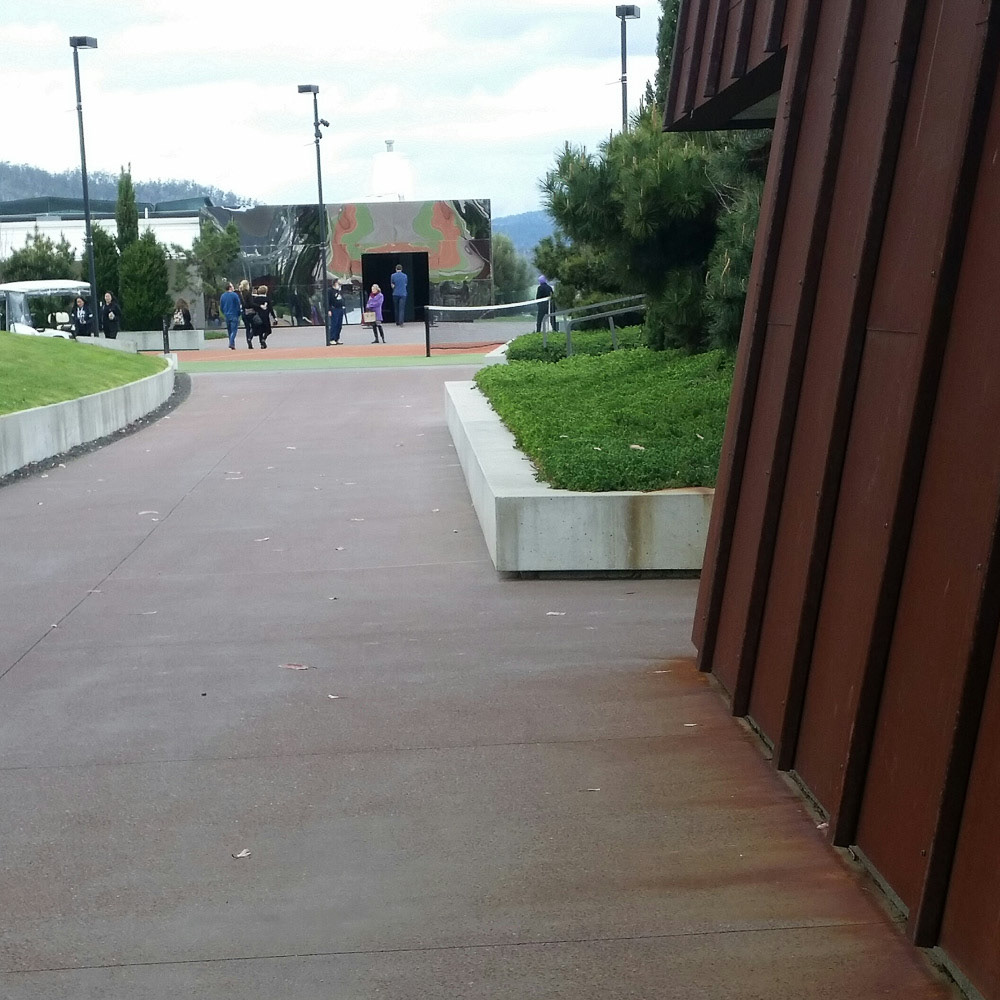
All paths lead to the MONA grand entrance...

Reflections........
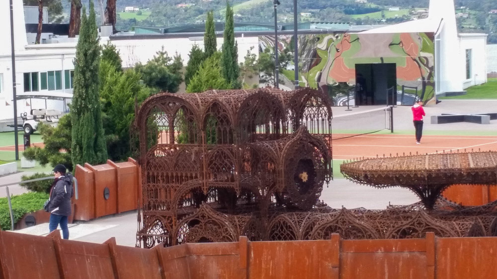
Oxidization of the bare steelwork and wire sculptures is an architectural finish widely embraced at MONA.
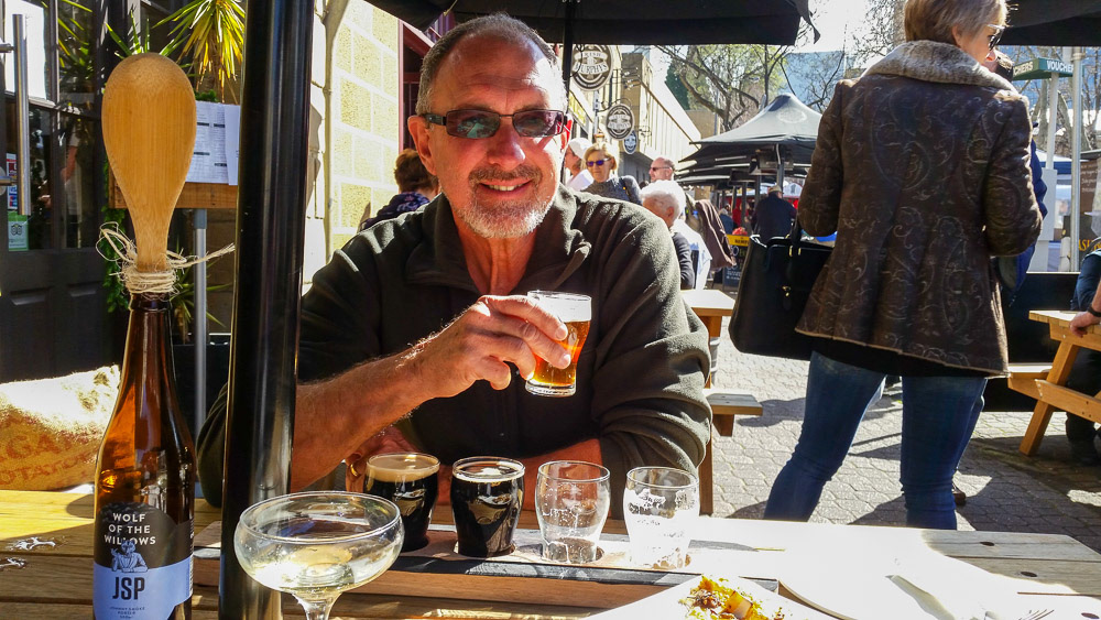
Sampling the brews at the Salamanca Markets.
Cheryl people watching ...
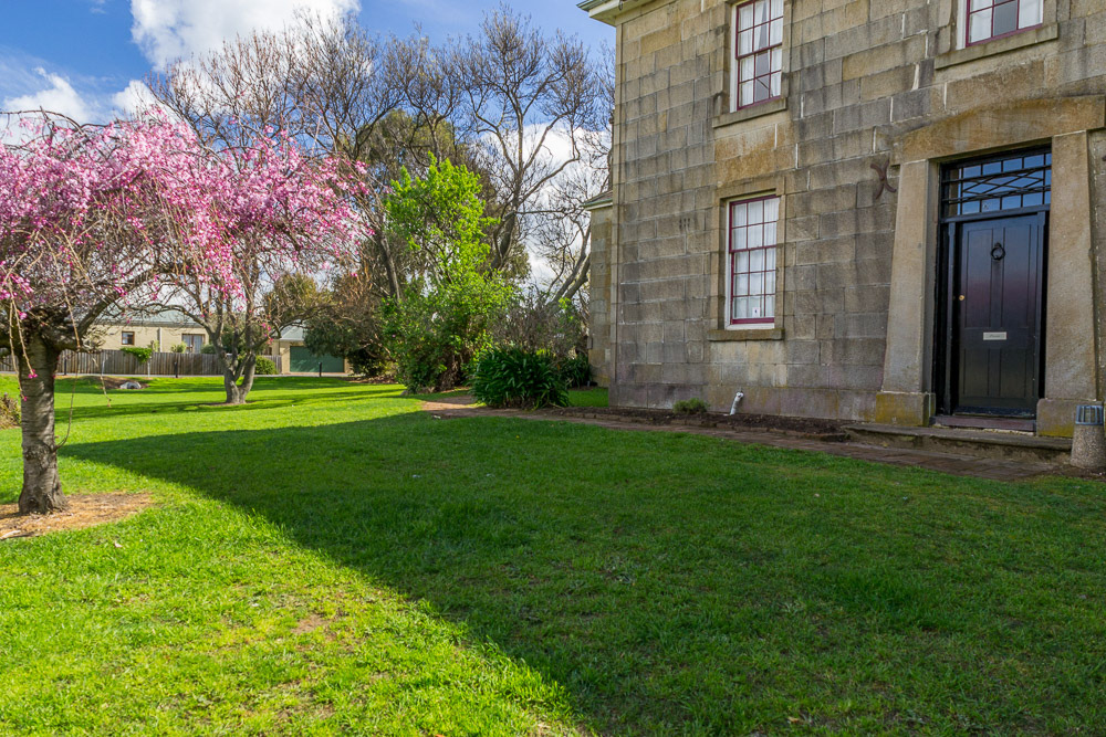
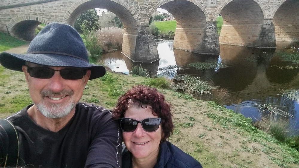
After our time in Hobart we retrace our tracks to visit Freycinet National Park. On our way we drop into the historic town of Richmond best known for it's historic bridge built in 1825, around the time of the town's first settlement. It's Australia's oldest bridge still in use today.
Historic Richmond
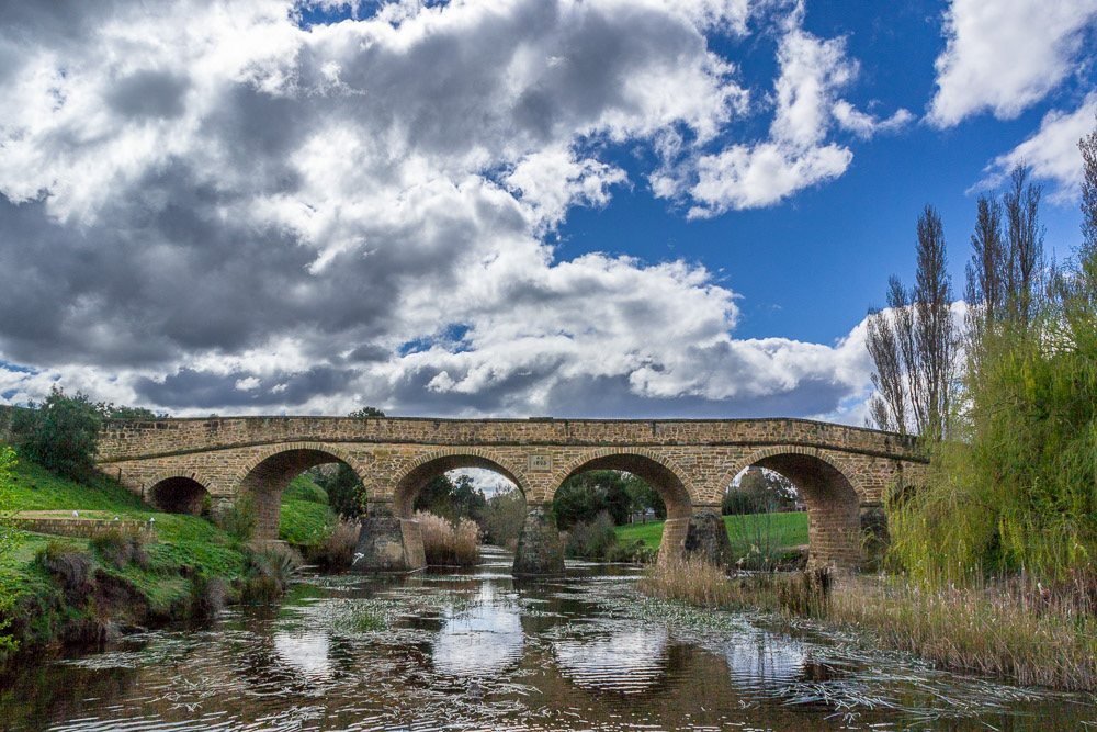
Richmond bridge crossing the Coal River. It was originally named Bigge's bridge.
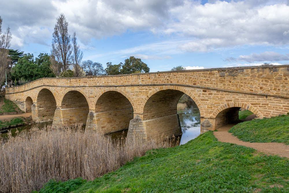
Richmond Bridge commenced construction 1823. The heritage listed It is the oldest stone span bridge in Australia.
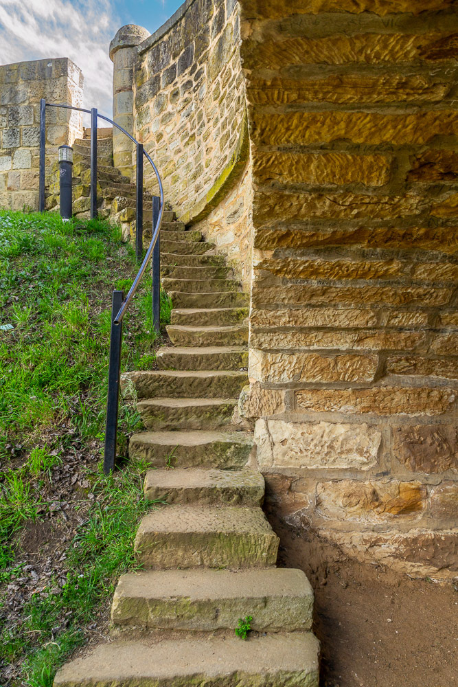
Time-worn sandstone treads lead to the road above.
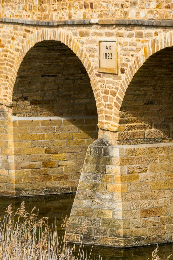
The 1823 Bridge Plaque was added after its opening in 1825.
Richmond Gaol was built in 1825 as part of Governor Arthur's system of police districts. The building was added to in the 1830s and was last used as a gaol in 1928.

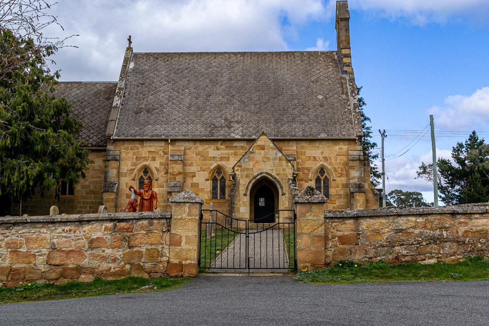
This beautiful sandstone building started its life as a Congregational Church in 1875.
No longer in use as a church these ornately hinged doors bar entry to the public.
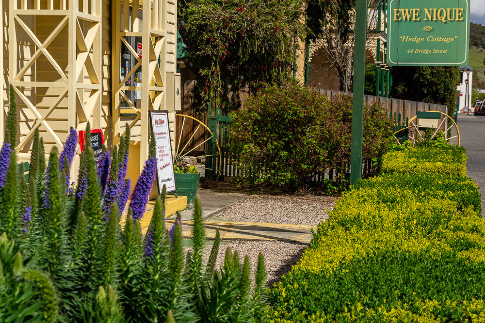
"Hedge Cottage" - home to an Ewe Nique shop where browsers are welcomed
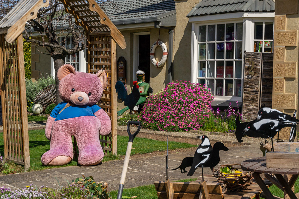
There's a bear there.....come inside.
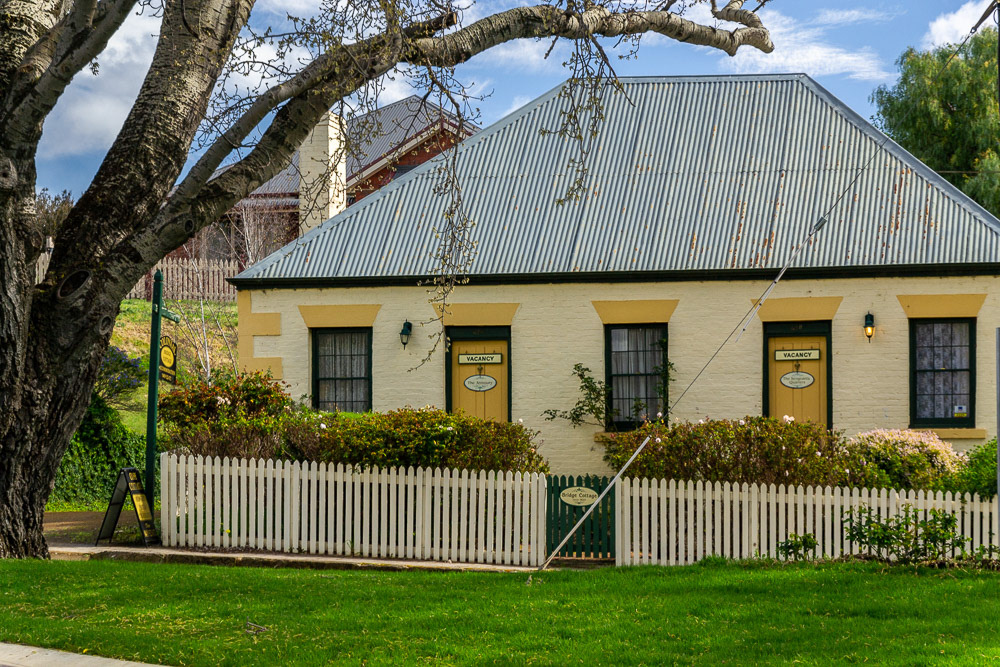
Bridge Cottage cieca 1823 is now an up-market B&B, unfortunately no information regarding its original purpose.
We're all smiles in Richmond.
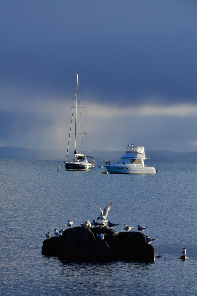
Freycinet National Park
We spend several days in the National Park exploring by car, boat and even on foot enjoying some of the truly spectacular scenery on offer in the area.
Richardsons Beach was just a short walk from our campsite.
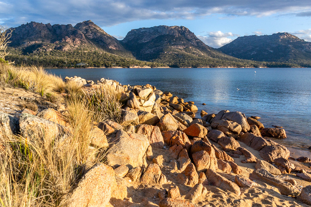
"The Hazards" - Mt Baudin, Mt Amos and Mt Mayson provide a spectacular backdrop to the bay.
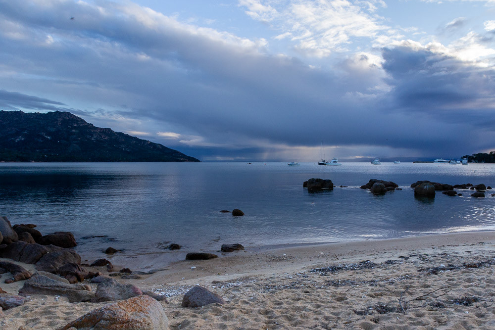
A storm sweeps across the bay.
Illuminated by the afternoon sun these yachts are prominent against the stormy sky.
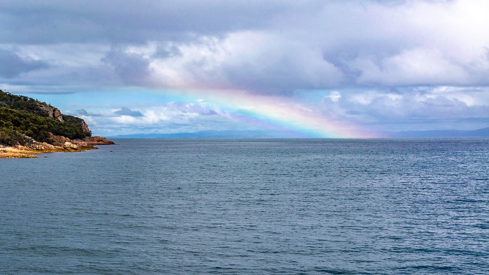
A rainbow lights up in the distance as the showers clear from the bay.
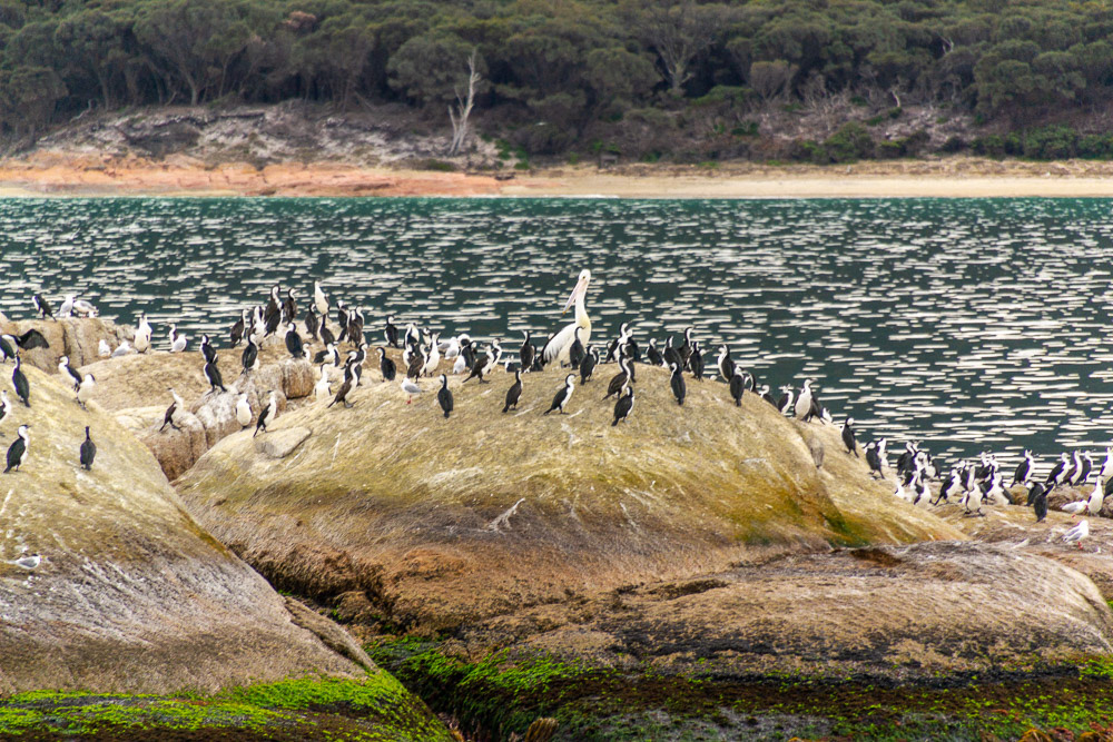
A Pelican upsets the pecking order on this rocky outcrop.
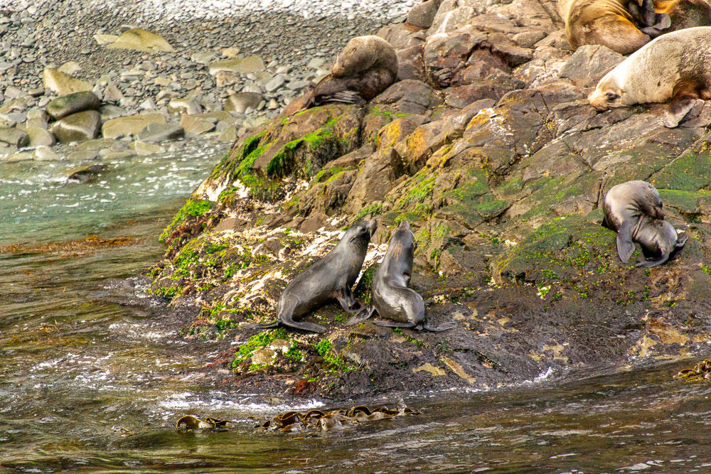
Australian Fur Seals blissfully going about their daily business.
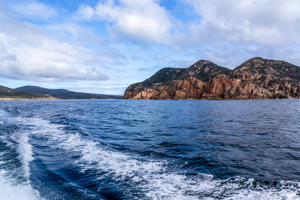
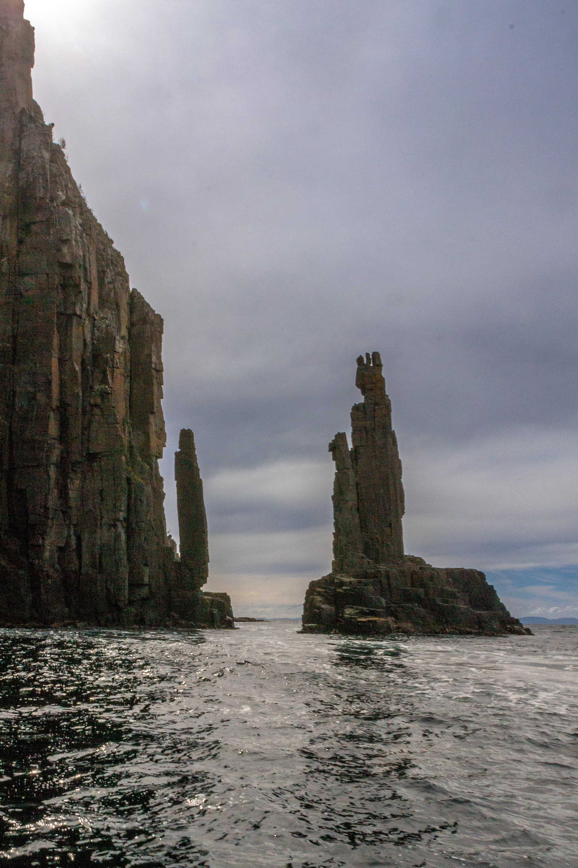
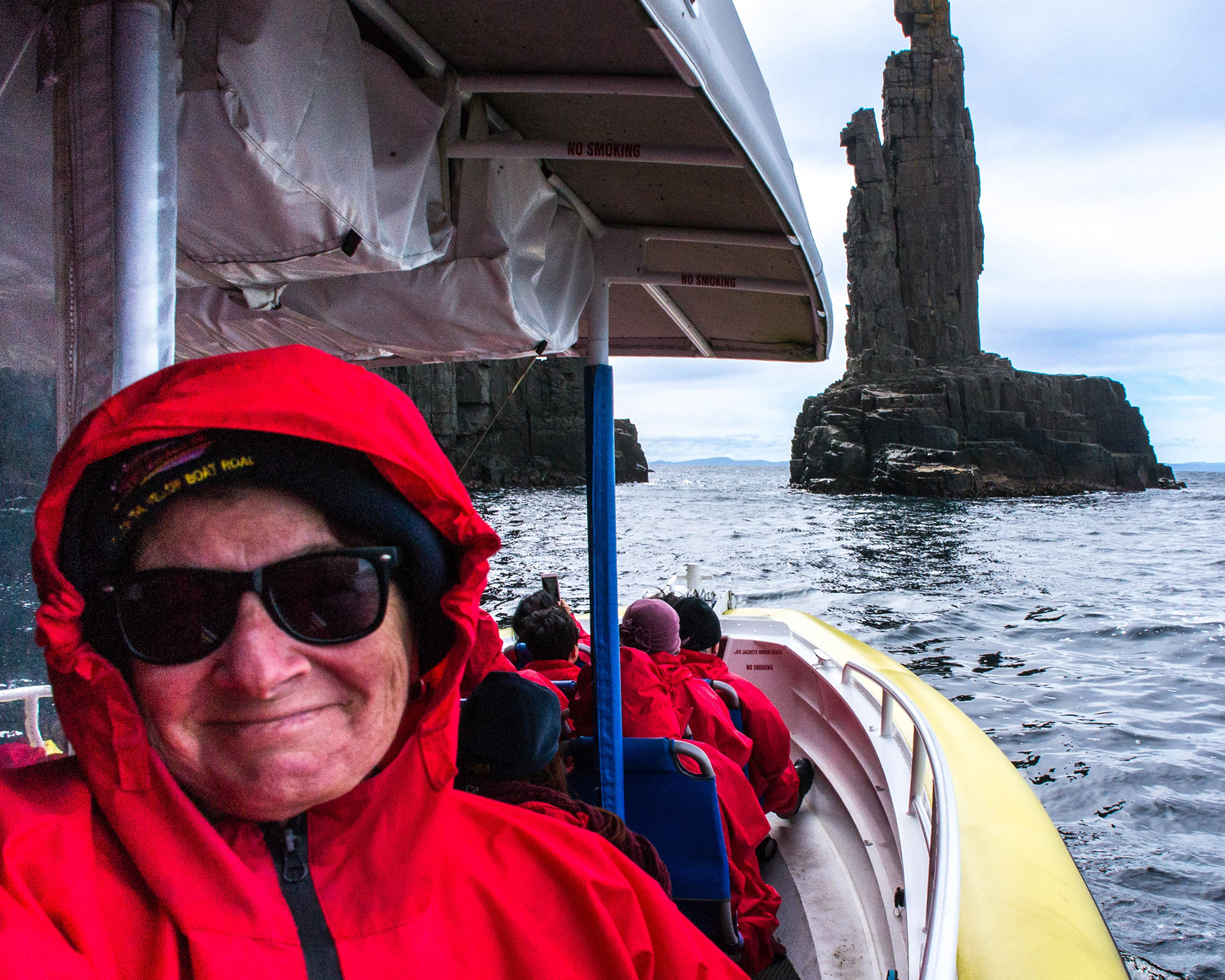
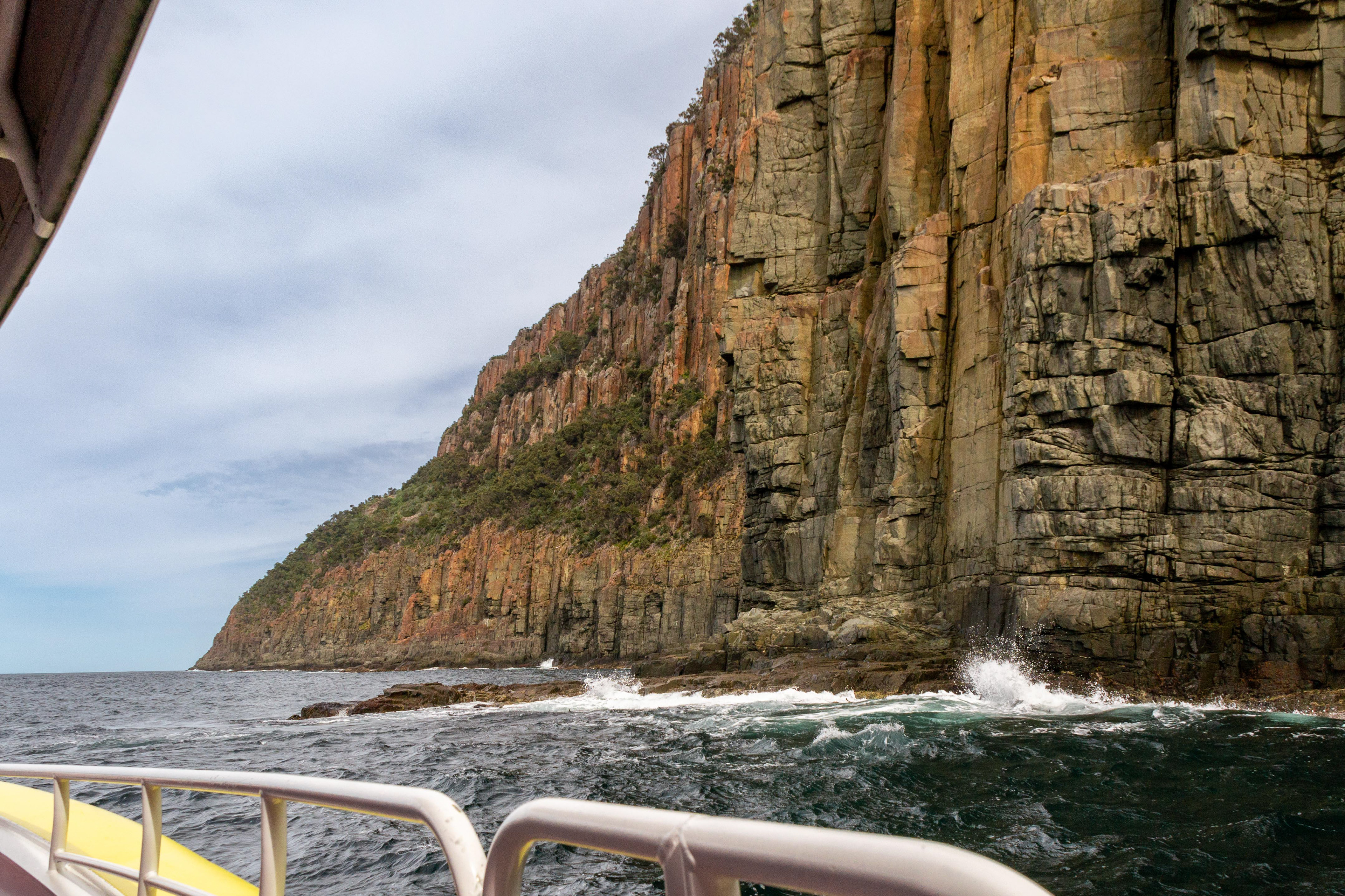
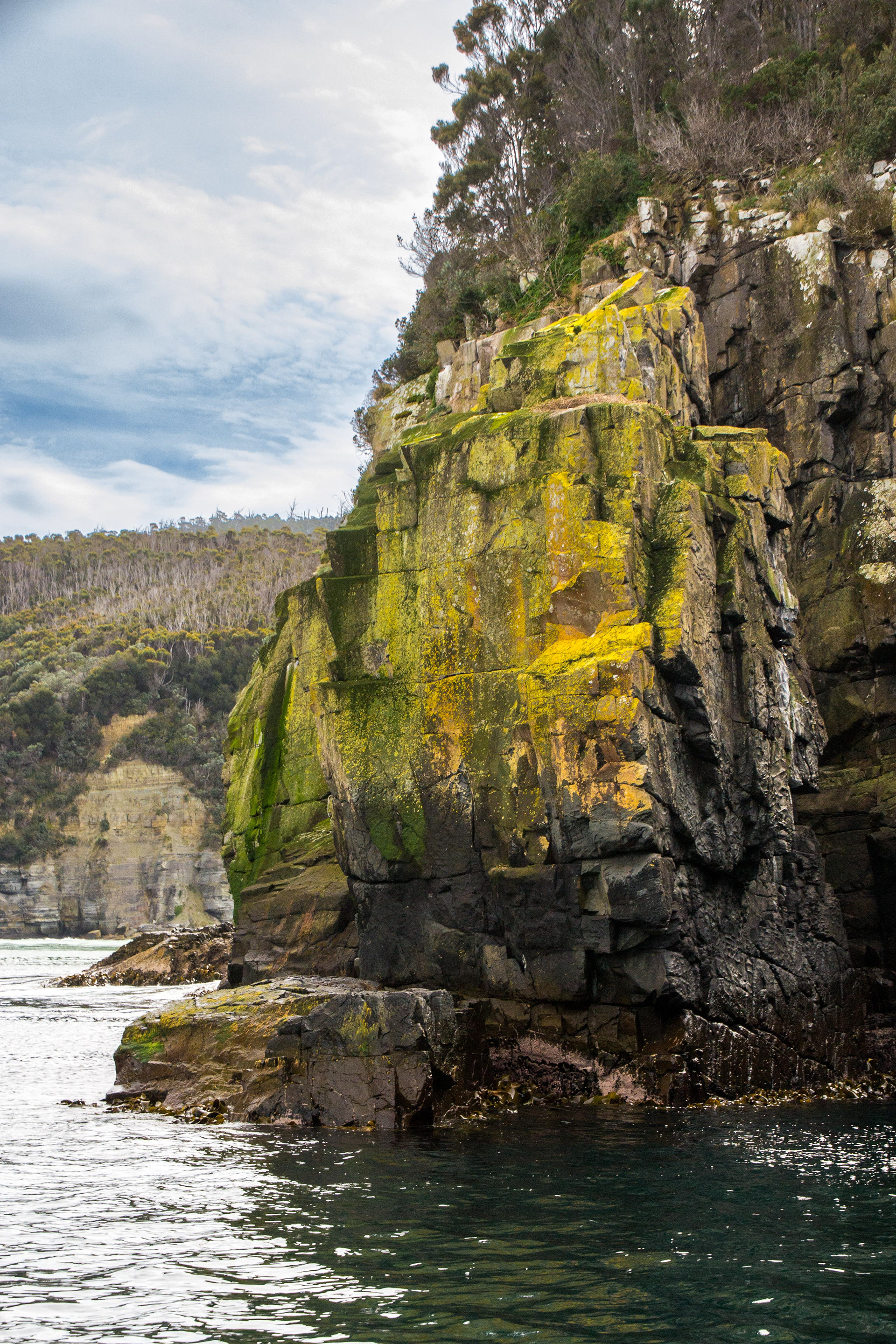
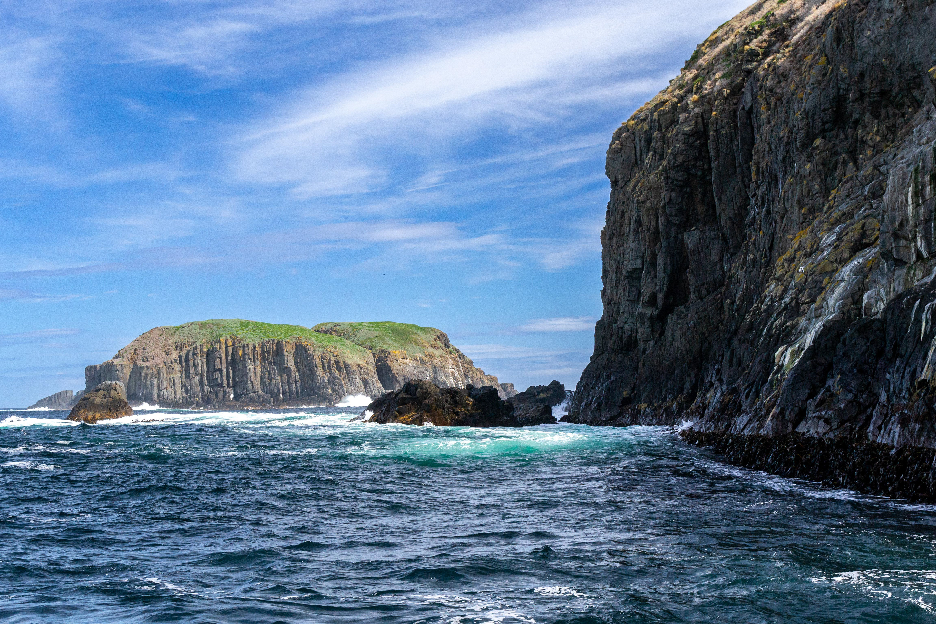
Cruising along the outer Freycinet Peninsula the scenery is spectacular.

Around every bend the rugged beauty of the Freycinet coastline continues to deliver WOW

Firey lichen paints spectacular patterns on the rock faces.
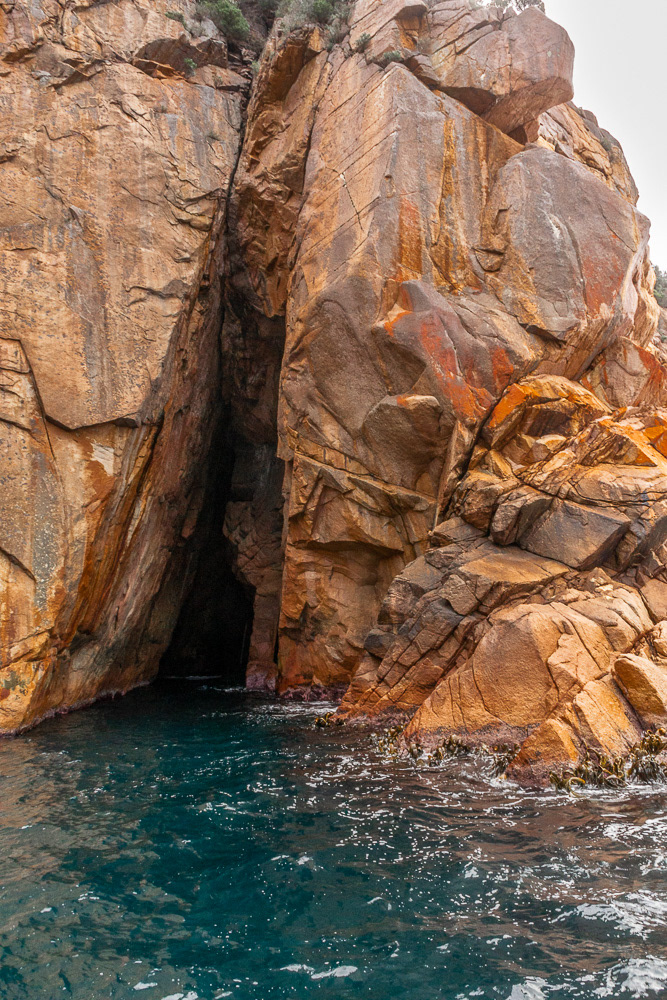
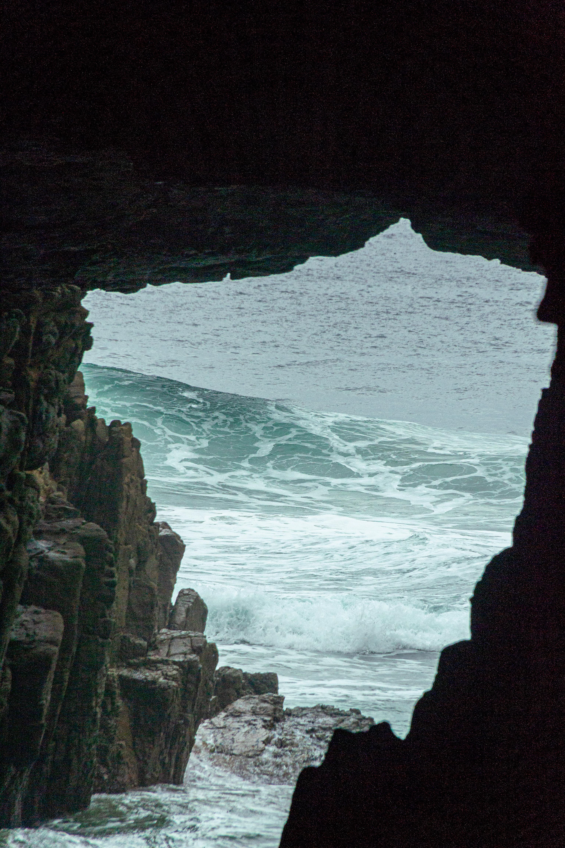
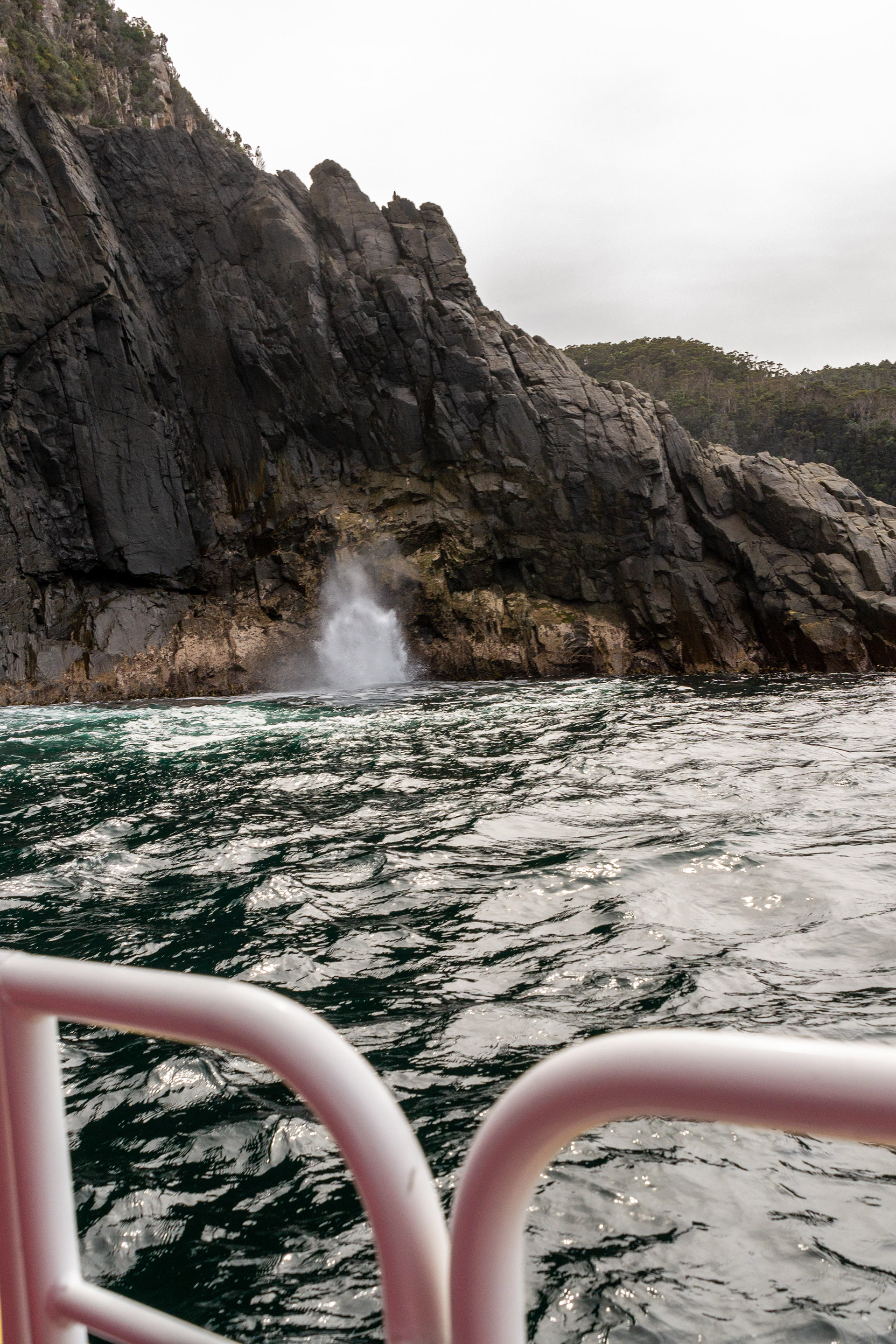
Sea caves hide in the fractured rock crevices.
Moody sky forms a perfect backdrop to the spectacularly coloured rugged coastline on the ocean side of the Freycinet Peninsula.

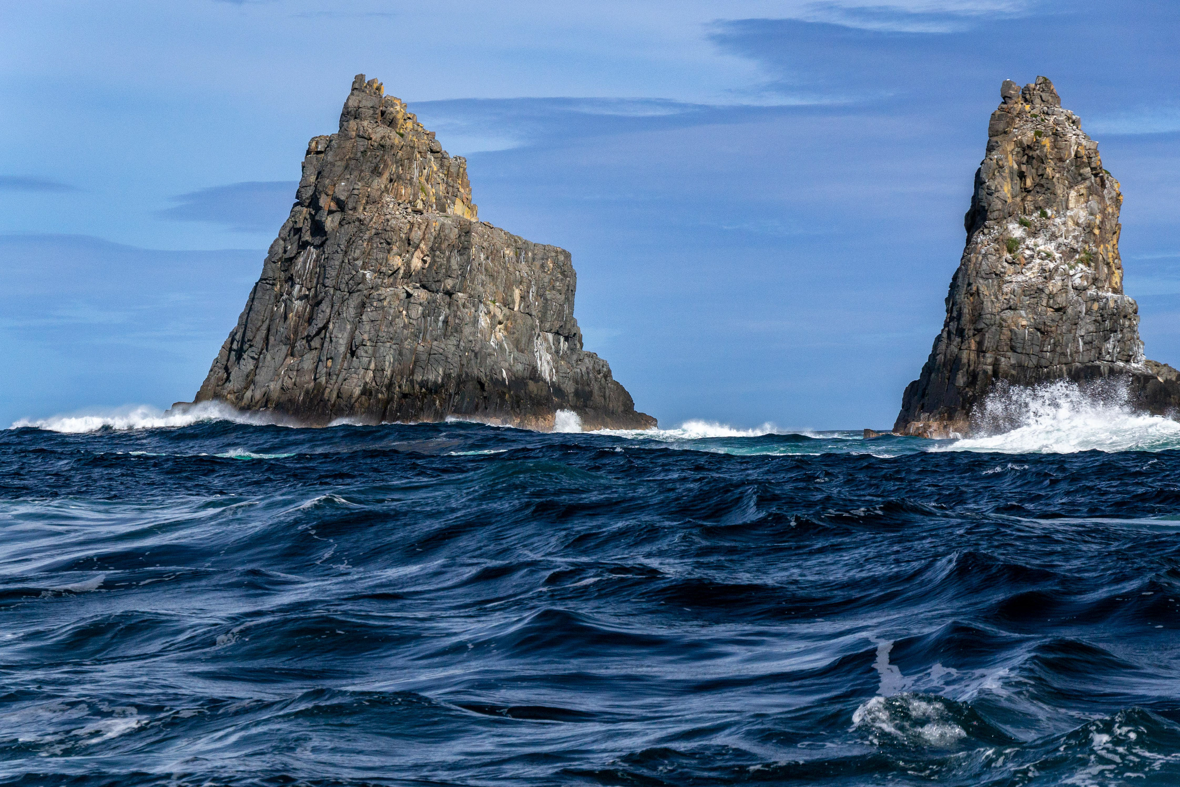
An amazing rocky pinnacle rises from the ocean a truly spectacular sculpture formed by nature.

How do you celebrate your arrival in Wineglass Bay....with a wine of course.

On our homeward journey we drop onto Cape Tourville to check out the scenery.

Cape Tourville lighthouse.
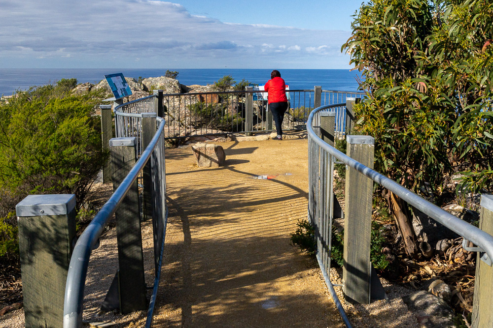
Cheryl taking the information at the "Nuggets"lookout.

Worth the walk......looking over Wineglass Bay
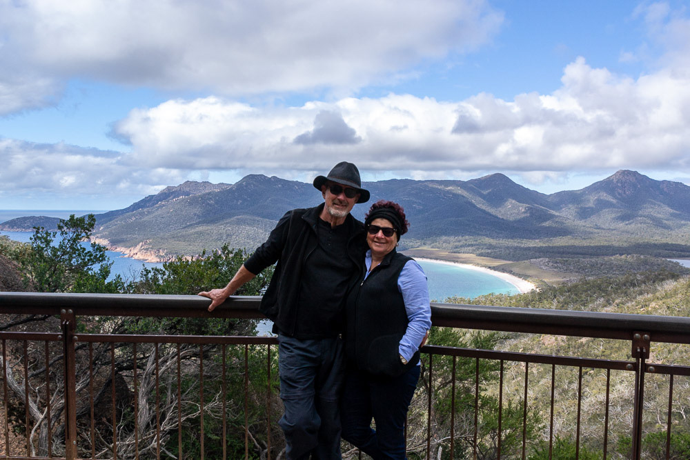
Cheryl and Ross at the Wineglass Bay Lookout
Bicheno
We only make a brief stop here on our way south to the Tasman Peninsula.

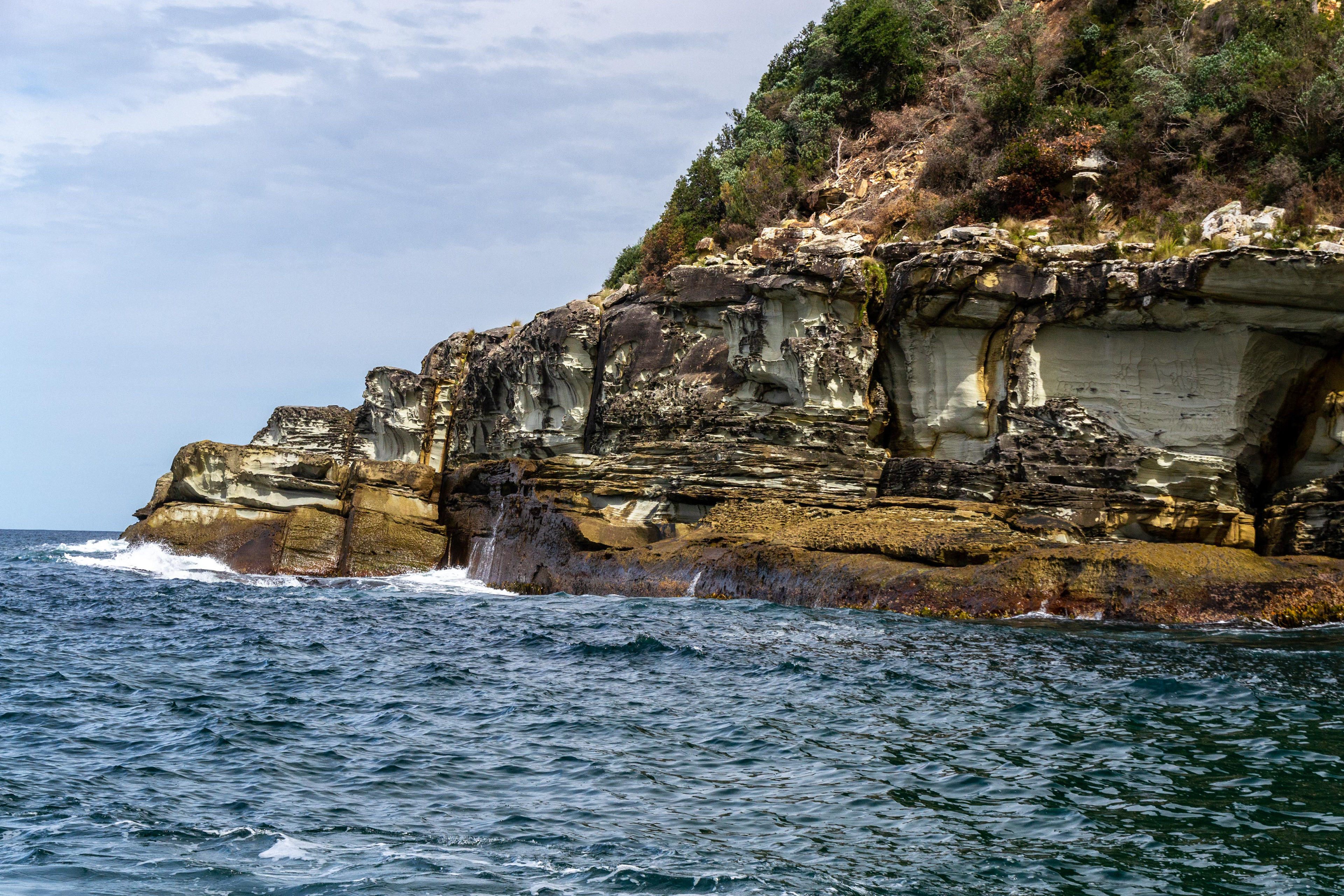
Calm seas beyond the rocky shoreline at Bicheno.
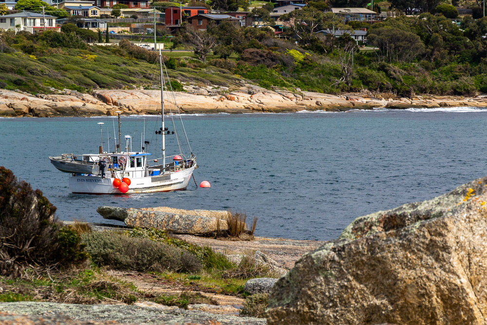
Fishing boat at anchor in the Port of Bicheno.

Leichen covered rocks at Bicheno.
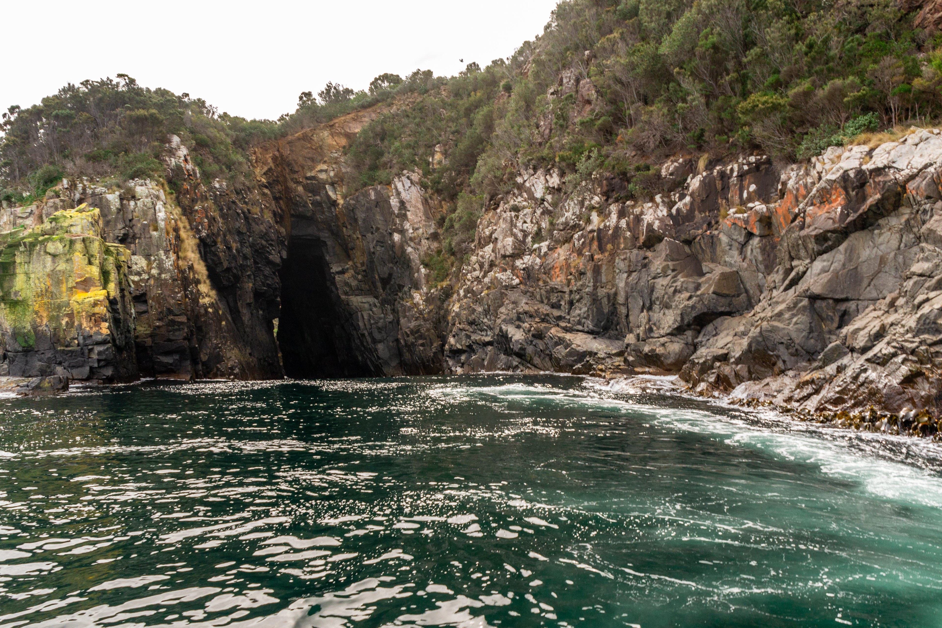
Passage to the ocean.
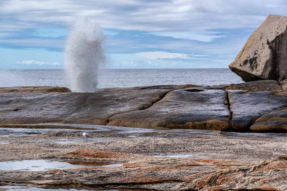
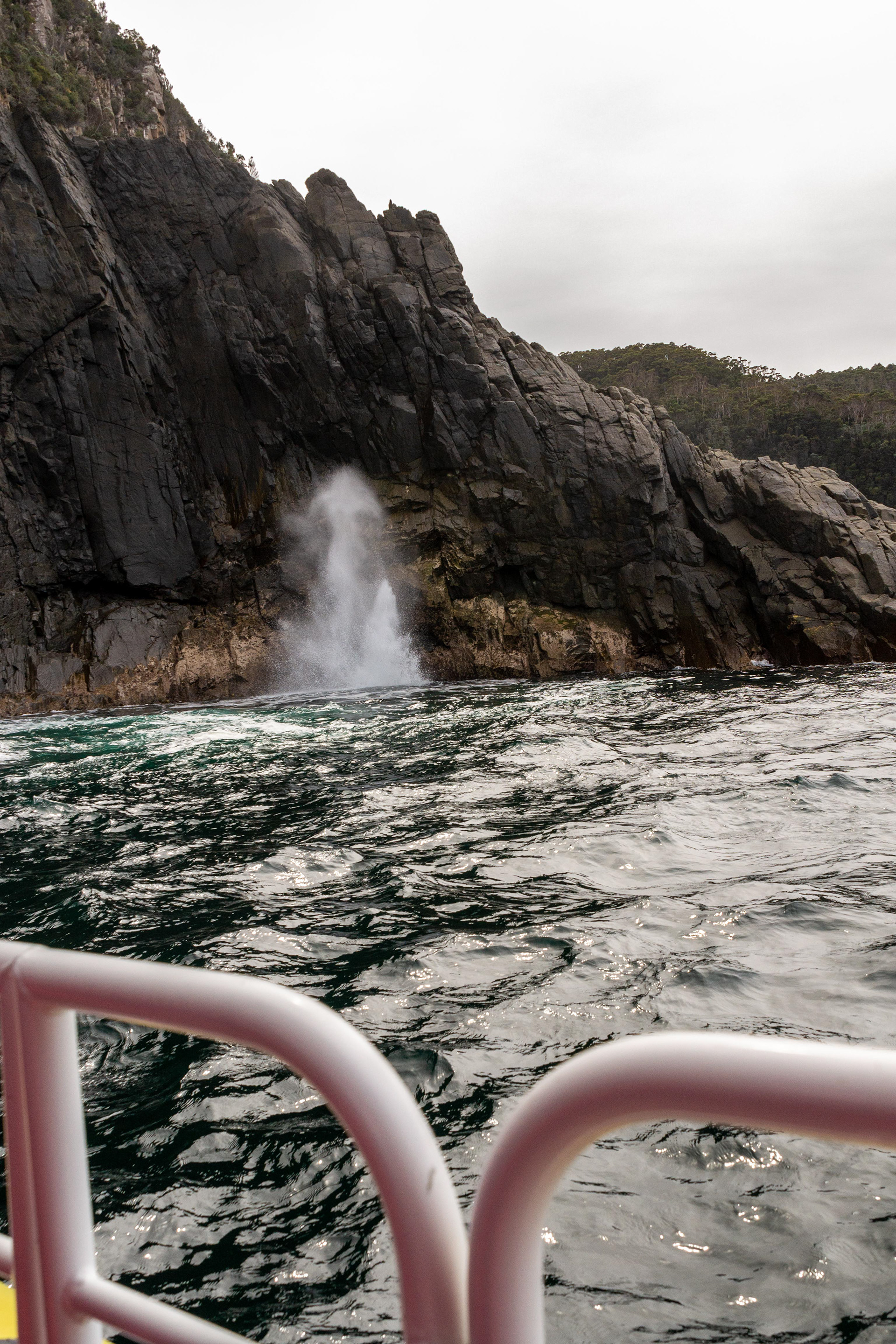
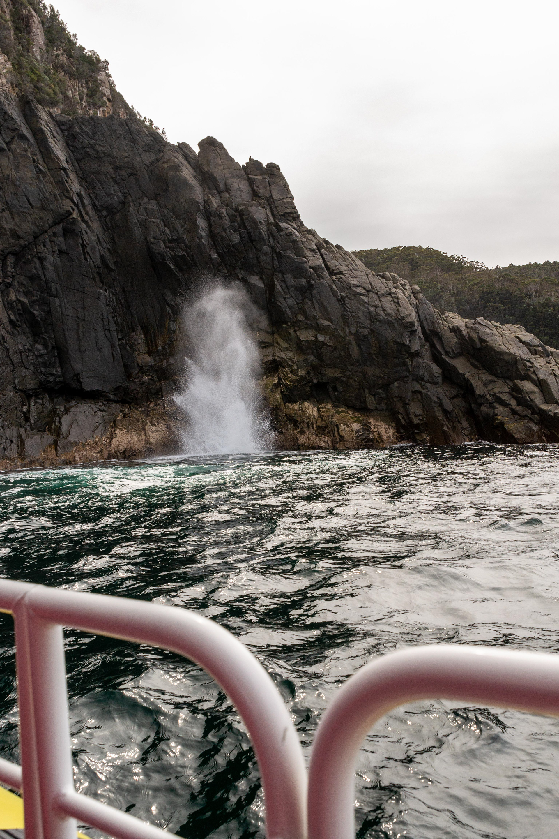
The Bicheno blowhole provides a spectacular show even on a relatively calm day.
Maria Island tantalisingly close in the distance....
Buckland and The Tasmanian Bush Garden
On our drive south we came across this special reserve and display garden featuring the native flora of south-east Tasmania. It is beside the Tasman Highway 4 km south of Buckland and approximately 50 km north-east of Hobart.


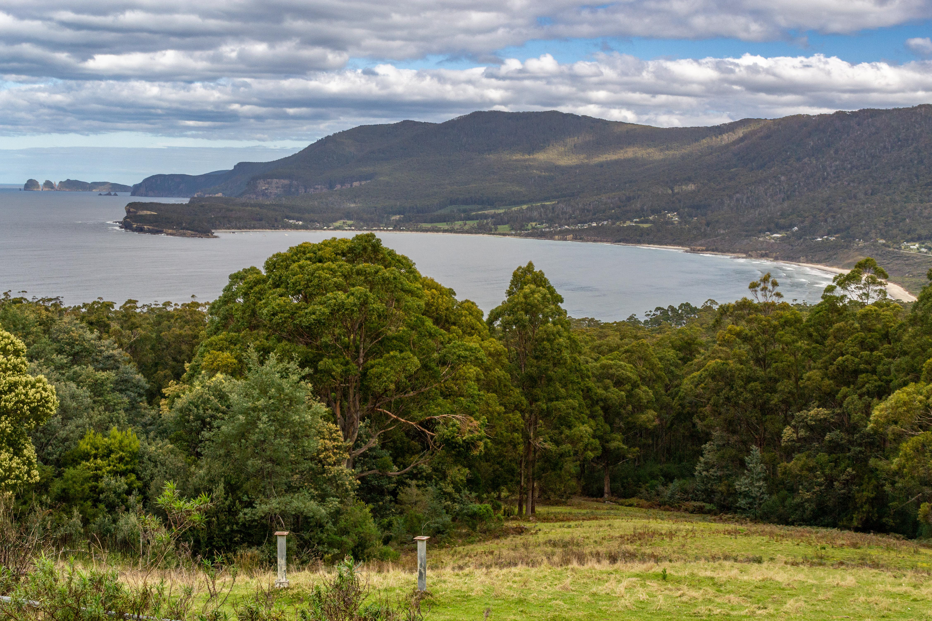
Tasman Peninsula
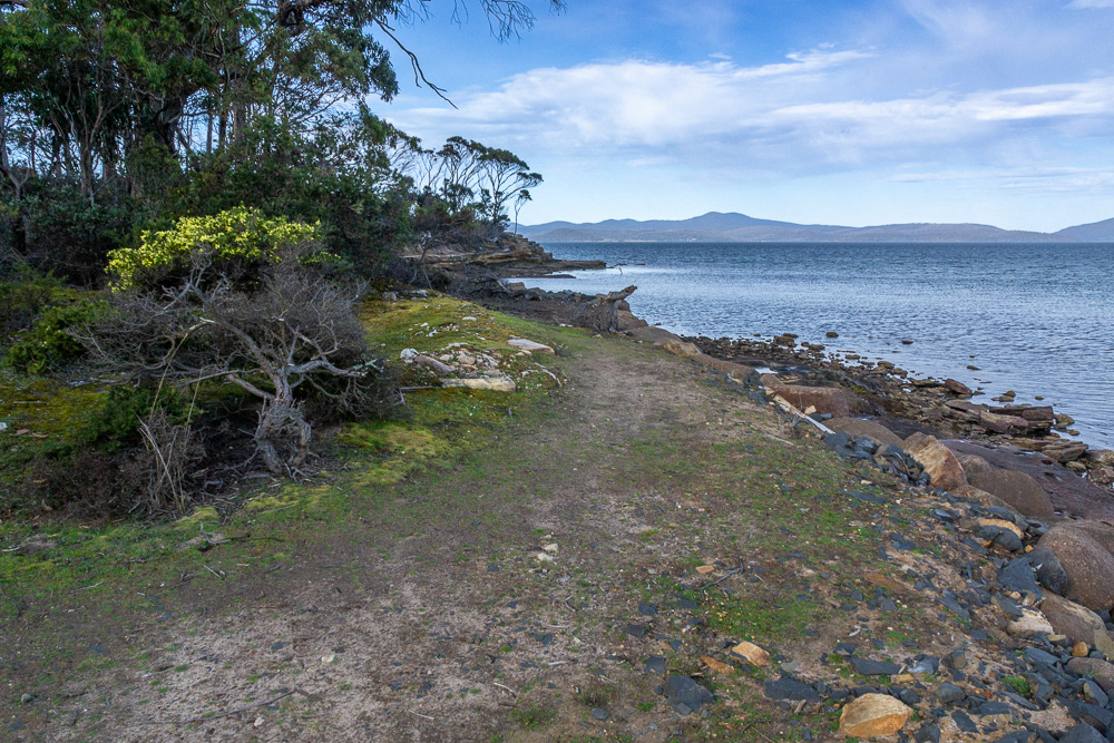
Our destination here is the campground at Lime Bay State Reserve is a beautiful, secluded reserve of sheltered beaches and pretty eucalypt woodlands and surprisingly doesn't get a lot of visitors. We set up here as our base camp while we explore the popular tourist attractions of the Peninsula and some not so well-known attractions like the convict coalmines.
Remnants of the 1833 Saltwater River coal mines, where Port Arthur's most hardened convicts were sent for punishment are a stark reminder of the harsh conditions that prevailed at that time. Ruins of underground cells and mine entrances are still visible.

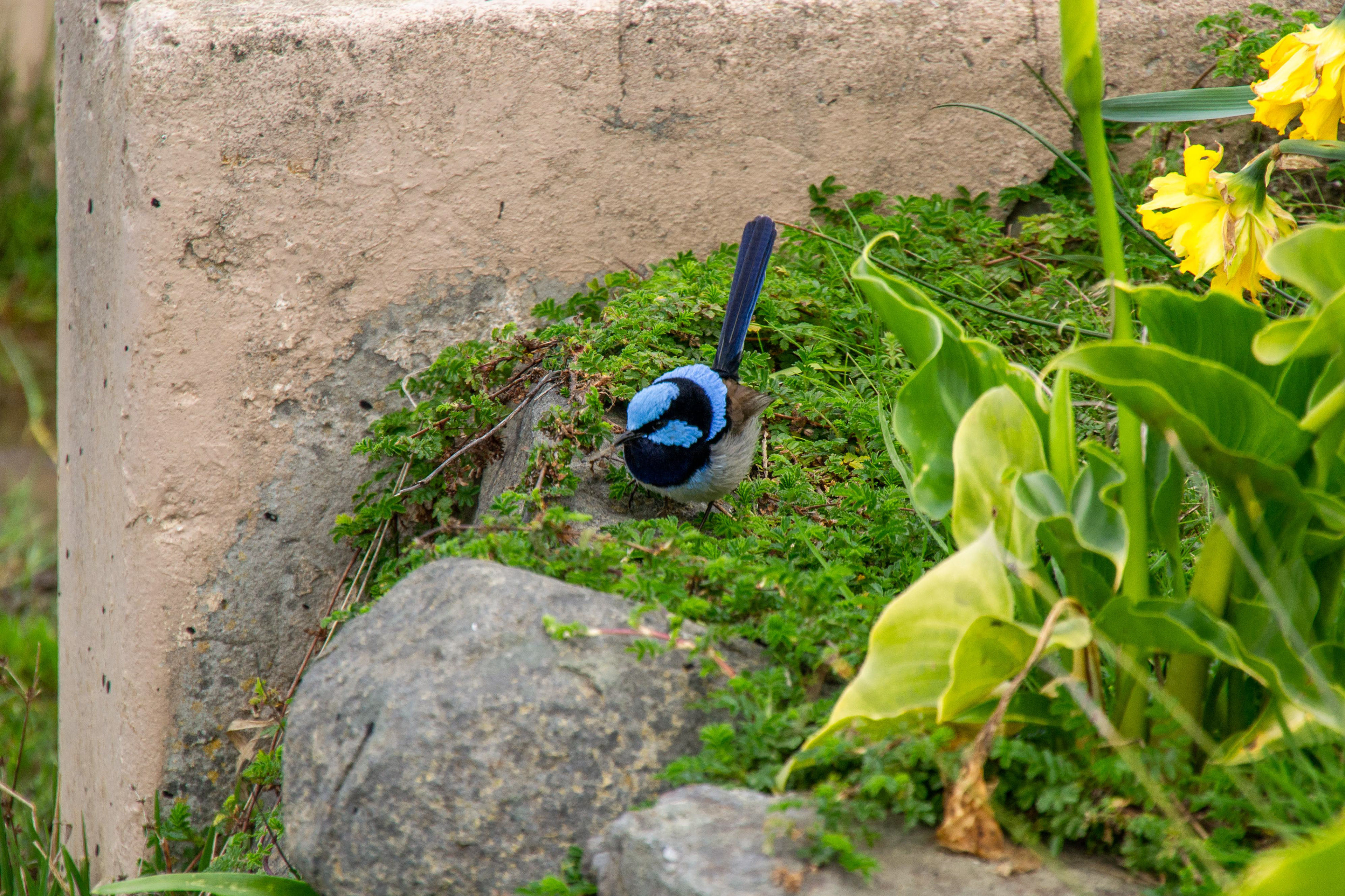
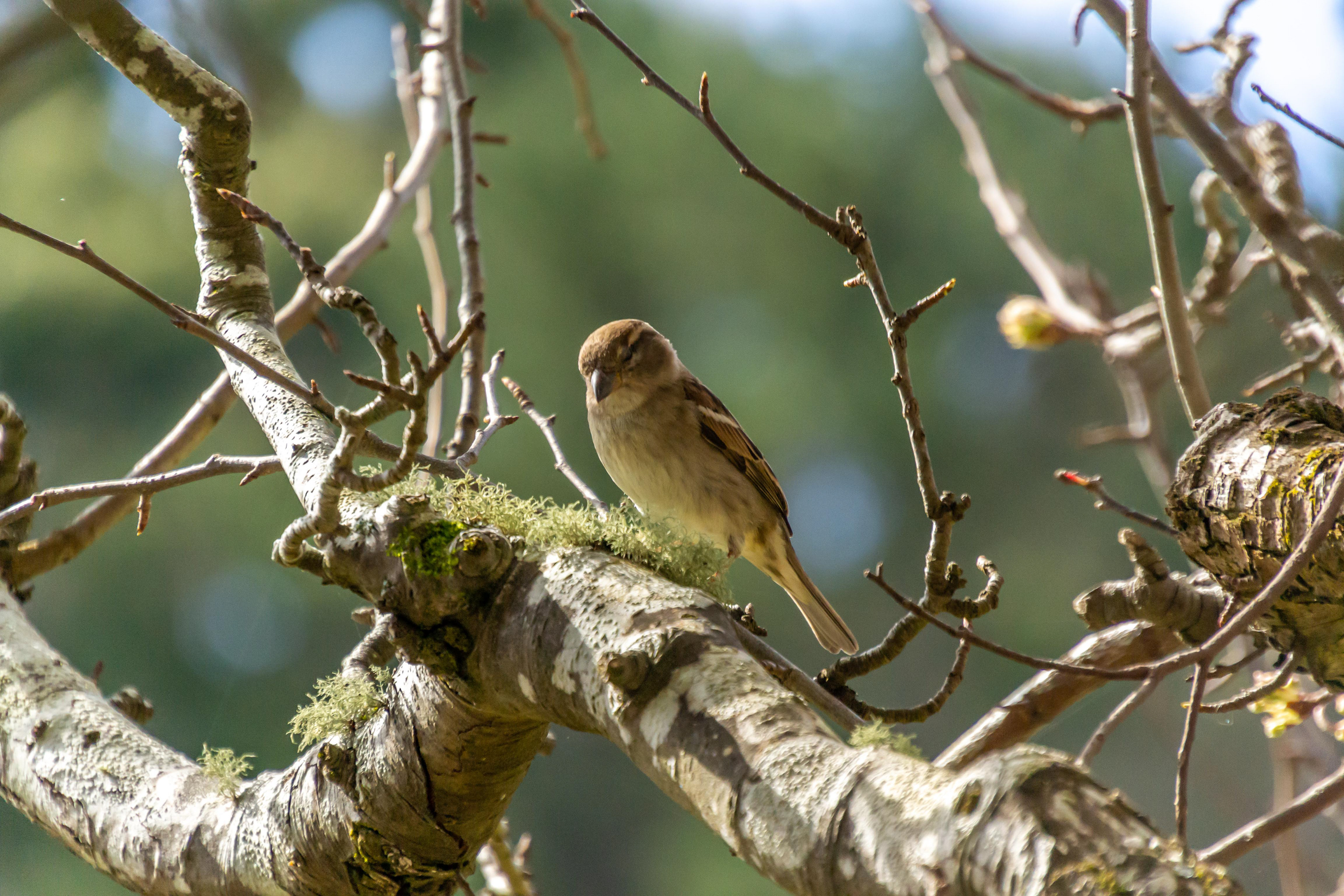
A Superb Fairy-Wren searches un the garden
The Tasman Blowhole at Eagle Hawk Neck appears benign on a calm day.

The Tasman Arch, a spectacular towering natural-arch bridge
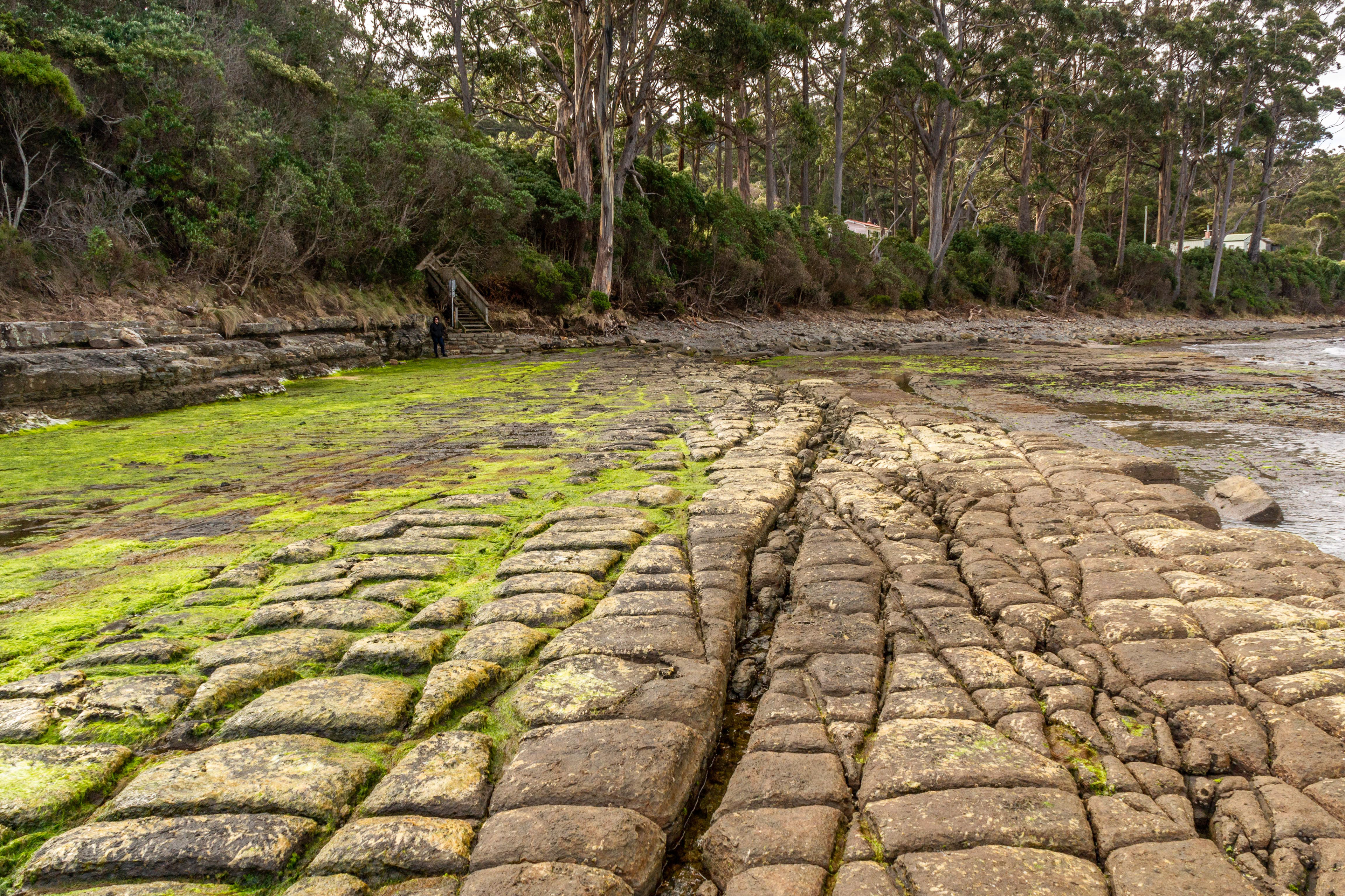
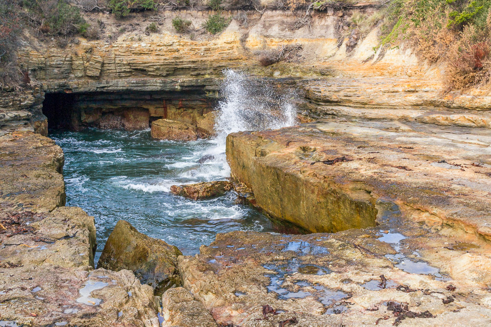
Tessellated pavement at Eagle Hawk Neck is extremely rare, one of only a few in the world. This is an example of the "loaf" type.

"Pan" type tessellated pavement when saltwater wears away the center portion of the stone into pools.
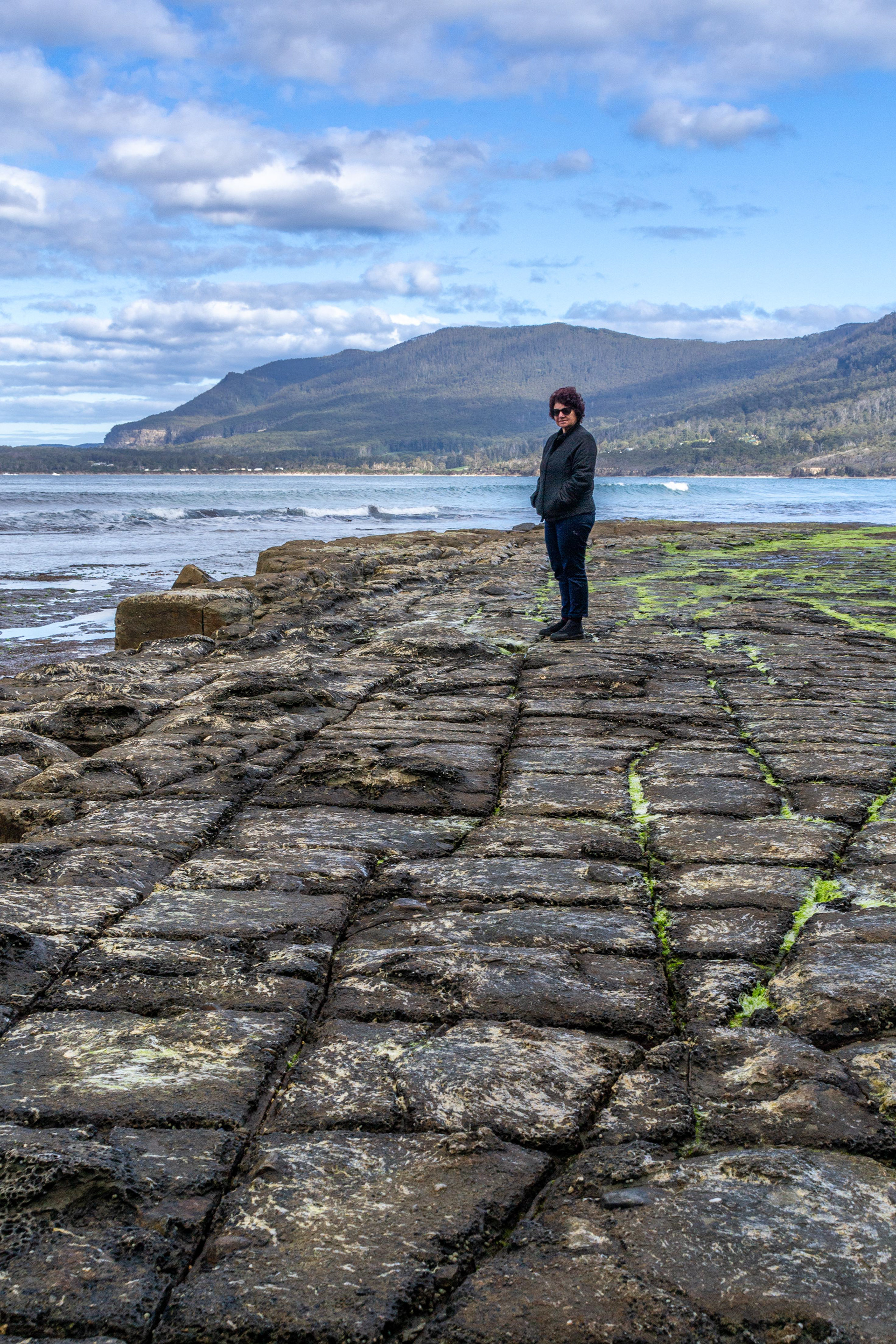
Cheryl exploers the tessellated pavement.
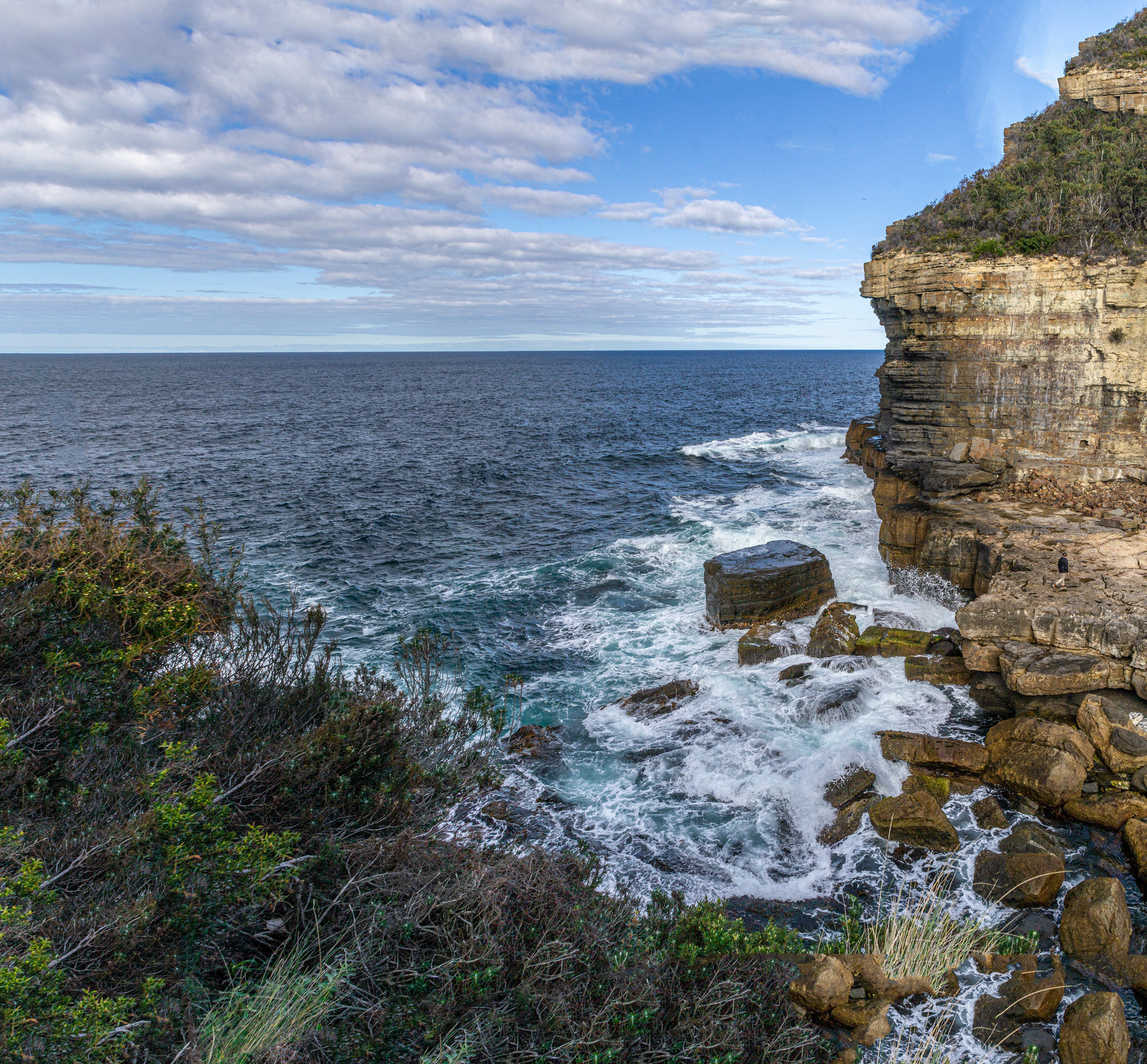
One of many of the rugged cliff faces of the Tasman Peninsula.
Devils Kitchen, a 60m-deep rugged cleft where swells of the Great Southern Ocean crash and swirl around the base. Even on relatively calm days this is an awesome sight.
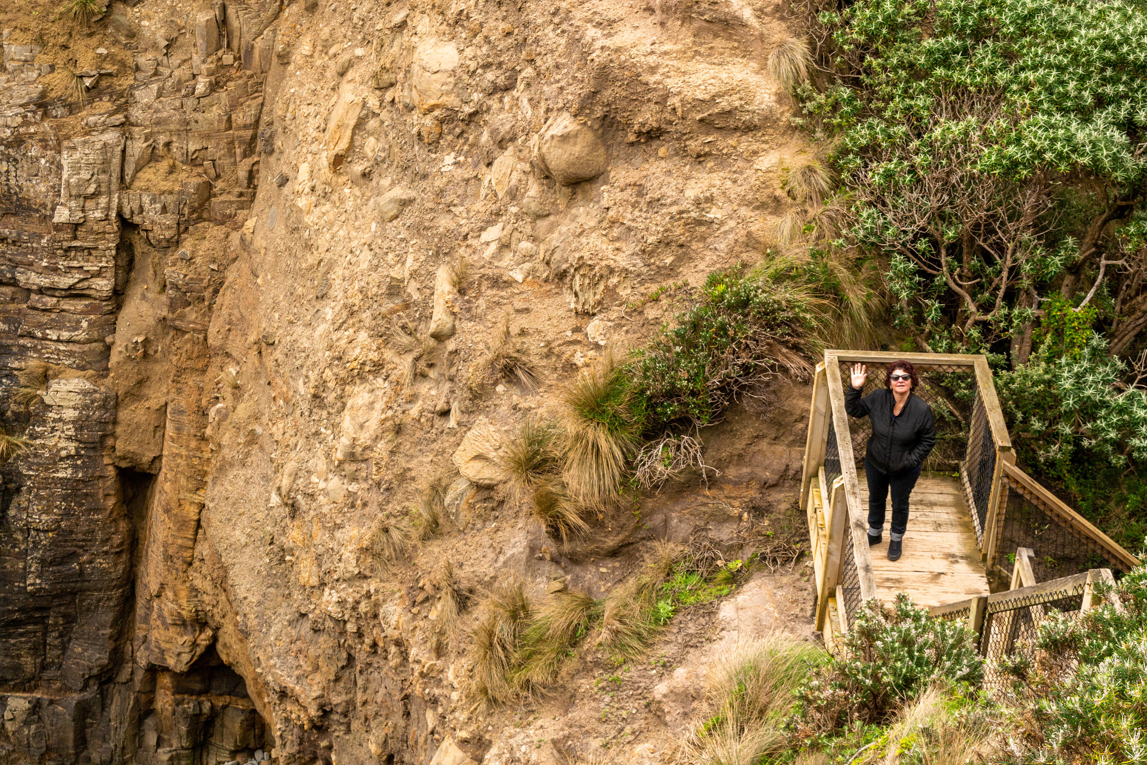
Cheryl pauses on the way down to Remarkable Cave.

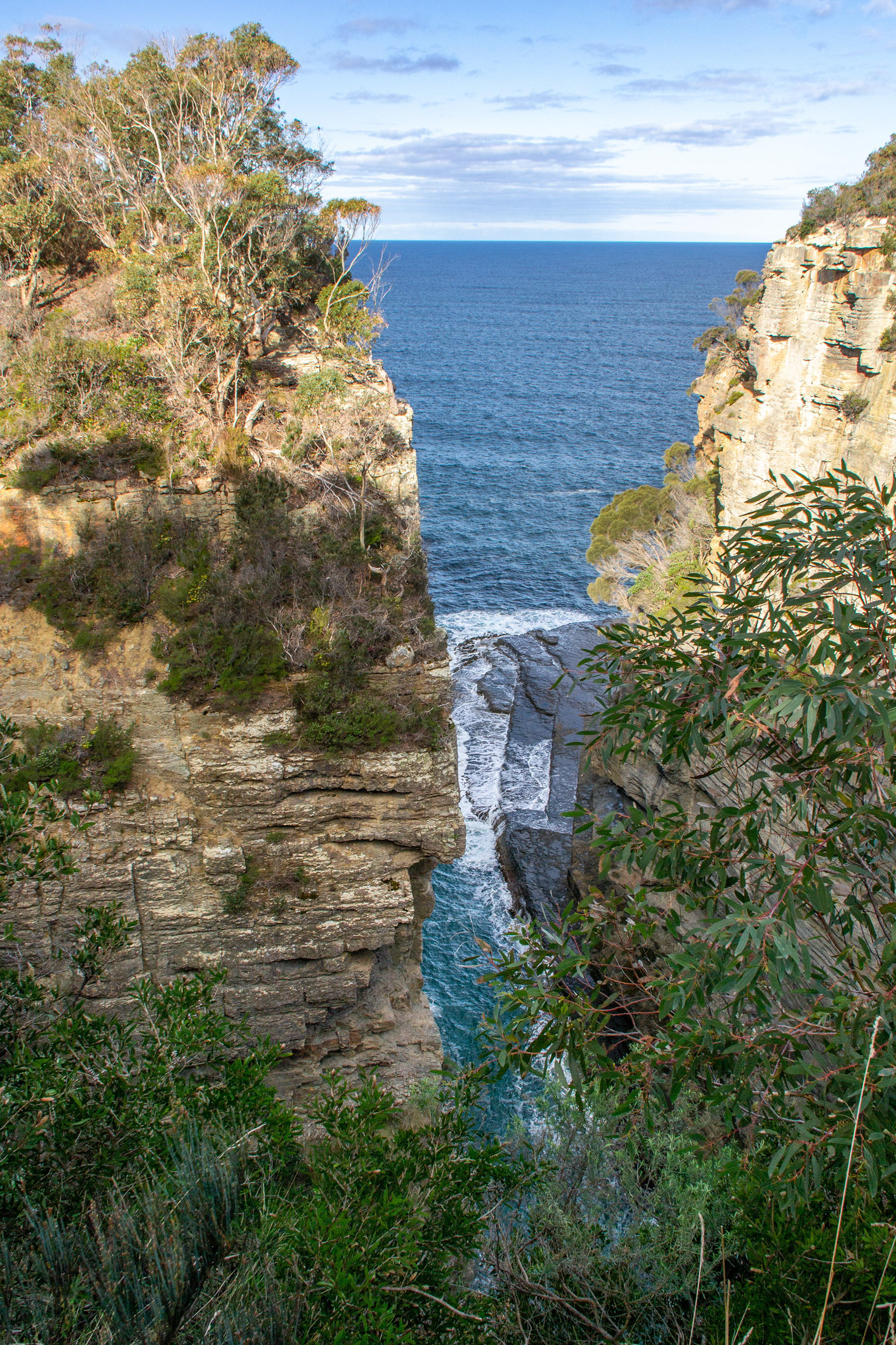
Overcast sky provides a moody background to one of two ocean-facing entrances to Remarcable Cave
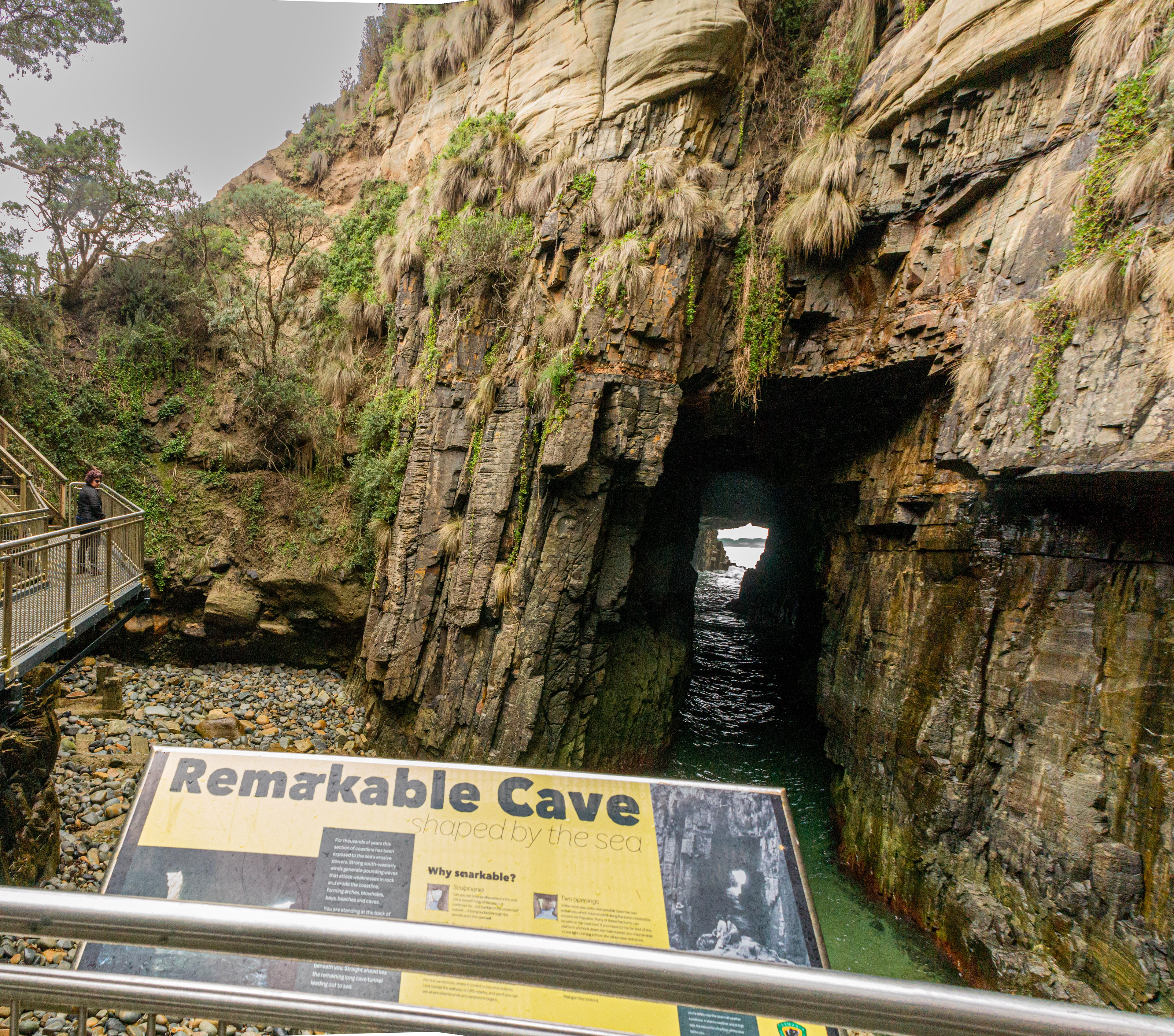
Remarkable cave in the background. Unlike most sea caves, Remarkable Cave features two ocean-facing entrances caused by erosion along fractures created by ancient earth quakes.
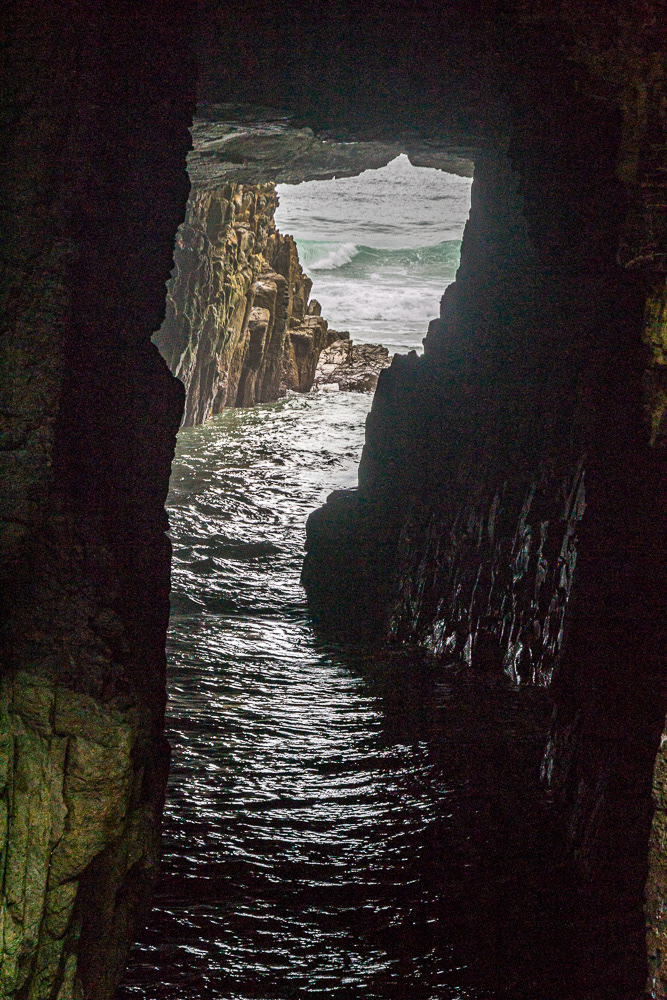
Looking throught Remarkable Cave to the Southern Ocean.
The opening, of Remarkable Cave when. viewed from the platform, resembles the shape of Tasmania.

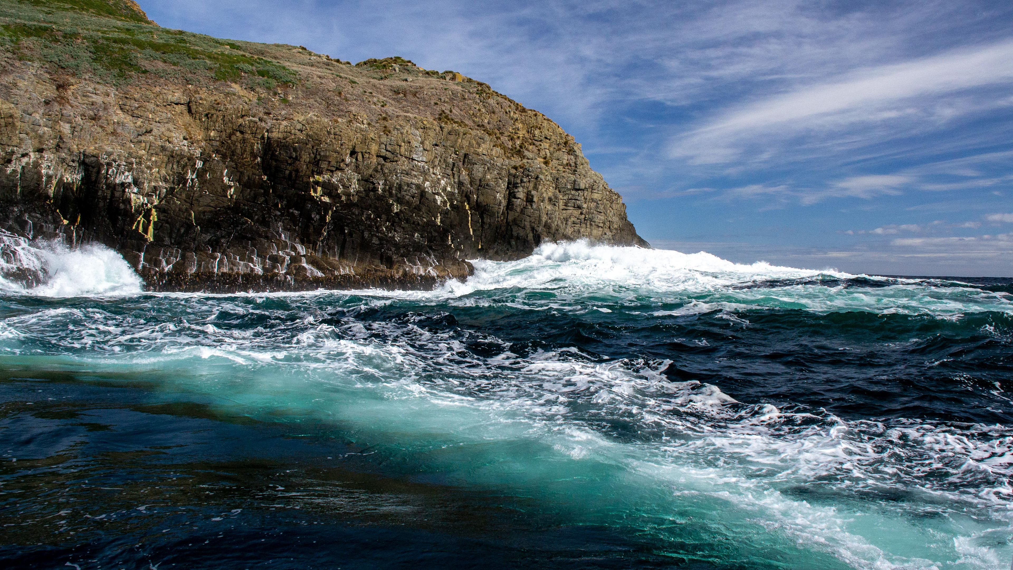
A rugged coastline formed by the Southern Ocean.
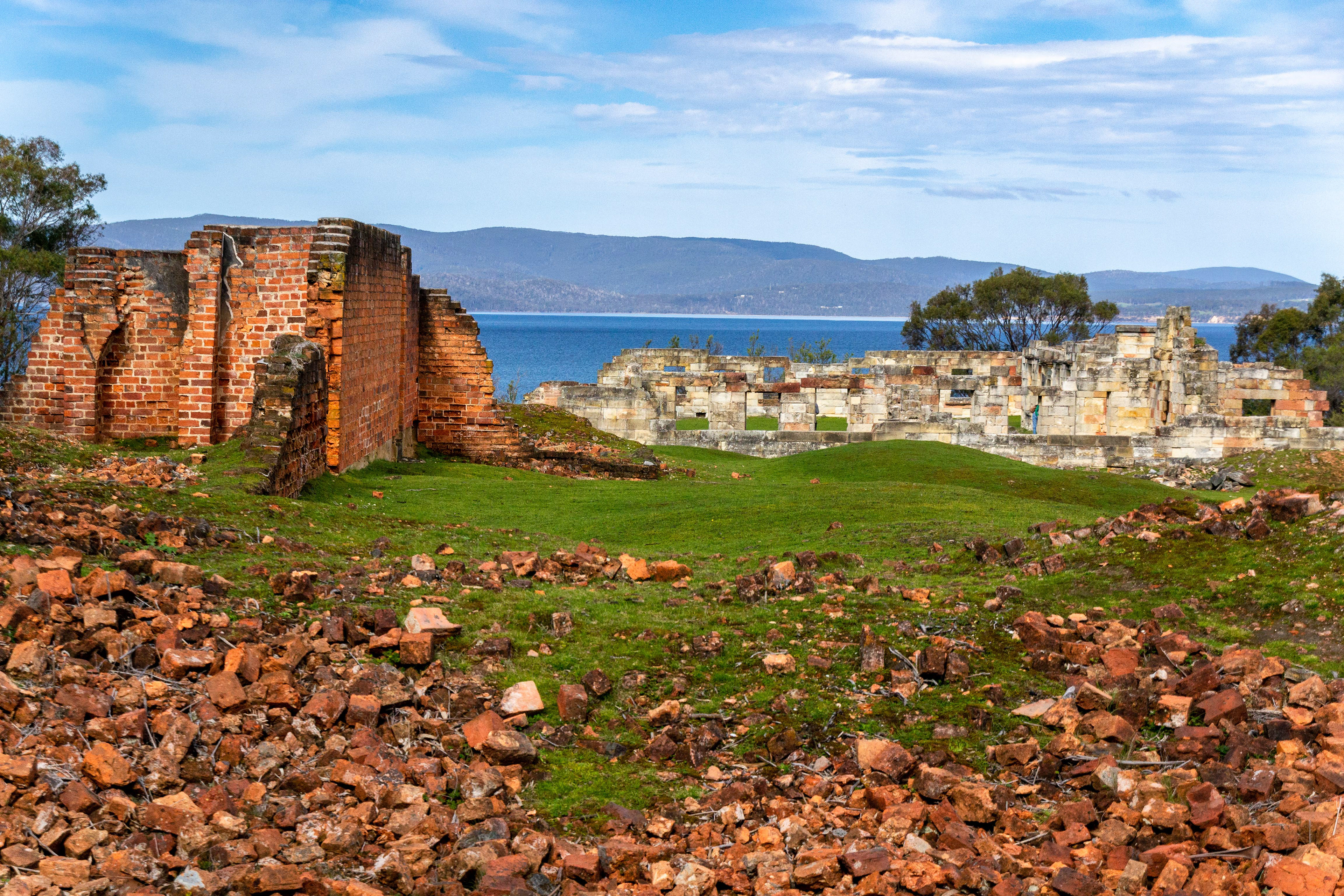
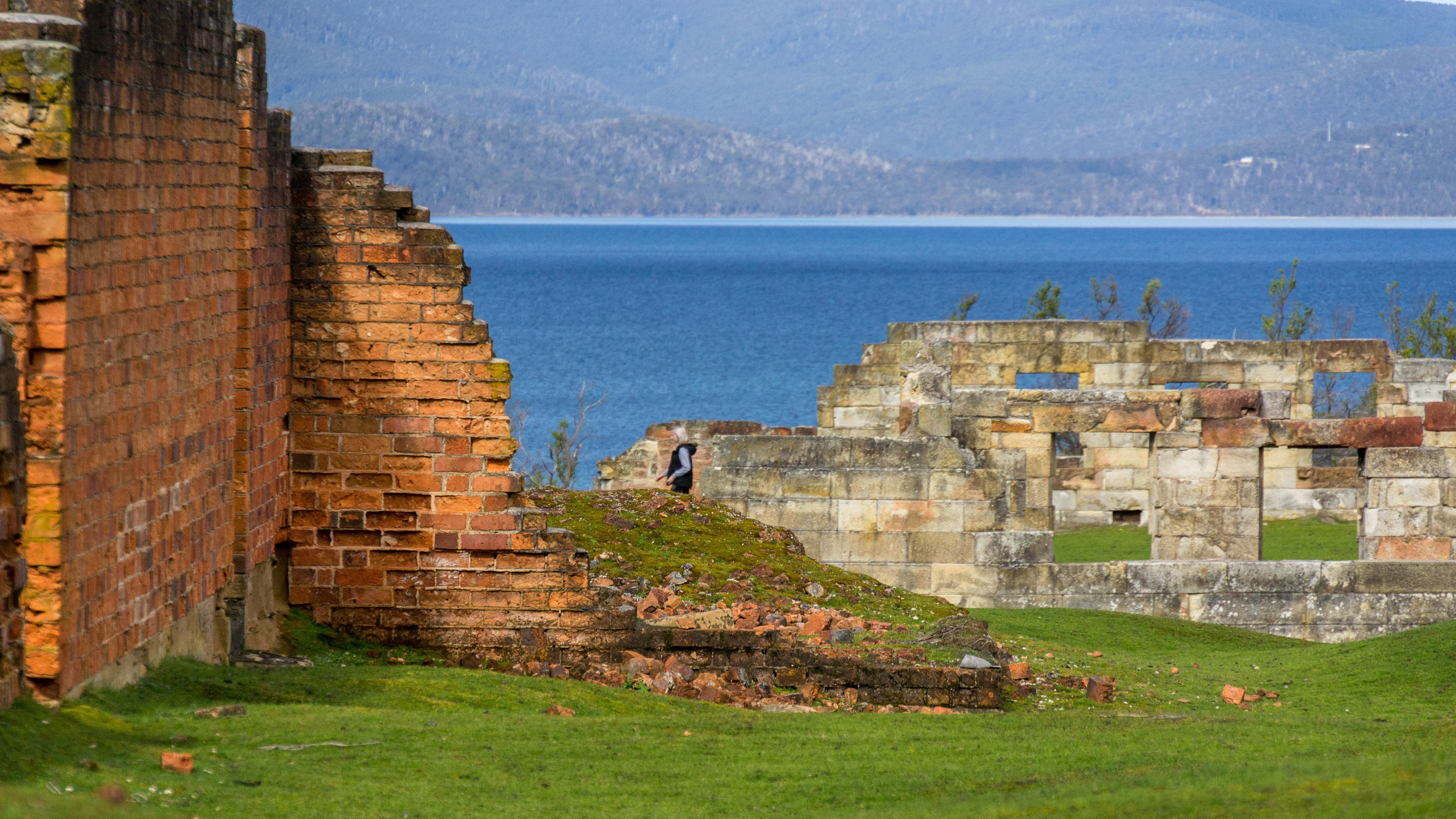
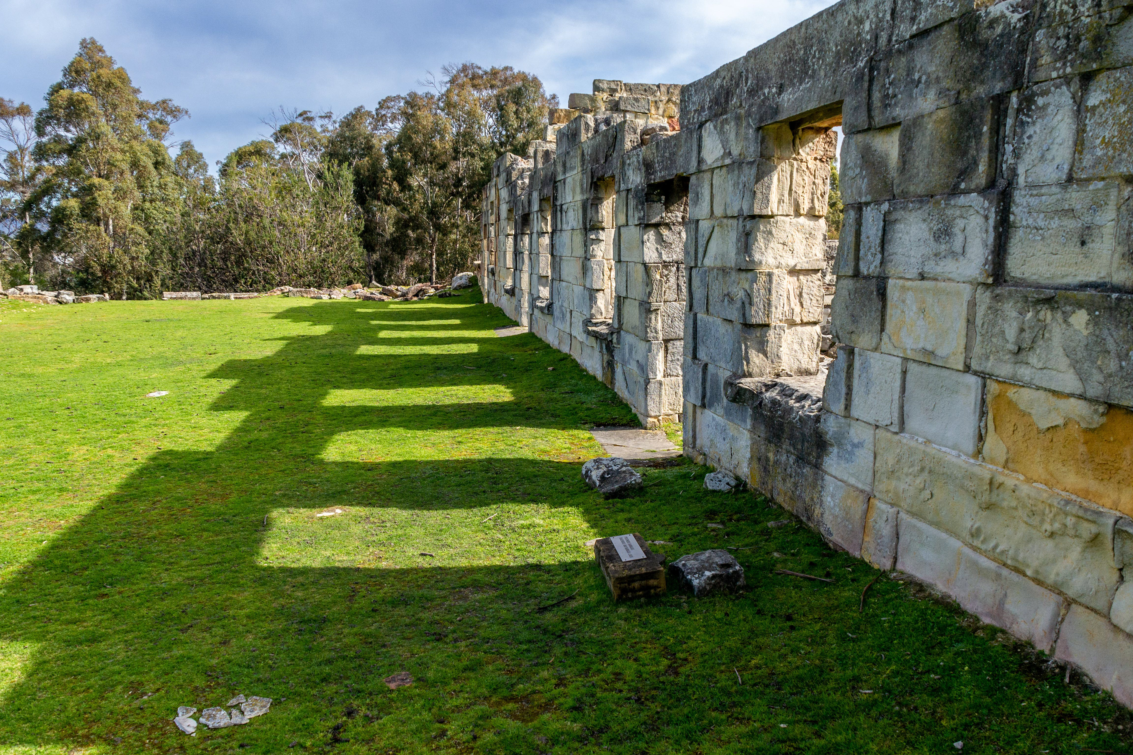
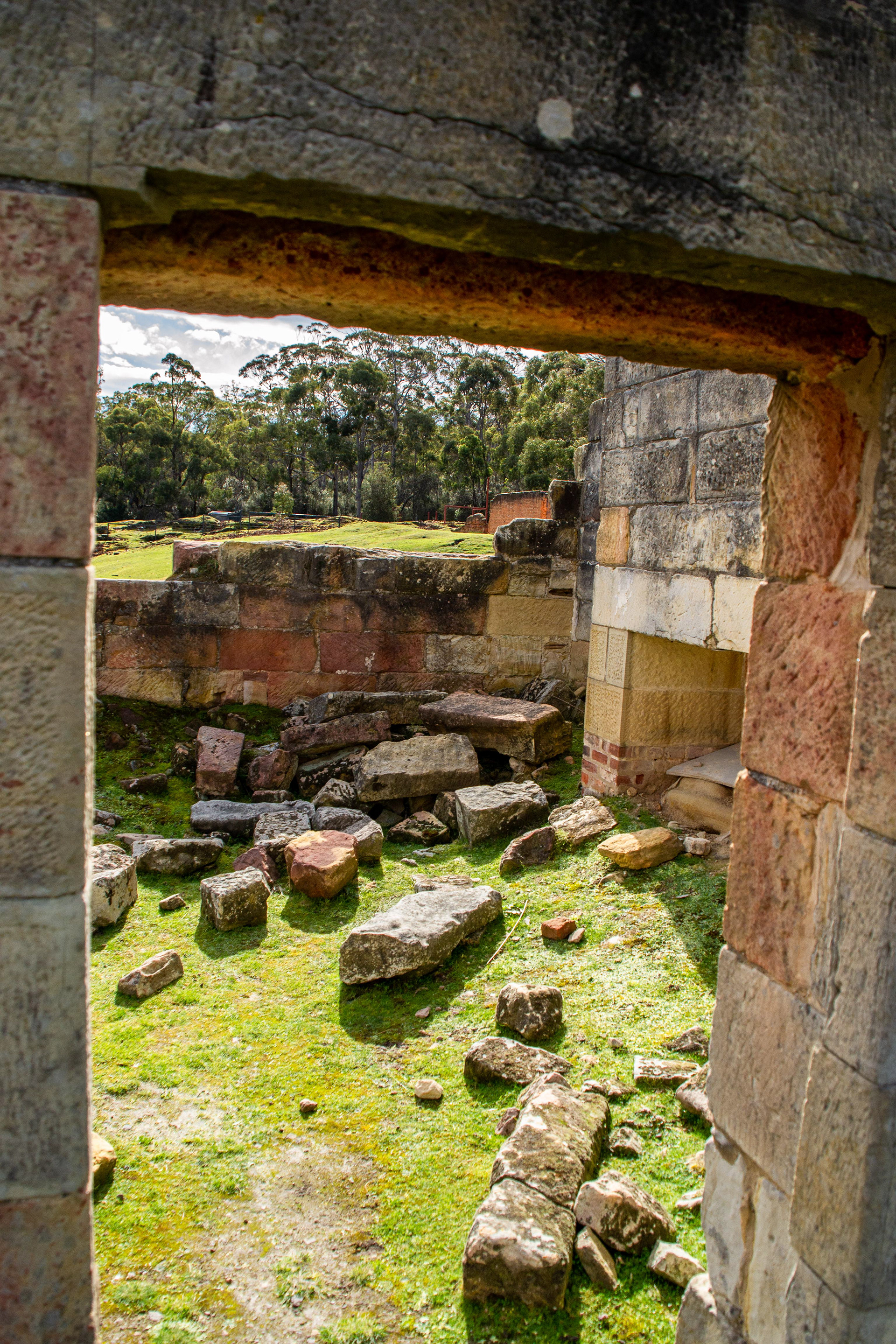
Historic Convict Coal Mine Site
This convict coal mine on the Tasman Peninsula opened in 1833, reoffending convicts from Port Arthur and elsewhere suffered additional hardship in this isolated work camp. The ruins which remain at the site include a complex of punishment cells, separate apartments, barracks, workshops, warder’s lodgings and a chapel.

Bricks lay trewn around the site amongs the ruins of the convict penitentiary precint of the Limestone Bay coal mine.
Lime Bay Coal Mine penitentiary ruins.

Imposing sandstone ruins on the hillside were once comfortable quarters for the commanding officer, surgeon and other officials.
Shadows of a grim history.
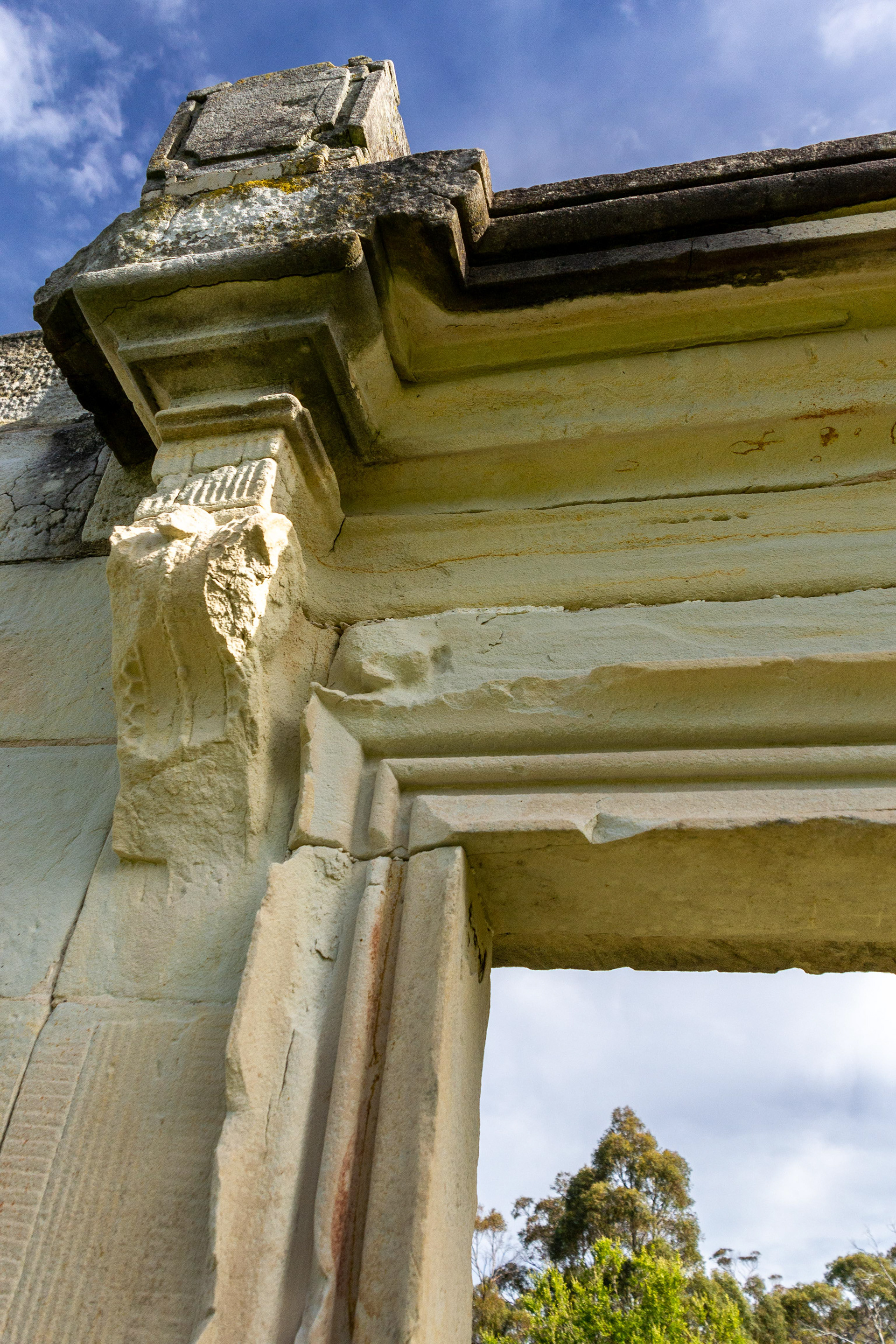
Carved sandstone lintels frame the openings hinting to the grandeur of the officers quarters.
A window into the past.

More sandstone ruins on the hillside.
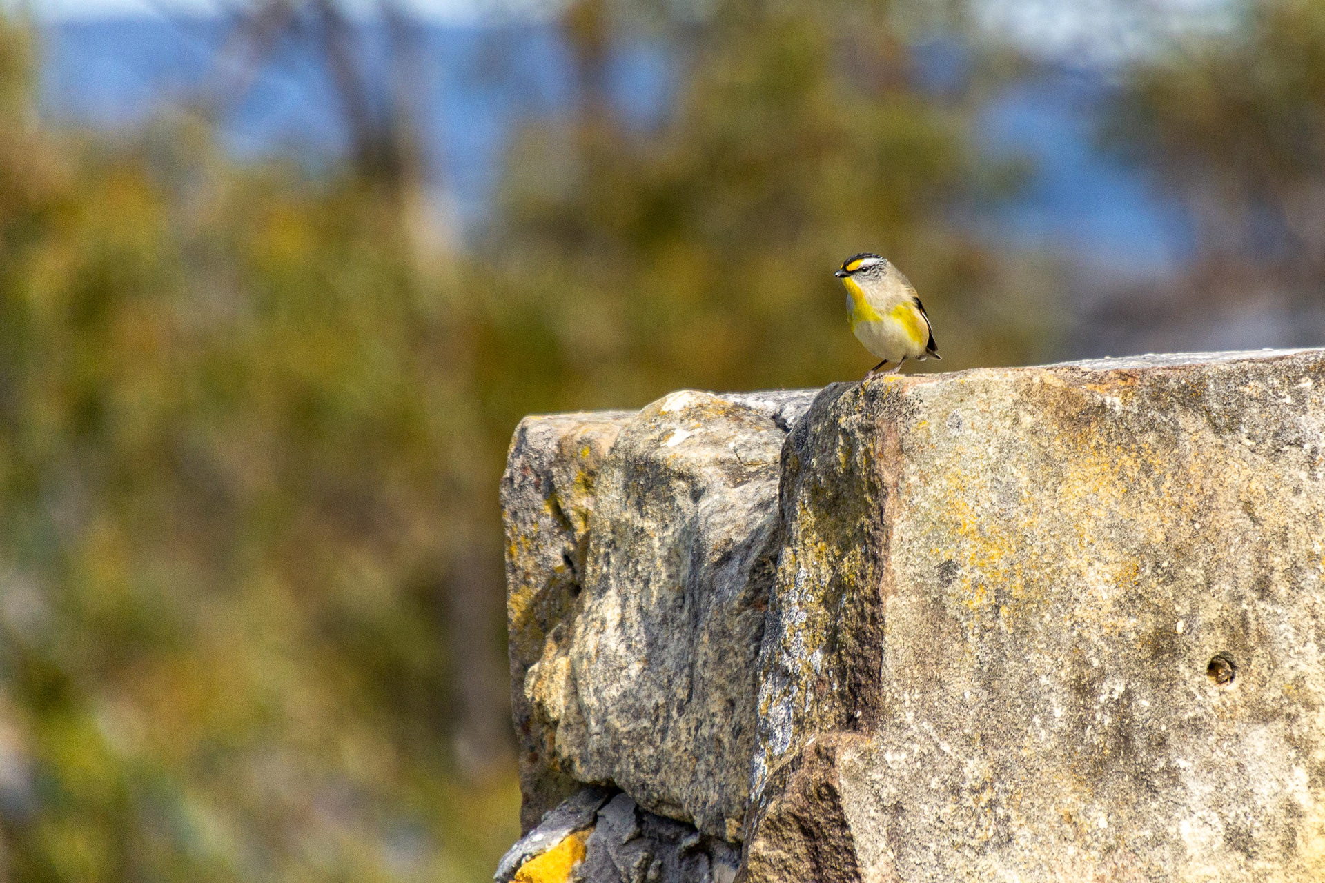
A Stirated Pardalote perches on the sandstone wall.
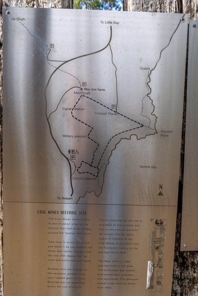
A plaque gives an insight to the extent of the Historic coal mine site.
Plunkett Point
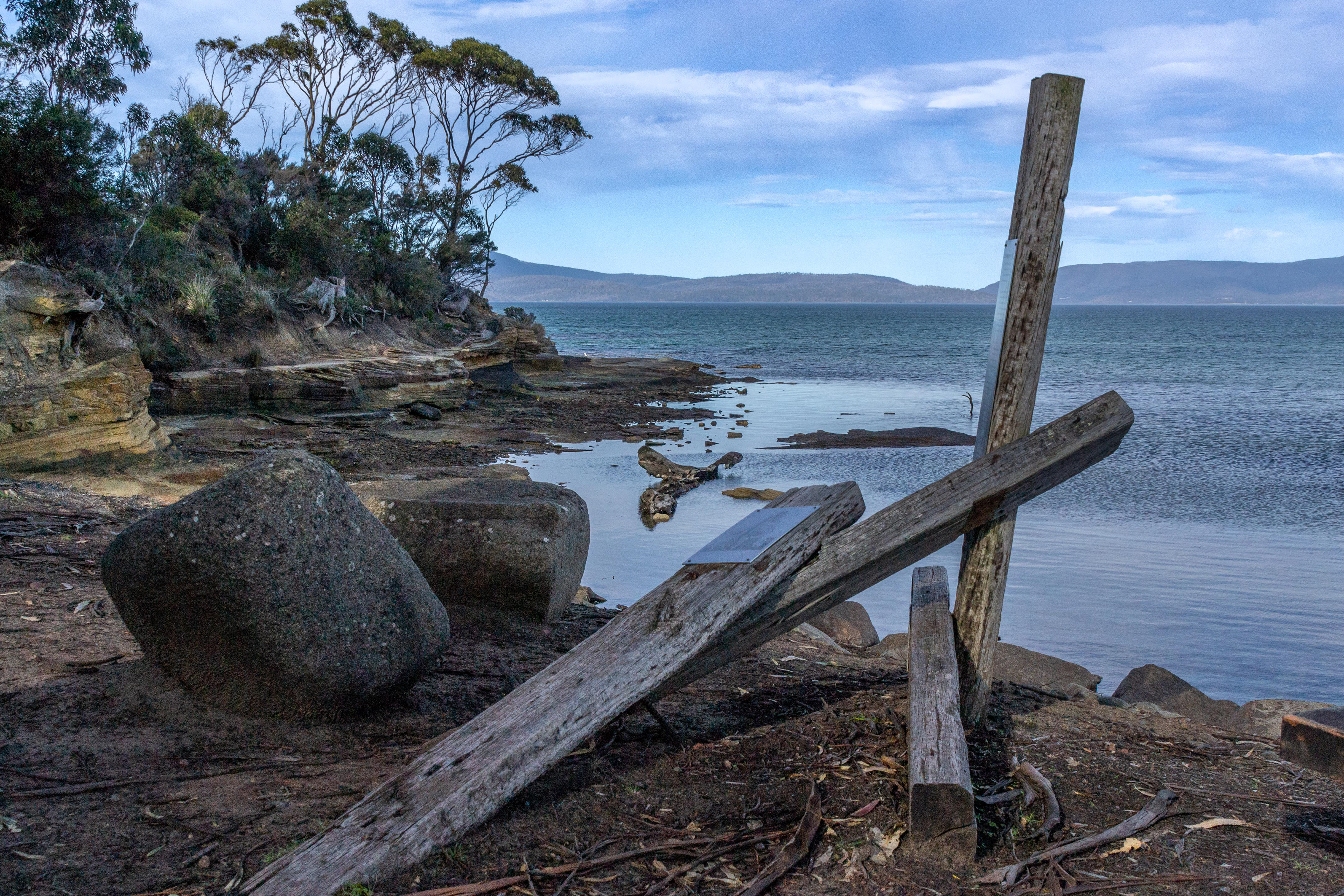
Plunkett Point - the only remains of the boat-loading point for the coal mine.
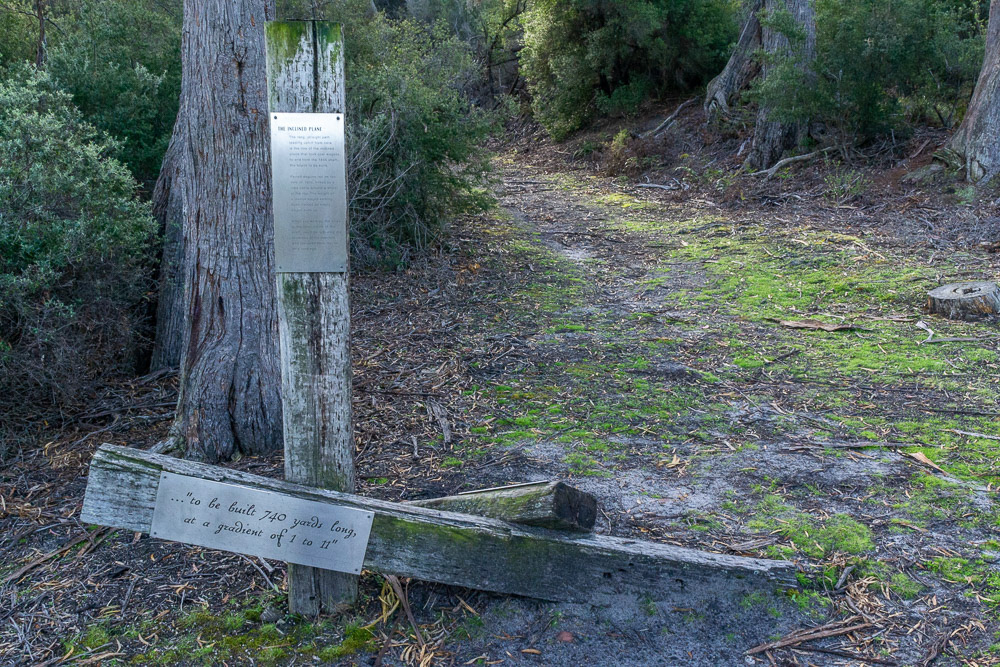
The start of the inclined plane leading up to the main shaft from Plunkett Point.
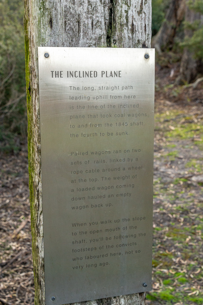
The ingunity of the inclined plane explained.
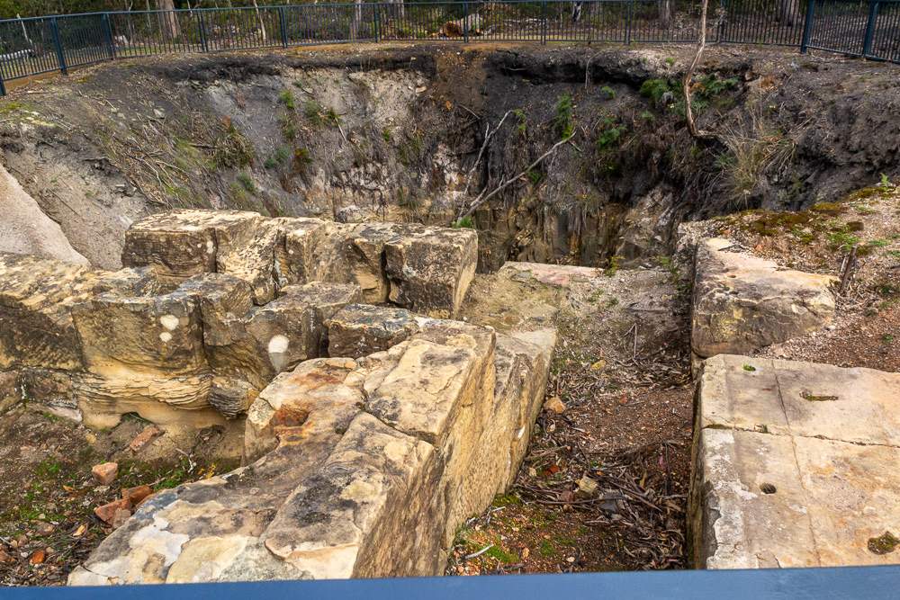
The main shaft of the coal mine dates back to c1845. Convicts were lowered by a rope windlass on a bosun chair to work the mine.
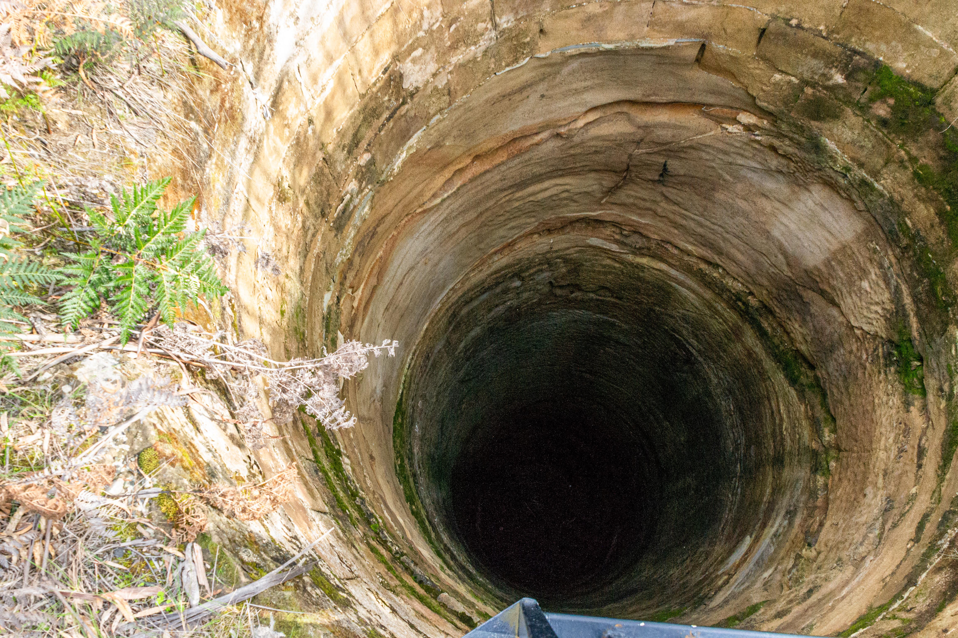
One of the stone lined air shafts serving the mine.
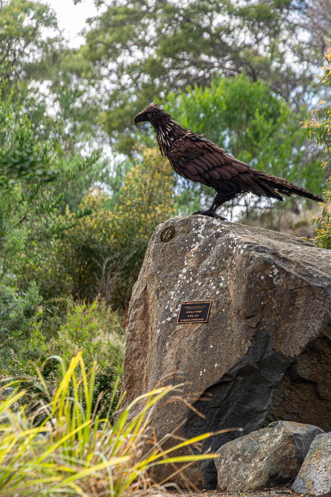
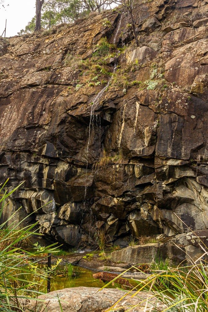
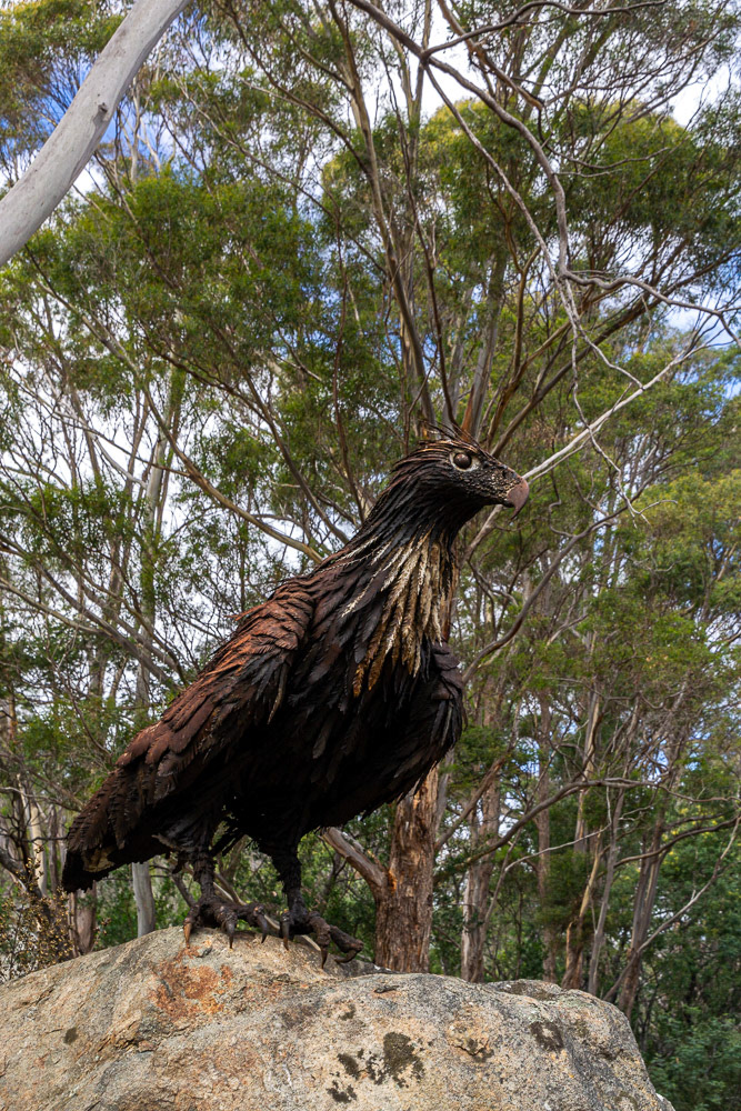
Tasmanian Devil Unzoo Conservation Park
The Unzoo project is an innovative and holistic wildlife experience dedicated to showing unique animals and plants of Tasmania while taking a lead role in preserving the critically endangered Tasmanian devil.
A Superb Fairy Wren
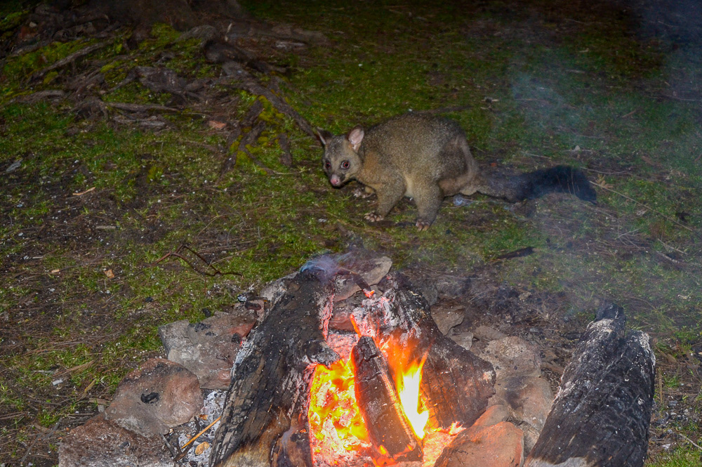
A Tasmanian Possum cautiously approaches our campfire, Lime Bay.

The Devil sleeps.
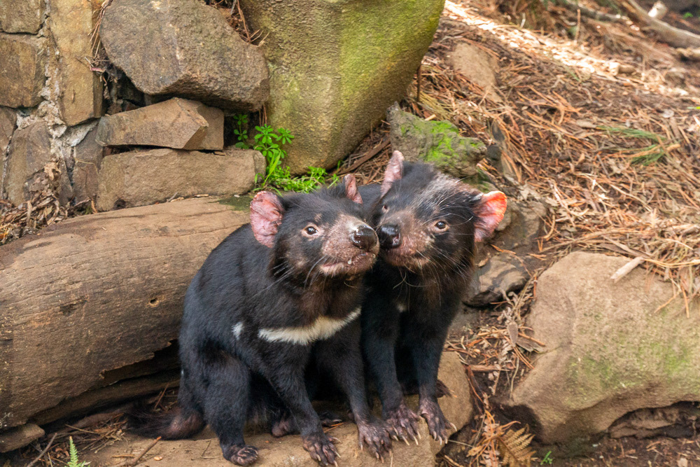
Affectionate Devils.
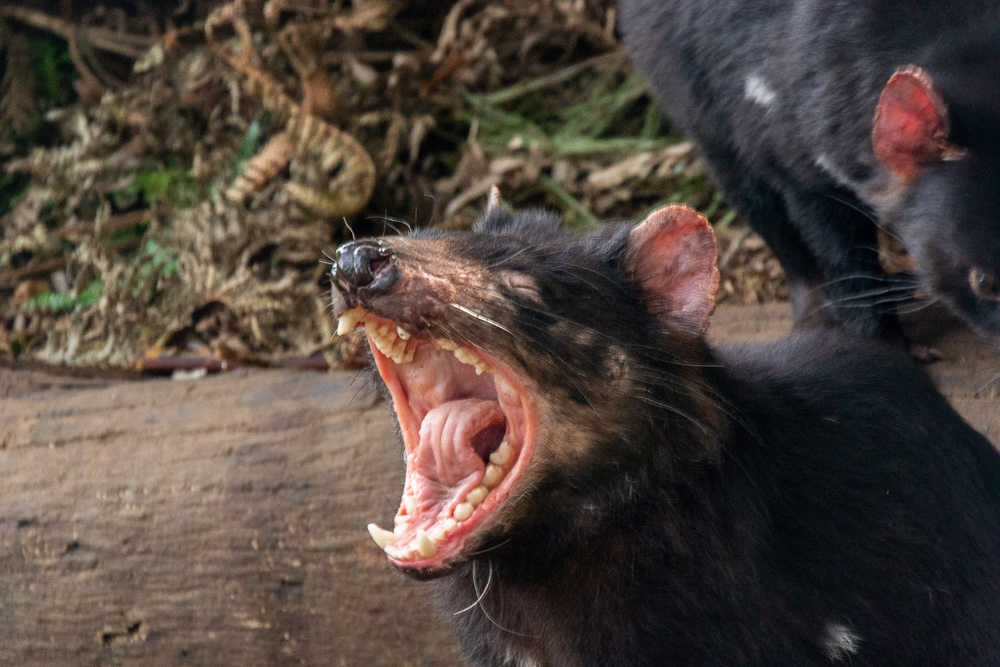
The fearsome jaws of a Tasmanian Devil.

An Eastern Quoll.

A cute Eastern Quoll sound asleep.
A Tasmanian Possum in the park.
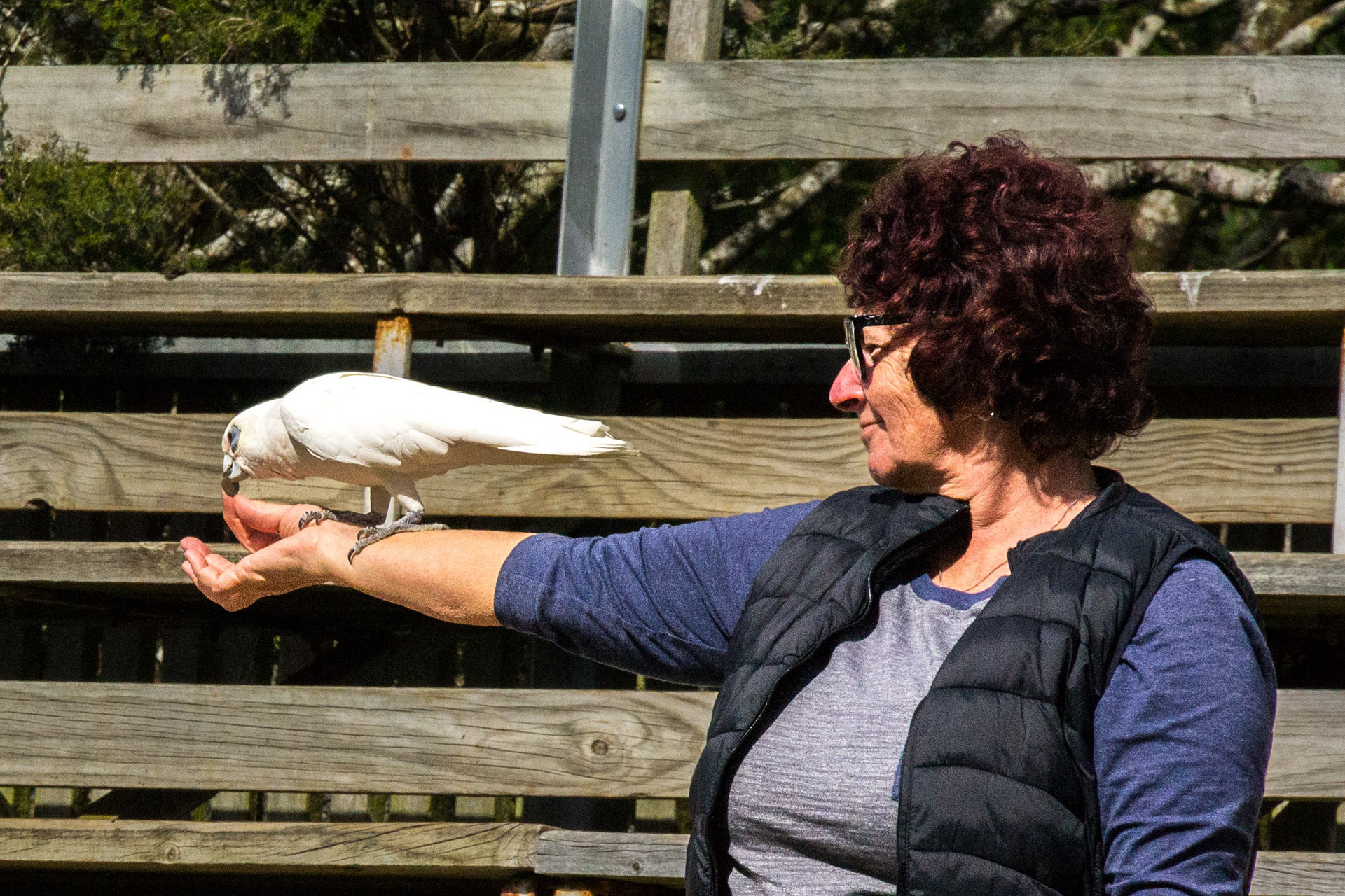
Cher with a Little Corella at the Unzoo.

The Eastern Rosella steals the show as it strides confidently across the ground.
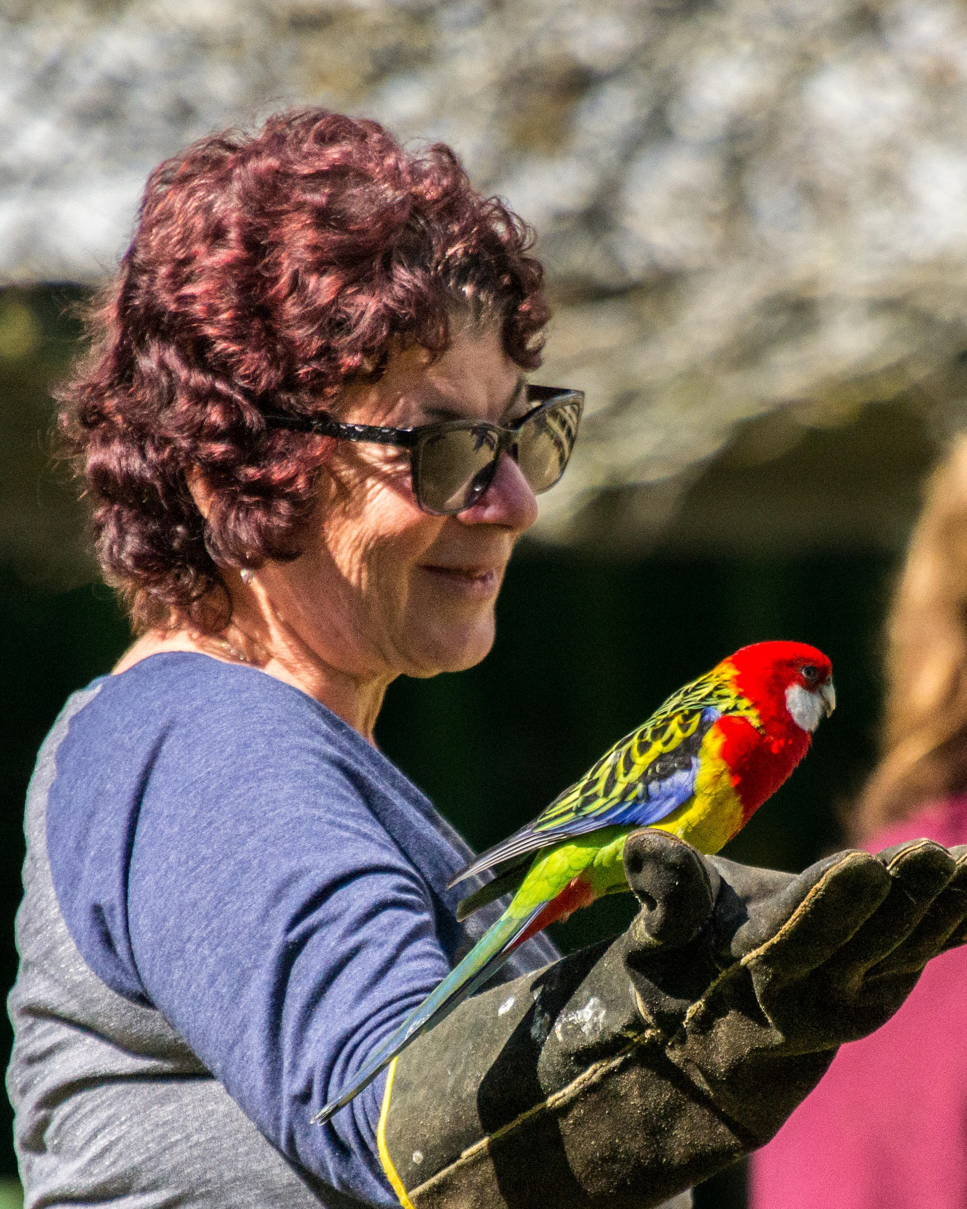
Cher and the Eastern Rosella.

A Tawny Frogmouth

A pair of Tawny Frogmouths imitating branches as part of their camouflage strategy against predators.

Cape Baron Goose strolls around the grounds of Unzoo.
A Red Wattlebird
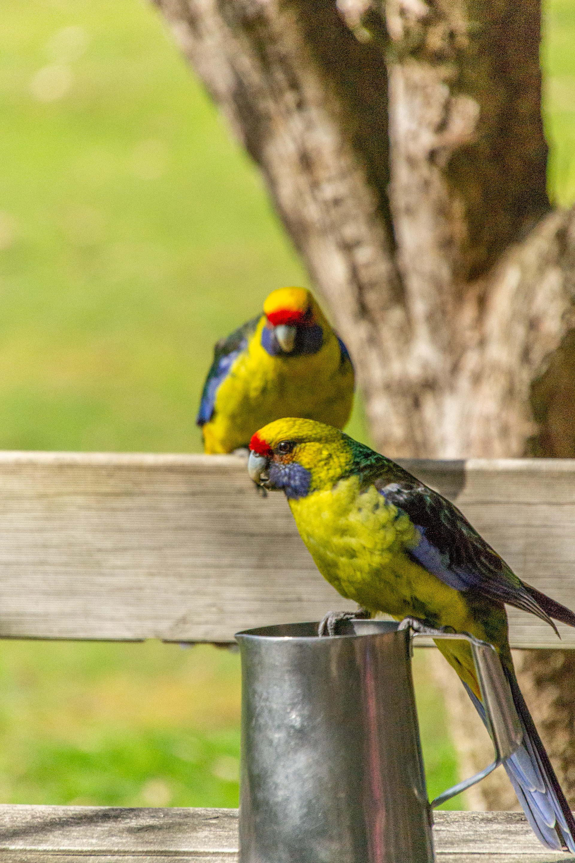
Green Rosellas check out the tankard contents.n Rosellas
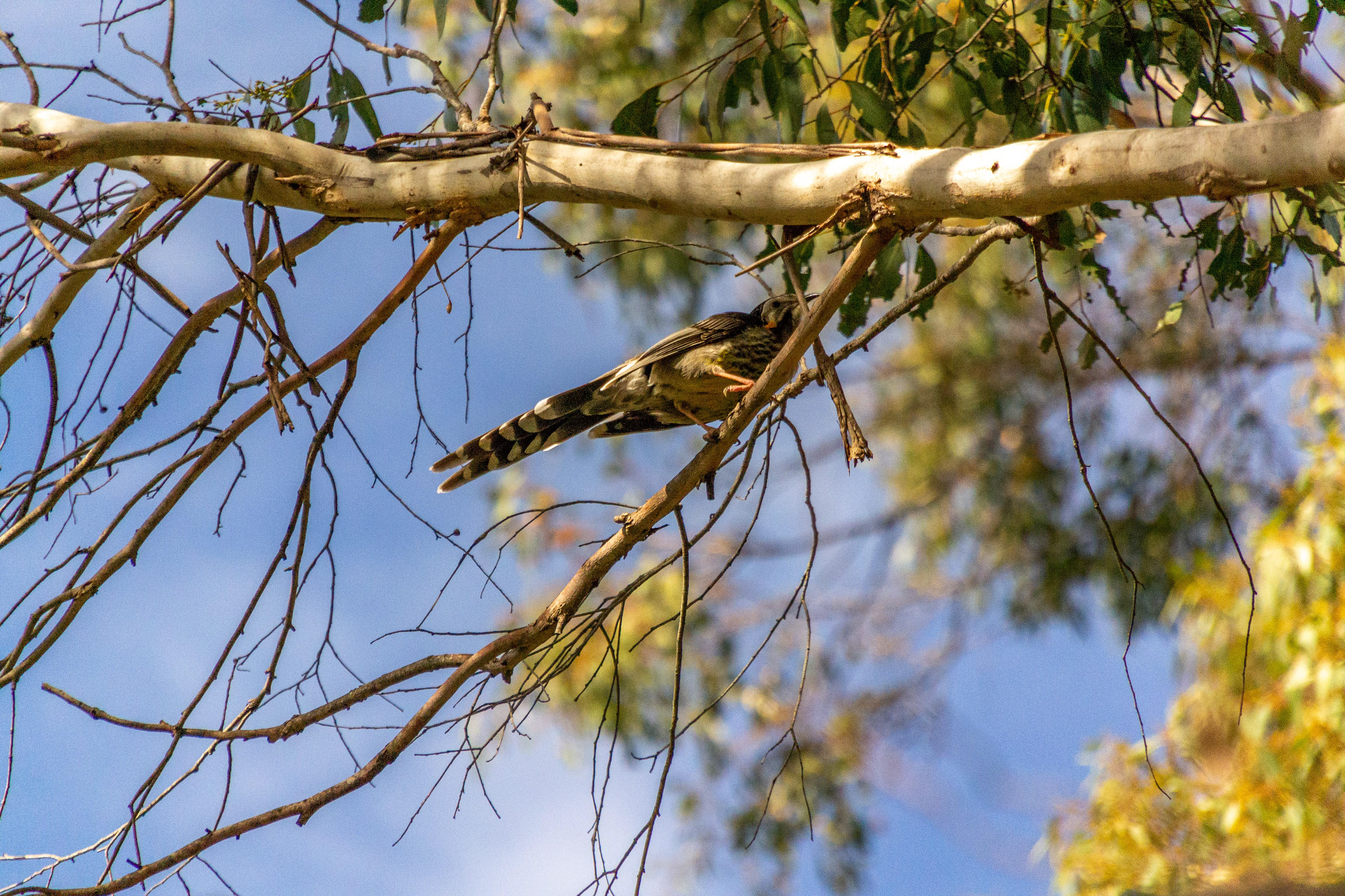
A Tawny Grassbird observes proceedings from above.
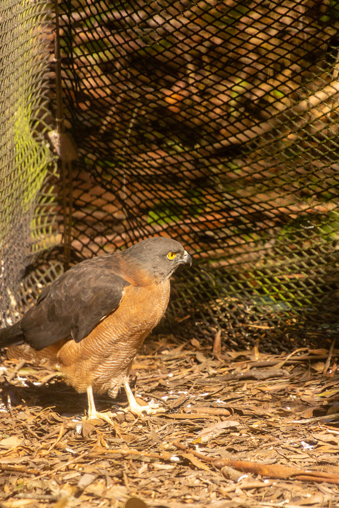
A Brown Goshawk

A Grey Goshawk
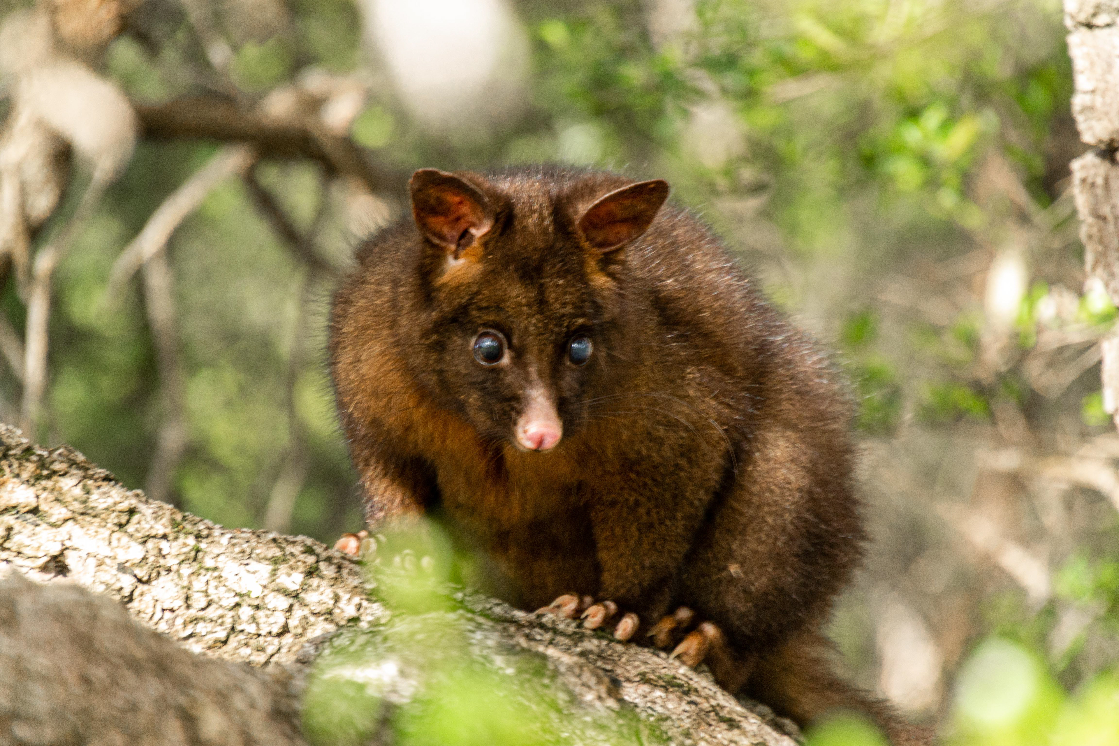
A Possum peers down from above.
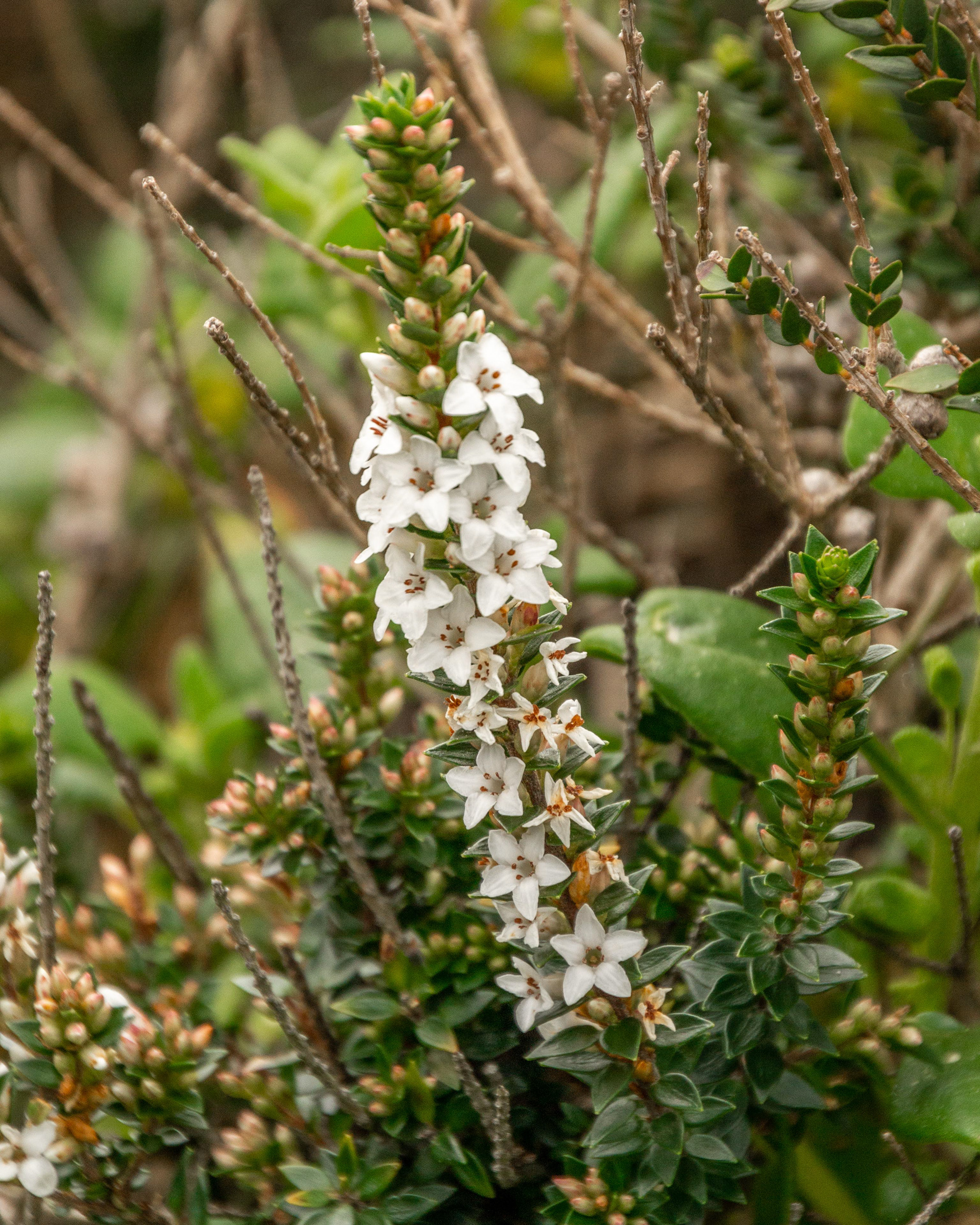
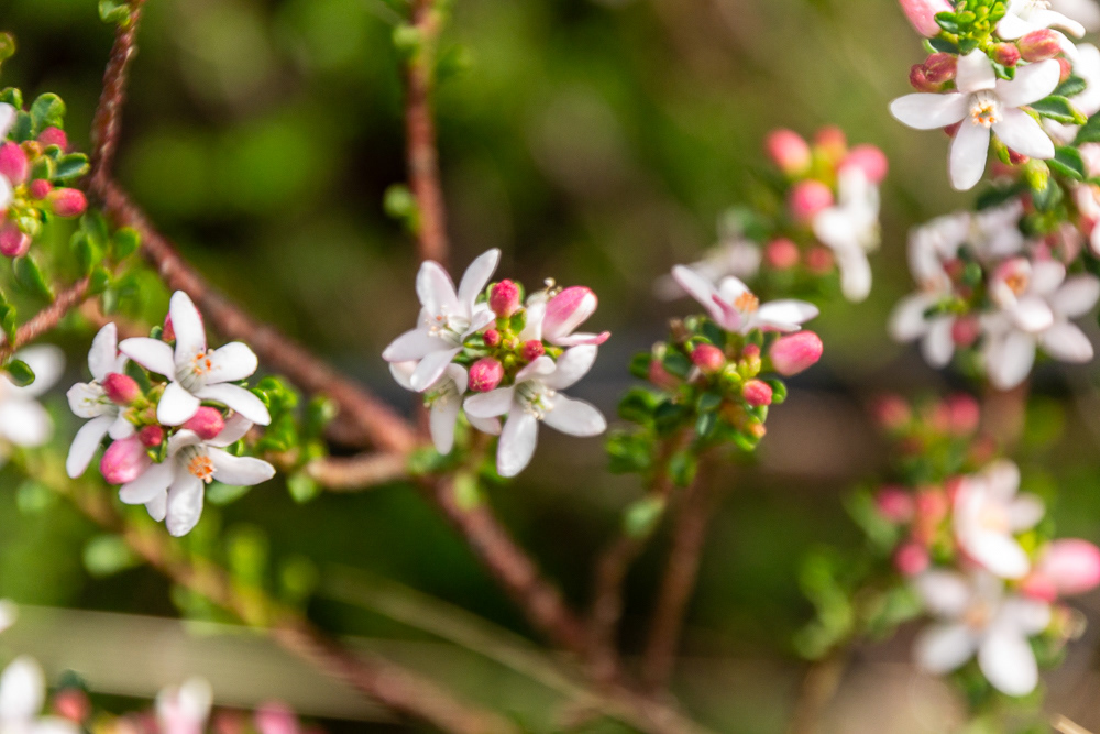
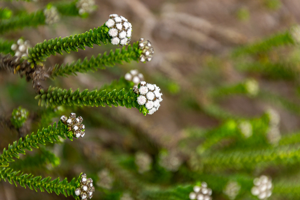
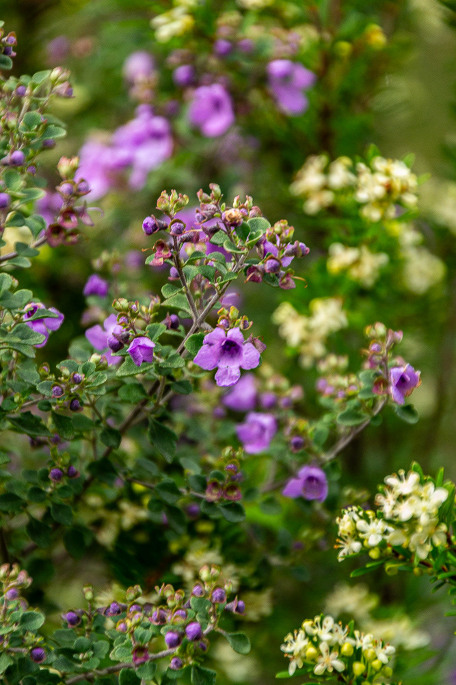
Epacris Marginata - a type of heath endemic to Tasmania.
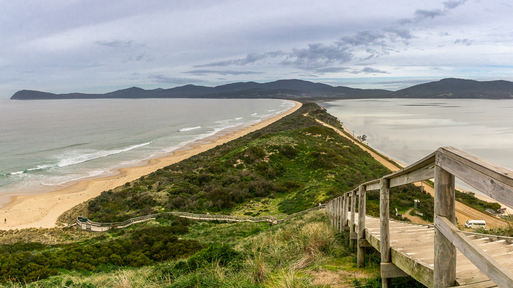
Bruny Island
A short ferry hop across the D' Entrecastaux Channel from Kettering is Bruny Island which lies off the south-east coast of Tasmania. The island has two sections North Bruny and South Bruny, separated by a narrow isthmus known as The Neck".
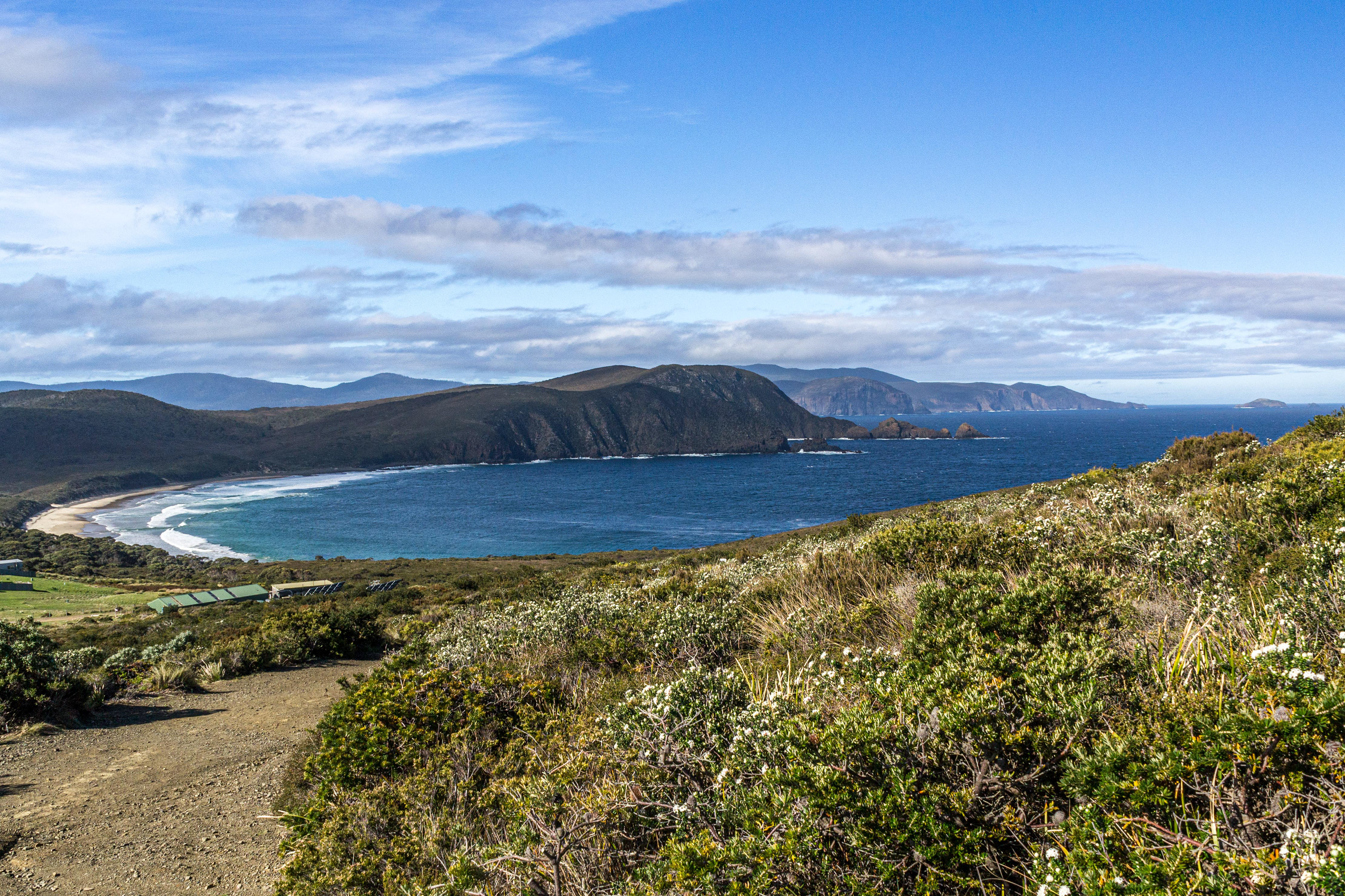
The spectacular vista over Cloudy Bay.
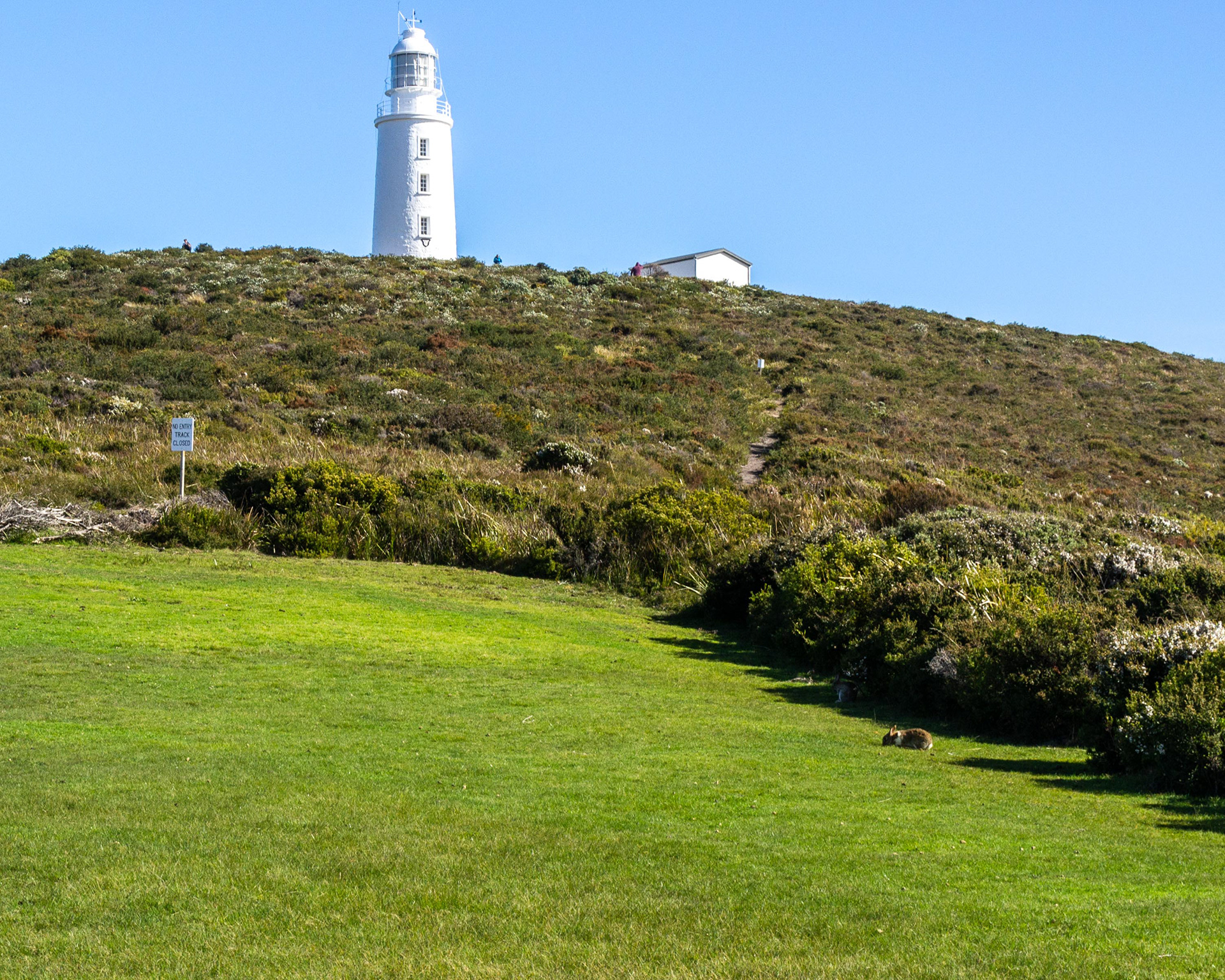
A Bruny Island bunny below the lighthouse.

A brief pause on the pathway to the lighthouse.
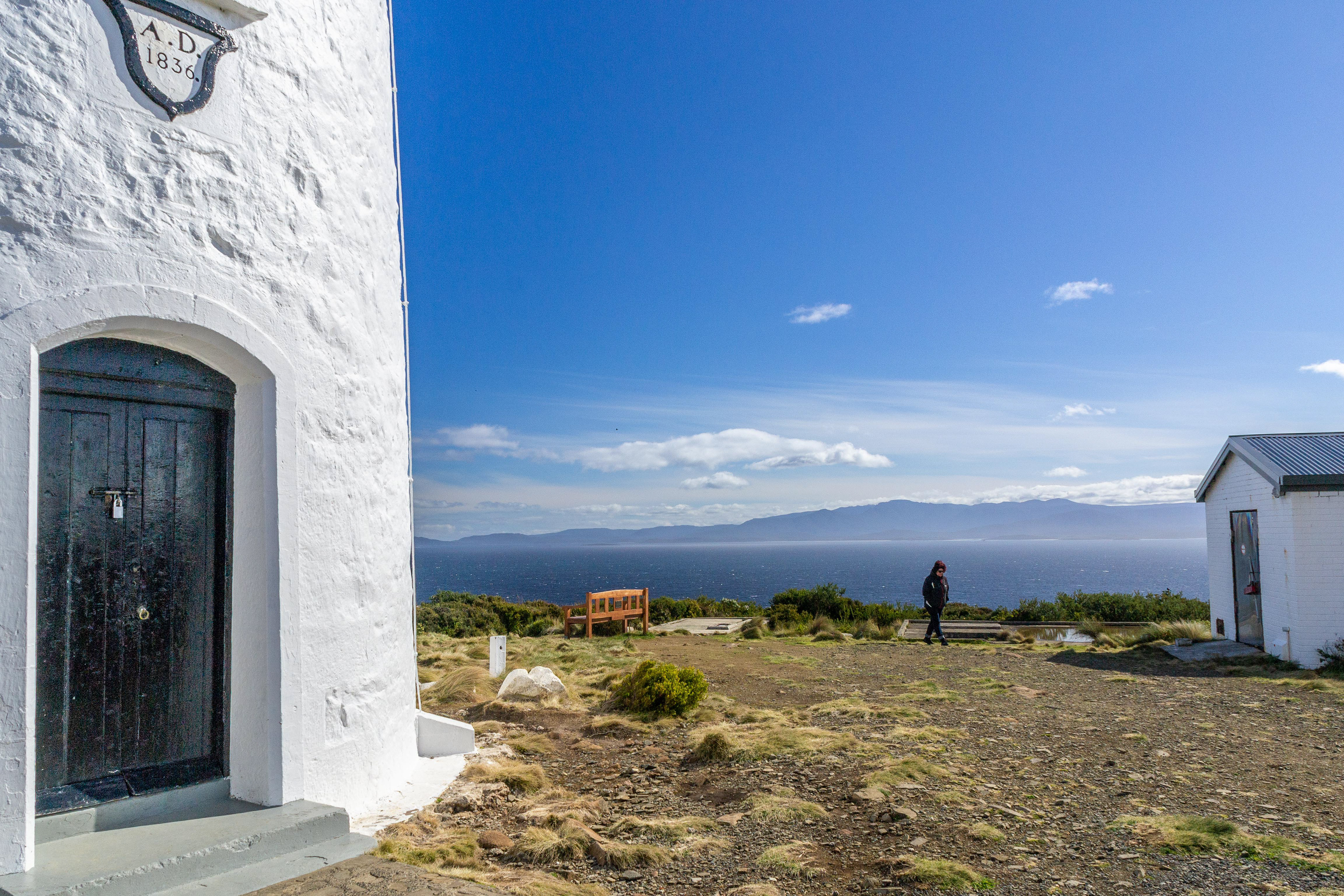
Cape Bruny Lighthouse, built 1836.
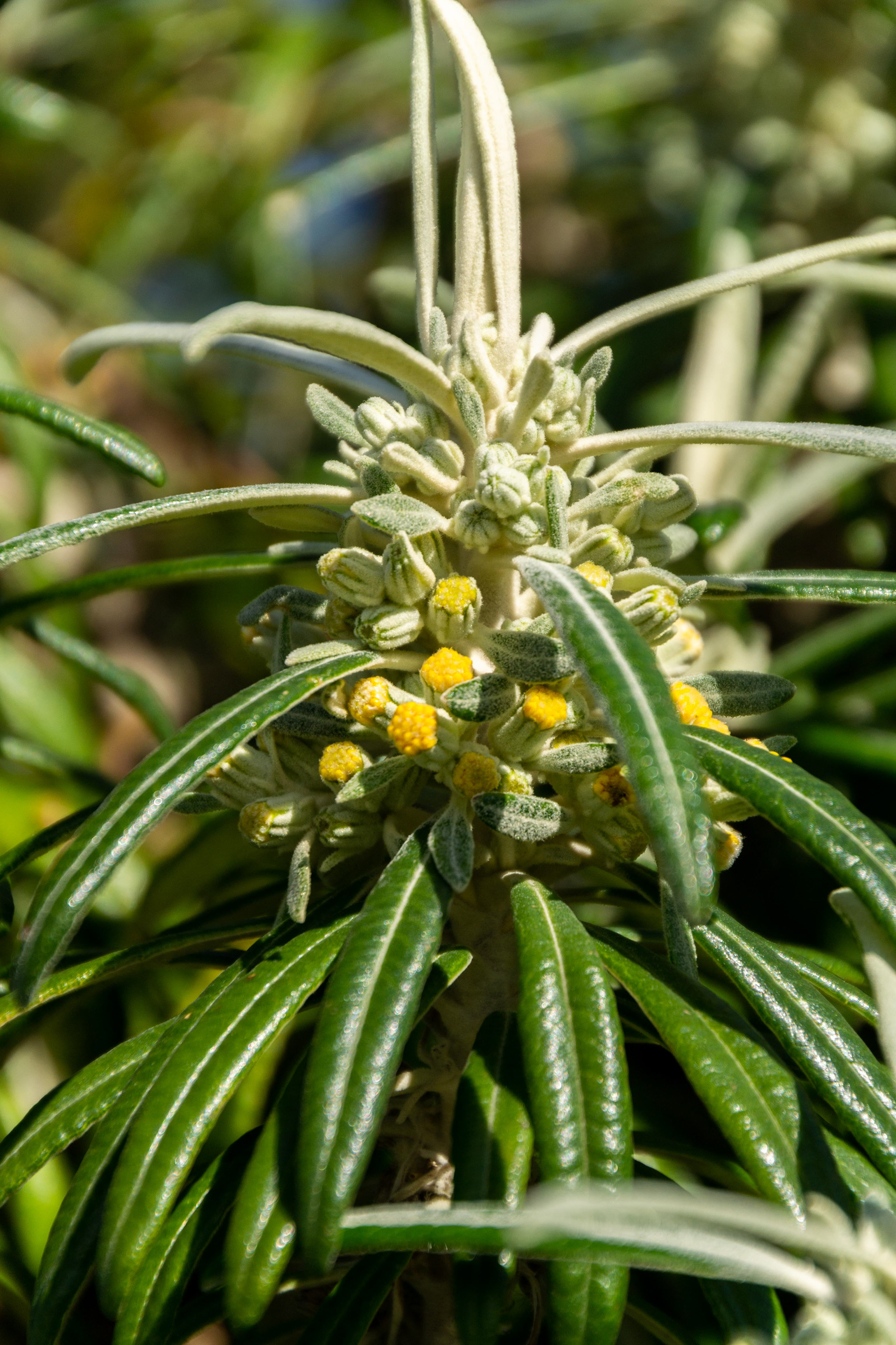
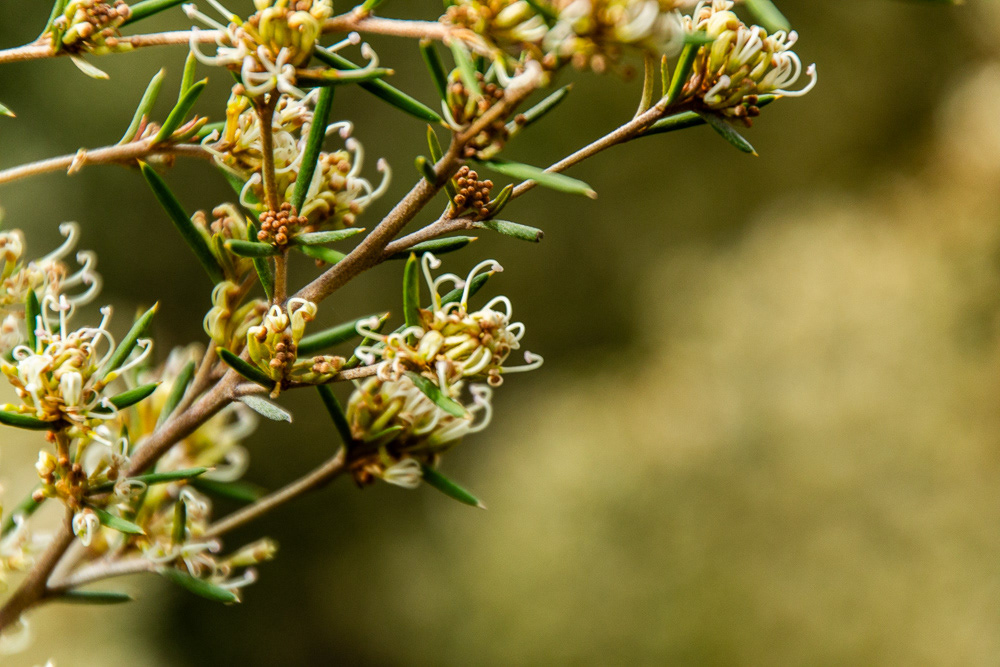
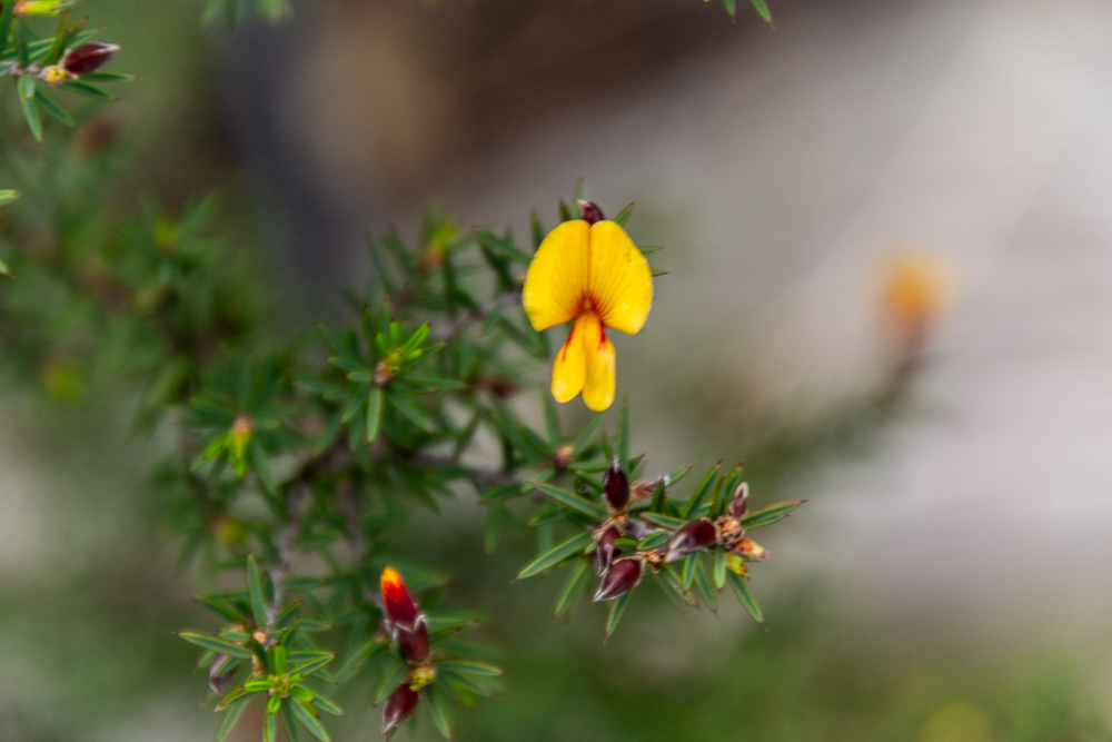
A native plant in bloom.
The Neck, Bruny Island.

Tracking a shell.
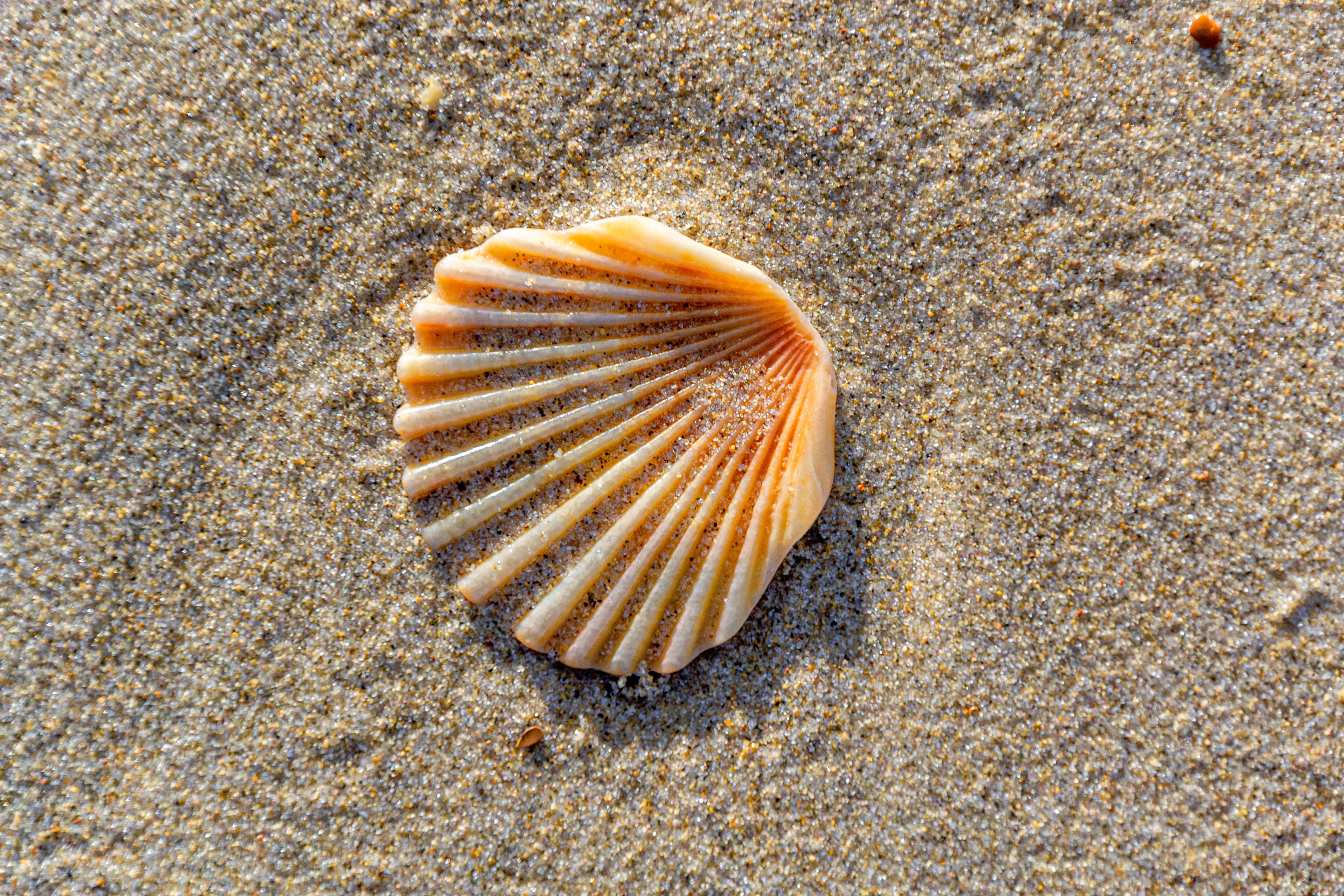
Found........the "Shell" motif.
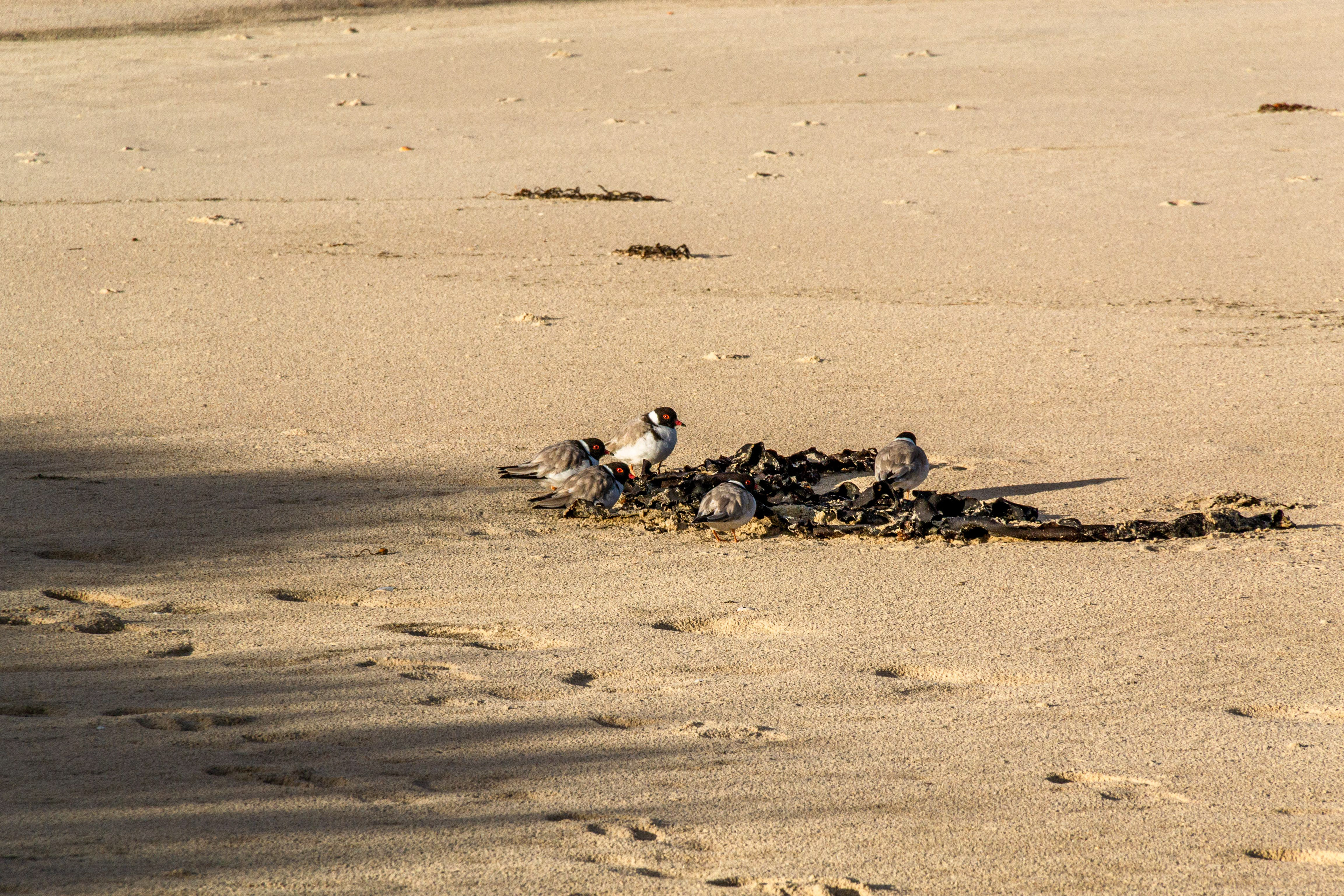
Hooded Plovers huddled in the seaweed.
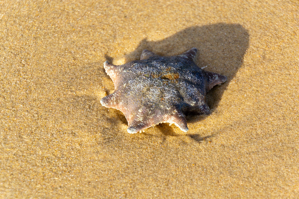
An Octa-starfish
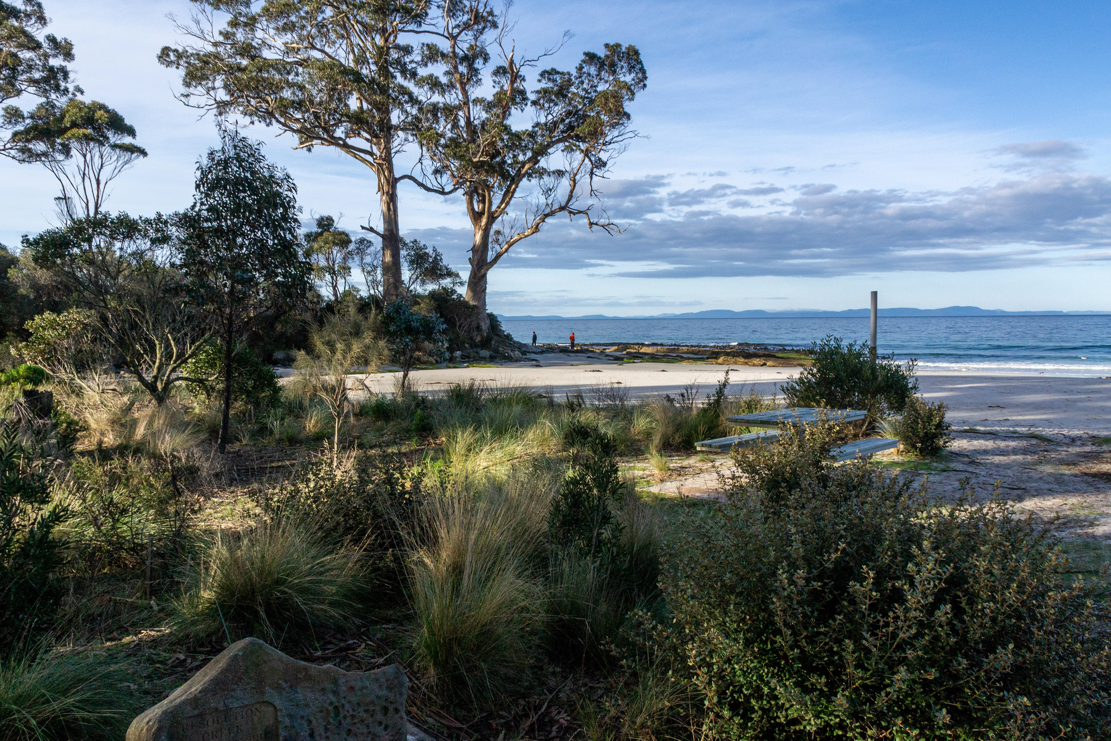
Adventure Bay on Bruny Island where Captain Cook came in his ship, ' The Resolution ' and filled up his water from this creek.
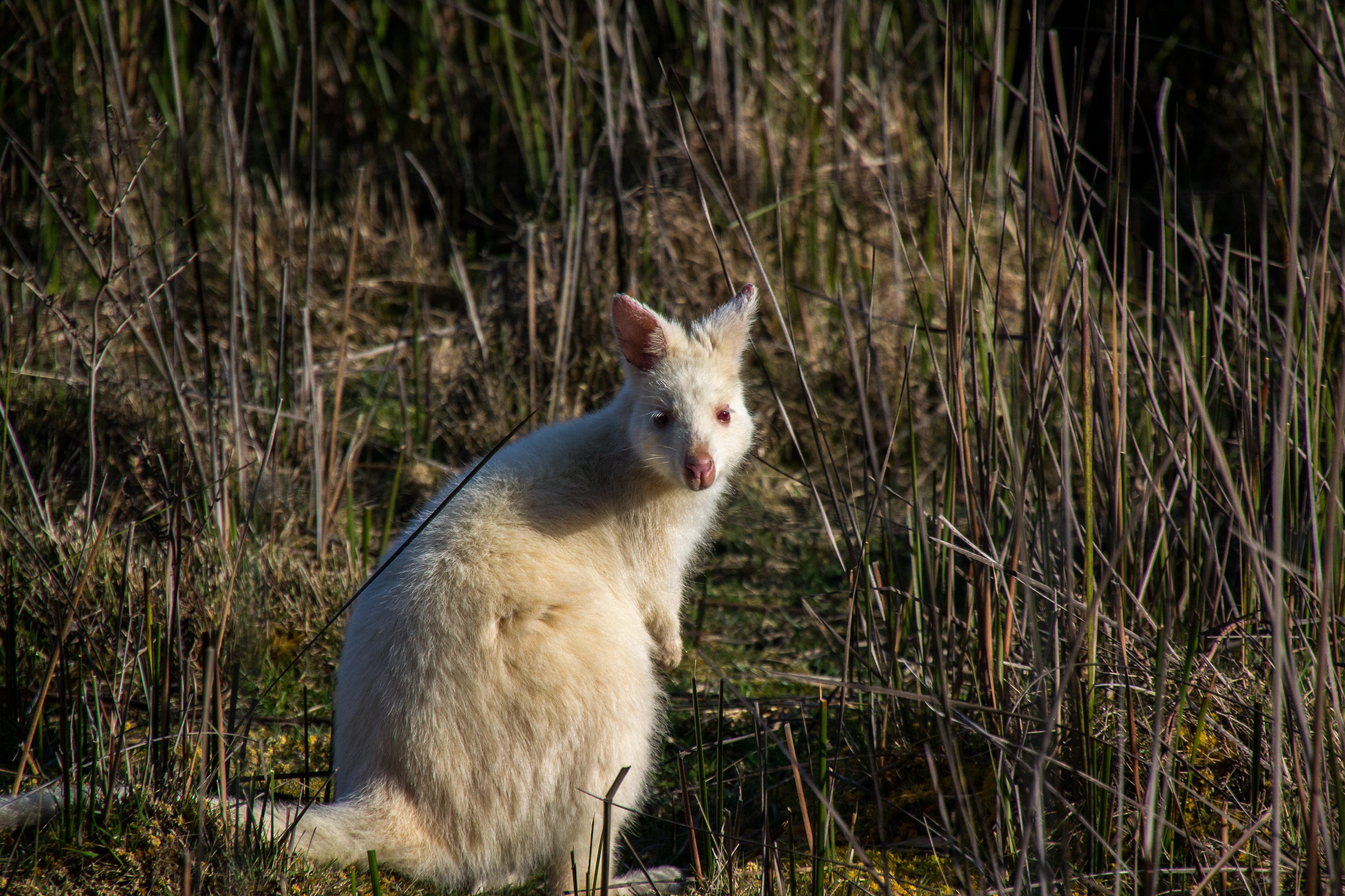
A rare White Wallaby, native to Bruny Island sits calmly beside the roadway.
Off to explore the coastline of Bruny Island........
Yellow lichen and white bird guano paint the weathered rockface

A sea cave eroded over the centuries and .
"The Monument", stands silhouetted against a threatening sky.
Cheryl weathering the elements at "The Monument".
Heading south adjacent the dramatic cliffs of Bruny Island.
Spray explodes from the surface...
....as air trapped in an underwater cave is compressed by the wave action...
...and eventually expelled...

...metres above the surface.
Weathered sandstone erodes to produce different textures and colours to the shoreline.

Iridescent green moss adds a pop of colour to the weathered sandstone.
Approaching a large sea cave..
Green and gold......the colours of Australia.

Resilient Kelp clings to the rock.
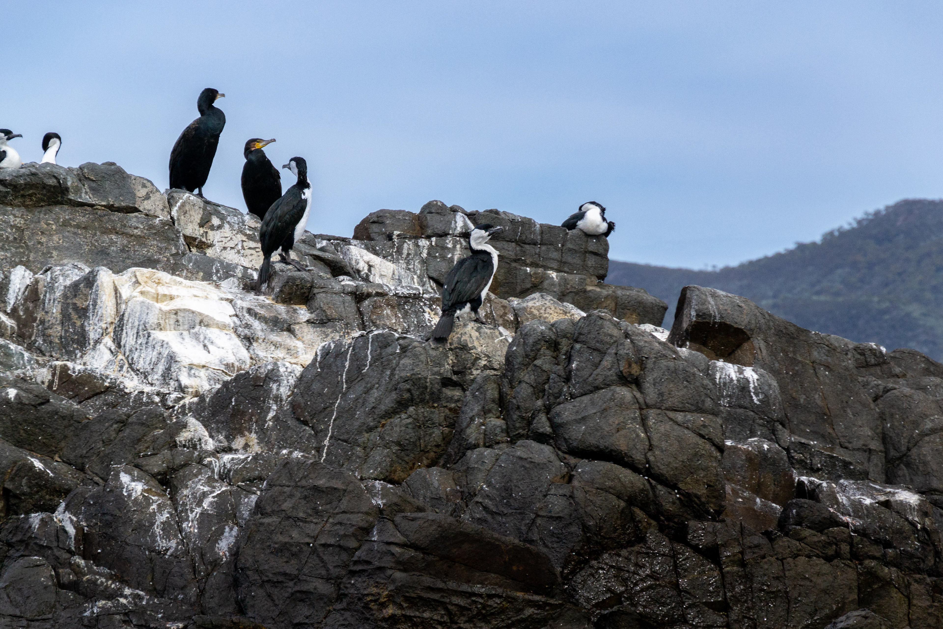
Pied Cormorants mark their territory.
Deep blue swells with turquoise tips and white caps against a streaky blue sky tipify the colours of the Southern Ocean.
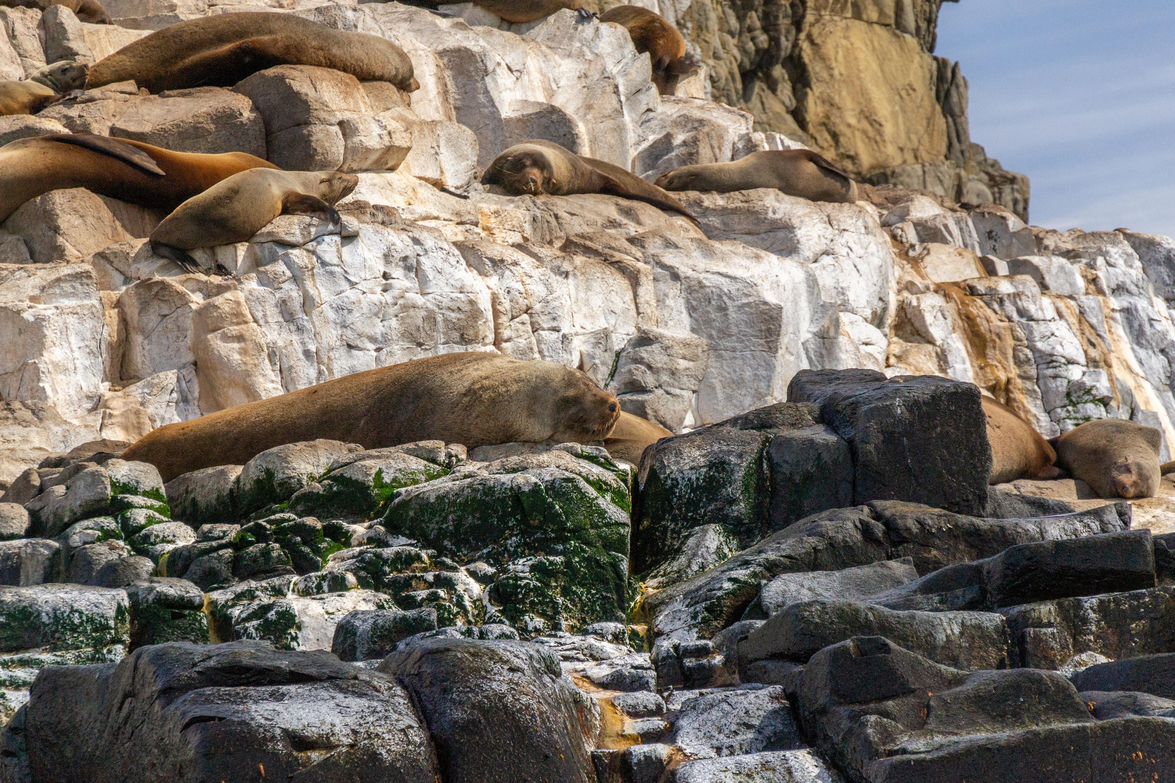
Australian Fur Seals bask in the sunshine oblivious to our presence.
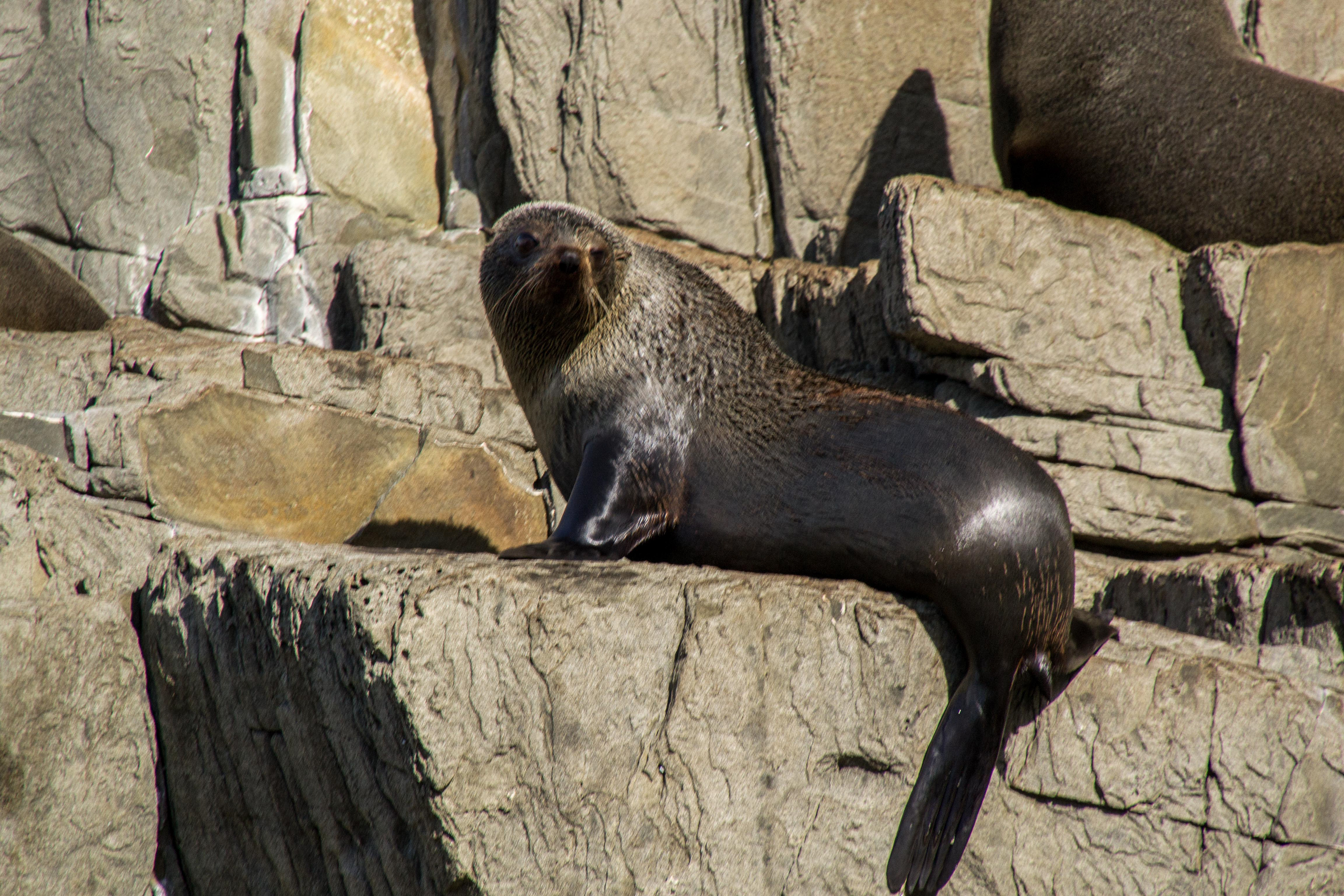
This seal watches as we cruise past its lofty perch.
Uninhabited islands rise from the ocean at the southern tip of Bruny Island.
Pillars of rock rise from the ocean depths.

Sampling the local craft brews after an enjoyable day cruising.
Huon Valley to Strathgordon
An old road in the little village of Franklin.
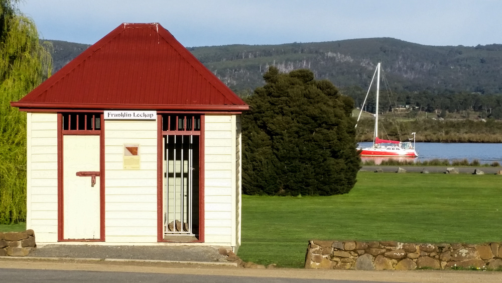
Is this Australia's smallest Gaol?
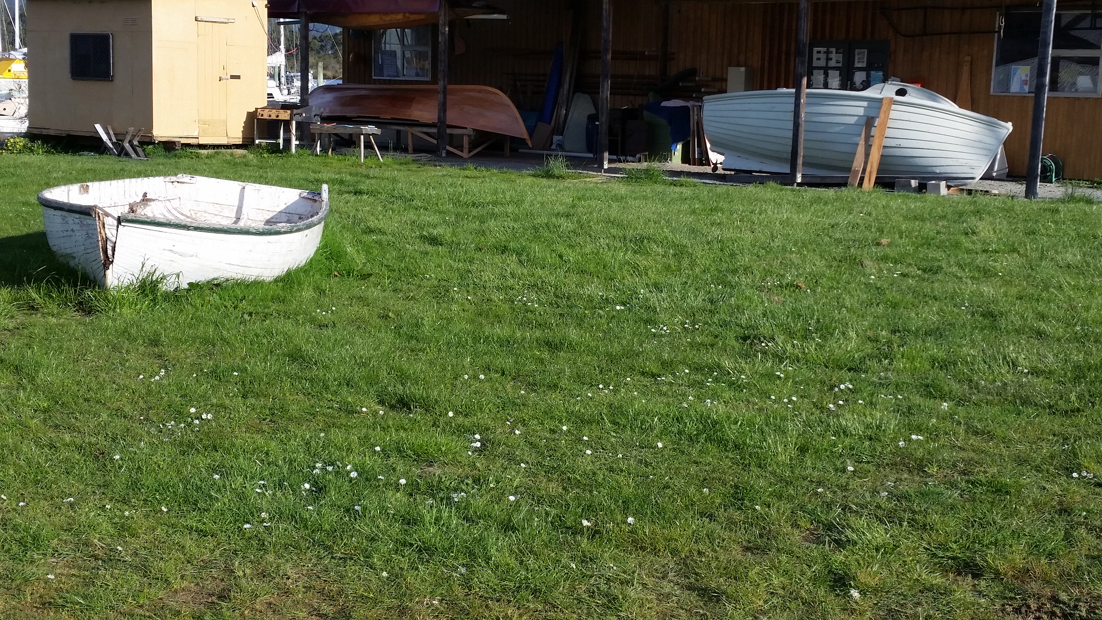
Wooden boats abound in Franklin.
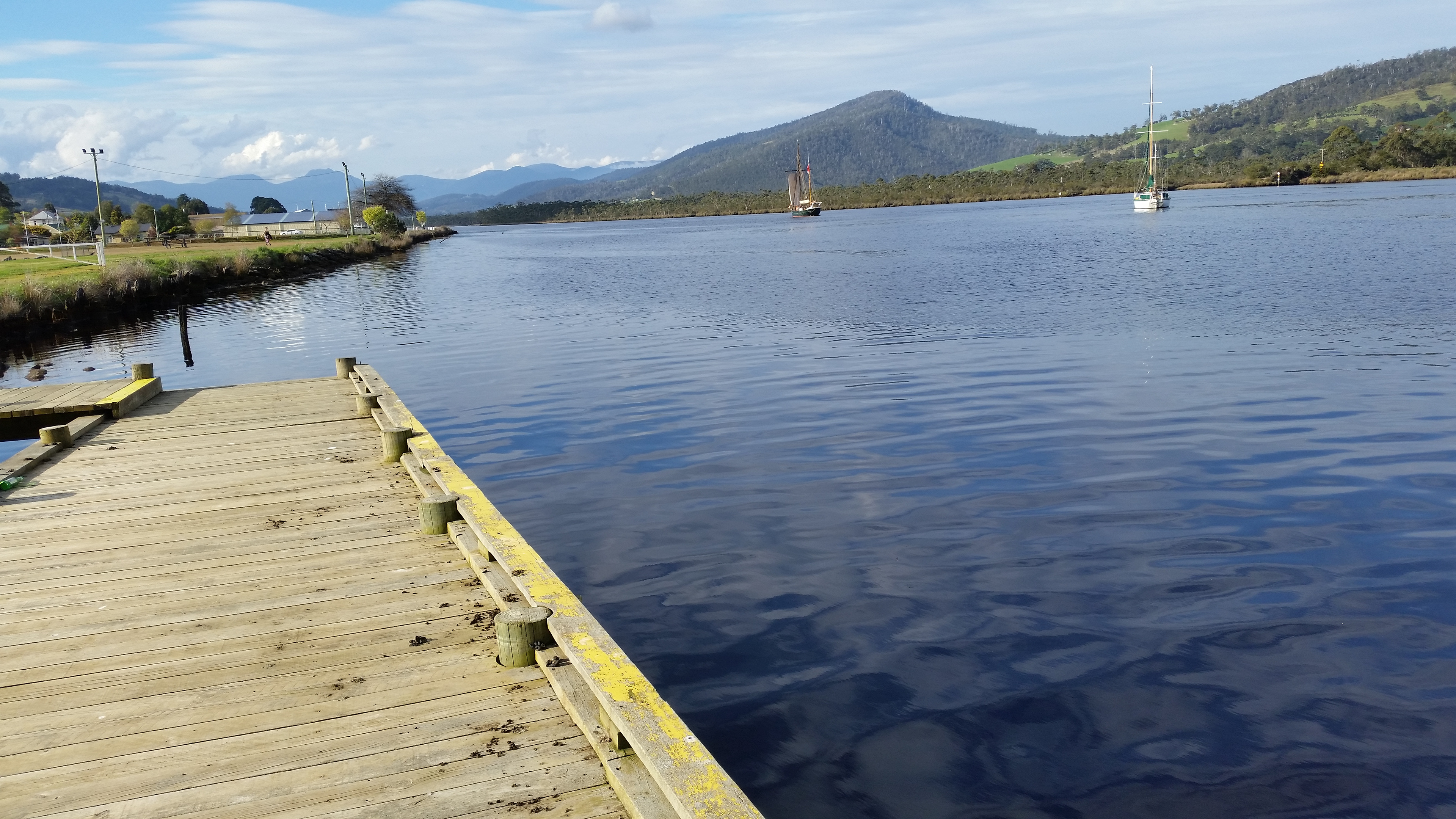
Dockside in Franklin overlooking the Huon River.
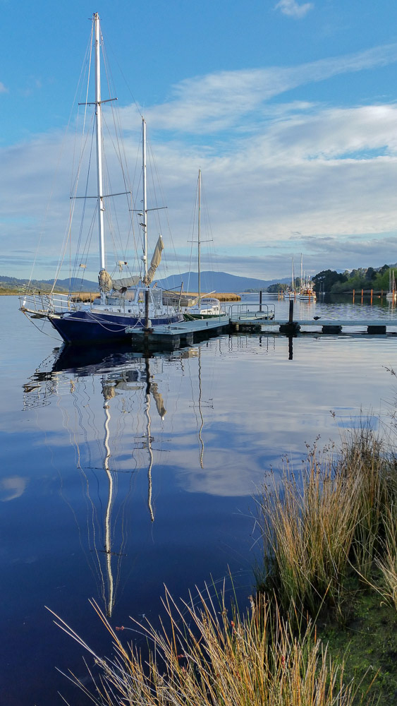
Reflections are mirrored in the dark, glassy calm waters.
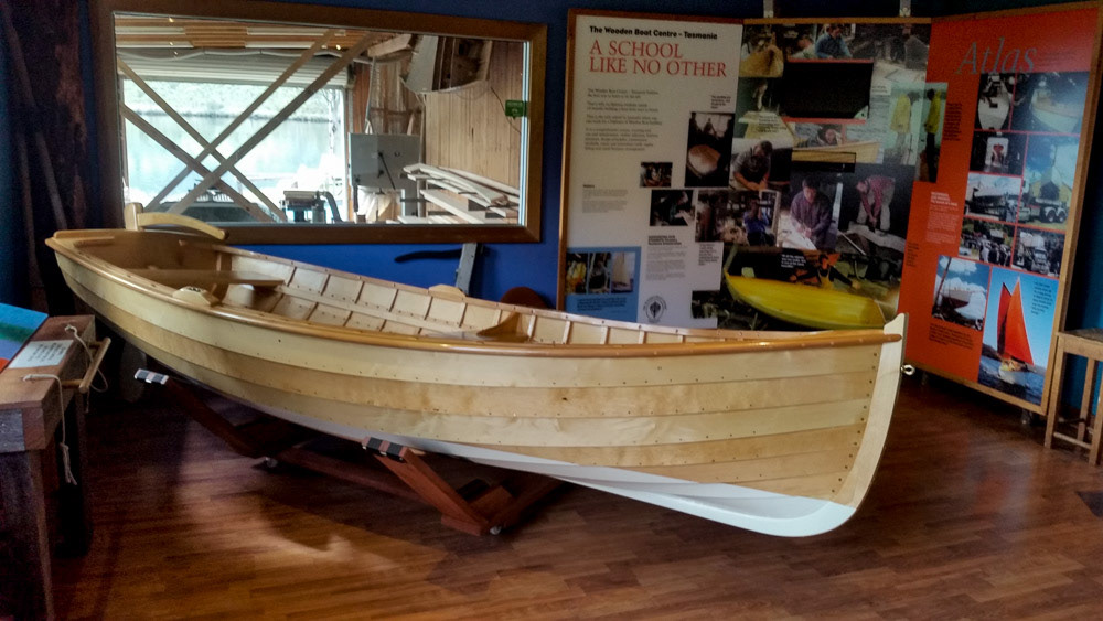
Franklin's wooden boat building school.
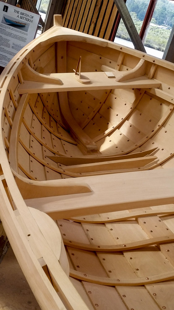
A Huoh Pine work of art built by skilled artisans.
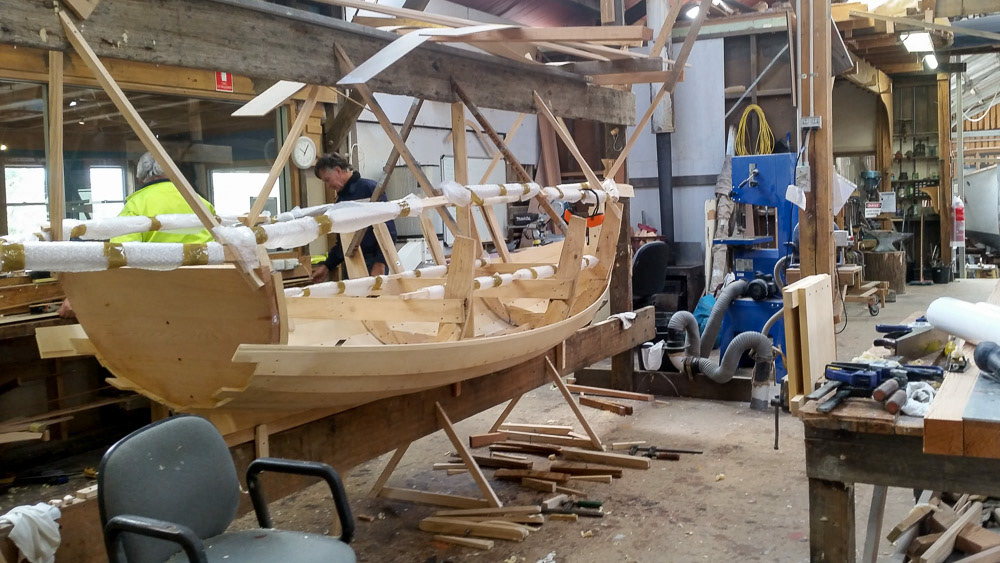
A work in progress.

Traditional boat building methods and tools still in use.

Historic Rail terminal at Ita Bay. The tramway was opened in 1919 to transport Limestone. In 1975 freight operations ceased. It now operates as a tourist route.
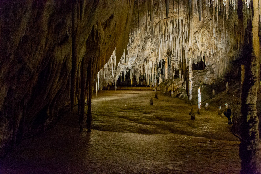
Hastings Caves and Thermal Springs in the far south of Tasmania’s beautiful Huon Valley.
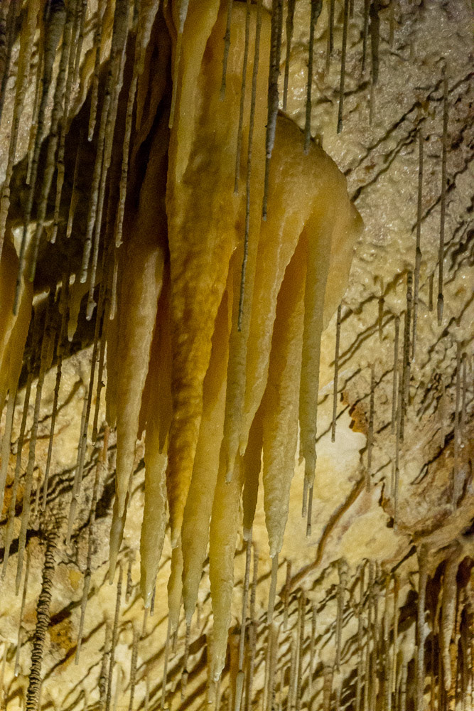
Strategic lighting dramatically highlights stalagmites and stalegtites of Hastings cave.
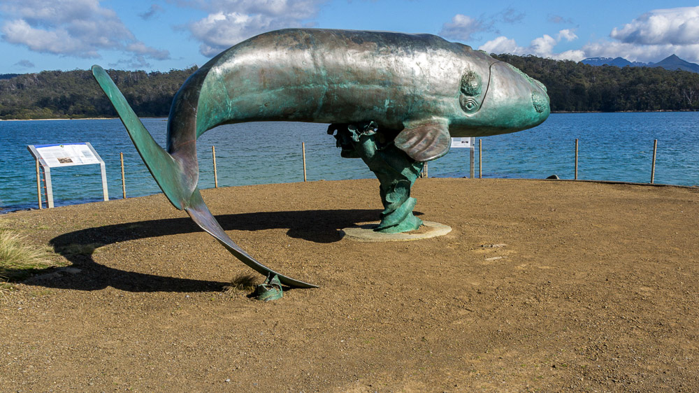
Cockle Creek - a bronze sculpture of a Southern Right Whale at Adams Point.

Huon River near the Tahune treetop walk.
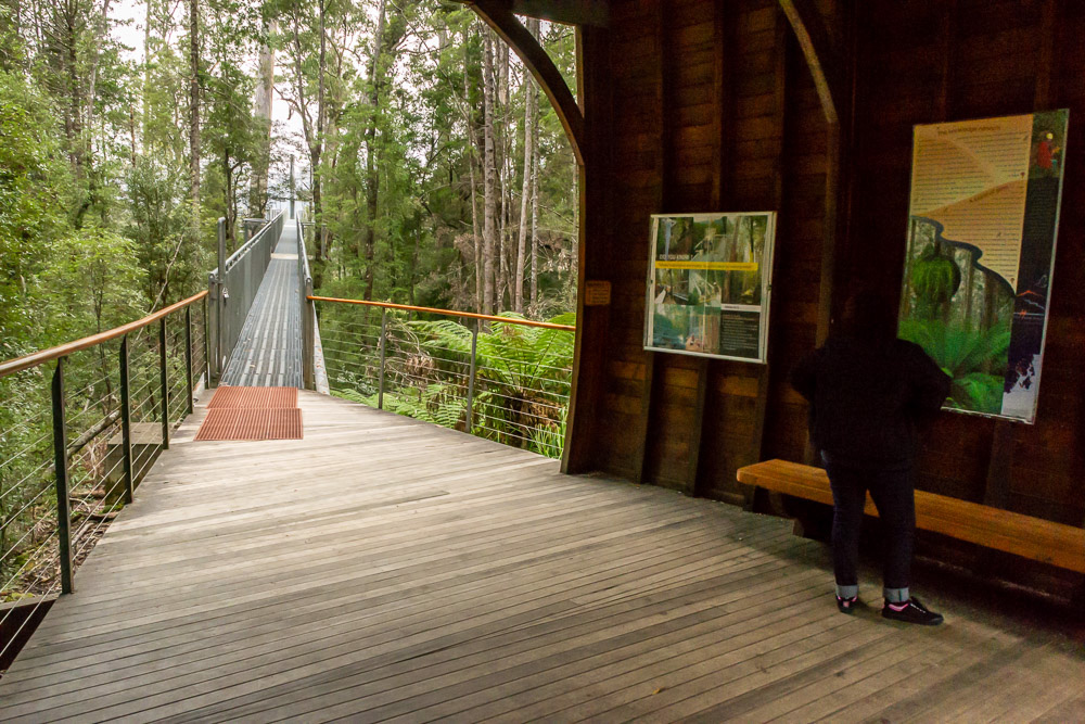
Starting point for the Tarhune air-walk..
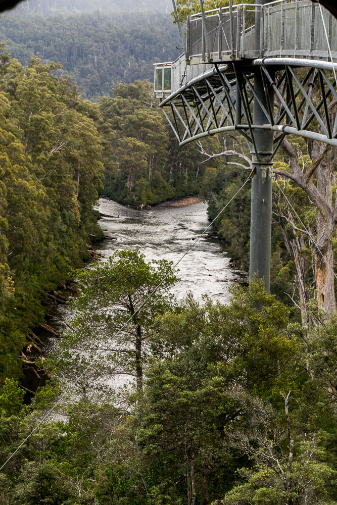
Tarhune Forest skywalk cantilevered 50 metres above the Huon River.
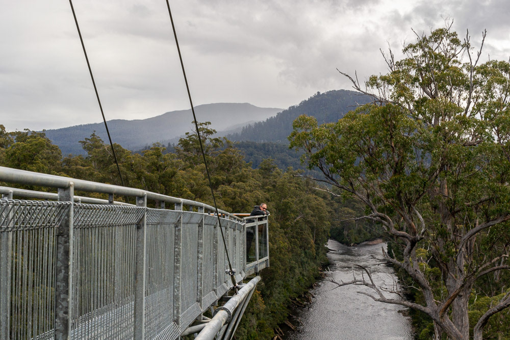
The end of the walk cantilevered over the river provides a spectacular view of the area.
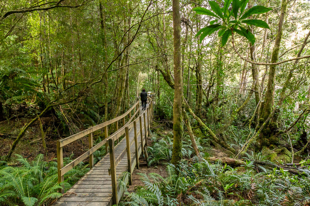
Exploring the forest at ground level.
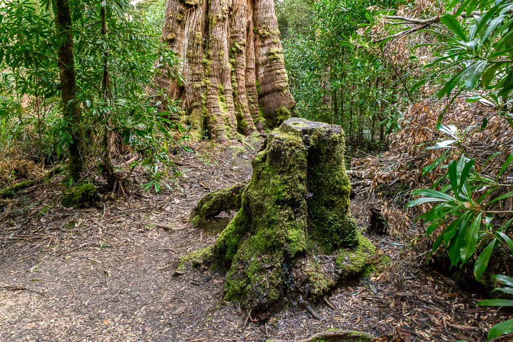
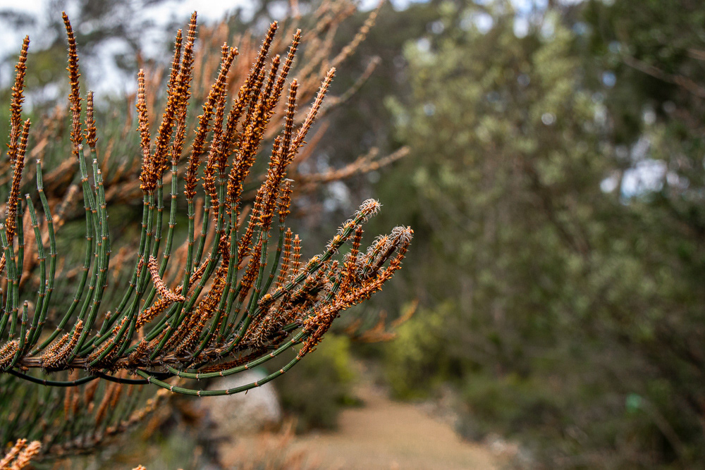
Some of Tasmania’s unique tree species including stringybark, king billy pine, sassafras, leatherwood, celery top pine as well as a plethora of mosses, ferns and fungi are encountered.
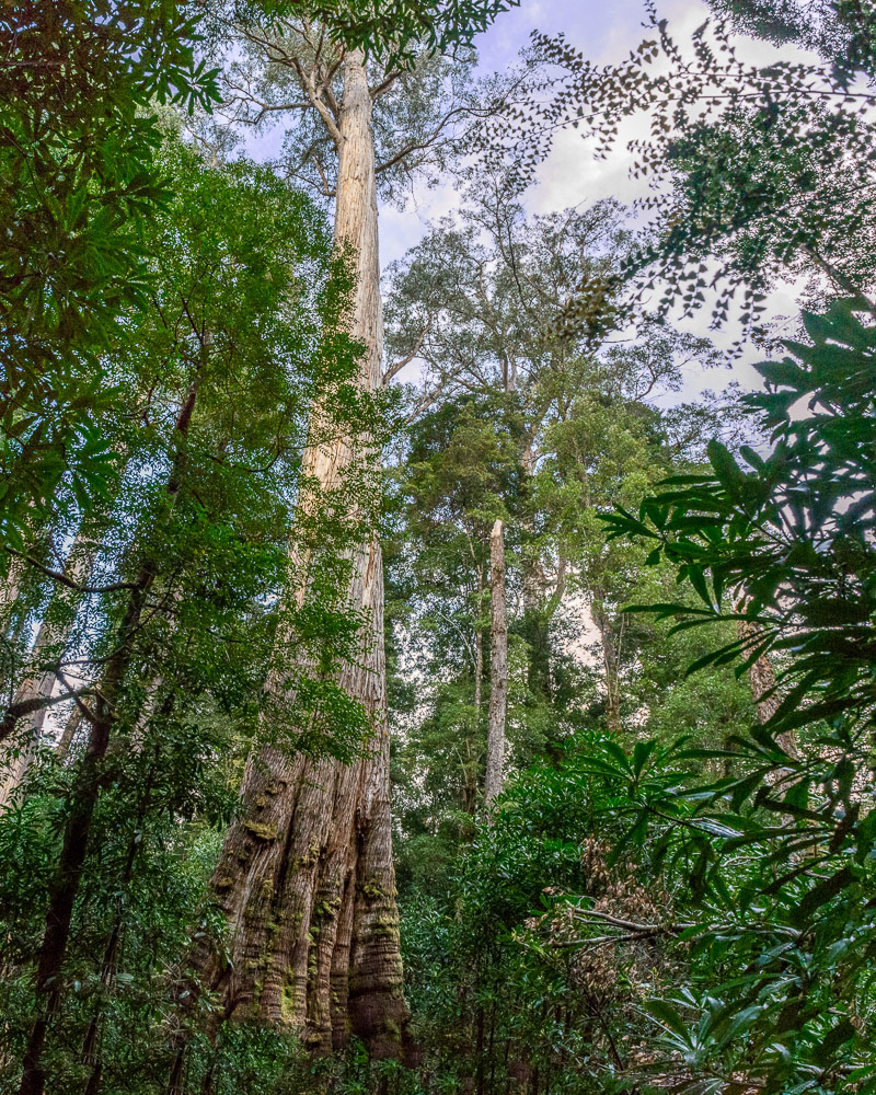
One of the forest giants.
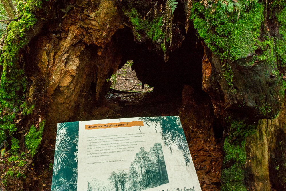
Not a Huon Pine....... it's a Stringybark Eucalyptus.
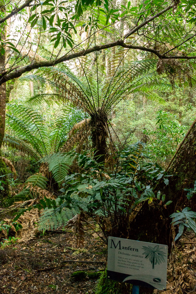
A "Manfern" tree explained.
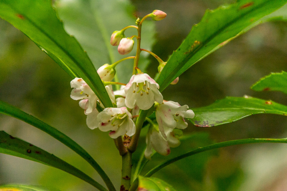
Anopterus glandulosus, commonly known as native laurel or Tasmanian laurel,
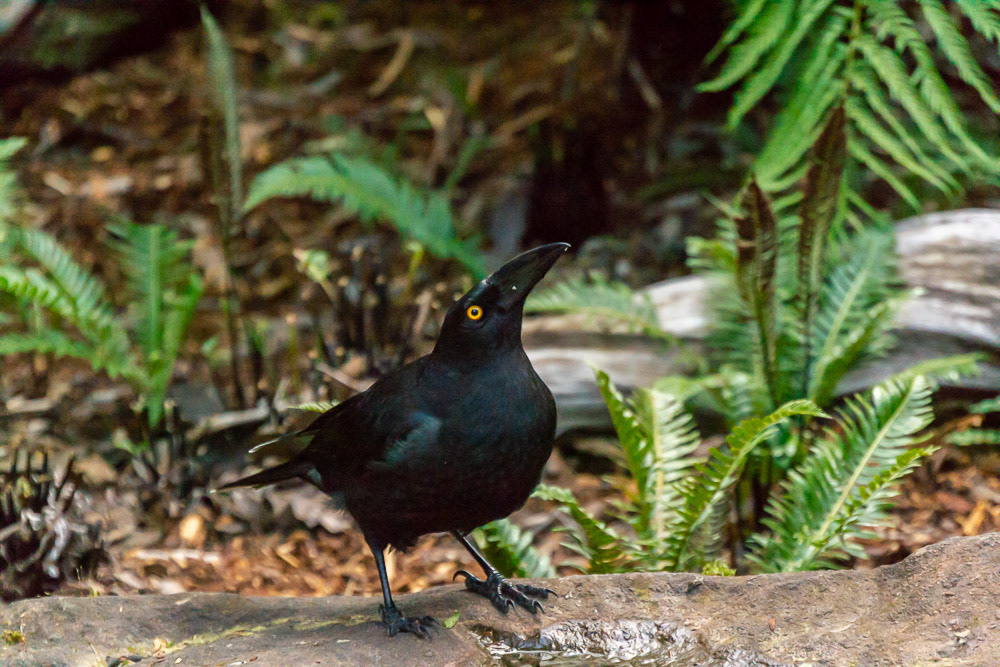
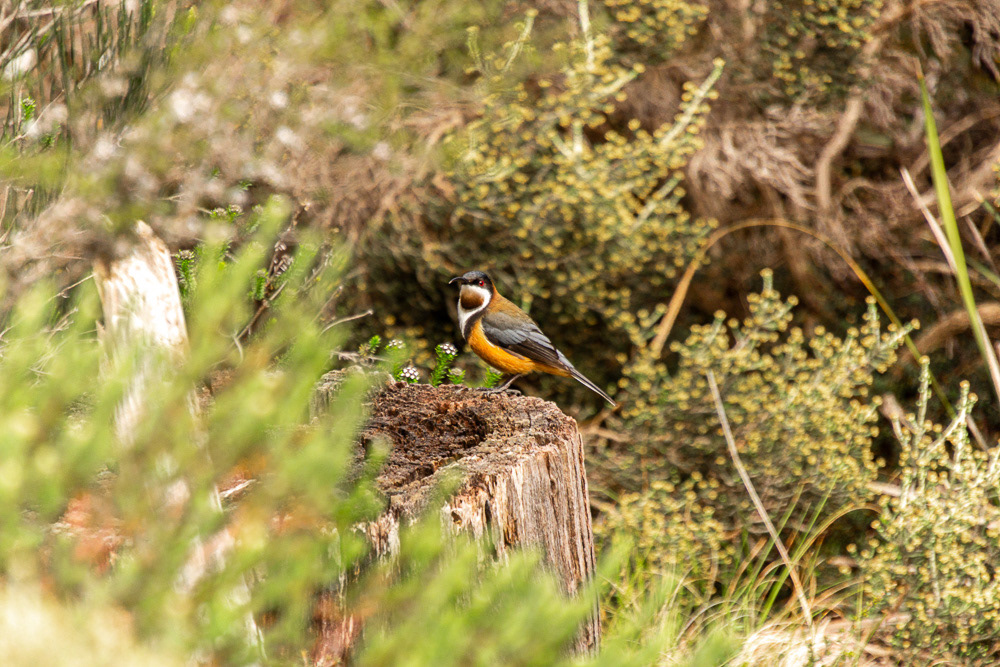
The bright yellow eye of a Black Currawong stands out from it's black bill. Unseen is it's black body and white tips to the flight-feathers and tail.
The high point of the trip into the rugged wilderness surrounded by craggy mountain ranges.
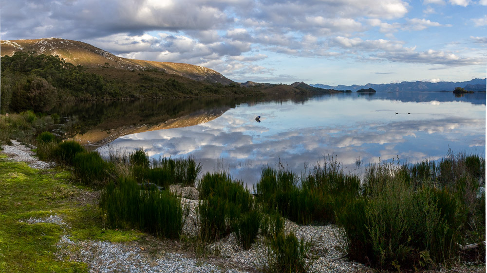
Panoramic view of Lake Pedder with shore and sky reflections.
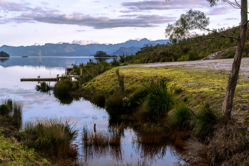
Lake Peder pontoon at the waters edge.
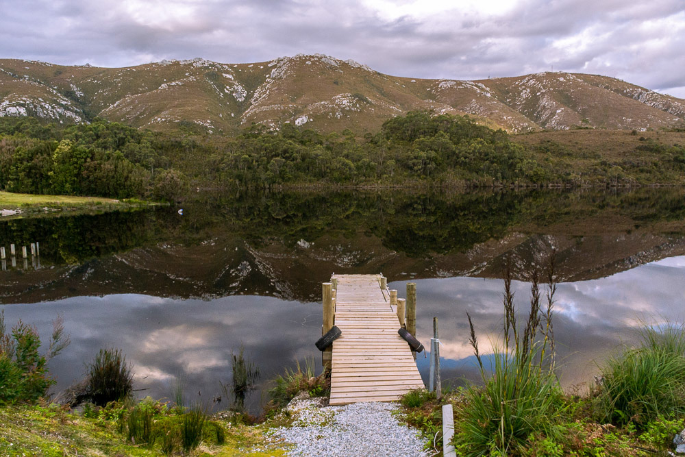
The surrounding hills are perfectly mirrored in the lake surface.
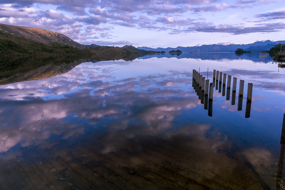
Sunset colours reflected in the mirror-smooth surface of Lake Peder.
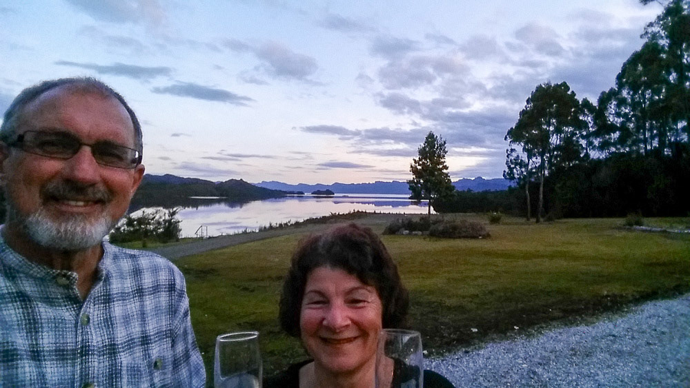
Sundowners before our anniversary dinner at the Wilderness Lodge.
A giant Huon Pine thkes shelter from the elements.
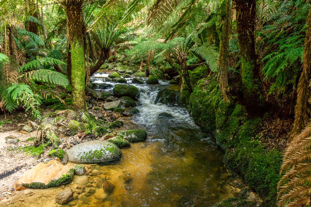
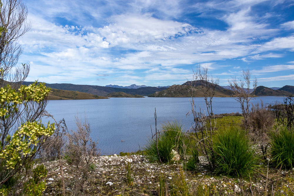
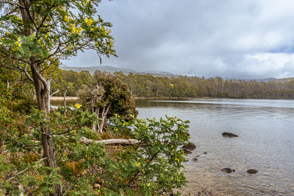
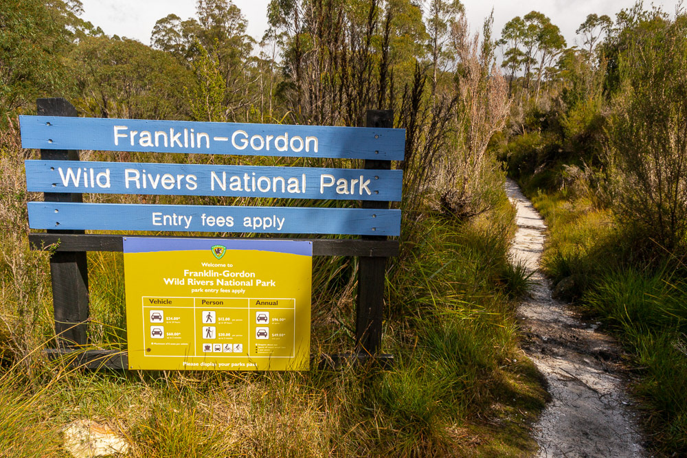
Franklin-Gordon Wild Rivers National Park
Our journey west along the Lyell Highway to Strachan takes us through the Franklin-Gordon Wild Rivers National Park in the heart of the Tasmanian Wilderness World Heritage Area short walks provide easy access to view the famous Franklin River while at Strahan, commercial cruises provide access to the magnificent Macquarie Harbour and Gordon River.
Stillwater River, Franklin Ranges and Hermit Valley.
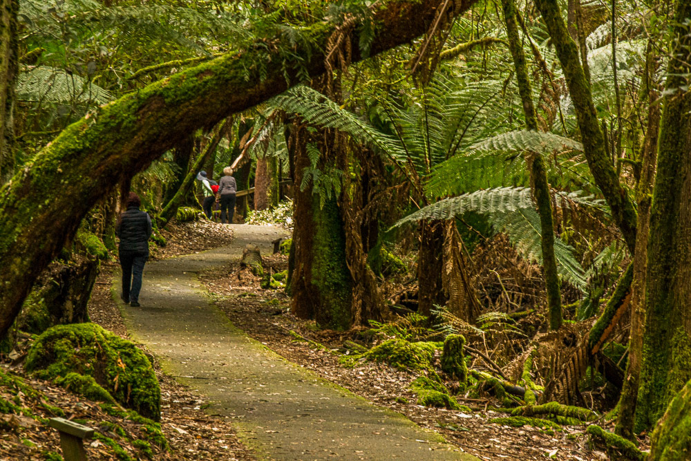
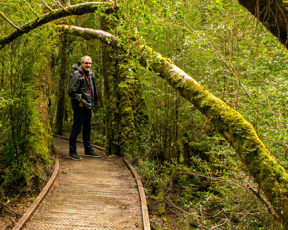
We follow a fern-tree lined path as we head to a waterfall.
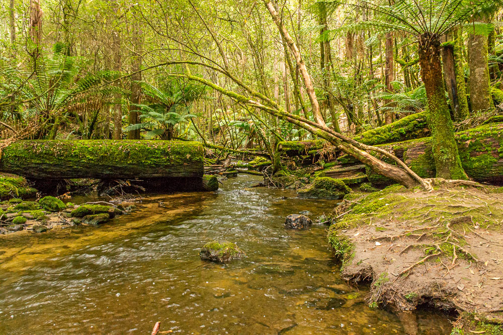
Russell Creek downstream of the falls.
Underneath the arches of moss-covered trees.
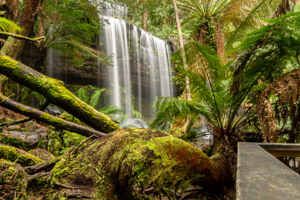
We arrive at Russell Falls.

The Russell Falls are a tiered–cascade waterfall on the Russell Falls Creek located in the Central Highlands.
We take in Lake St Clair on an overcast day and spot a few pops of colour amongst the trees.
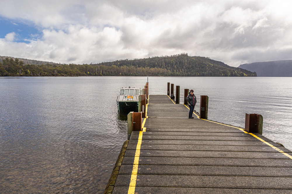
Cheryl on the Lake St Clair jetty with the water taxi.
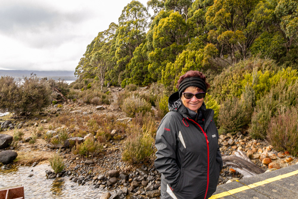
On the banks of Lake St Clair.
Path entrance off the Lyell Hwy leading to the Franklin River Swing Bridge.

Franklin River - crystal clear water but coloured by tannins.
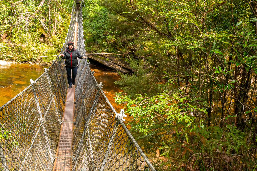
Cheryl negotiating the swing bridge over the Franklin River.
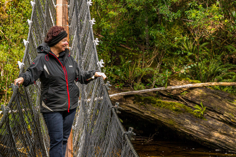
Enjoying the view downstream from the centre of the bridge.

Franklin River
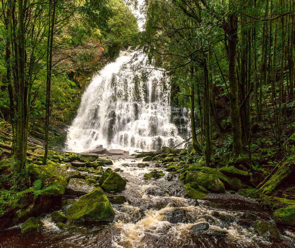
Nelson Falls - a short walk in from the Lyell Highway, before arriving in Queenstown from Derwent Bridge, is a beautiful set of falls.
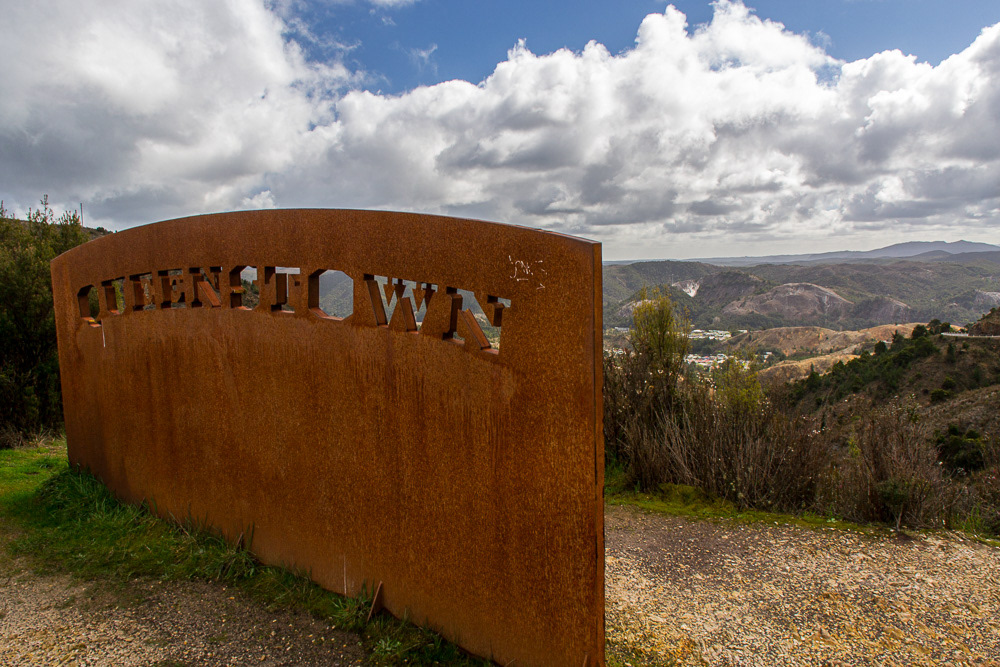
Queenstown lookout.
Queenstown nestled in the valley below the lookout.

Parked at the lookout overlooking Queenstown surrounded by a moonscape vista.
Hells Gate, Sarah Island and Strachan
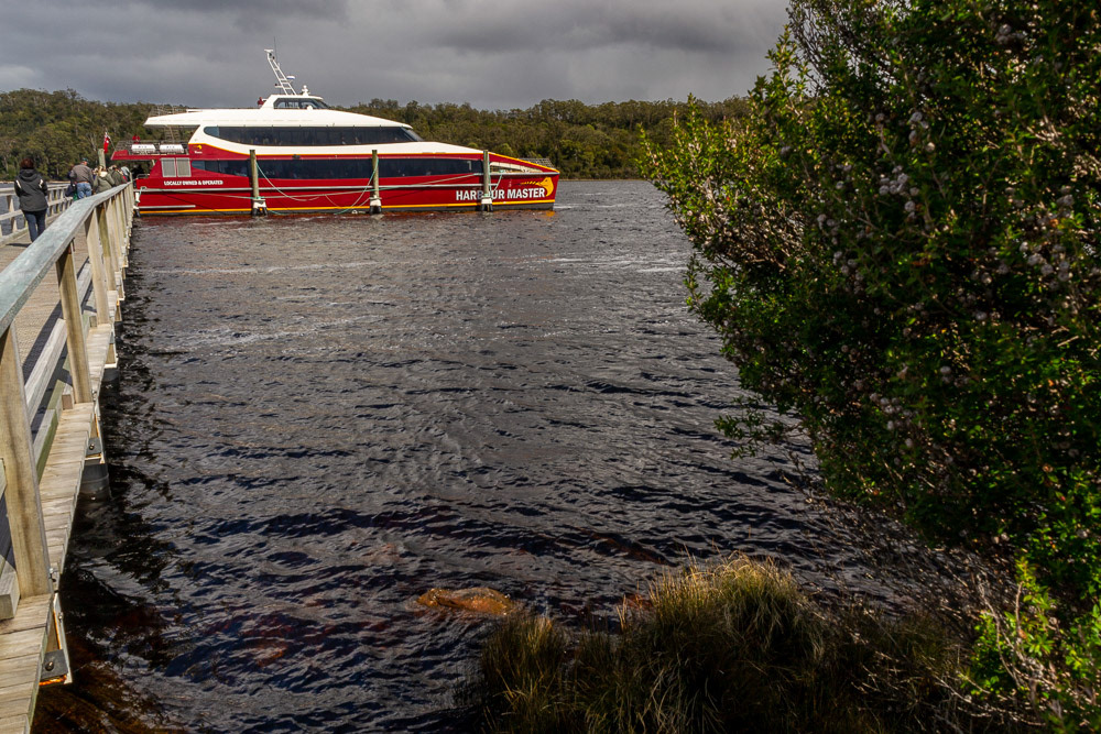
From Strachan wharf we embark on a cruise taking in Hells Gate, Sarah Island and the Gordon River. Hells Gate is the name of the mouth of Macquarie Harbour on the West Coast. It is notorious for it's shallow and dangerous channel entrance to the harbour.
The name of the channel relates to the original convicts' claim that it was their point of "entrance to Hell", being the Macquarie Harbour Penal Settlement on Sarah Island.
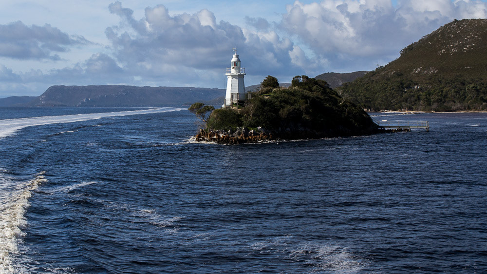
Bonnet Island lighthouse, Macquarie Harbour.
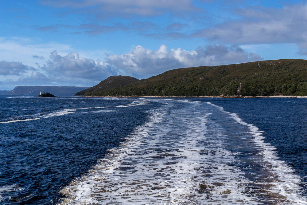
Looking back towards Bonnet Island lighthouse from the main channel.

Fisherman's village at Macquarie Heads.
Rocky headland at Macquarie Heads

Hells Gates, viewed from the ocean side of the entrance. Entrance Island is on the left. Bonnet Island lighthouse is visible in the distance.
Hells Gates lighthouse.
Hells Gates, viewed from the ocean side of the entrance. Entrance Island is on the left. Bonnet Island lighthouse is visible in the distance.
Looking back towards Macquarie Harbour from the main channel rock wall on the outside of the channel's curve.
Sarah Island Jetty.
Tourist launches now visit Sarah Island.
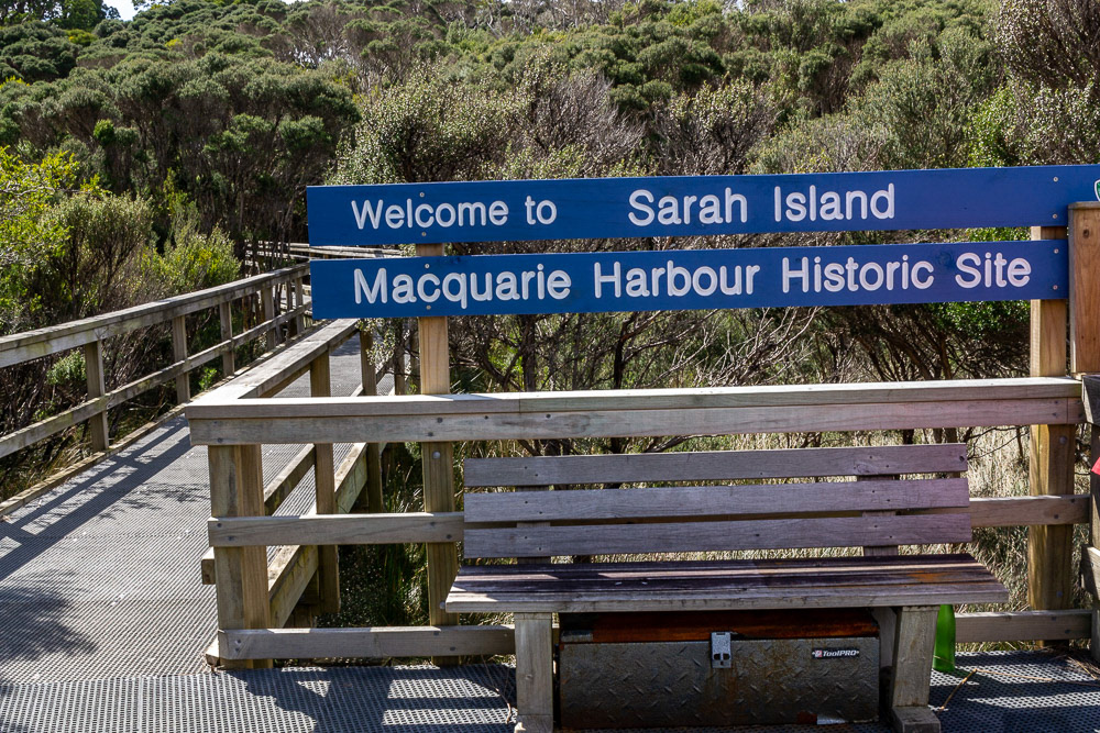
Visitors are now welcomed on arrival at the jetty.
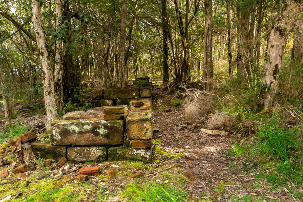
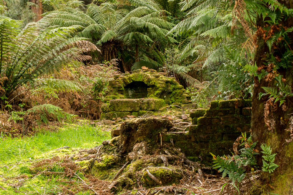
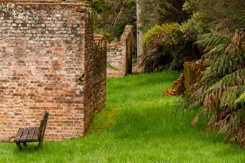
Once cleared of all vegetation to establish the penal settlement nature has reclaimed the ruined remnants of the convict settlement established 200 years earlier.
Moss covered bricks are dotted throughout a forest of tree ferns.
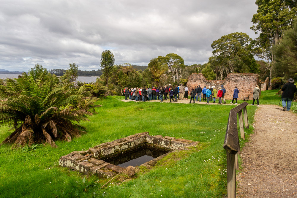
A tour group gathers beside one of the more substantial ruins of the early convict days.
Selected clearing reveals the ruins of the convict settlement established 200 years earlier.
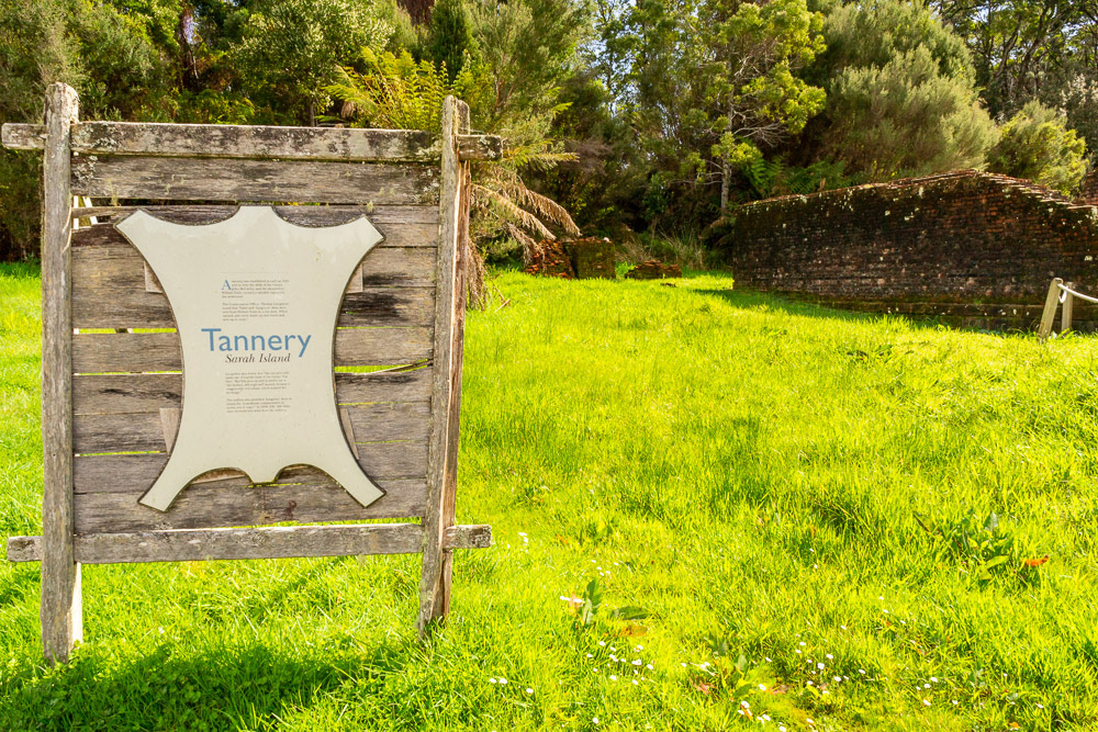
Remnants of the Tannery, one of several industries operated by the convicts.
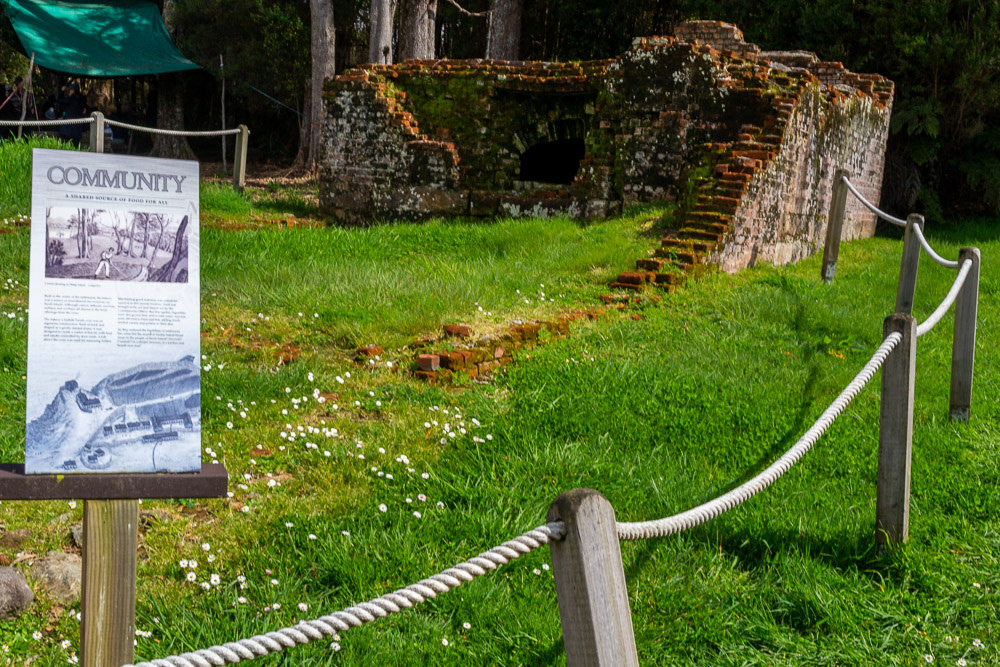
Story boards give a hint as to the extent of the convict settlement community in it's heyday.
Ruins of a penitentiary building on the SW side of the islend.
The small ships harbour at Strachan.
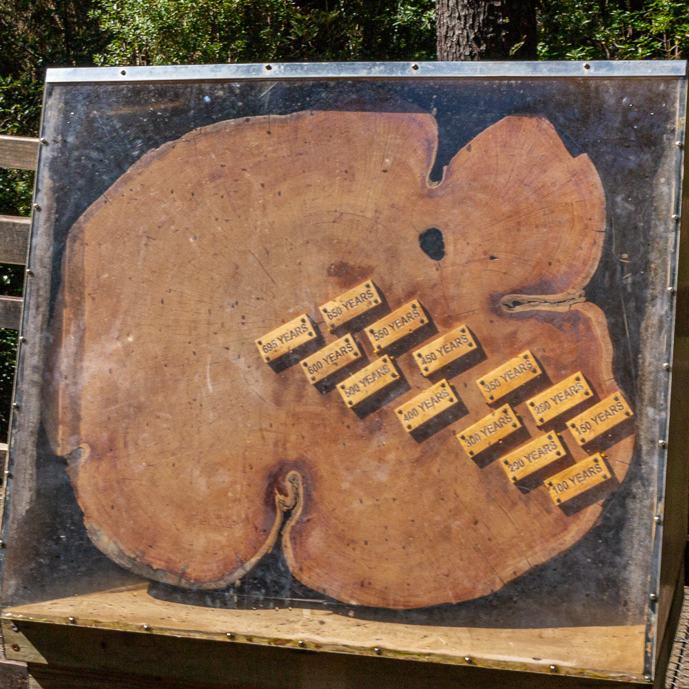
The growth rings of a giant Huon Pine reveal the ages.
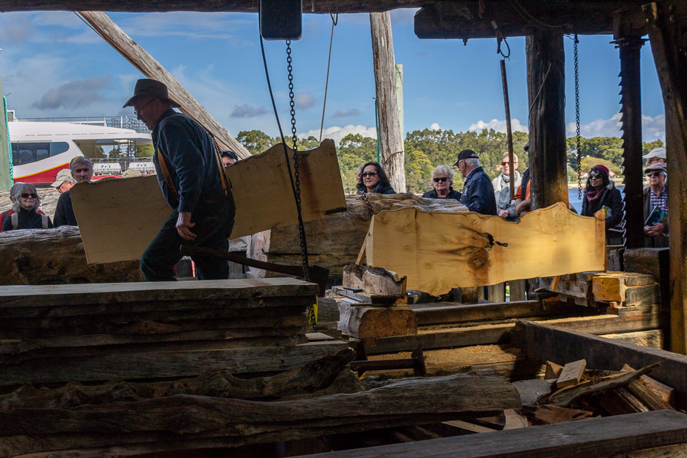
A slab of precious Huon Pine is sawn from a log in the sawmill.
Botanical Creek flows through temperate rainforest ferns and vegetation.
Hogath Falls in full flow after recent rainfall.
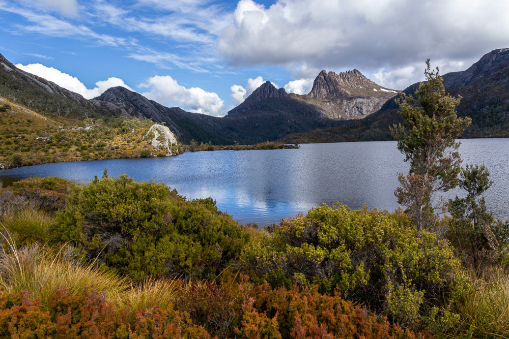
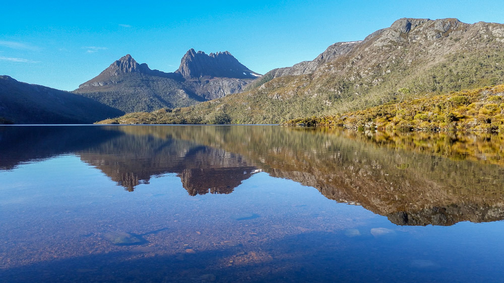
Cradle Mountain and Dove Lake
Cradle Mountain is both a locality and a mountain in the Central Highlands region of Tasmania. The mountain is situated in the Cradle Mountain-Lake St Clair National Park.
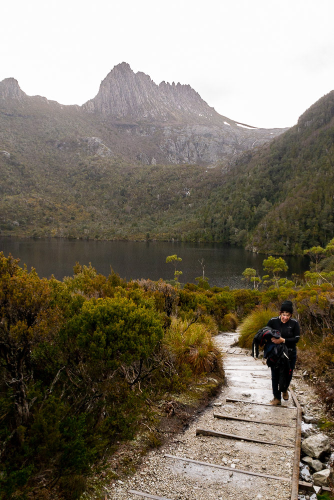
Dove Lake lays directly beneath Cradle Mountain and has a 6km circuit walking track with epic views.
The track undulates around Dove Lake, traverses beneath the mountain, then returns through magnificent rainforest to the starting point. Along the we pass through some of Tasmania's special vegetation, such as buttongrass, myrtle, sassafras, fagus and King Billy pine.
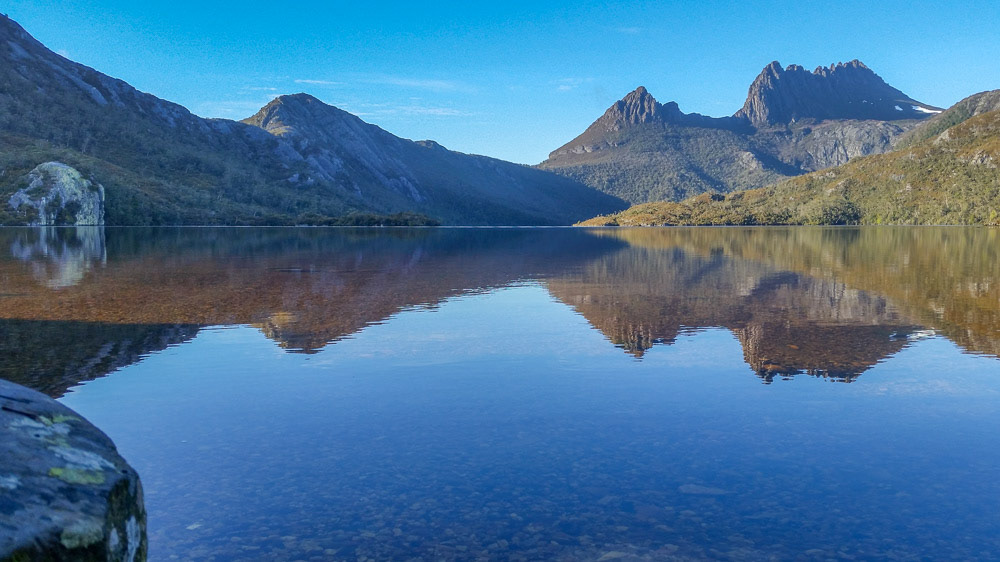
Cradle Mountain reflected in Dove Lake on a crisp, clear morning.
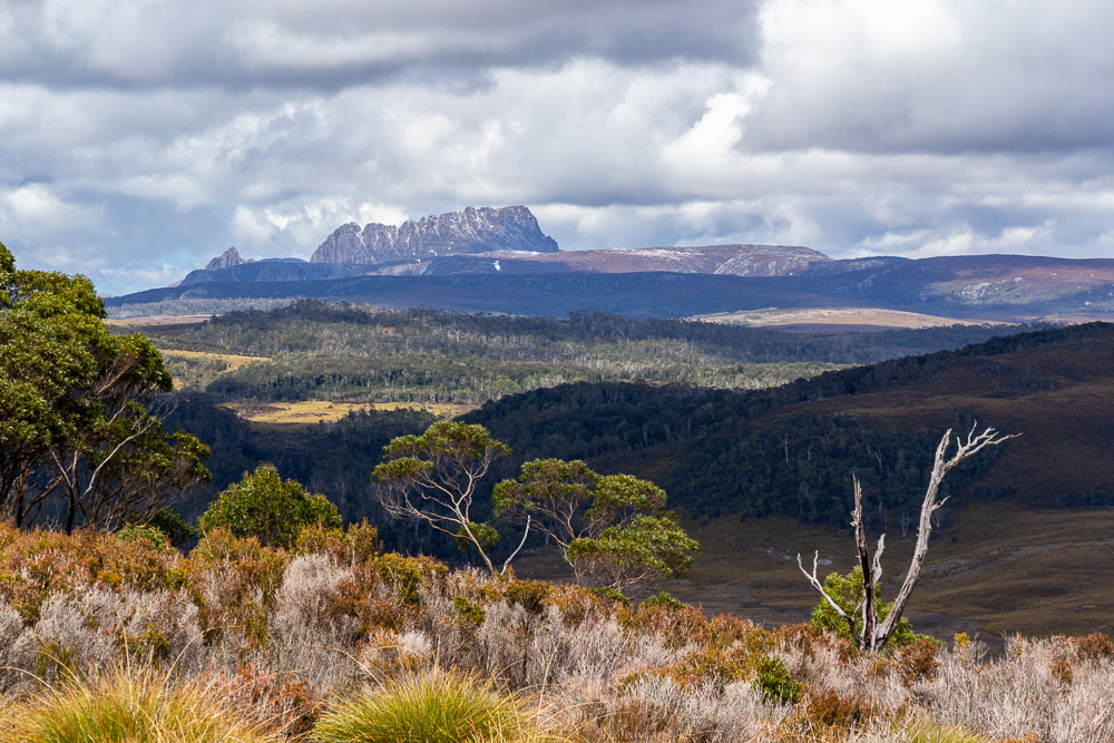
Alpine eucalypt, myrtle forest and button grass of the Cradle Mountain National Park stretch before us with Barn Bluff and Mount Roland in the distance.

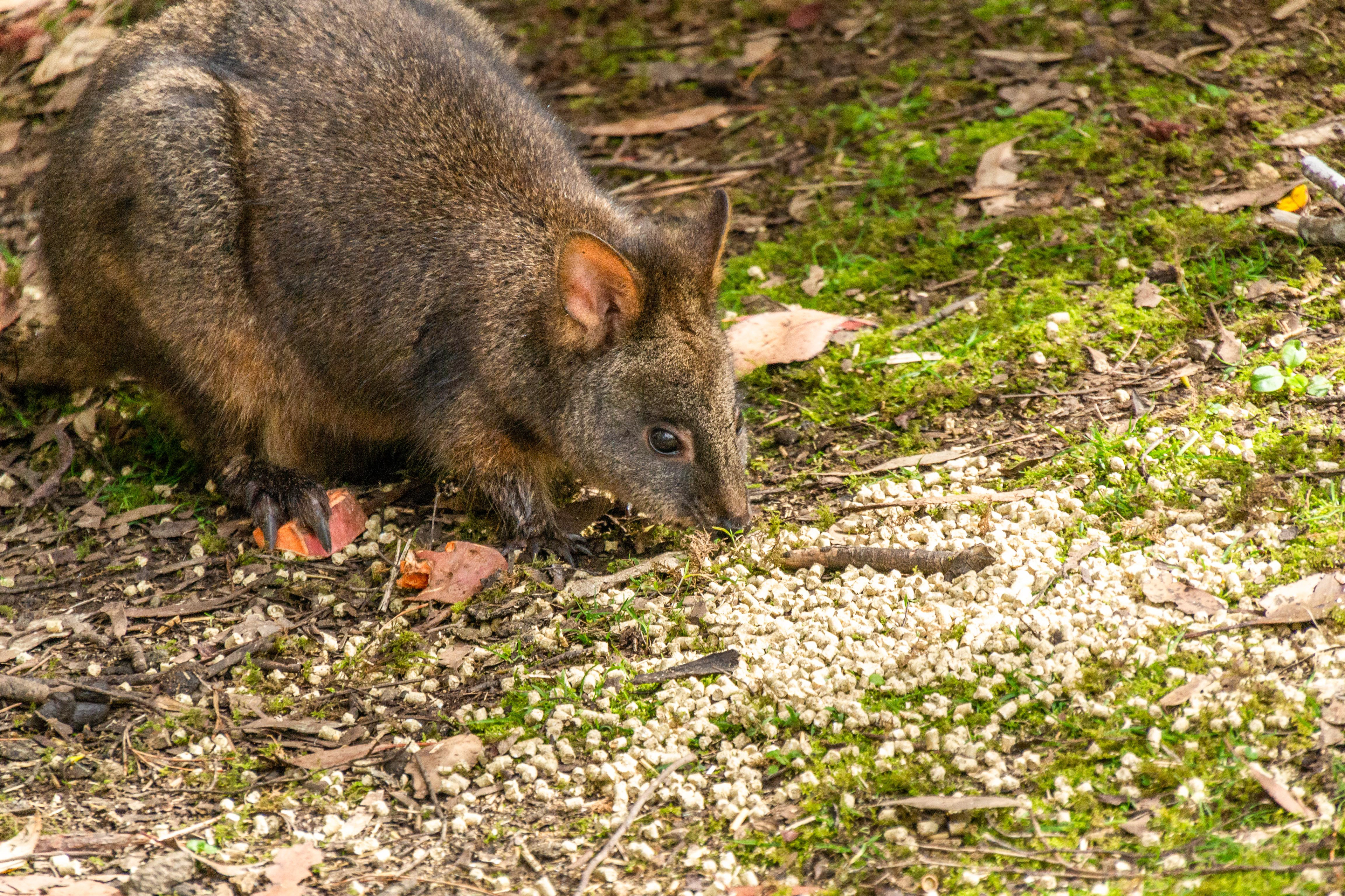
A Tasmanian Pademelon grazes on the outer edge of the forest.
Cradle Mountain provides a spectacular backdrop to Dove Lake as we begin our trek around the lake circuit.
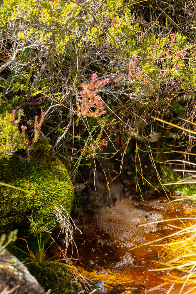
Rainfall runoff feeds wetlands of the heathland vegetation.
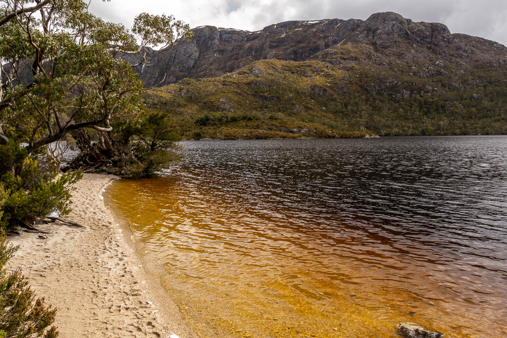
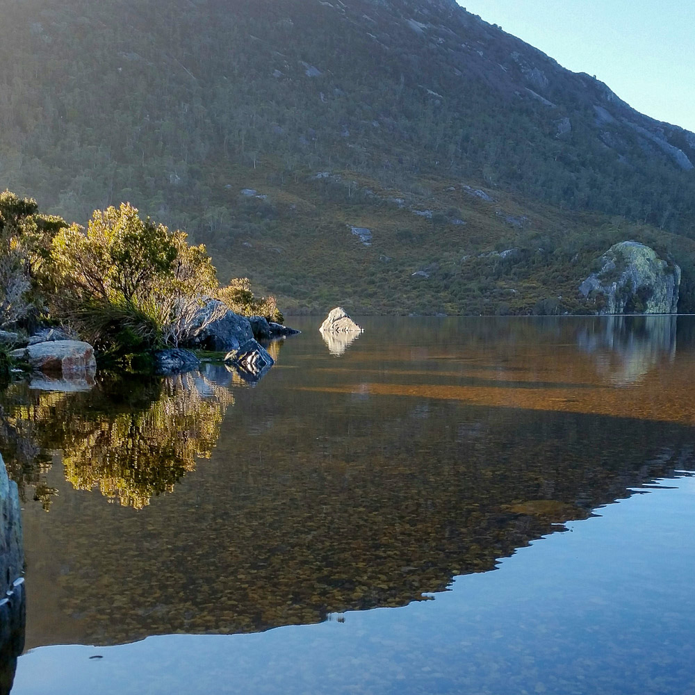
A well-trodden beach at Dove Lake.

We squeeze past a huge, knurled burl displaying a kaldekaleidoscope of natures colours.
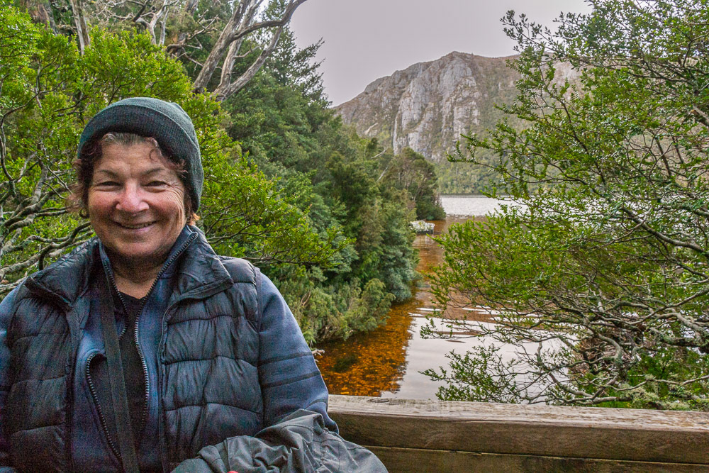
Cher taking a break on the way around Dove Lake trail.

Crystal clear streams flow over gravel beds after a sudden downpour.
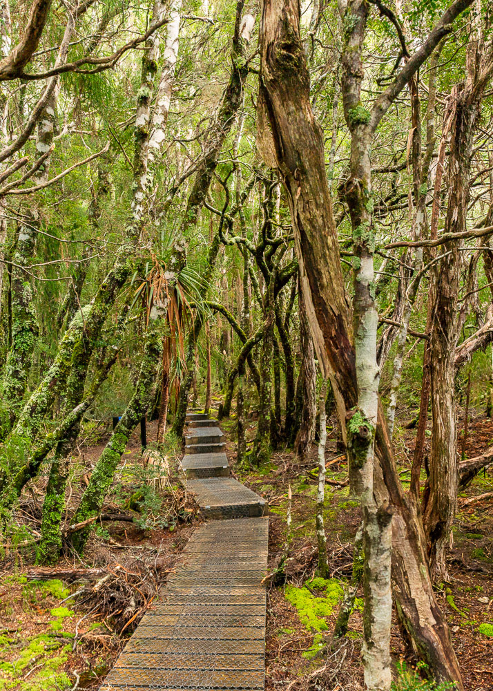
Dove lake trail boardwark weaves its way through the moss laden tea-tree forest.
Cher negotiating the final climb approaching the boatshed. It's been a day fo changing fortunes, crisp blue sky at the start of the treck, torrential rain mid-way around and now low cloud mist.
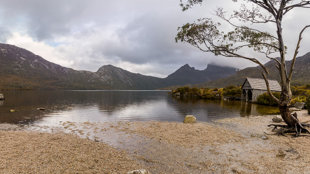
We arrive at Dove Lake boatshed amidst drizzle and overcast skies.
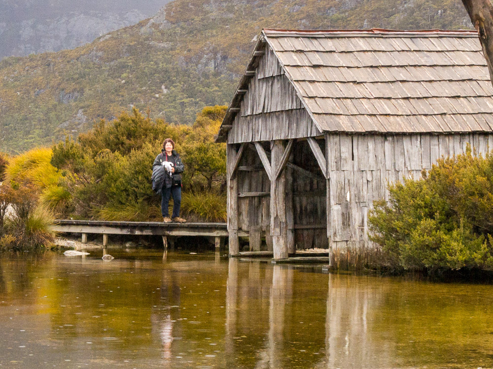
Cher on the boardwalk beside the Dove lake boatshed.
Early the next morning Cradle Mountain is reflected in the mirrored surface of Dove Lake.
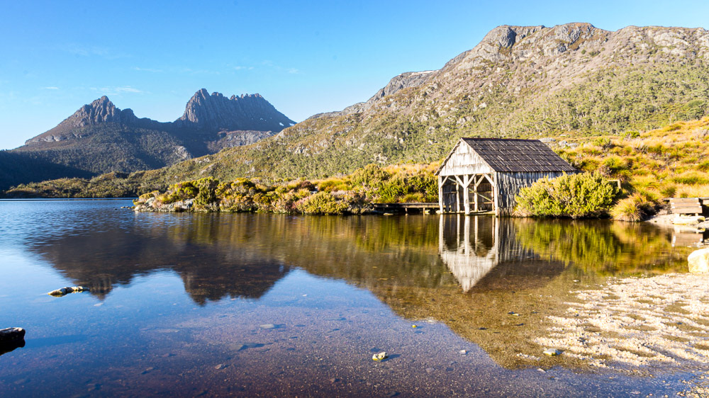
Dove lake boathouse with Cradle Mountain in the background on a crisp morning.
Light, shade and reflections facilitate a glimpse below the calm surface of Dove Lake.

A panoramic view of Dove Lake and Cradle Mountain
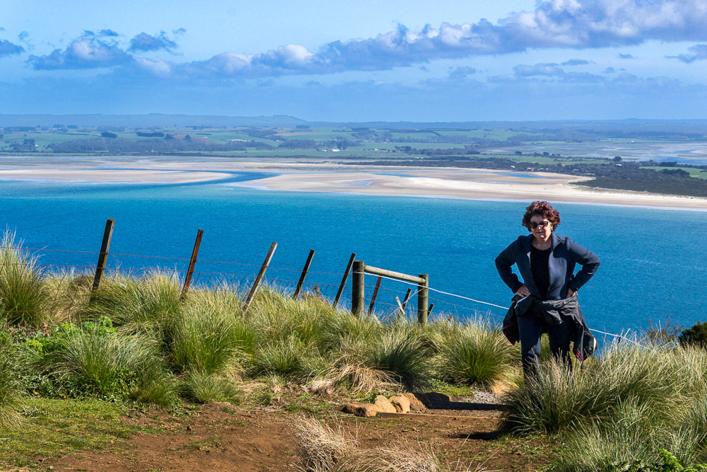
Stanley
Located on the North-West coast Stanley is a small fishing village and a popular tourist destination, it's most popular landmark is commonly called "The Nut" ( Munatrik ), an old extinct volcano. Originally it was named Circular Head by Bass and Flinders in 1798 and here we visited the Highfield Historical Site the original home of the Van Diemen's Land company in Circular head, northwest of Stanley, a stunning example of early colonial architecture from the Regency Period
Cheryl approaches the summit of The Nut after the steep climb up the track.
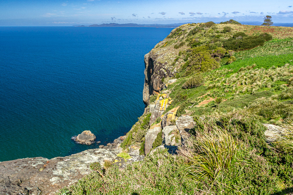
Spectacular views over Bass Strait from the Nut.
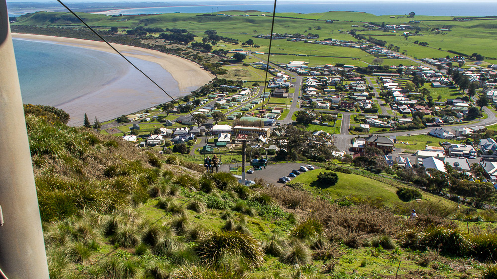
The view over Stanley from the chairlift on the ride back to the carpark.
Hifield House overlooking Stanley and The Nut. Highfield Historic Site represents a stunning example of early colonial architecture from the Regency Period (1811-1820).
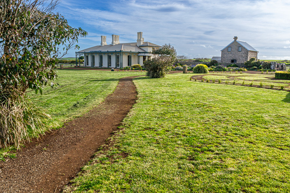
Highfield House and its extensive manicured surrounds is an impressive sight.
Approaching the Fairfield Estate - authentic cow-dung on the driveway.
The impressive bluestone outbuildings of Fairfield Estate.

Strolling around the outbuildings at Fairfield Estate.
Bluestone stables at Highfield.
Convict ruins overlooking Stanley and the Nut.
Launceston
Unfortunately for us the weather deteriorated while we were in Stanley and the wet weather impacted the remainder of our time in Tasmania. Heavy rainfall and flooding impacted the part of the state in which we were yet to visit and closing access to the North-western wilderness areas. Using Launceston as a base we managed to visit several places of interest when the weather permitted,
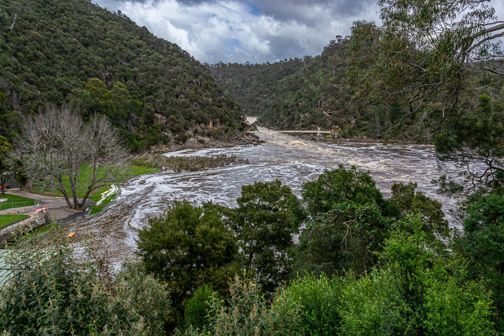
Cataract Gorge in flood. The First Basin is inundated by floodwaters.
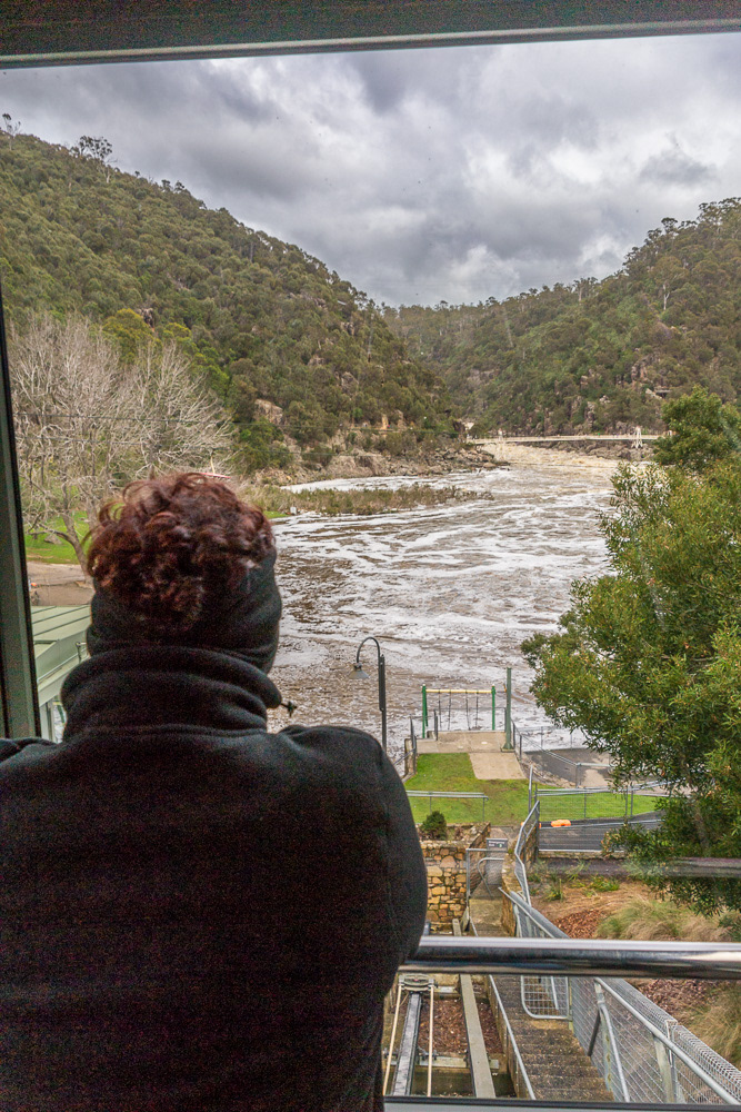
A view over the flooded picnic area of the First Basin as we descend via the funicular, Cataract Gorge suspension bridge in the background.
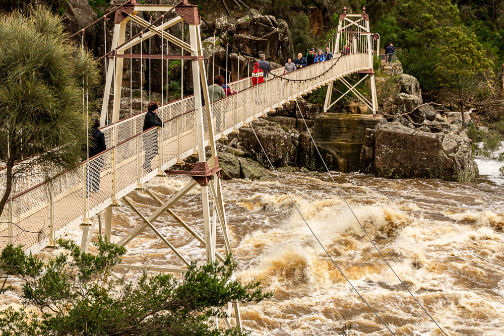
Raging floodwaters surge beneath the Cataract Gorge Suspension Bridge.
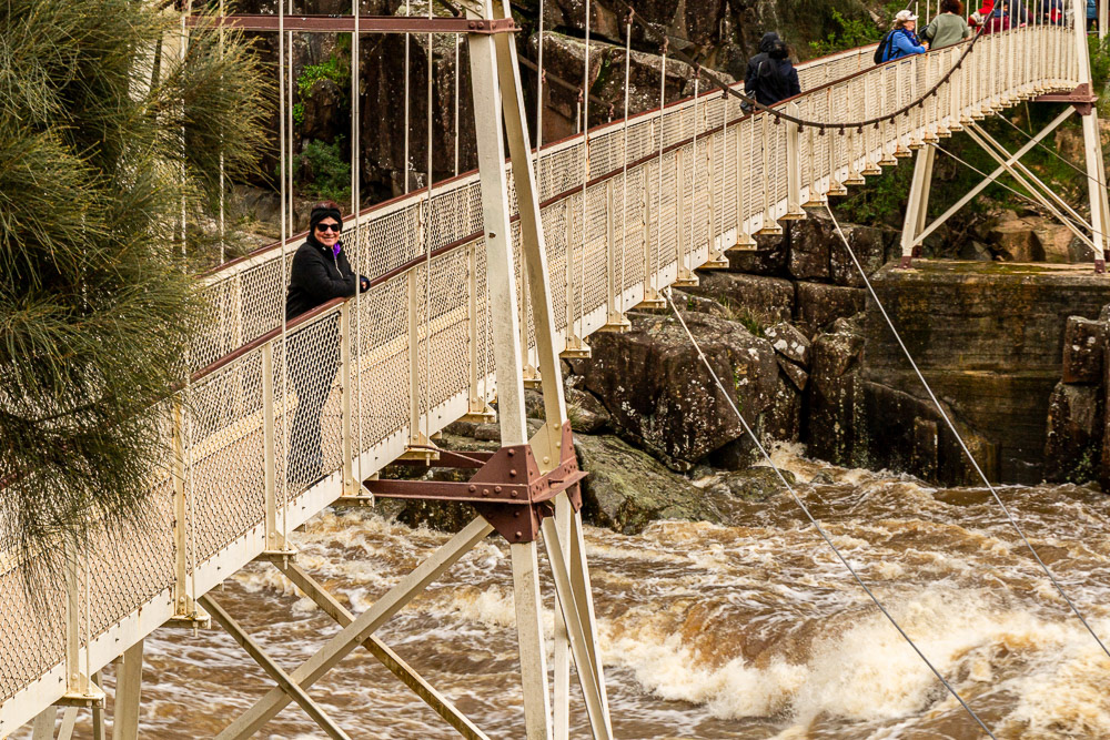
Cheryl gets a close-up view of the raging torrent.
One upside of the heavy rain Liffey Falls were in full flow.
The Crooked Church chapel from which the Winey derives its name.
The Crooked Church winery, a perfect venue for lunch on a rainy day.
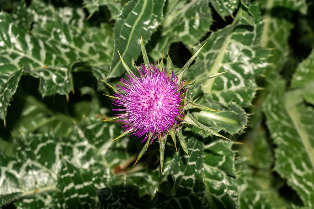
A Milk Thistle provides a bit of colour on a gloomy day.
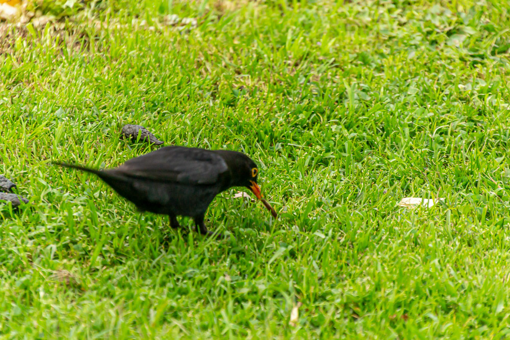
An early Blackbird gets a worm
Wynyard
We strike a beautiful sunny day during a break in the otherwise miserable rainy weather which enveloped us in our last week in Tasmania and drove to Wynyard for the day.
Here we visited Table Cape Tulip Farm, home of Van Diemen Quality Bulbs and to our delight their Tulips were in full bloom. The property takes its name from Table Cape, a volcanic plug located near Wynyard on the Northwest of Tasmania.
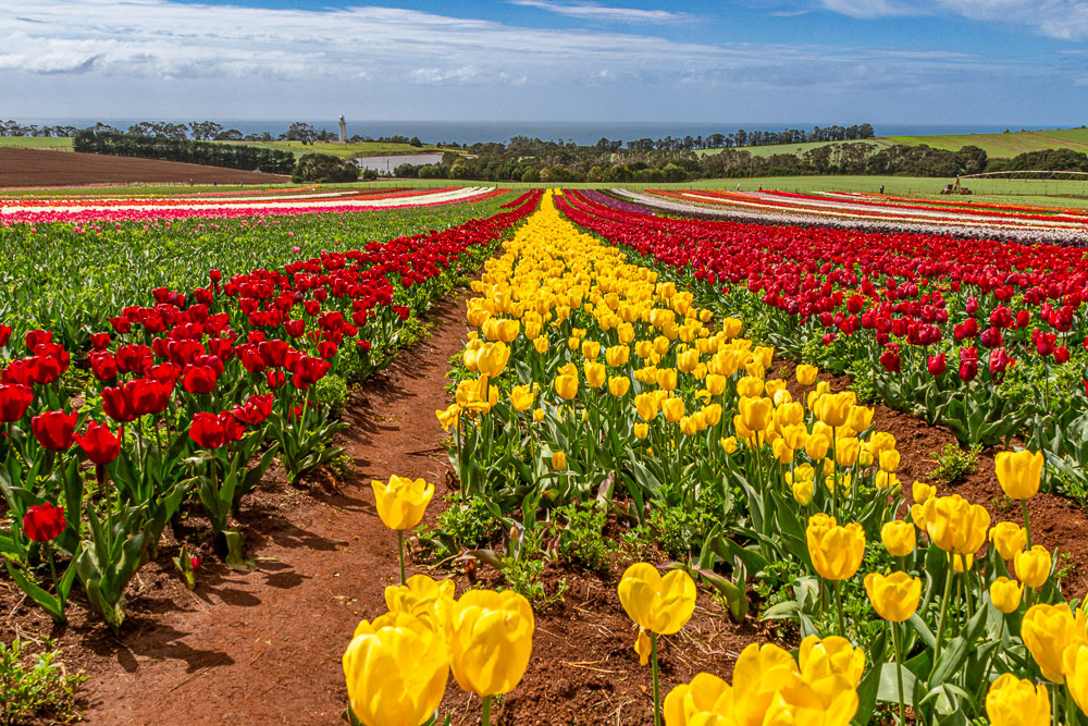
Tulip time at Table Cape Tulip Farm, Wynyard.
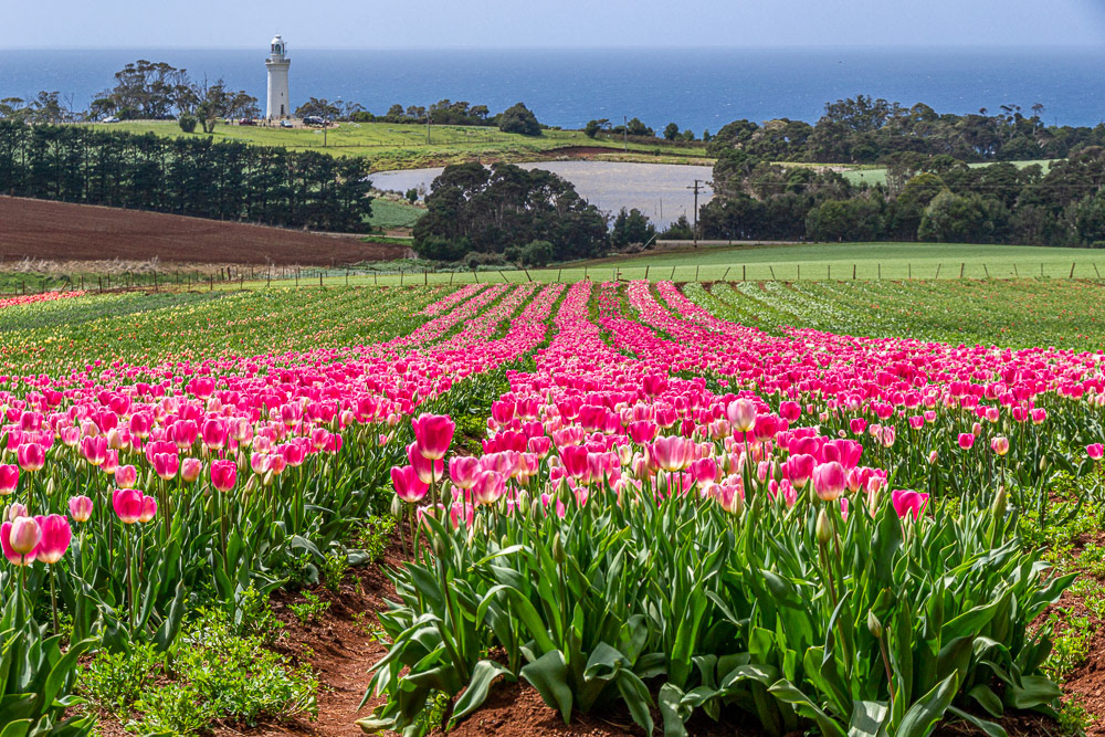
A swathe of pink Tulips directs towards Table Cape Lighthouse perched on the edge of 180m high cliffs.

Cheryl strolls through the fields of flowers.
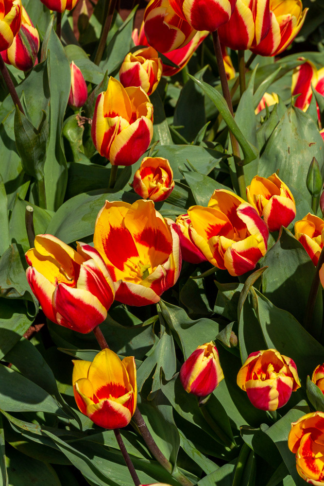
A verigated redand gold beauty.
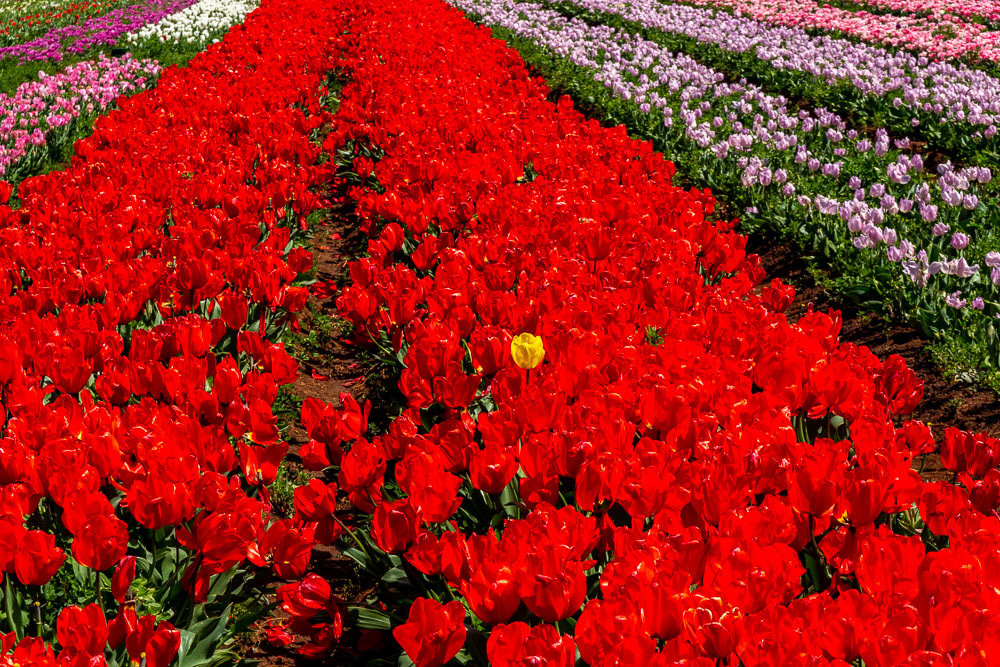
A golden rebel peeks through a sea of red.
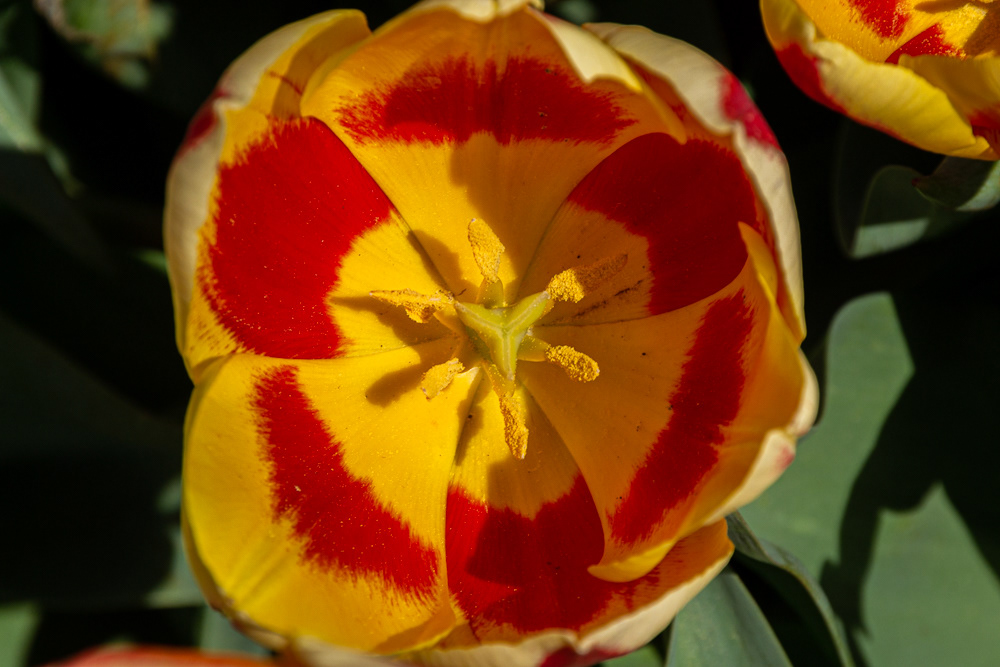
Stamen and petals of gold and red.
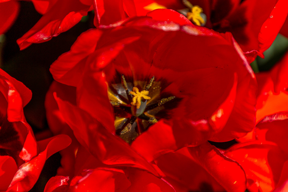
Vibrant vermillion petals surround a black heart and a gold stamen.
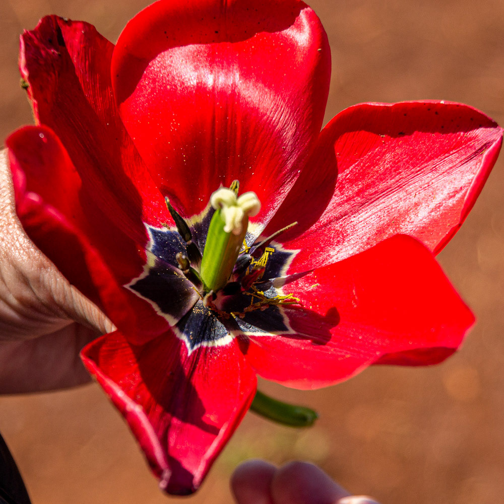
Simply beautiful