Lake Nuga Nuga
Lake Nuga Nuga is the largest natural water body within the Central Queensland Sandstone Belt and is located off the Arcadia Valley Road in the Lake Nuga Nuga National Park near the town of Rolleston.

Burnished vegetation fringing the shore of Lake Nuga Nuga are enhanced in the afternoon sun. Canarvon Ranges in the background.

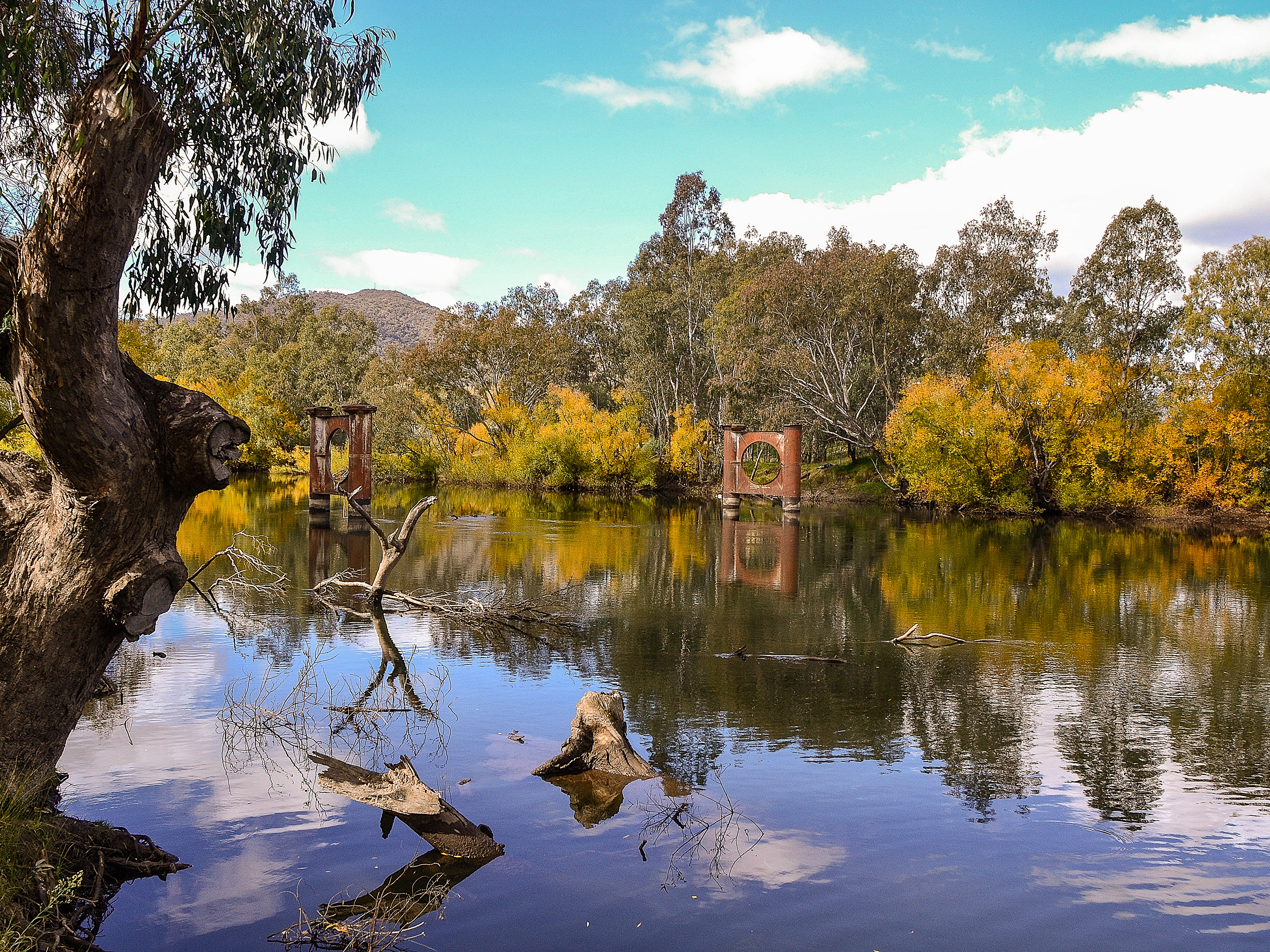
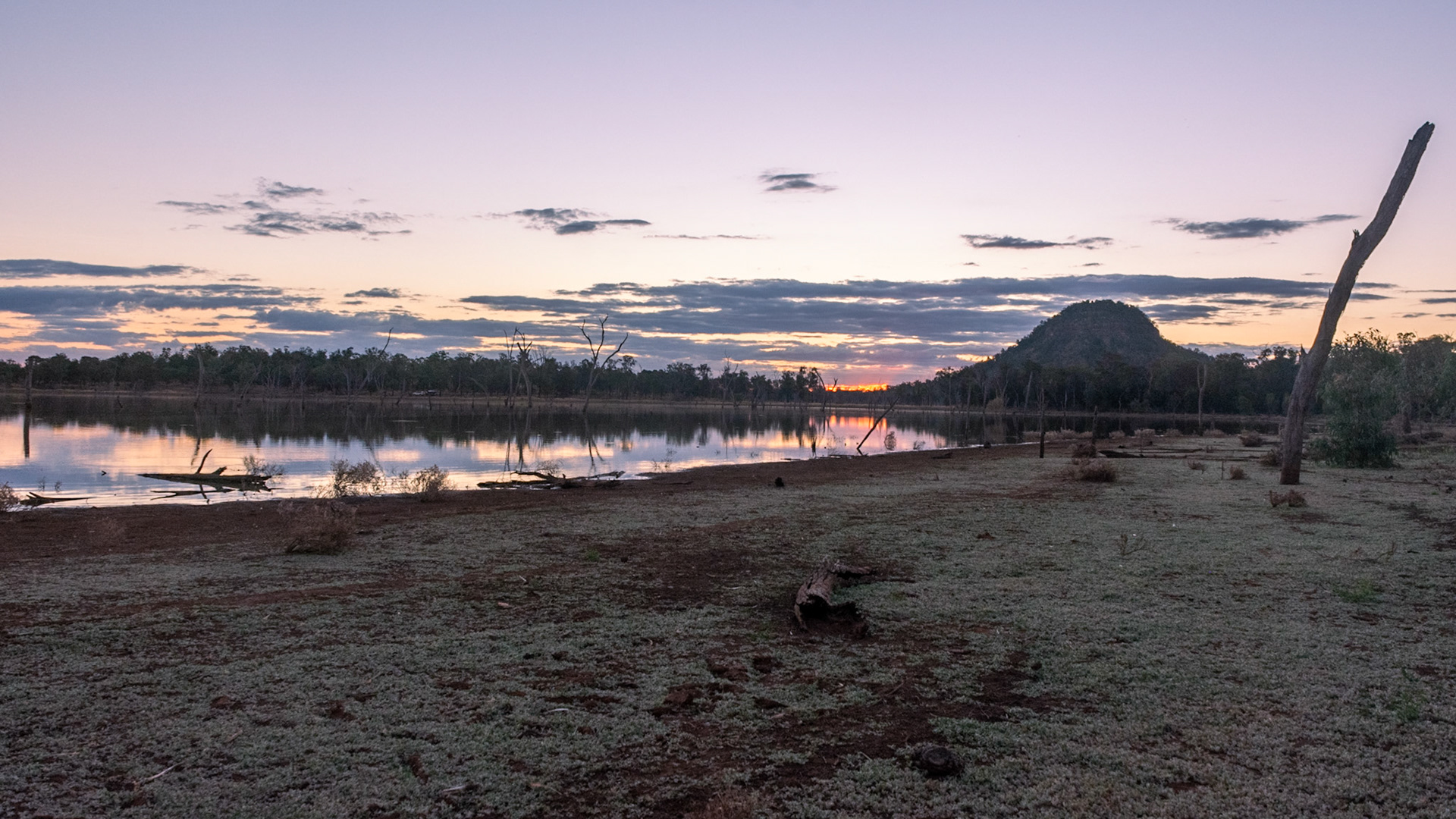
Skeletal remnants of trees stand in the ponded waters of lake Nuga Nuga.
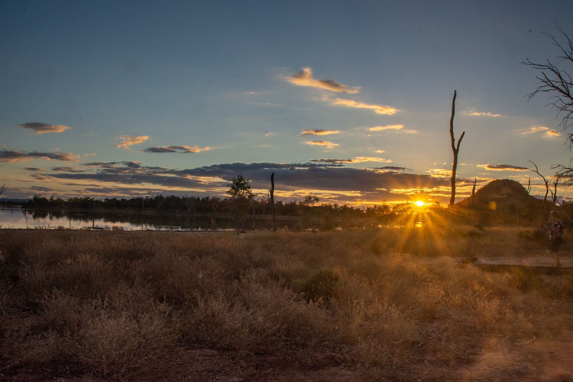
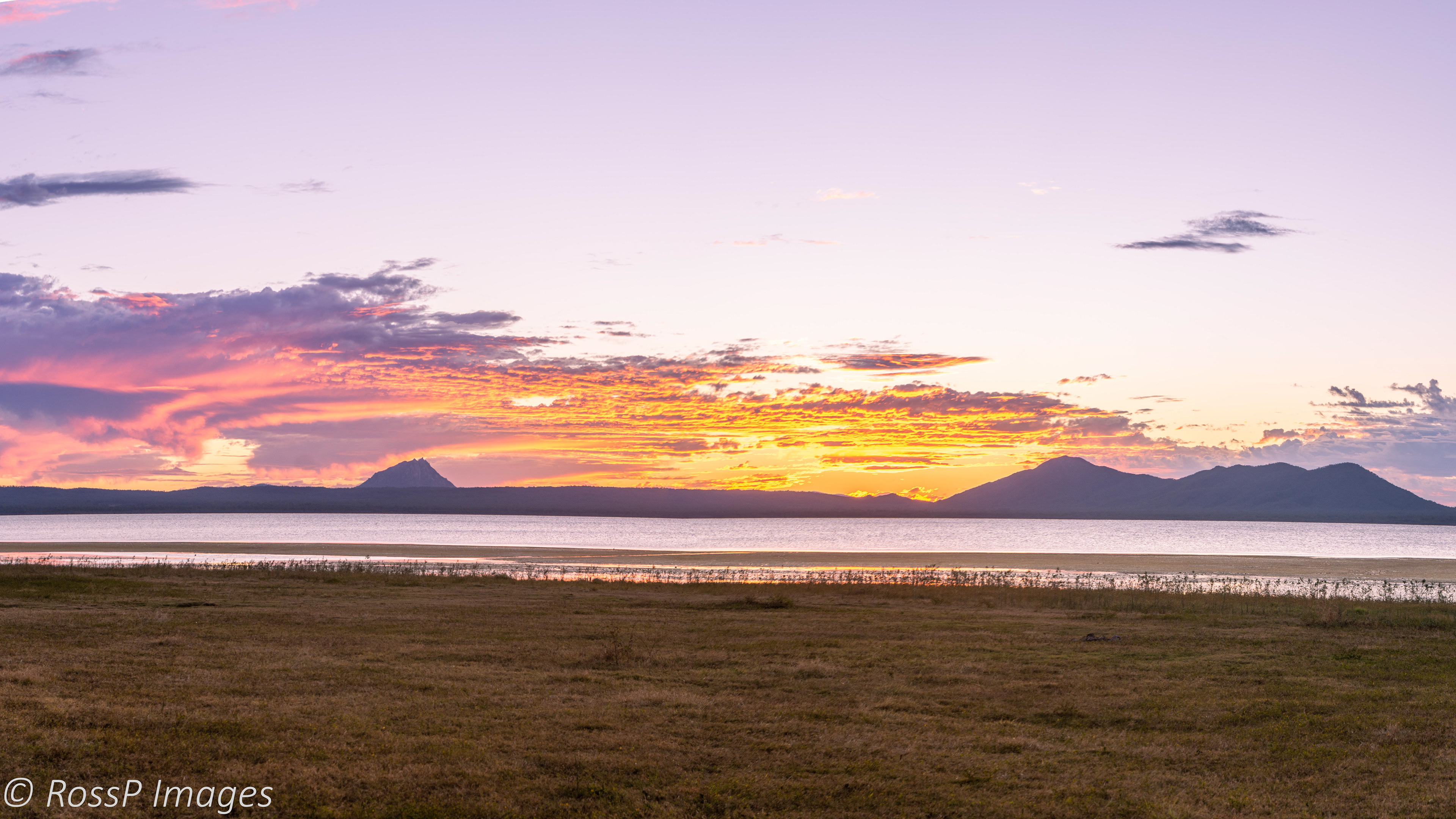
Sunset beside Mt Warrinilla at the Northern end of Lake Nuga Nuga
The last rays of sun for the day.

What a difference a day makes Lake Nuga Nuga is stirred up and muddied by wind. In the background the escarpments of Canarvon National Park.

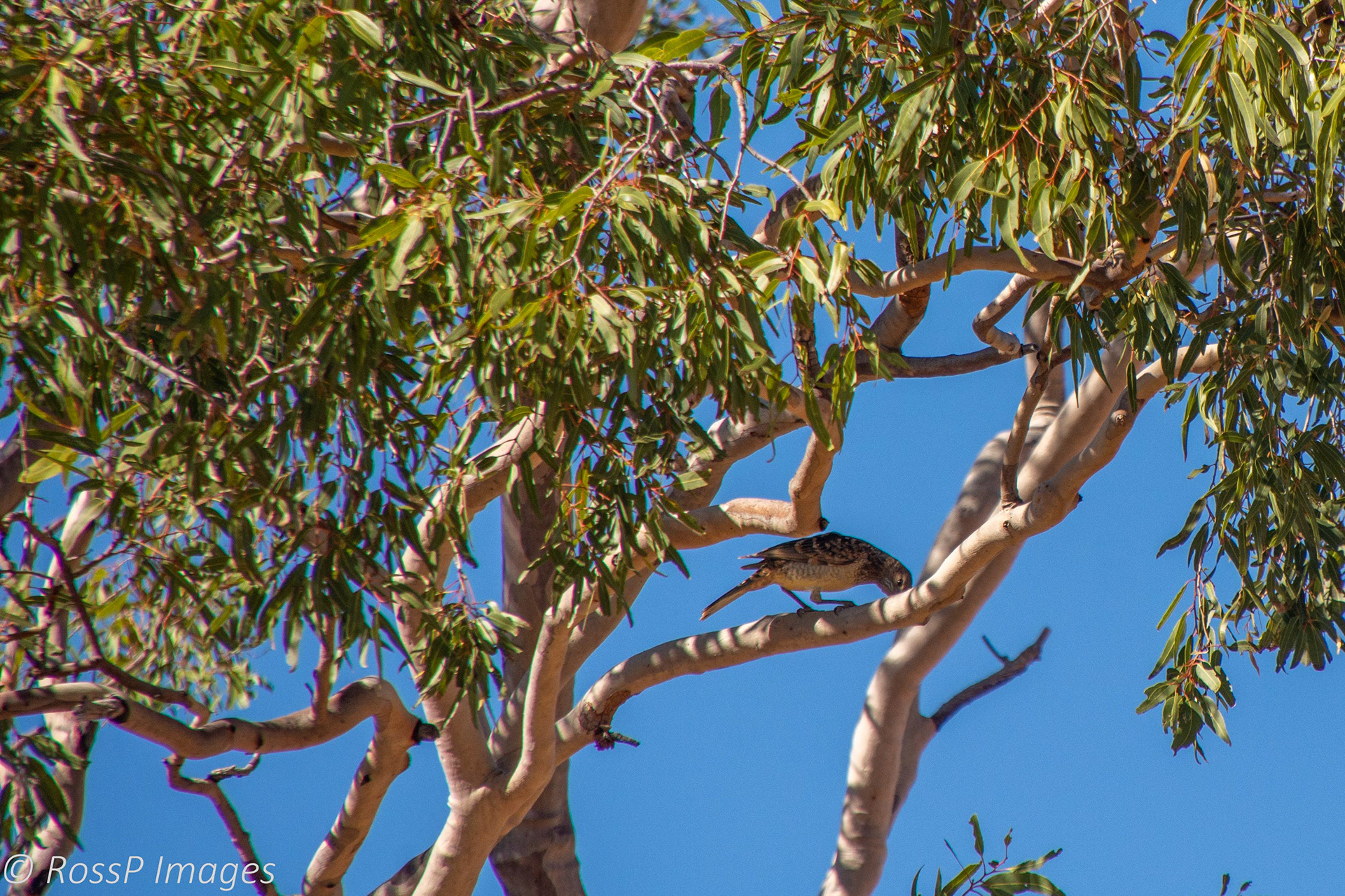
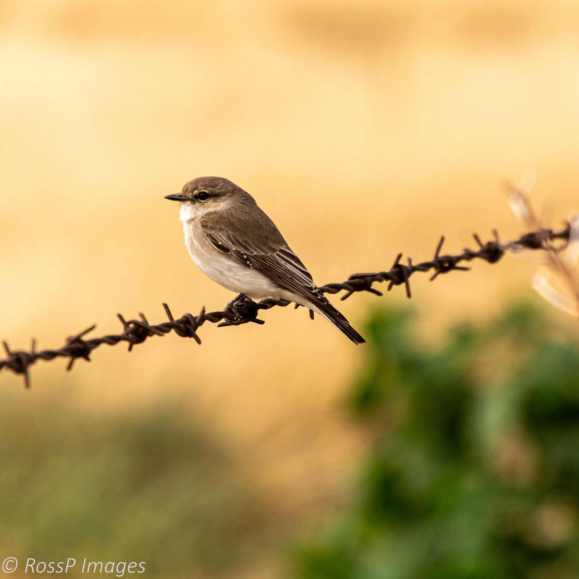
A pair of Whistling Kites with their nest above the lake.
Springsure
Located in the Central Highlands District approximately 70km North-west of Rolleston we stopover for a couple of days and check out the nearby attractions.
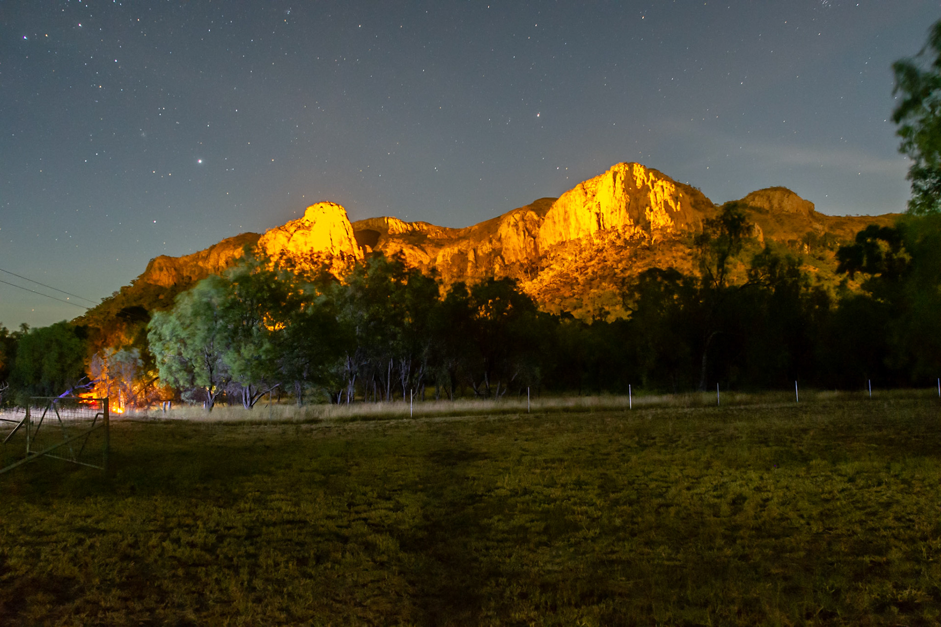
Virgin Rock is lit up at night providing a scenic backdrop to our campsite.

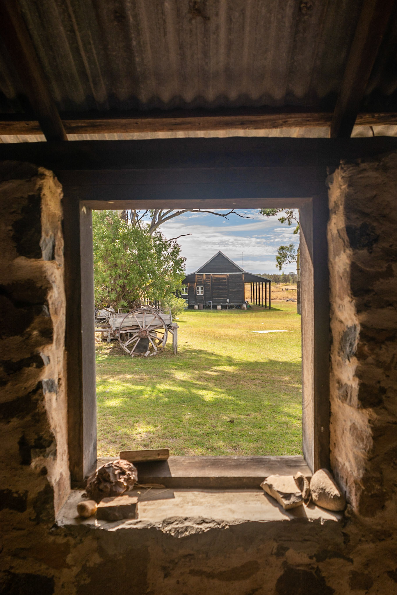
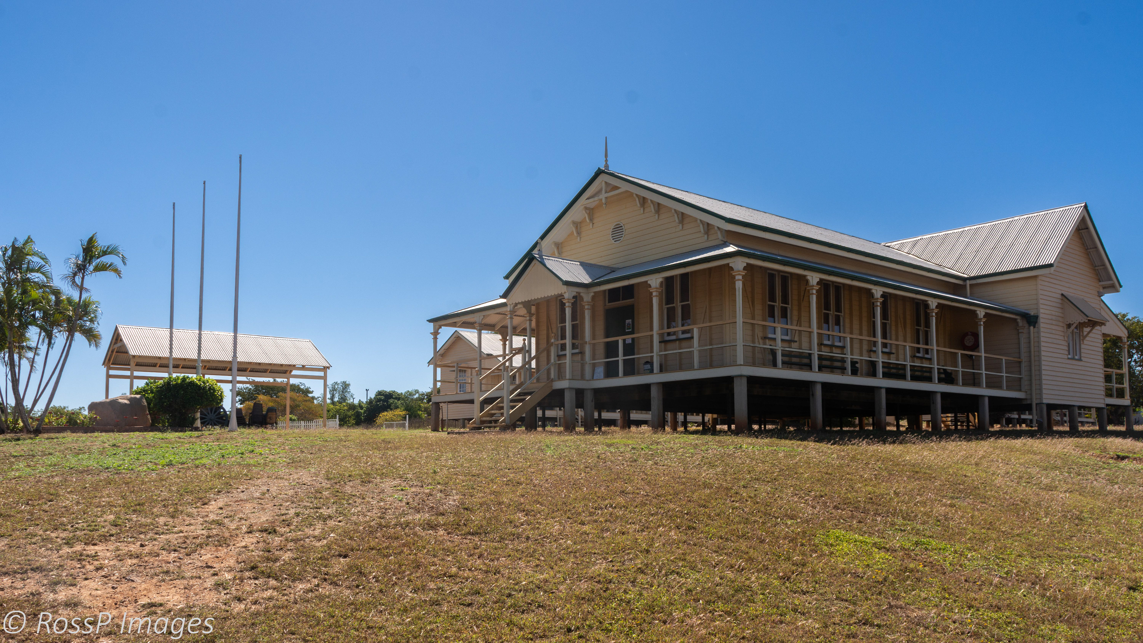
Cairdbeign Homestead and school in the foreground with the Old Rainworth Fort behind.
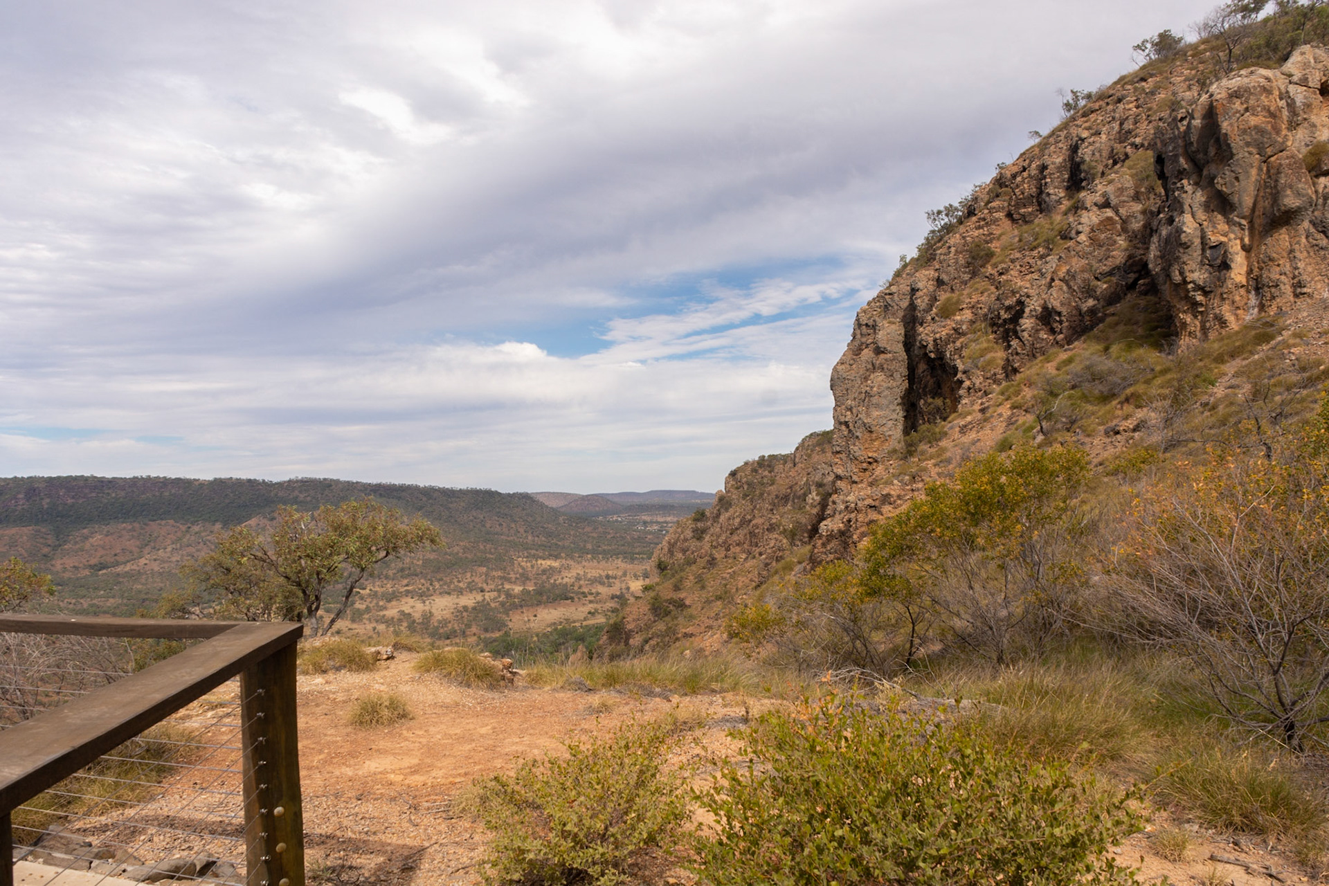
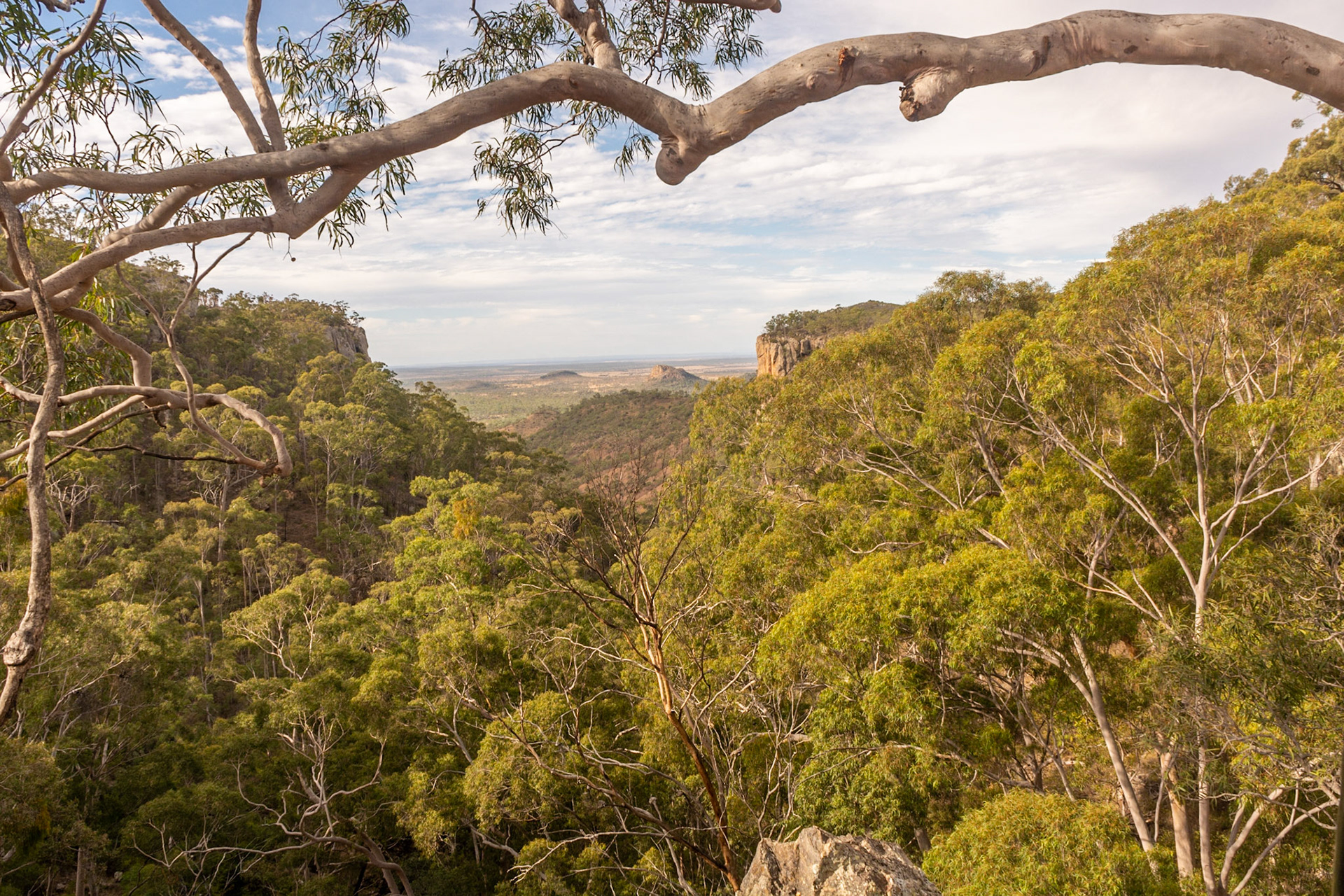
Eclipse Gap lookout at Minerva Hills National Park.
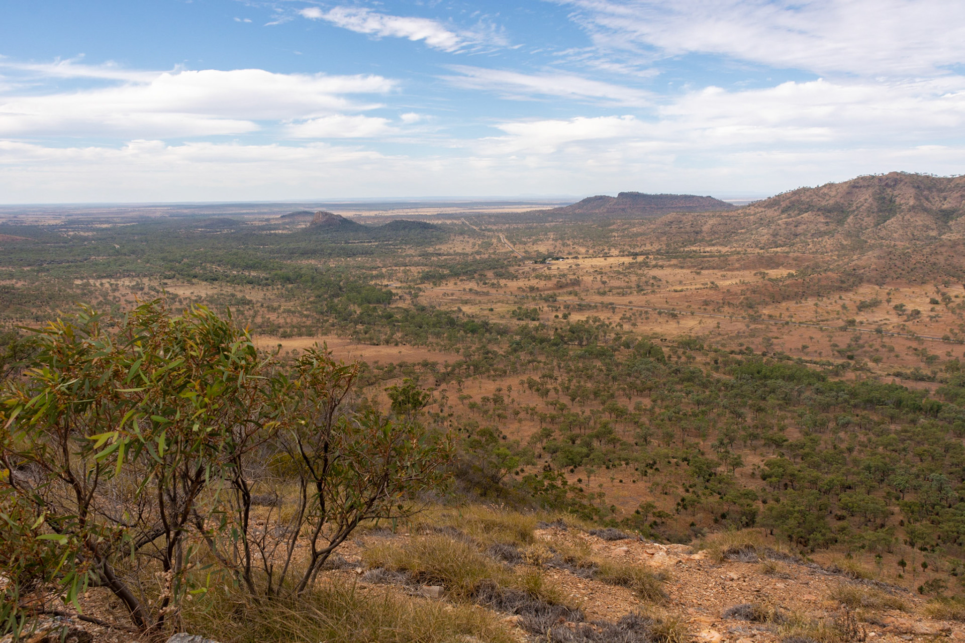
The view to the East from Eclipse Gap lookout at Minerva Hills National Park.
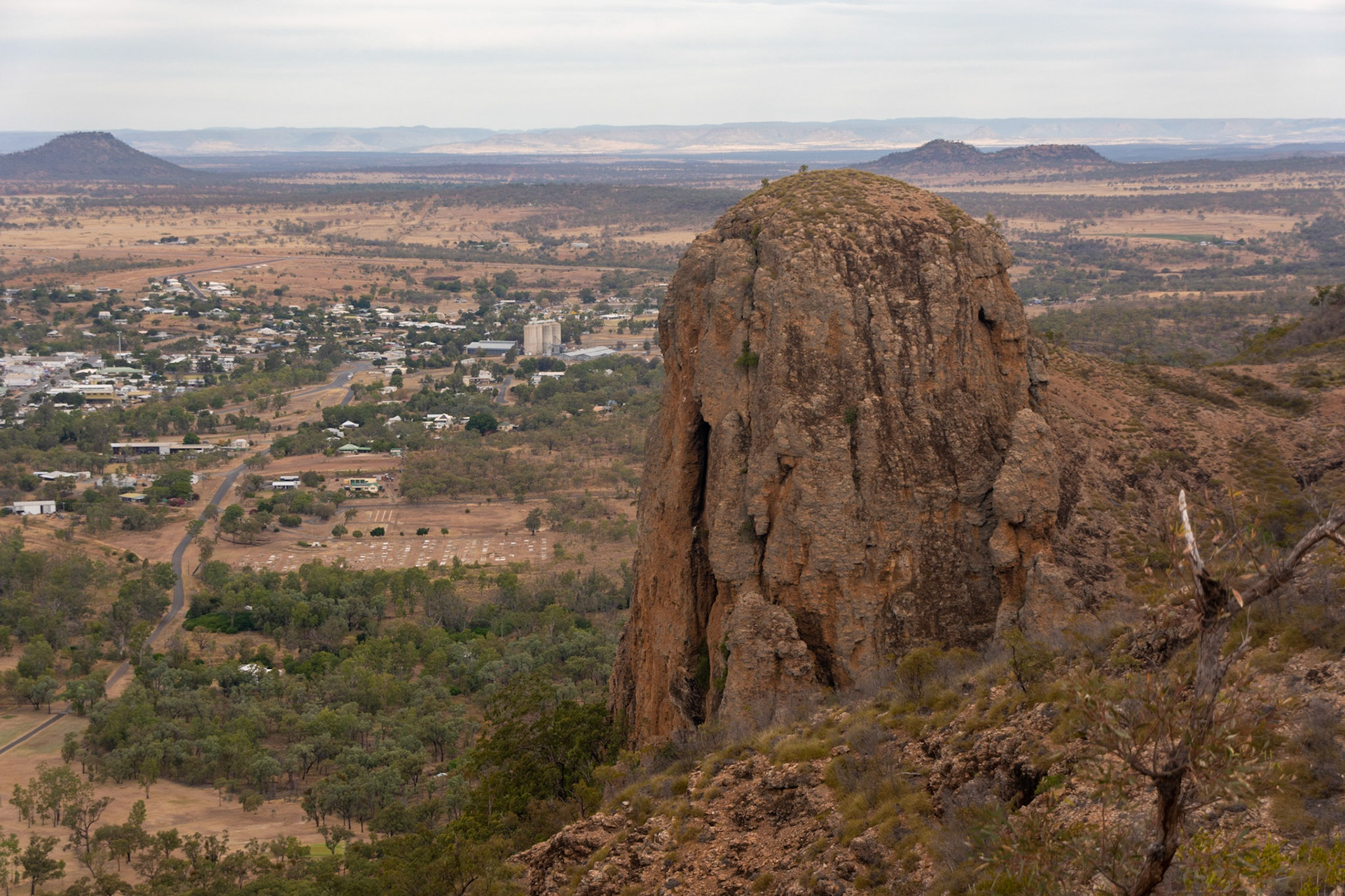
Virgin Rock with the town of Springsure below.

Fred's Gorge lookout.
Views at Fred's Gorge look out over grassy open woodlands, mountain coolibah, silver-leaved ironbark and gum-topped bloodwood, macrozamias and grasstrees.

Mt Zamia at sunset.
Lake Dunn
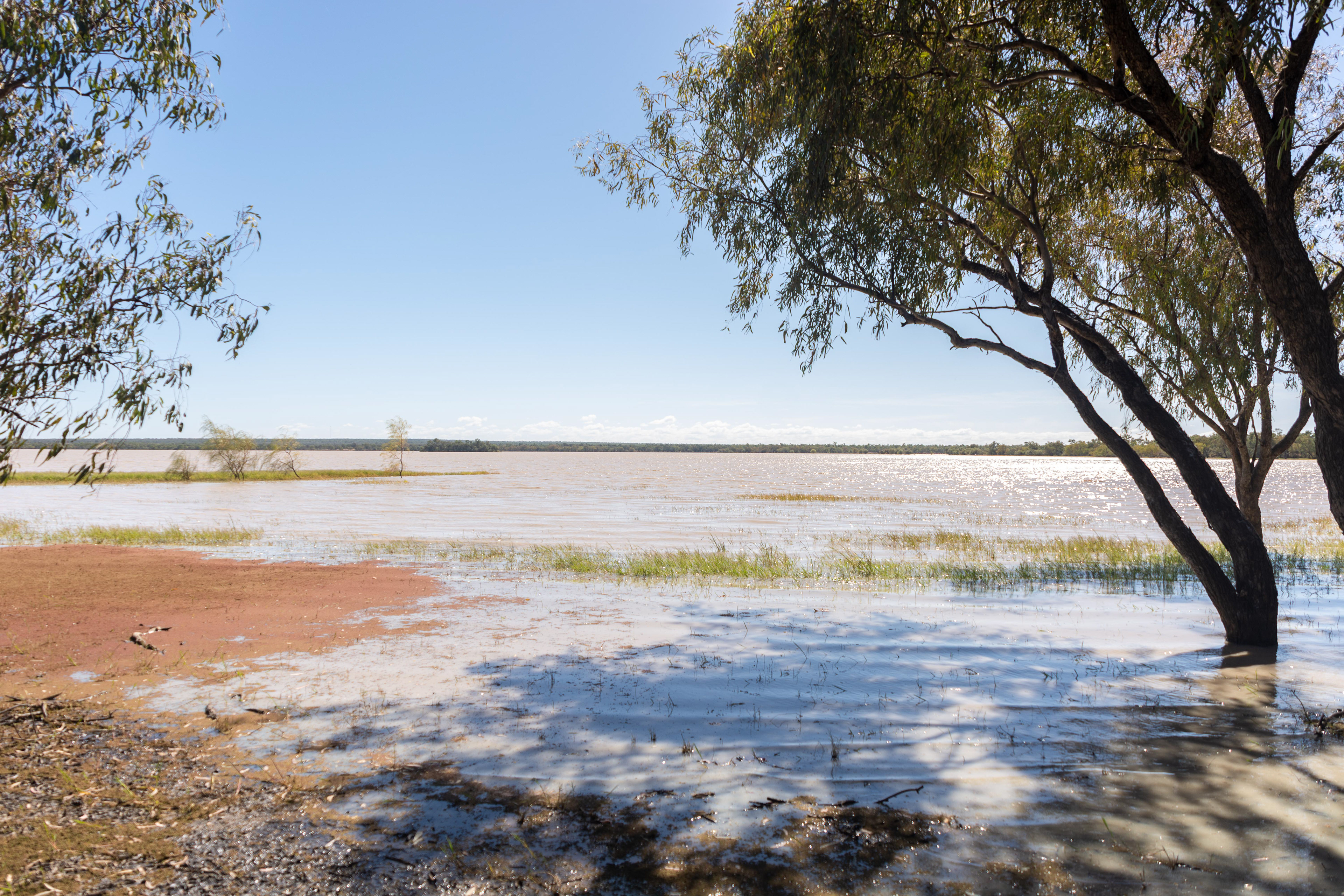
Lake Dunn is located near the township of Aramac is a freshwater lake in the Barcaldine Region. Also known as Pajingo Bola, meaning "Big Fella Waterhole," the lake is the only wetland area in Central West Queensland and is consequently home to a large waterbird population and other birdlife.
Lake Dunn also known as Pajingo Bola, meaning "Big Fella Waterhole,"

The freshwater lake is the only wetland area in Central West Queensland and is consequently home to a large waterfowl population and other birdlife.

An Eastern Great Egret wades in the wetlands of Lake Dunn.
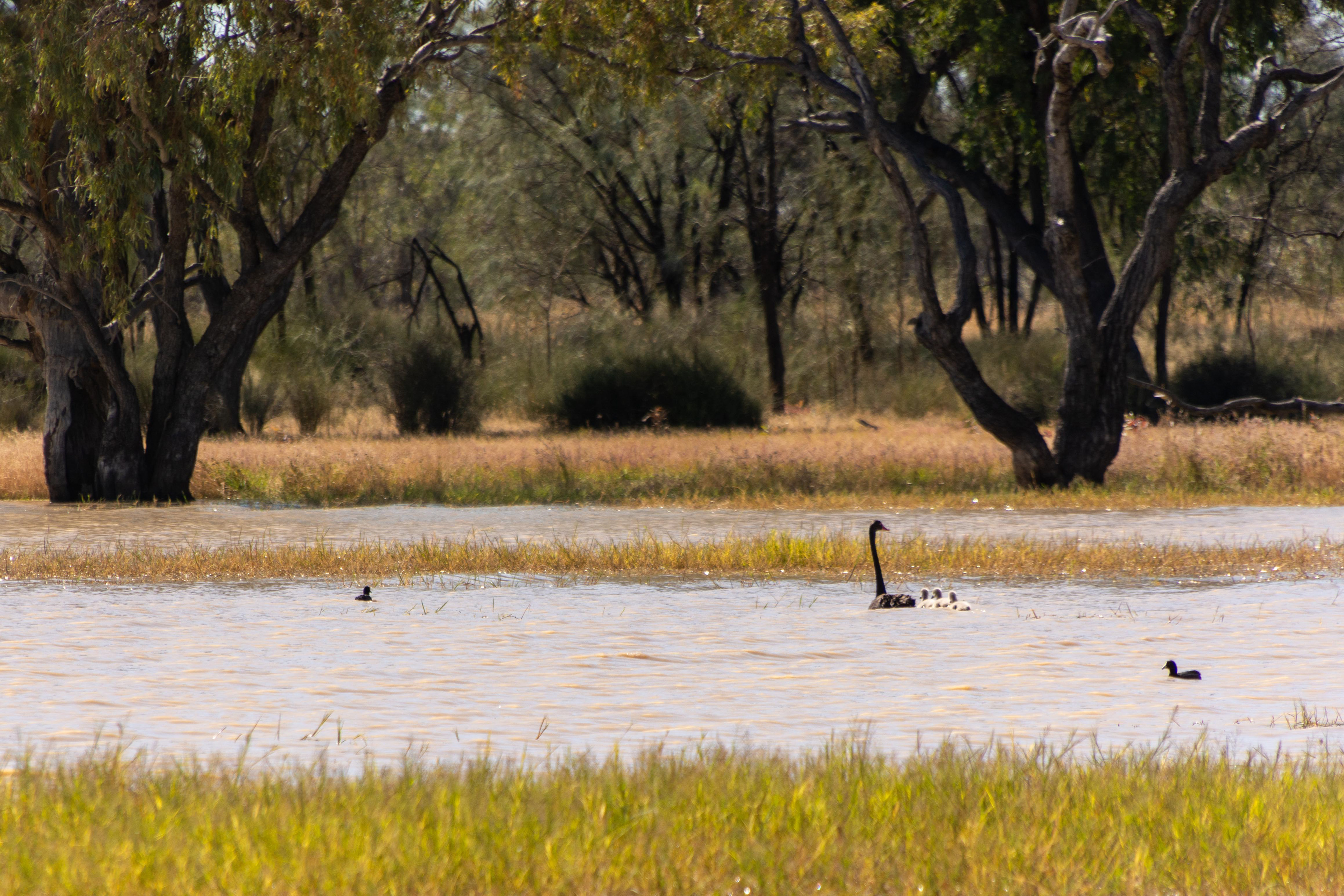
A family of Black Swans at home in the wetlands.
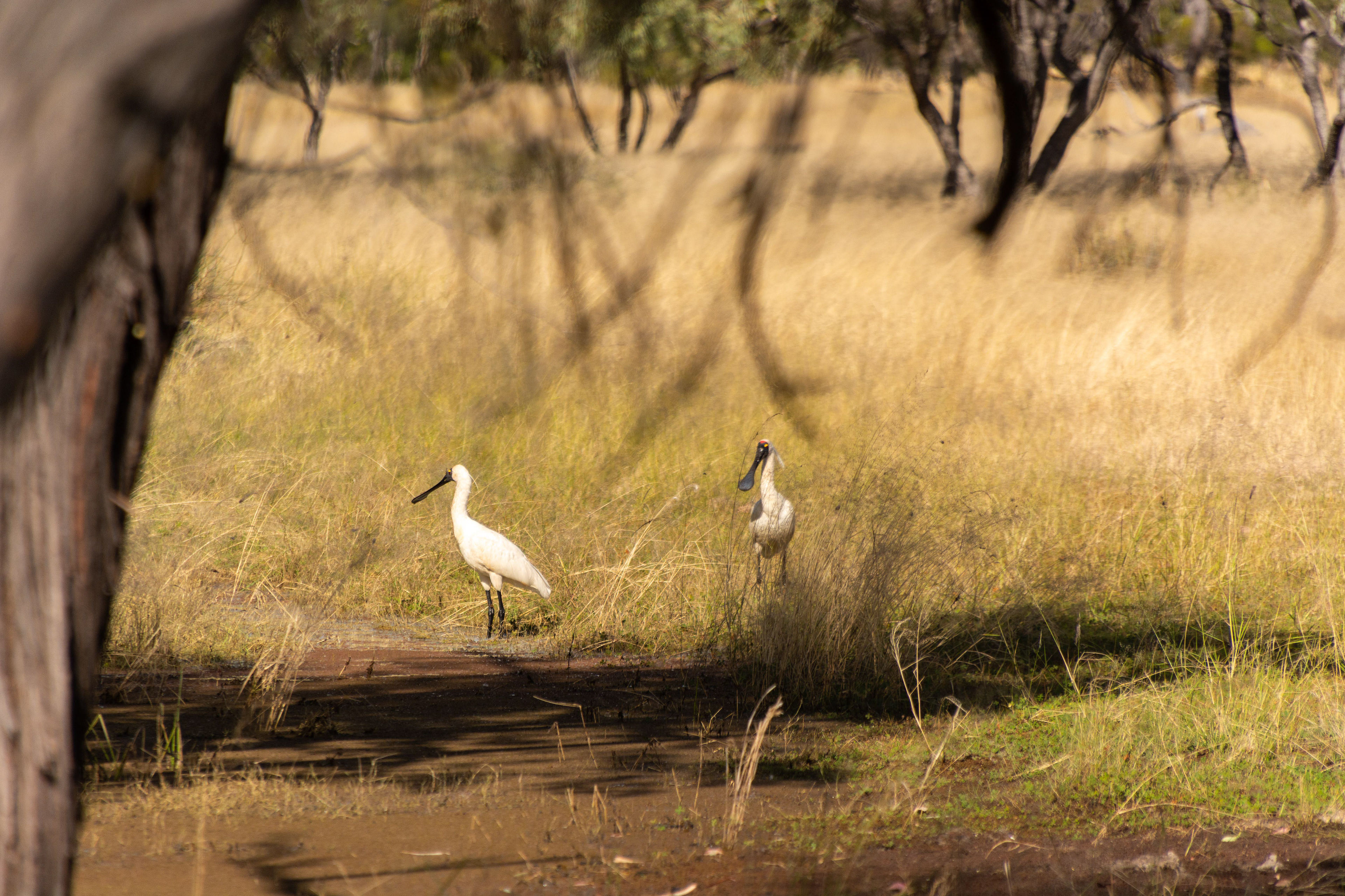
Royal Spoonbills searching the wetlands of Lake Dunn.
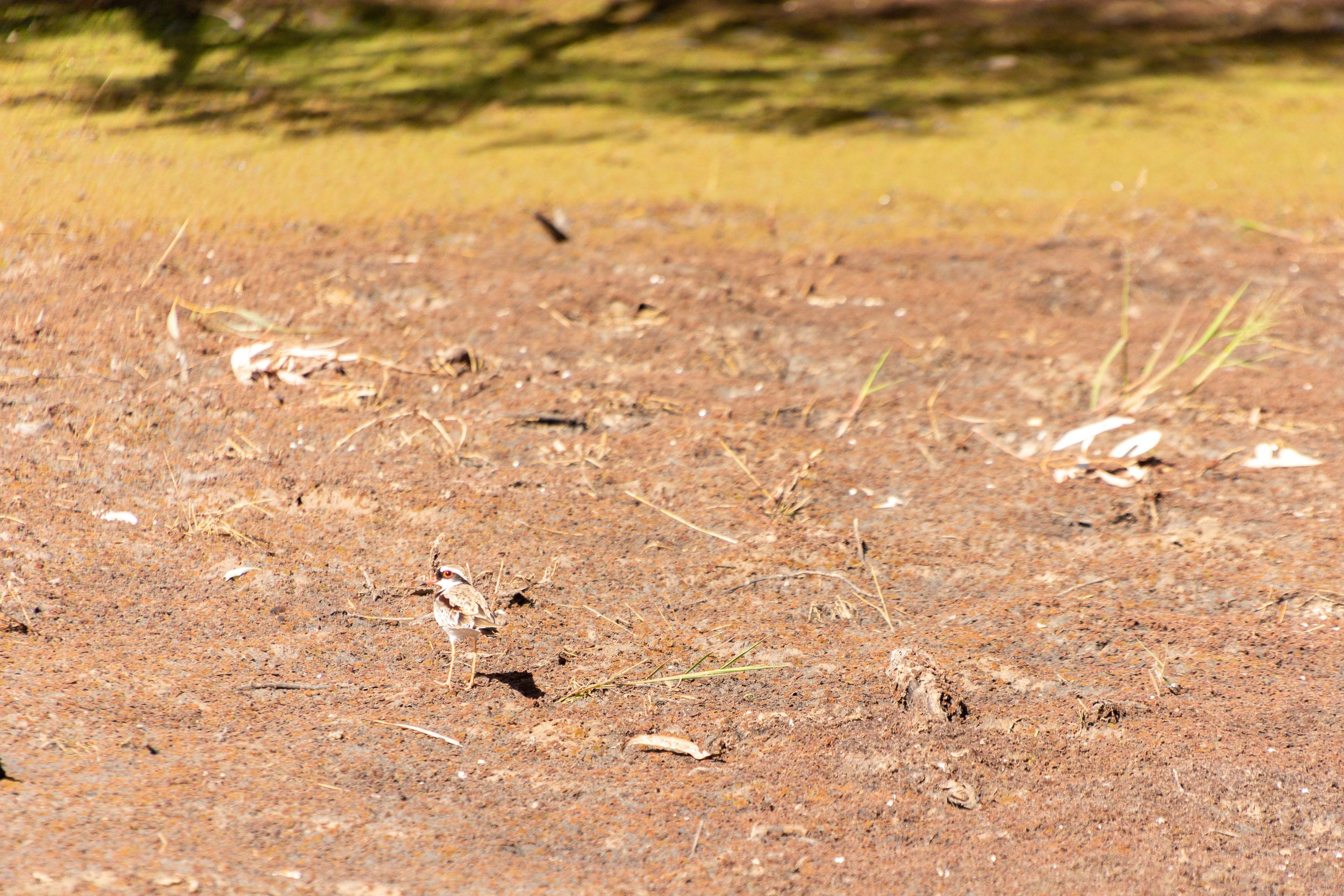
Black-fronted Dotterel.

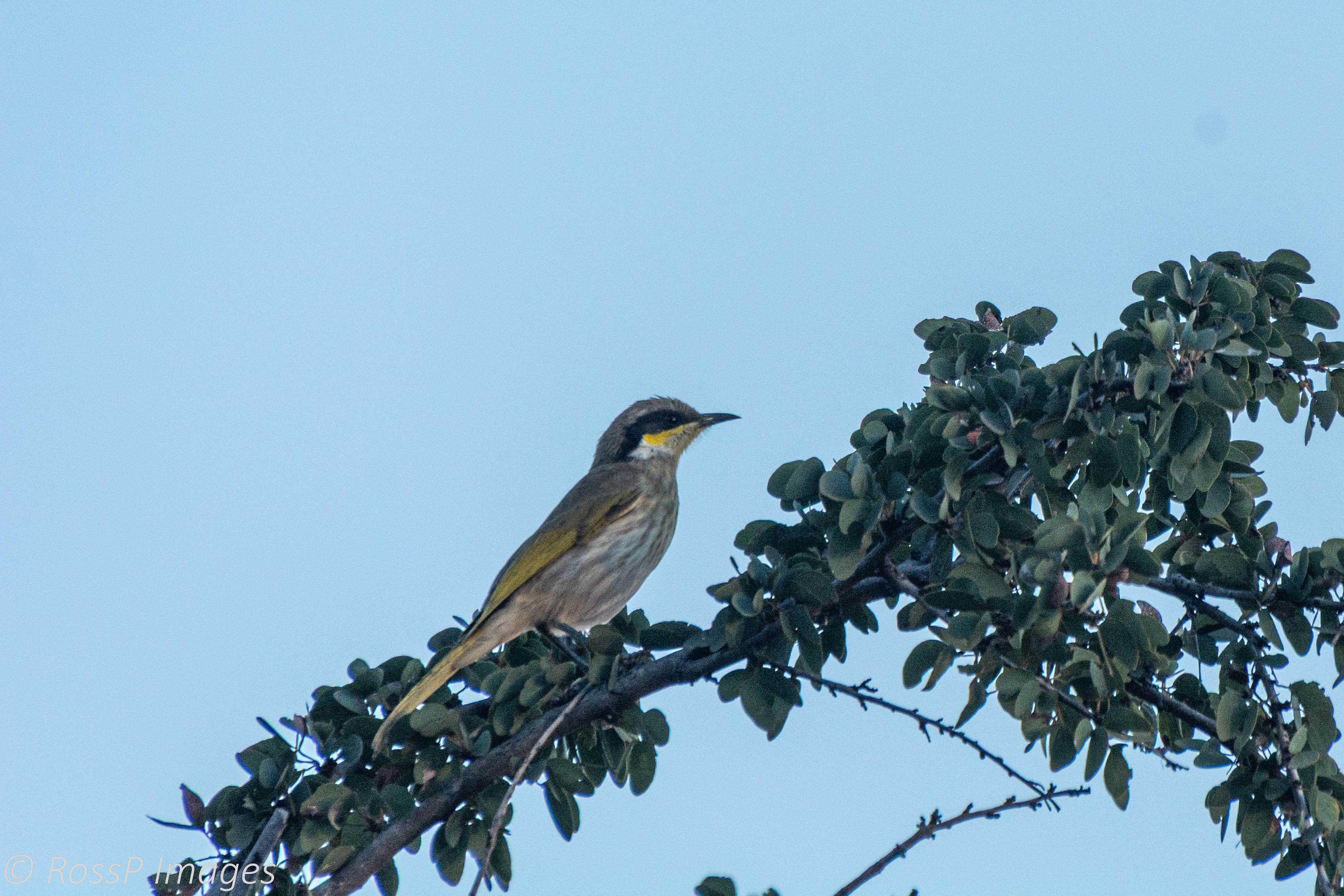
White-plumed Honeyeater.
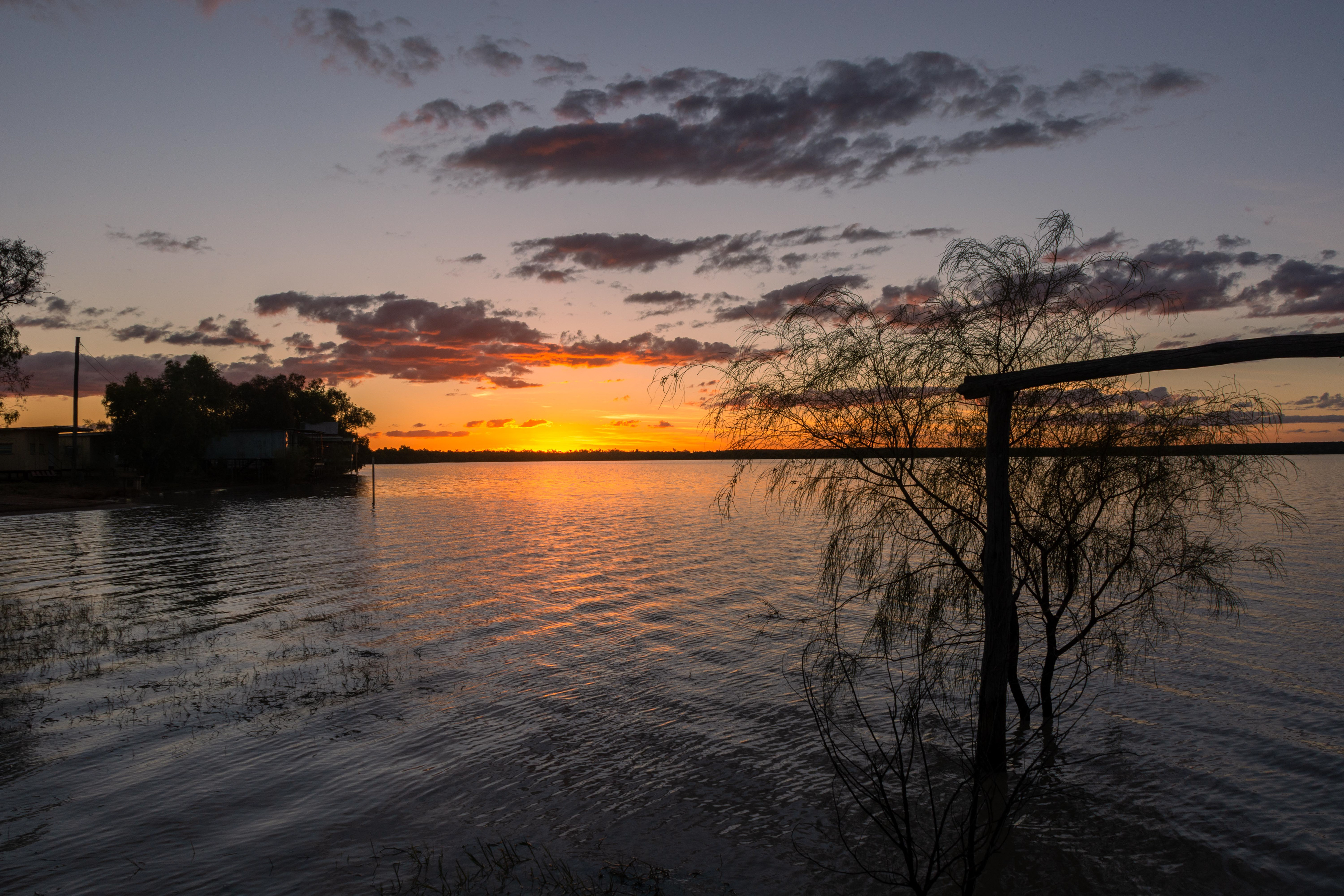
Sunset colours over Lake Dunn
From Lake Dunn we explored the sculpture trail, below are some of the items on display beside the roadside. This is a circuit which we commenced from the Aramac end. This is a loop of approximately 200km and along the way and are the works of a local sculptor, Milynda Rogers, who resided on a grazing property along the trail and decided she needed a platform to display her work. We also stop off at the renowned Gray Rock historical site to see names carved into the soft grey sandstone and drive through Horsetailer’s Gorge.

A giant Red-claw sculpture seems to point us in the right direction as we set off to explore.

Jillaroo mustering

Rodeo roughrider.

Helicopter stockman.

Lone Koala.

Stockman and his dog.

A huge buck deer.

A soldier returns.

Kangaroos fighting.

A Frill-neck lizard and many more to be seen ....

Grey Rock - some of the names engraved may have been from stagecoach passengers from earlier days.

Recently added names have been placed besides names engraved late in the 19th century..
Porcupine Gorge
This was our second visit to Porcupine Gorge National Park located 60km north of the town of Hughenden and although camping is available in the park no sites were available so this it was a day trip only.
The images below are taken from the top of the gorge walls however if time permits the walks at the bed of the gorge along the creek and its waterholes is well worth the effort.
Porcupine Creek
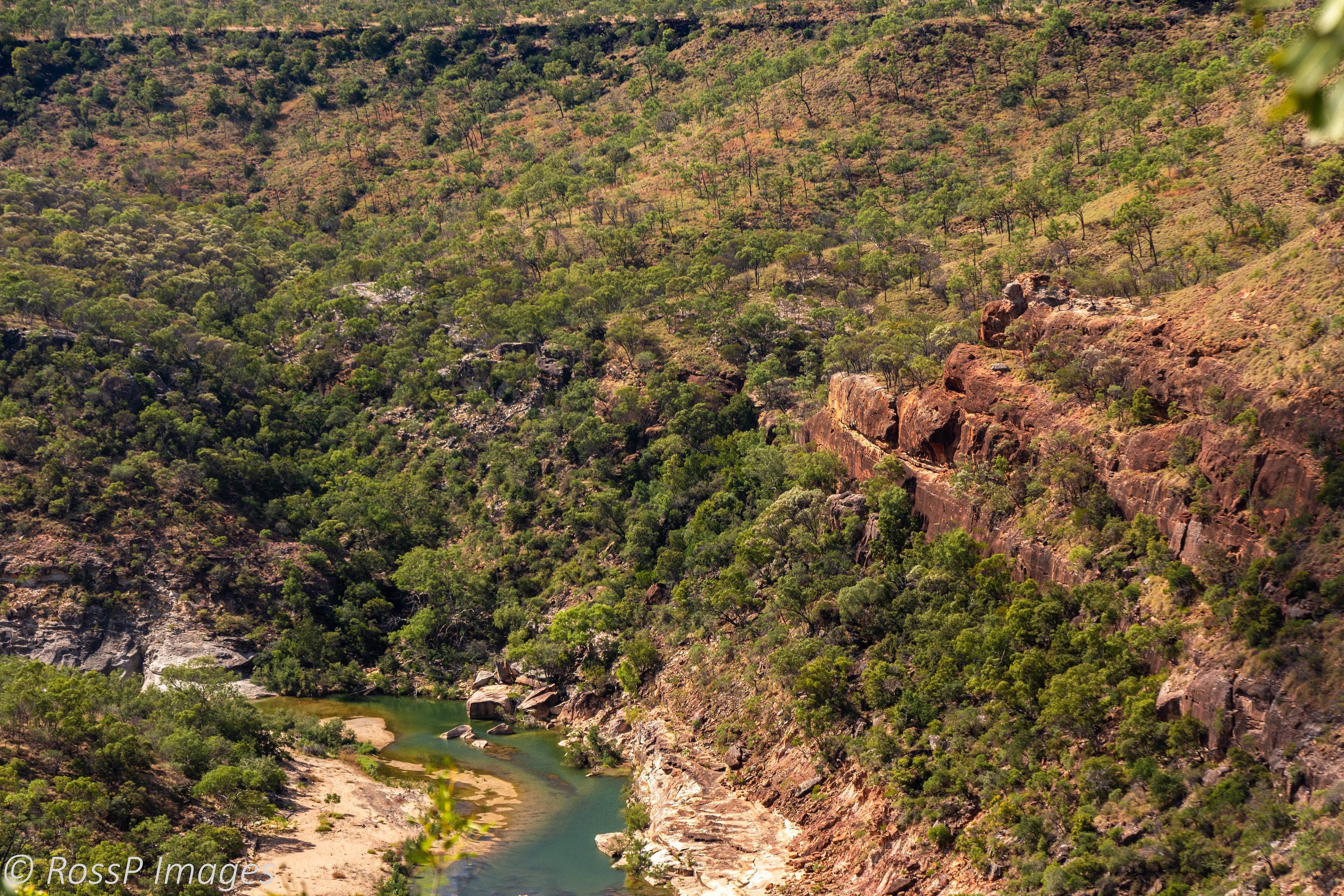
Rugged sandstone escarpments

Waterholes look inviting on a hot day.

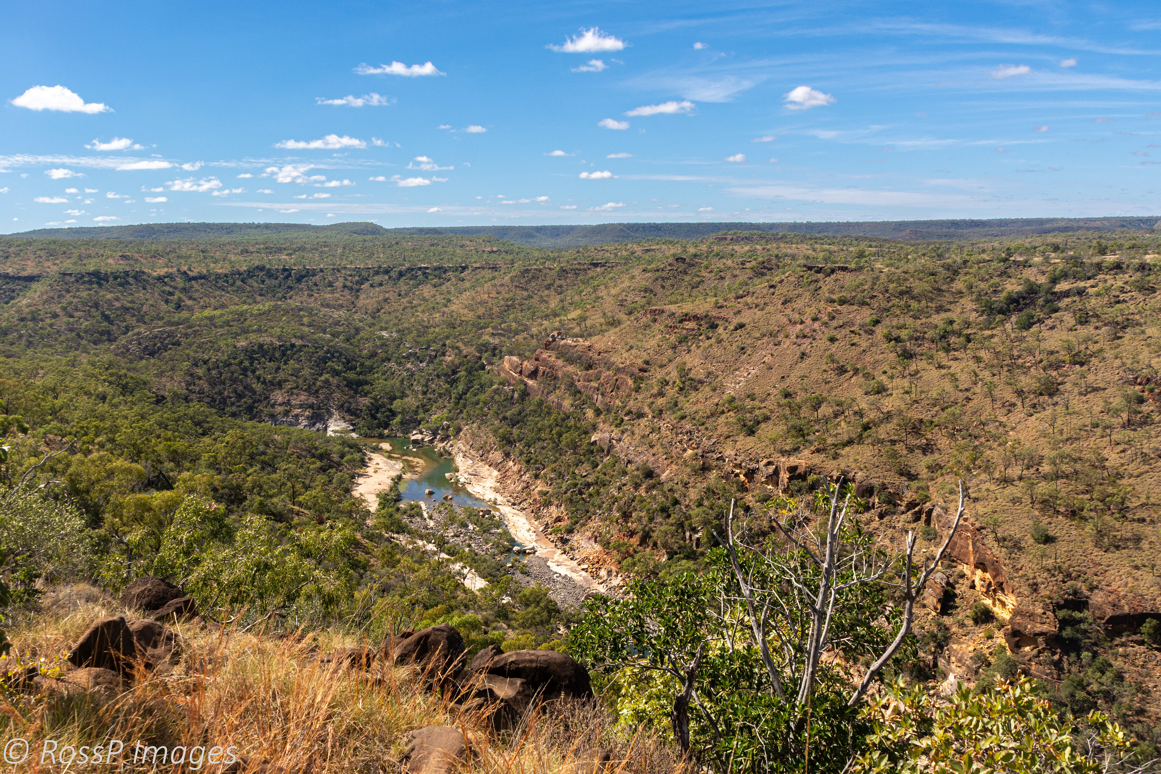
A steep, narrow section of the gorge carved out over the centuries by Porcupine Creek.

Porcupine Creek, from which the gorge derives its name. In the distance is "the Pyramid".
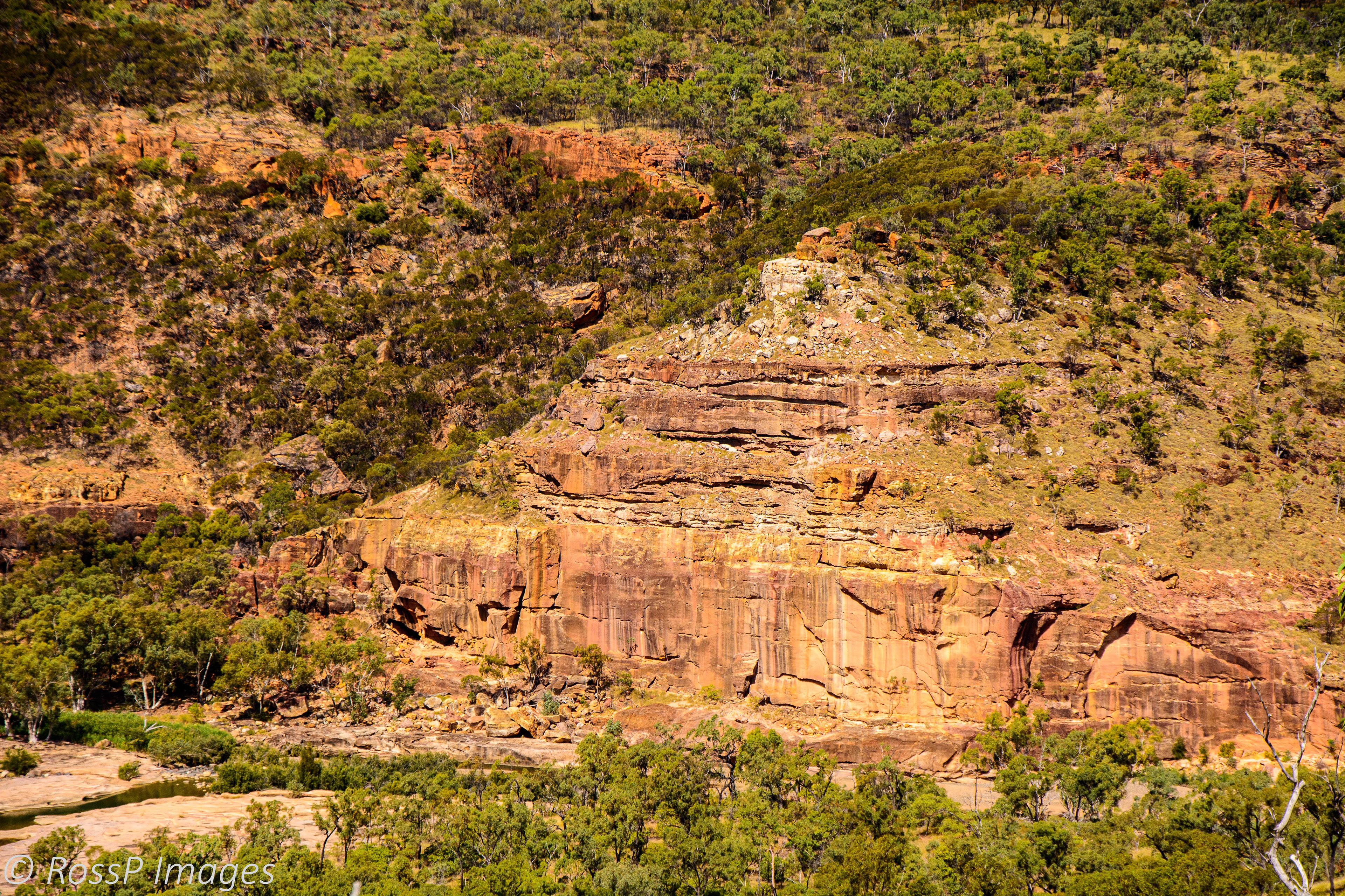
Up close to the multi-coloured sandstone face of "the Pyramid".
Kooroorinya Falls Nature Reserve
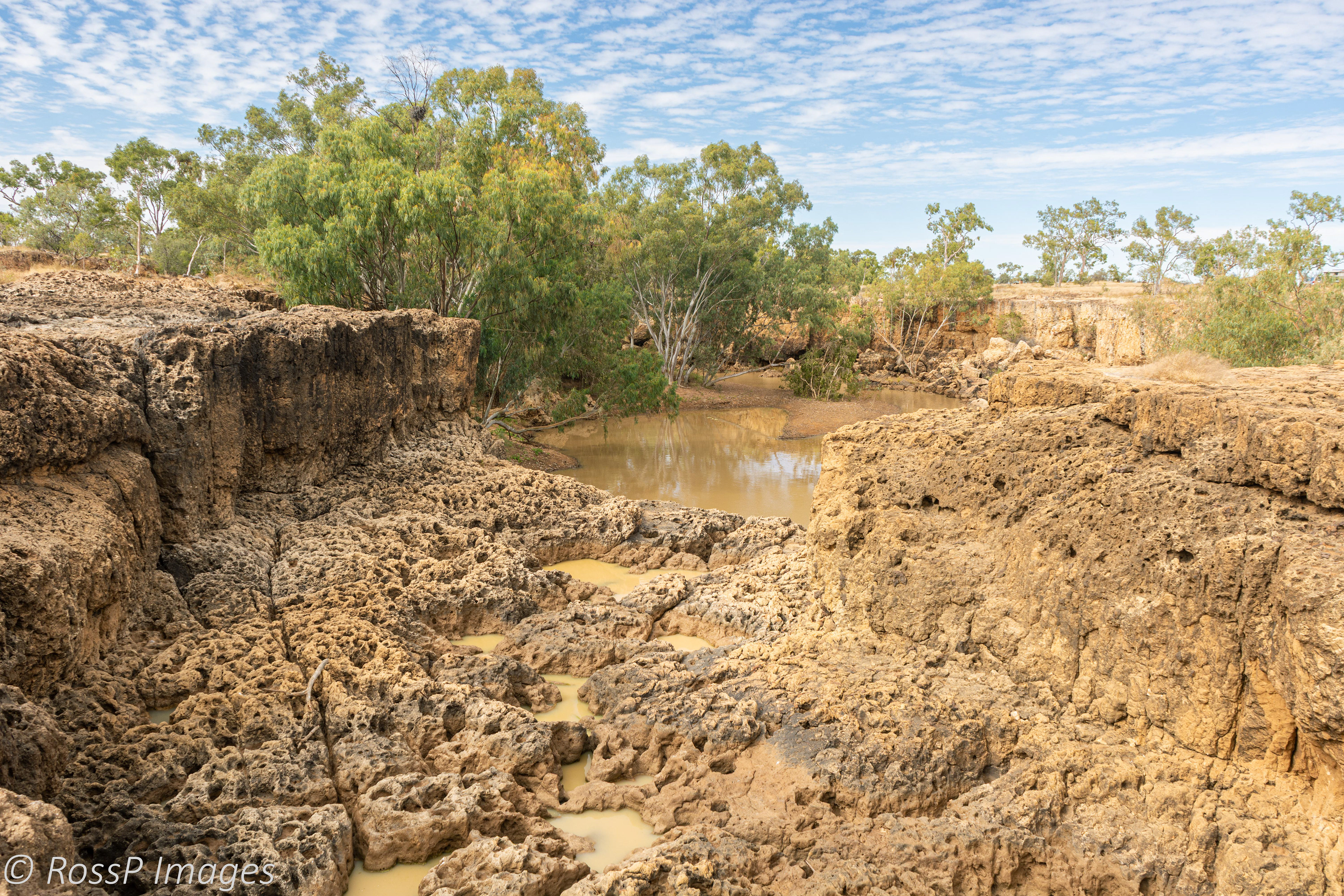
Located about 50km south of Prairie on the Prairie - Muttaburra Road, Kooroorinya Falls is a natural waterhole surrounded by high rock walls on one side and sandy, shaded banks on the other and abounding birdlife because of the permanent waterhole. Adjacent the falls is the Kooroorinya Racetrack which has a camp site with toilet and shower facilities.
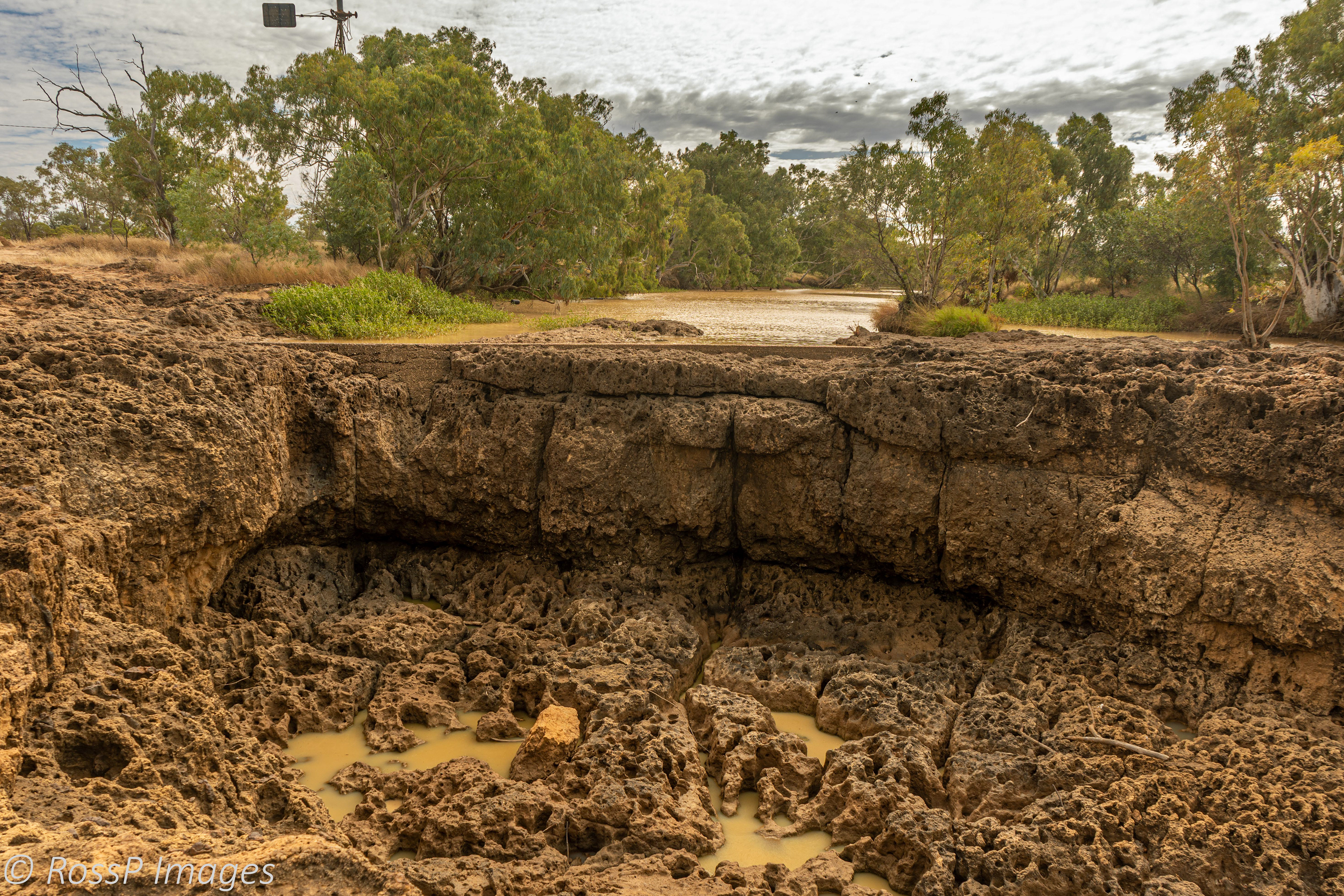
The exposed basalt rock face forms a natural weir at Kooroorinya Falls and is enhanced by a man-made concrete cutoff wall.
Exposed basalt rock downstream of the falls.
A Spotted Bowerbird.
Singing Honeyeater.
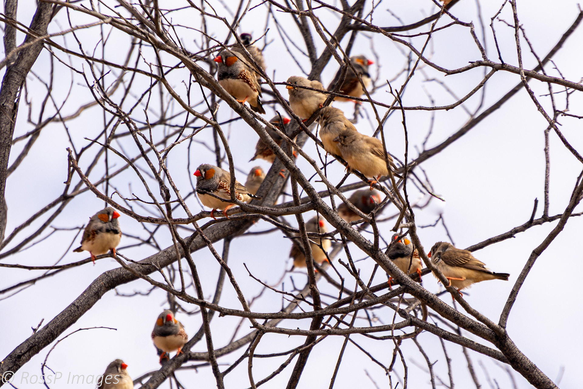
Flocks of Zebra Finches are attracted to the nearby permanent water source.
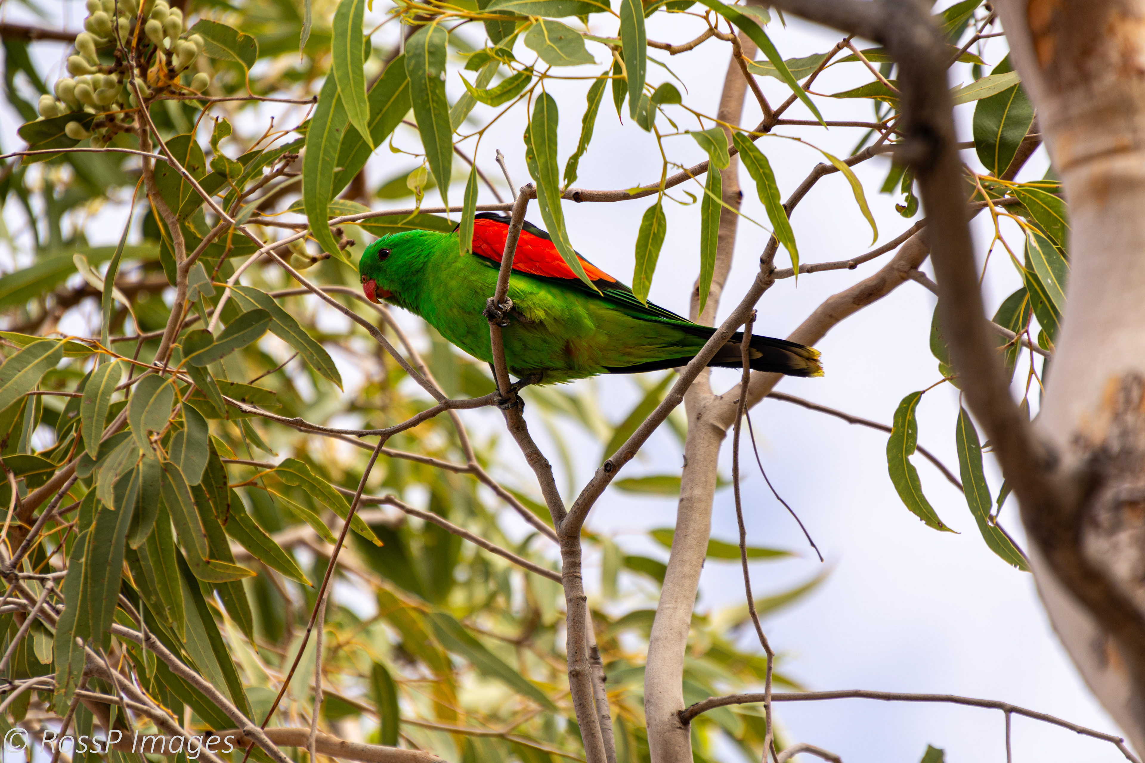
A Red-winged Parrot.
Western Gerygone.
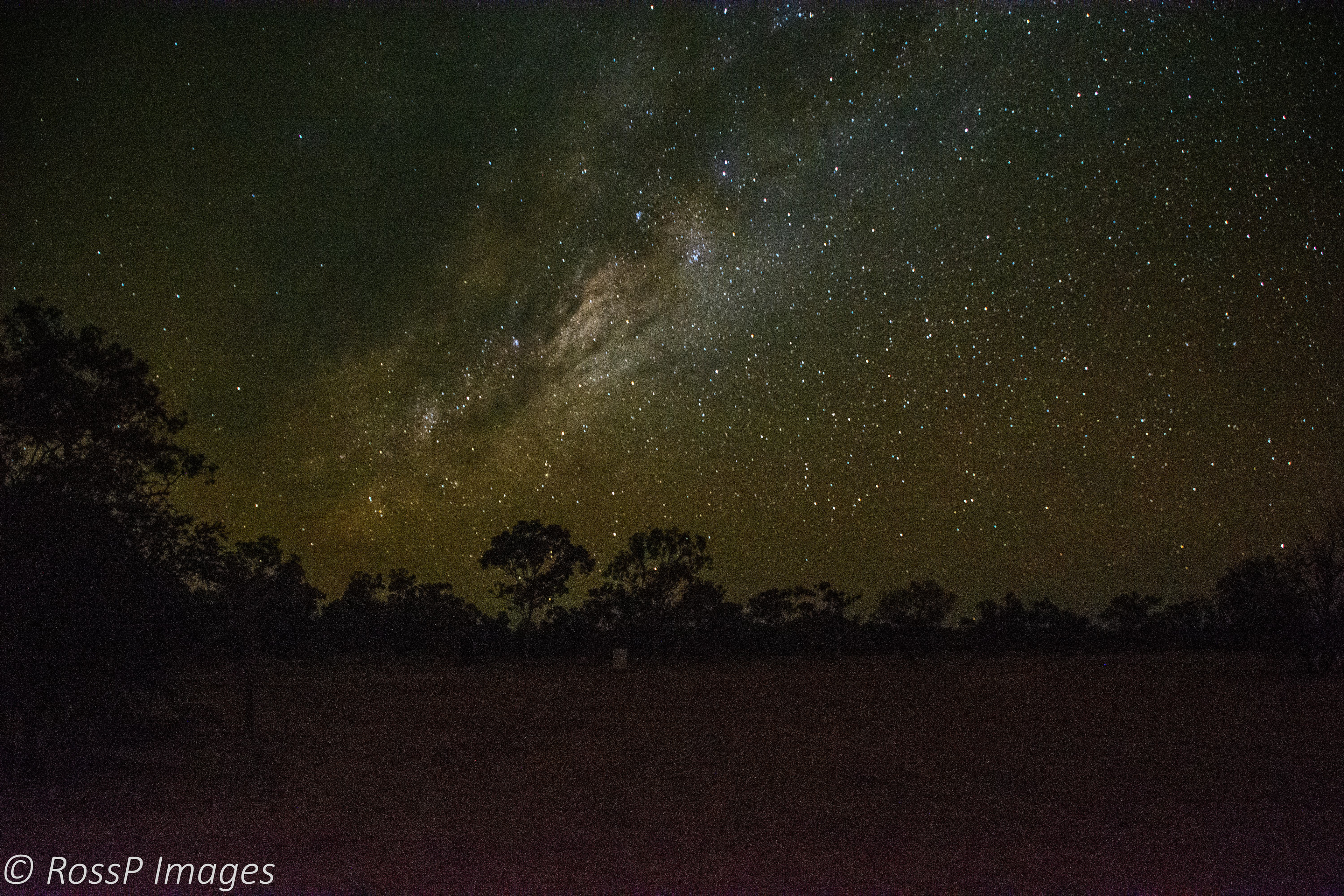
The night skies are spectacular.
Ravenswood
After leaving Kooroorinya we head for the Burdekin Falls Dam (Lake Dalrymple) and stop off in Ravenswood, a small rural town near Charters Towers. Following the discovery of gold in 1868 through to the early 1900's the township flourished and grew to nearly 5000 residents and boasted 48 hotels. Due to an industrial strike in 1912 and subsequently World War 1, by 1915 mining declined and the town was deserted however today, Carpentaria Gold's Ravenswood Expansion Project once more sees gold mining operational.
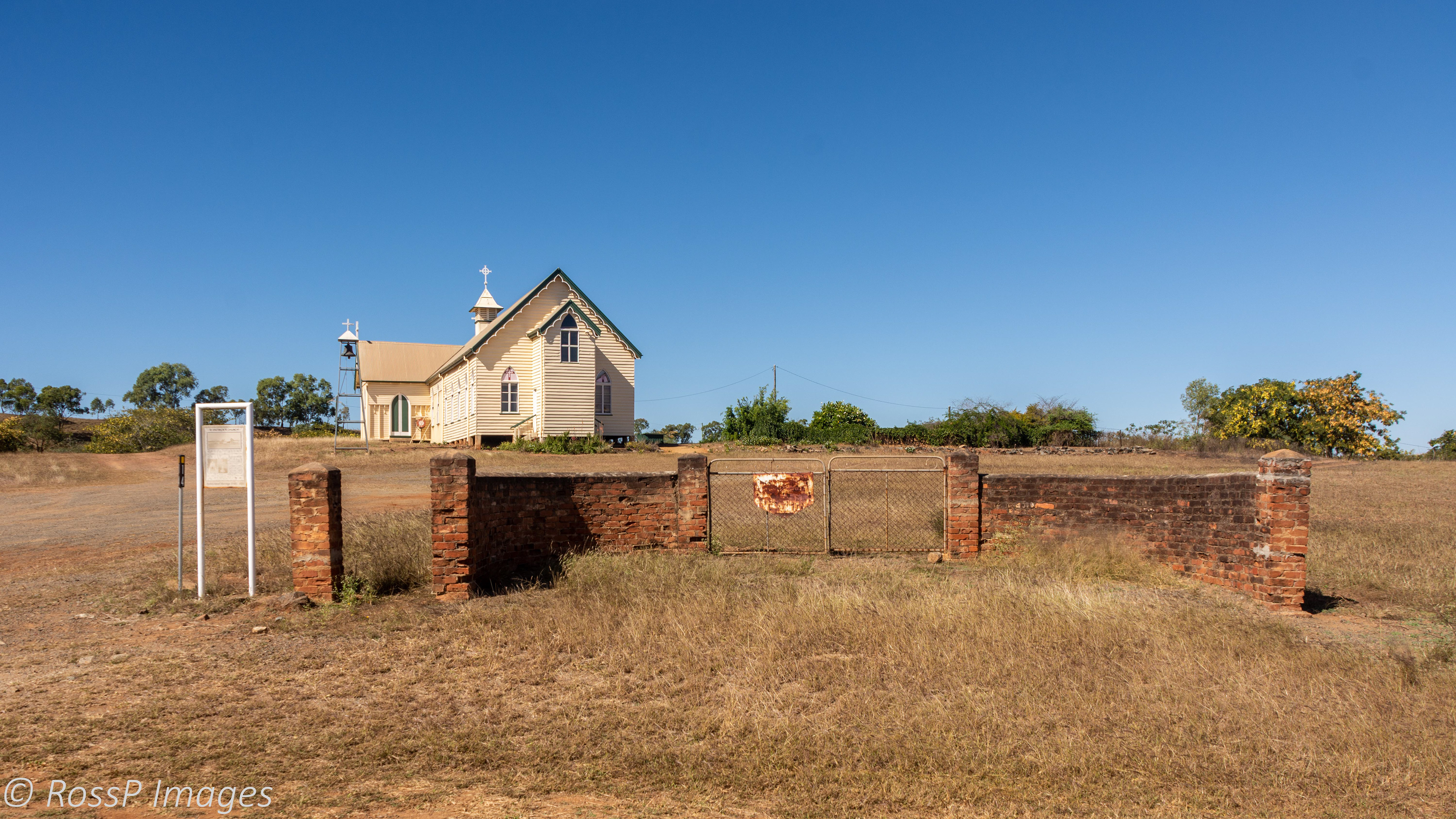
Ravenswood Community Church, formerly a Catholic Church.
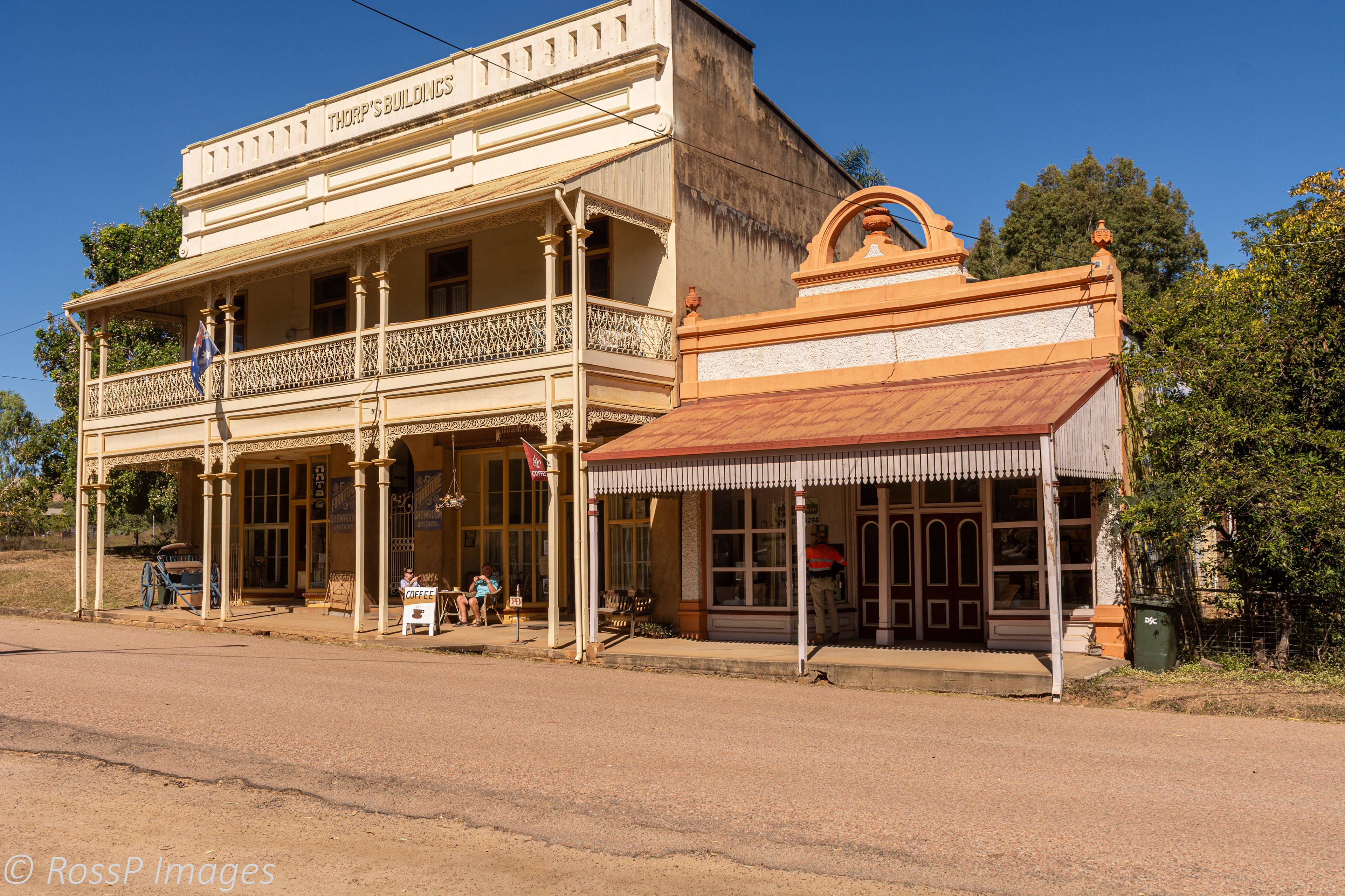
Thorps Building', originally a commercial building in Macrossan Street. Now a Tea Room and B&B with heritage memorabilia on display.
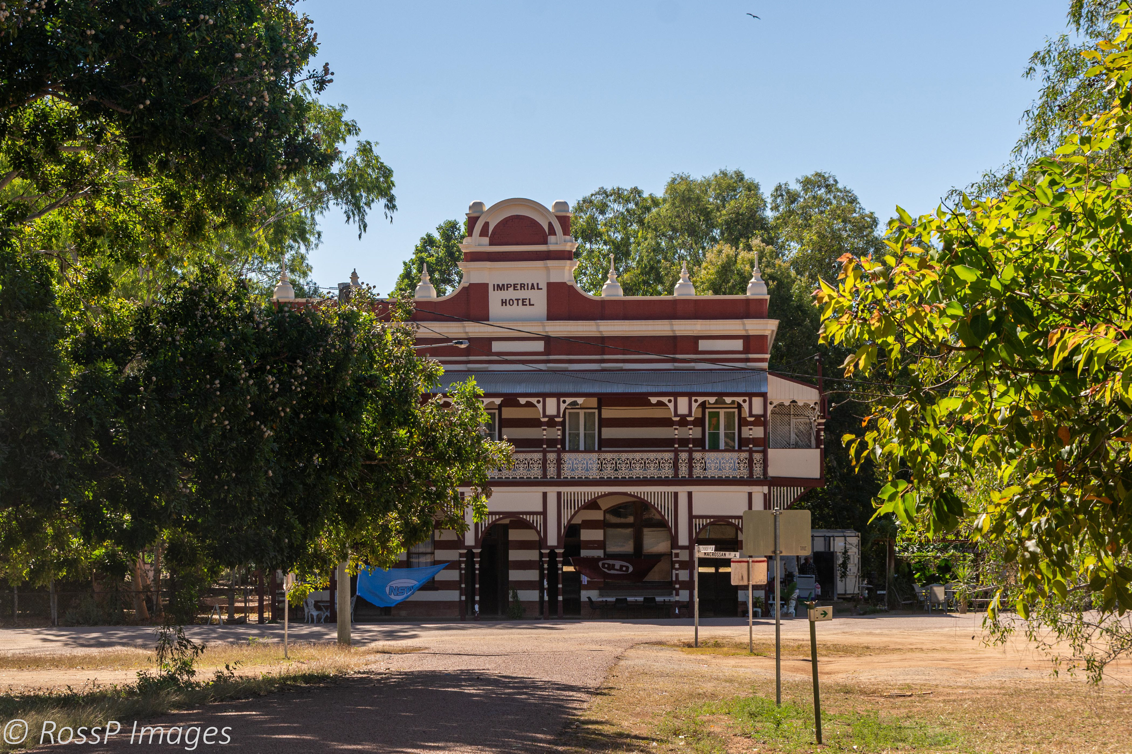
The heritage listed Imperial Hotel in Macrossan Street built in 1902.
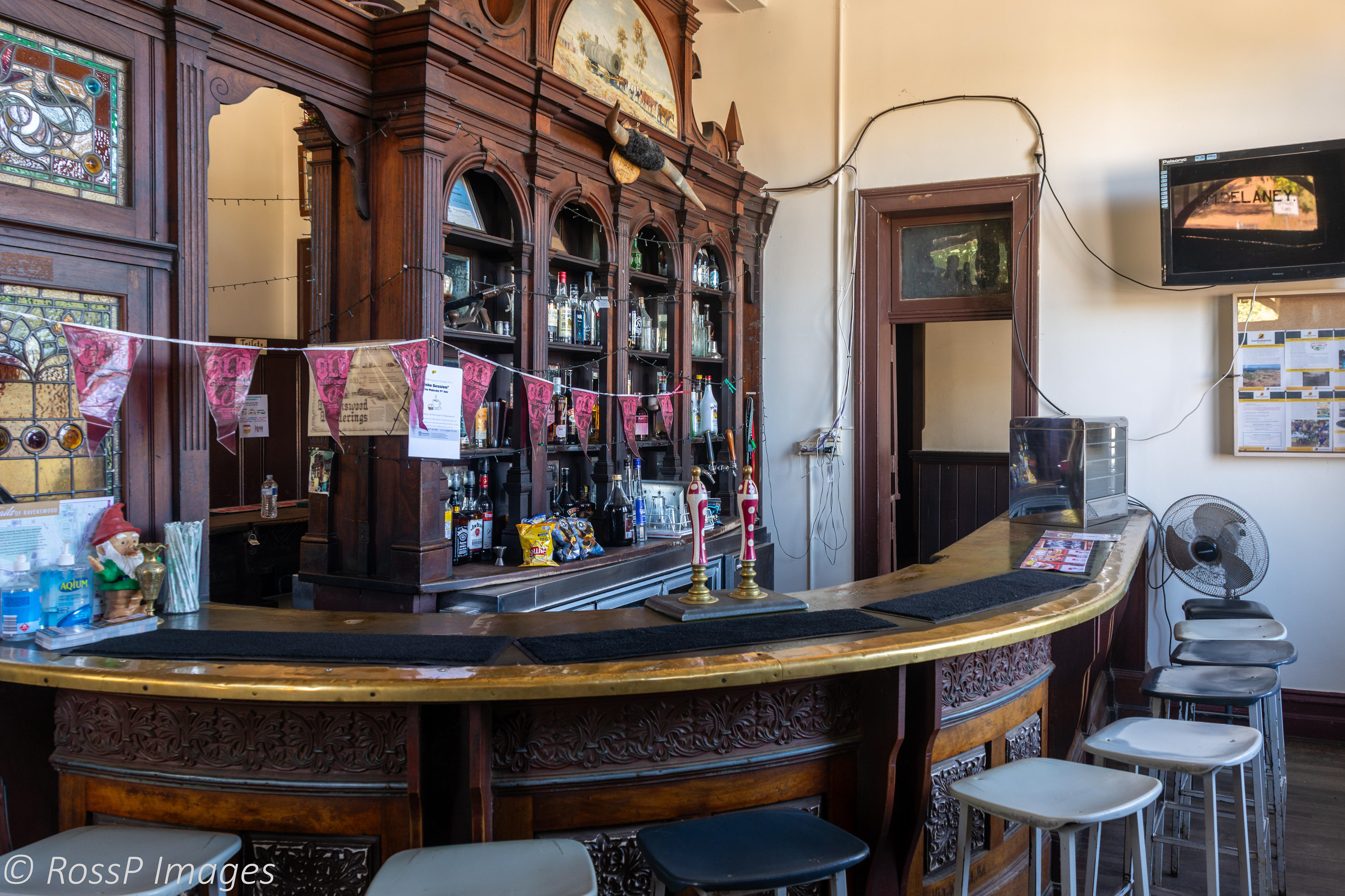
Inside the doors is like stepping back in time with original bar and cabinetry remaining as they were over 100 years ago.
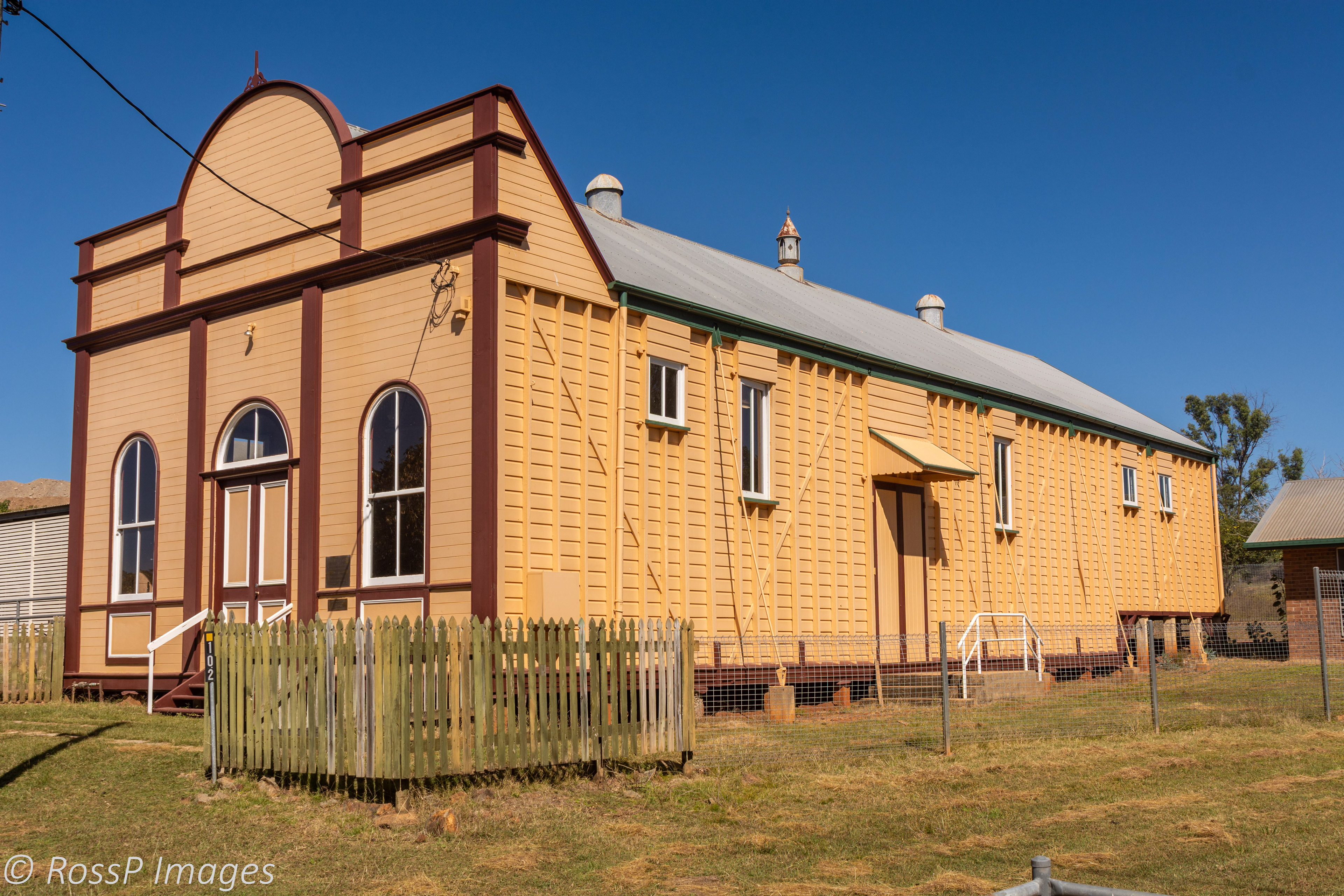
Ravenswood School of Arts built in 1884 is also Heritage Listed.
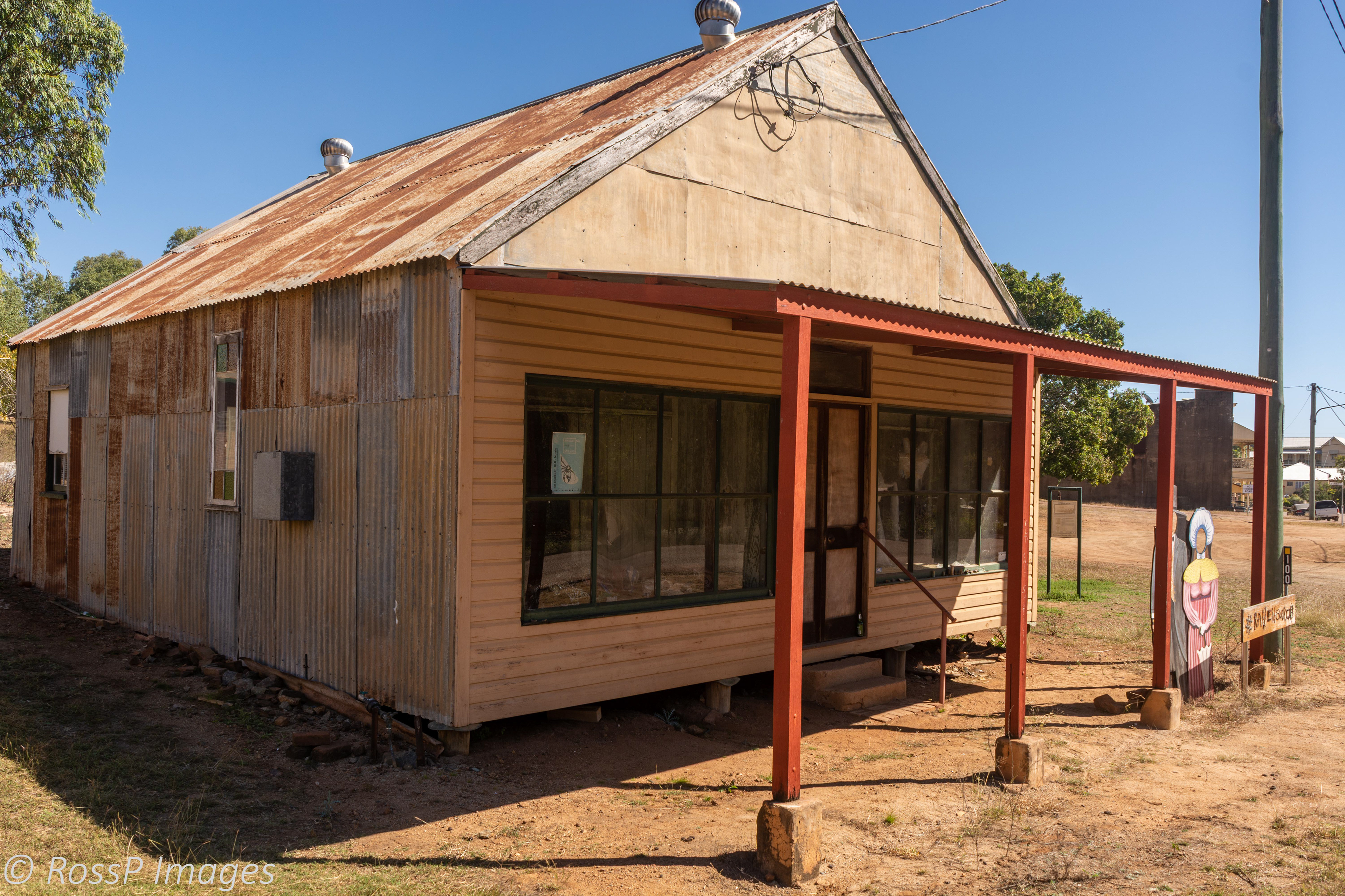
A corrugated iron building with a timber facade is a typical example early construction of the gold rush era.
The Ravenswood Court House and Police Station erected on the site in 1882 - the Court House, Police Station, and Cells, all of which were removed from the site in 1965 and later returned during the 1980's.
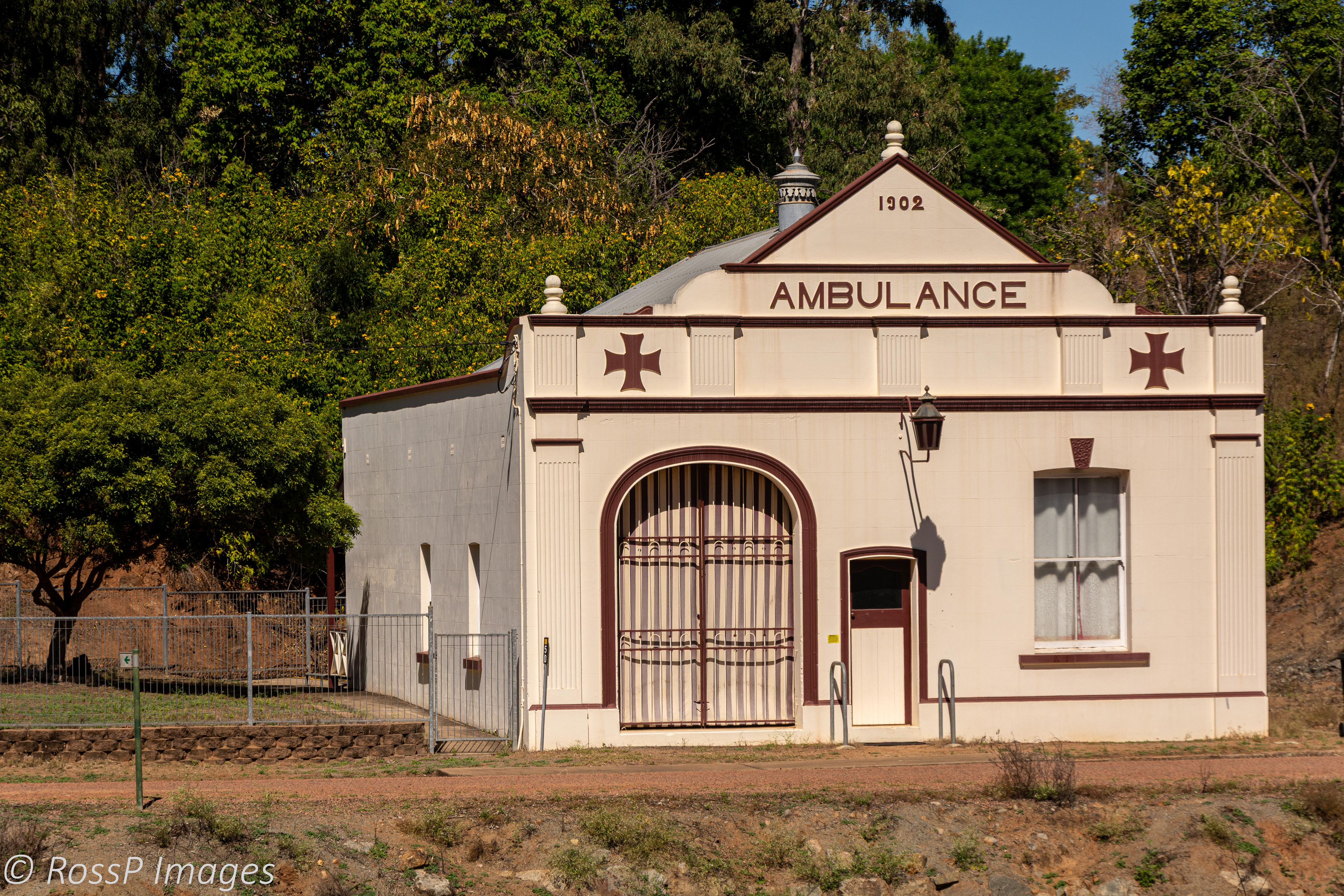
Ambulance building 1902.

Post Office and General Store has all needs covered with fuel and a vintage red telephone box in front.
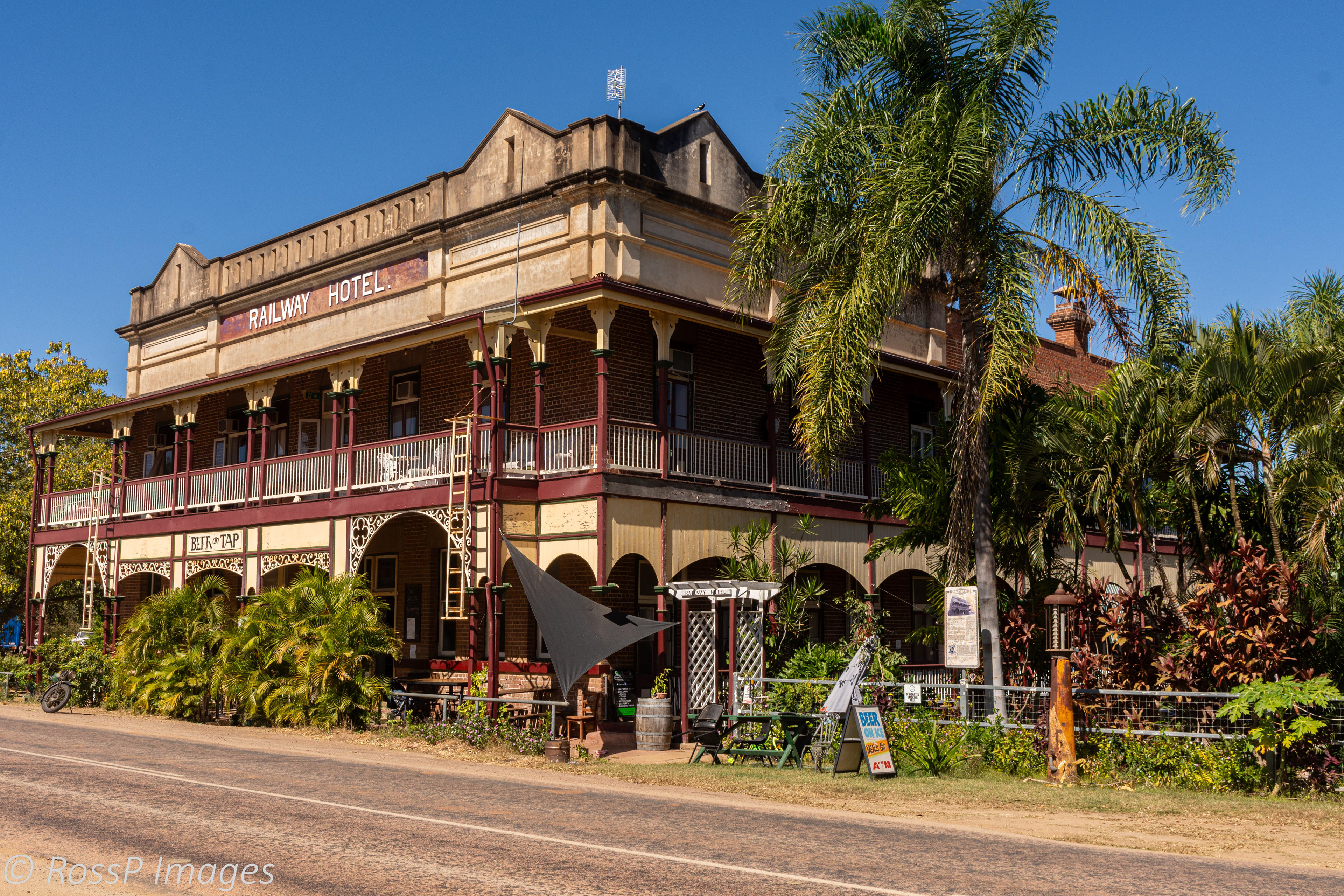
Railway Hotel, Macrossan St Ravenswood - one of the only two remaining out of 48 hotels originally operating during the gold rush era (many reputedly being little more than brothels).
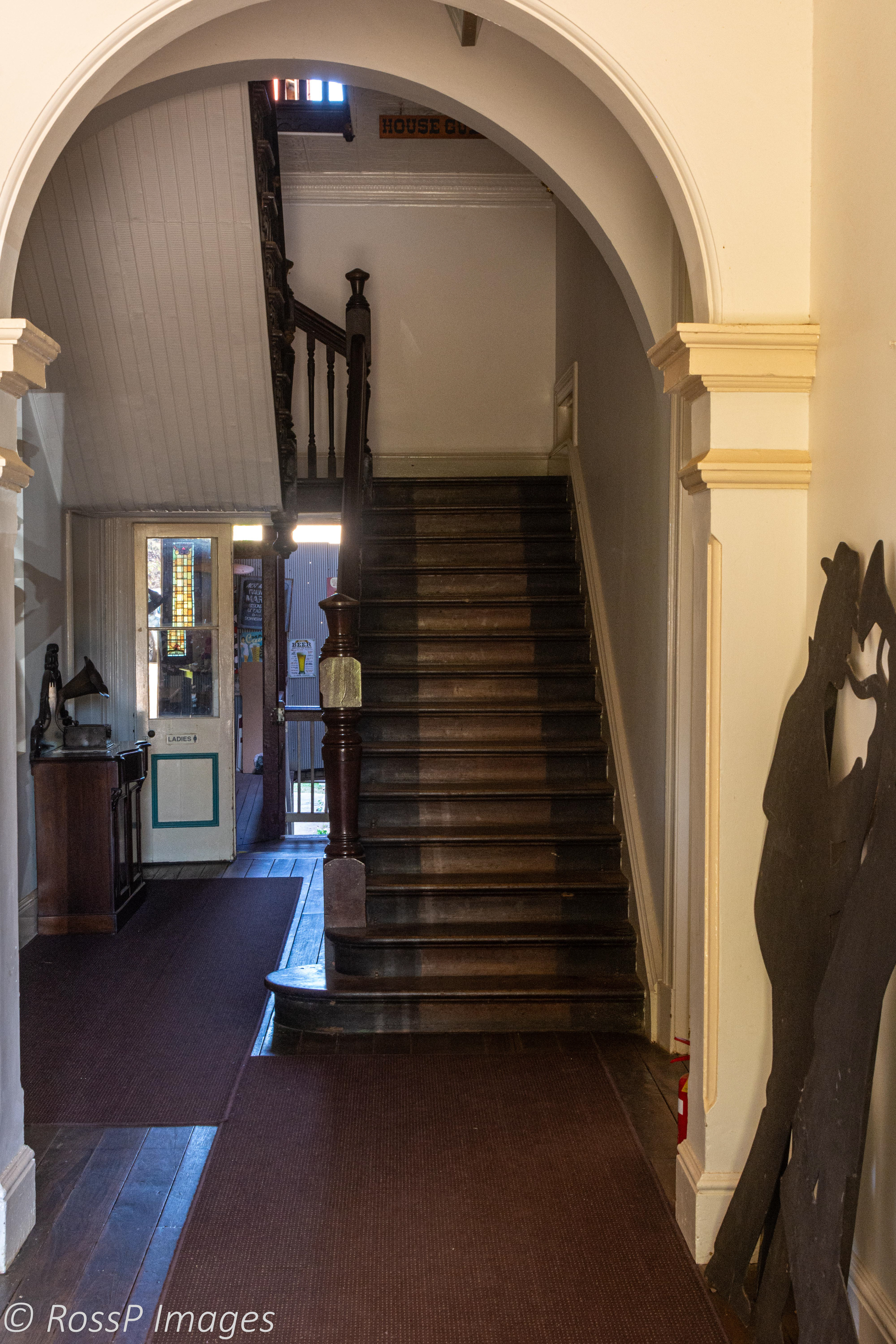
Once again inside is like stepping back in time.
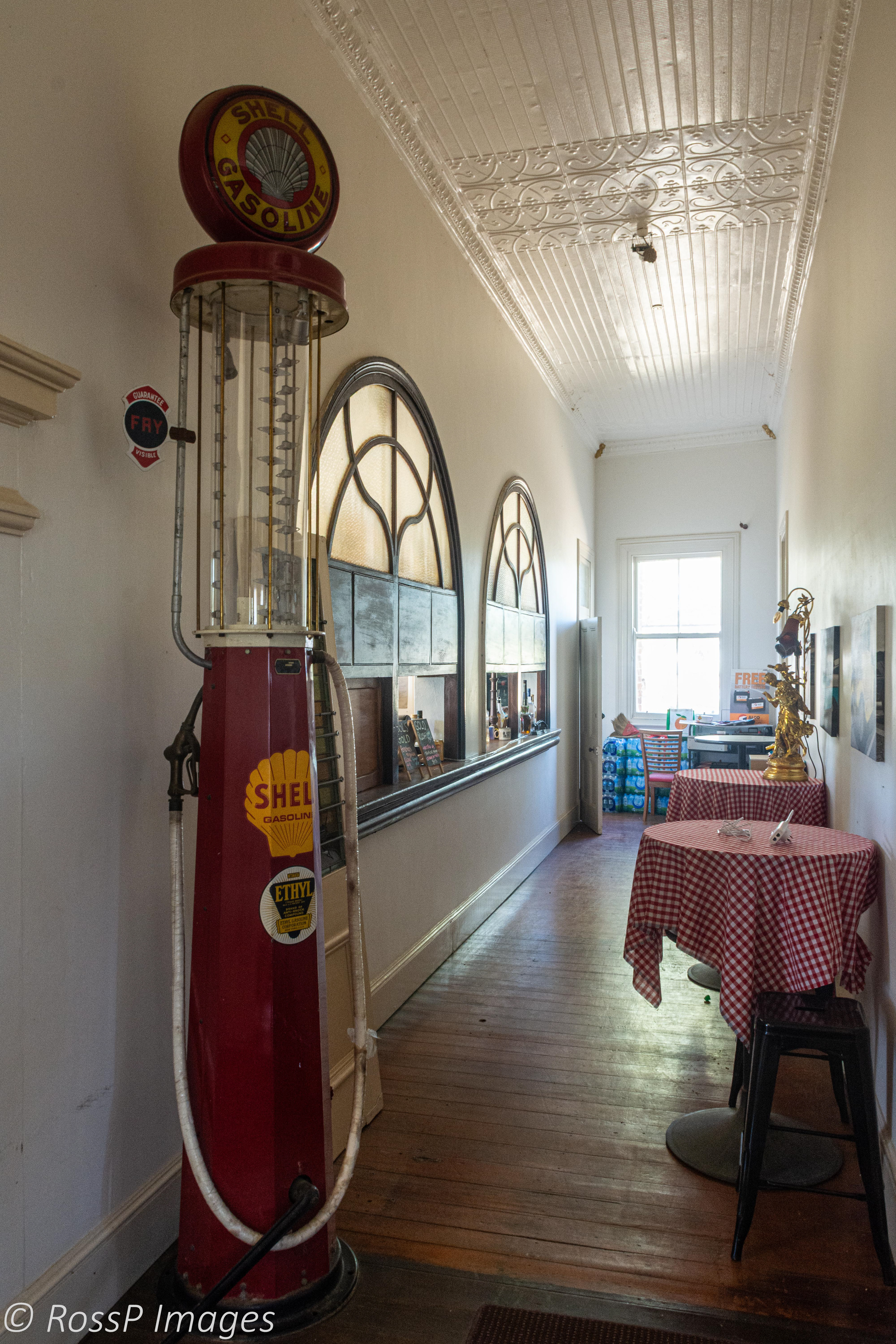
Just some of the memorabilia inside the Railway Hote.
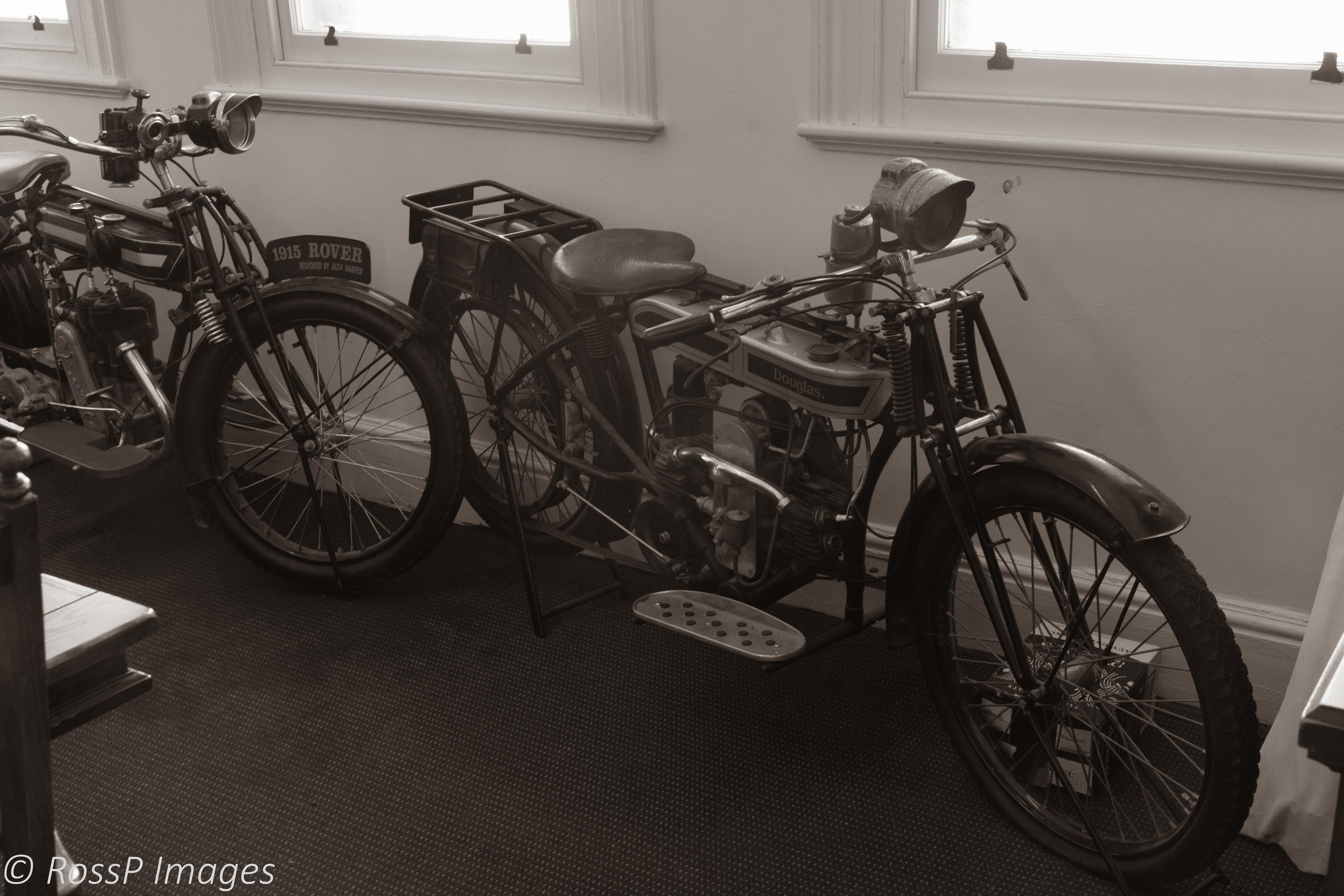
Fully restored and valuable, a 1915 Rover and 1907 Douglas Belt-drive Motorcycle has pride of place in the Railway Hotel's Dining Room.

Nearby is the Ravenswood Railway station.

Remnants of the Heritage Listed Mabel Mill of the New Ravenswood Company. Office and Assay House.
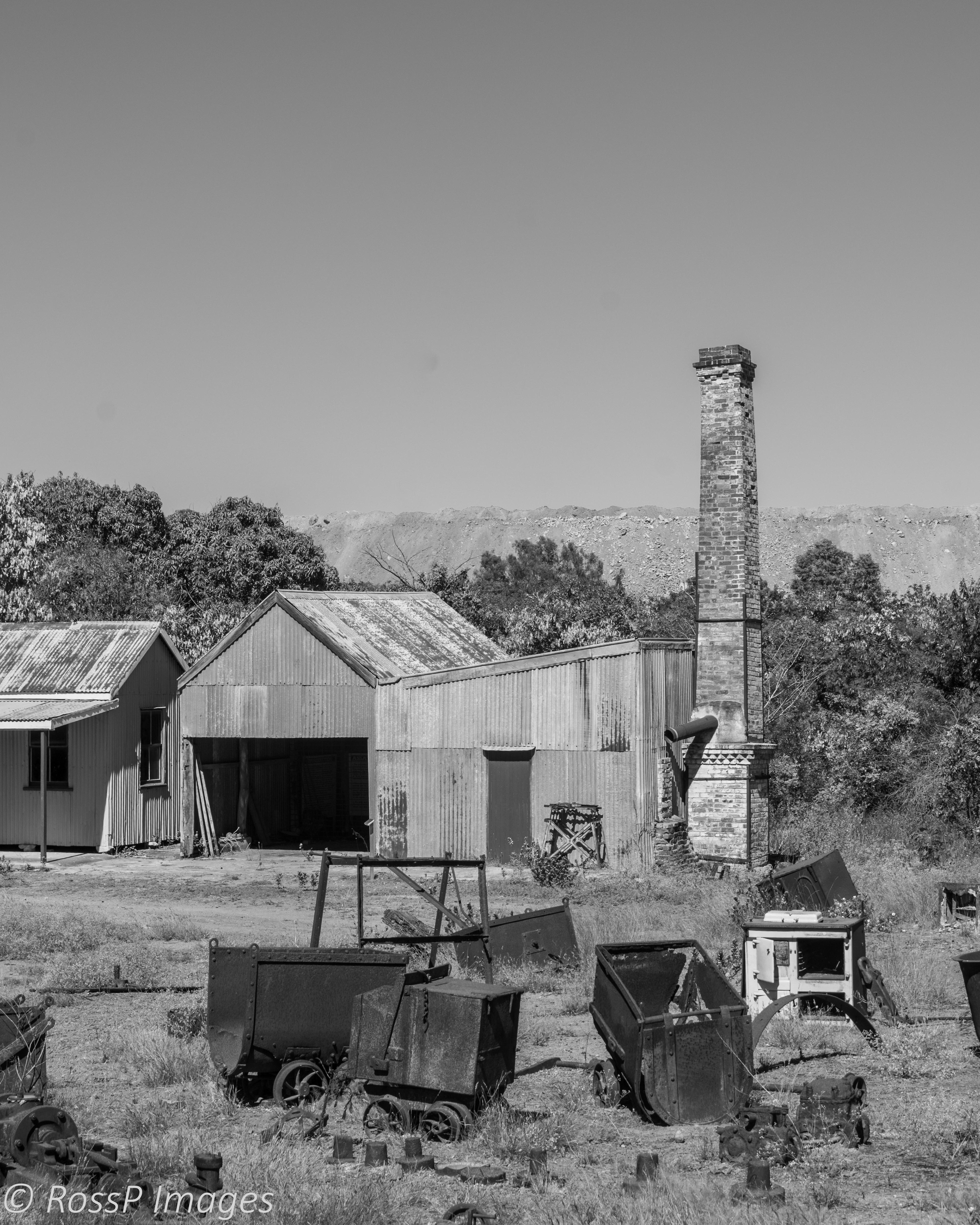
Mabel Mill of the New Ravenswood Company. Office and Assay House with the current open cut mining operations in the background.
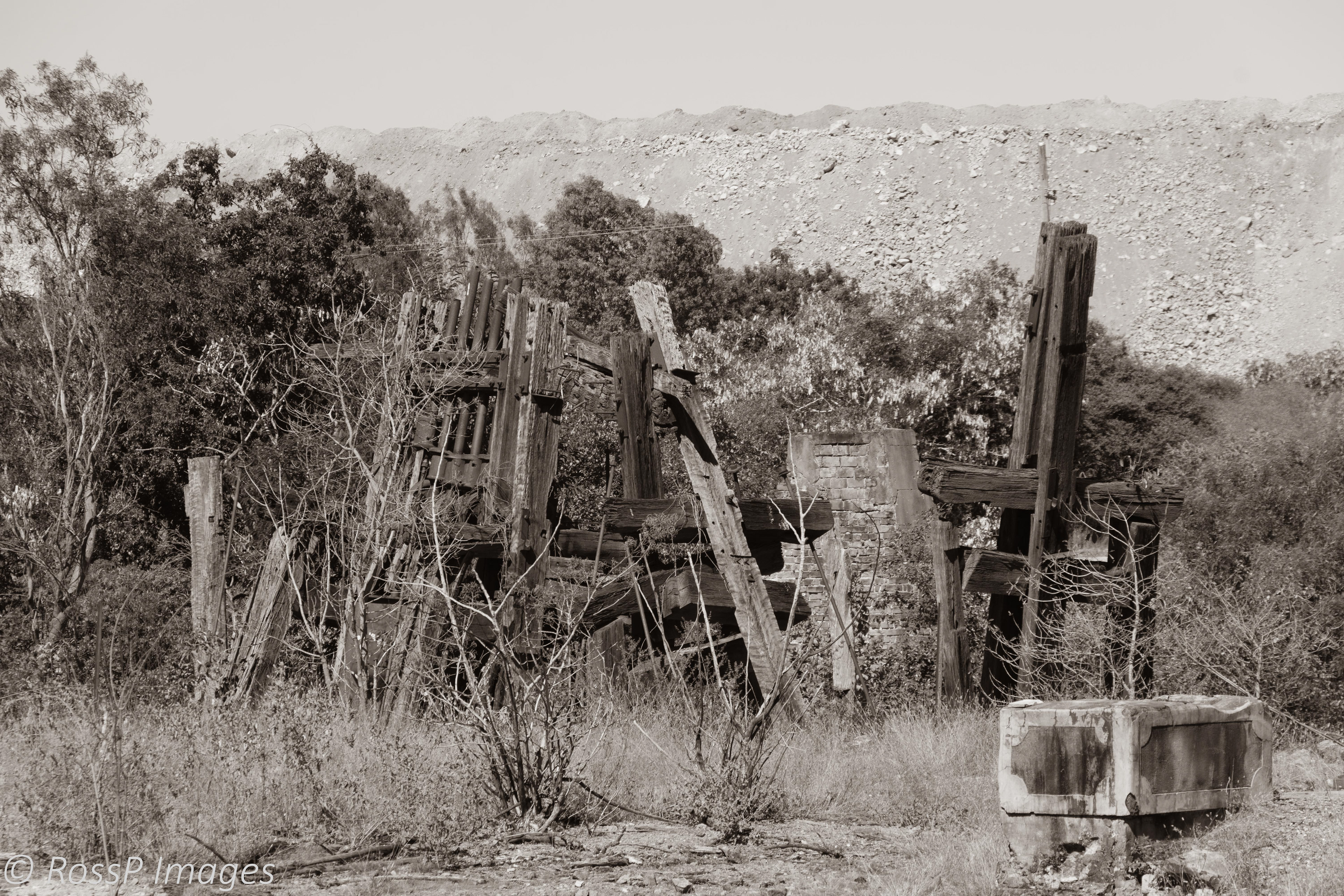
Remnants of the Mabel Mill stamper battery which was located nearby to the furnace building.
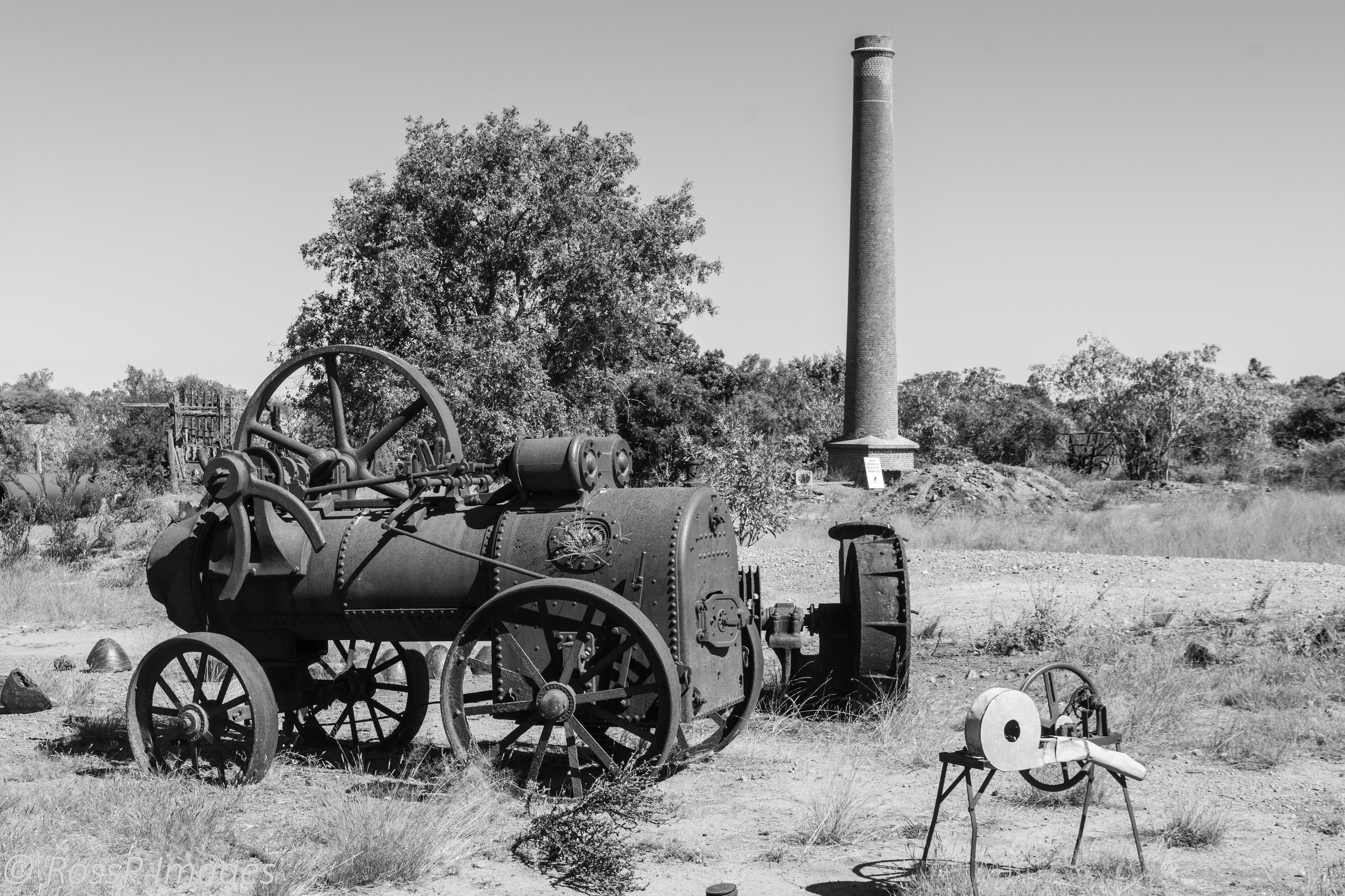
Remnant machinery, stamper battery and furnace stack on the Mabel Mill site.
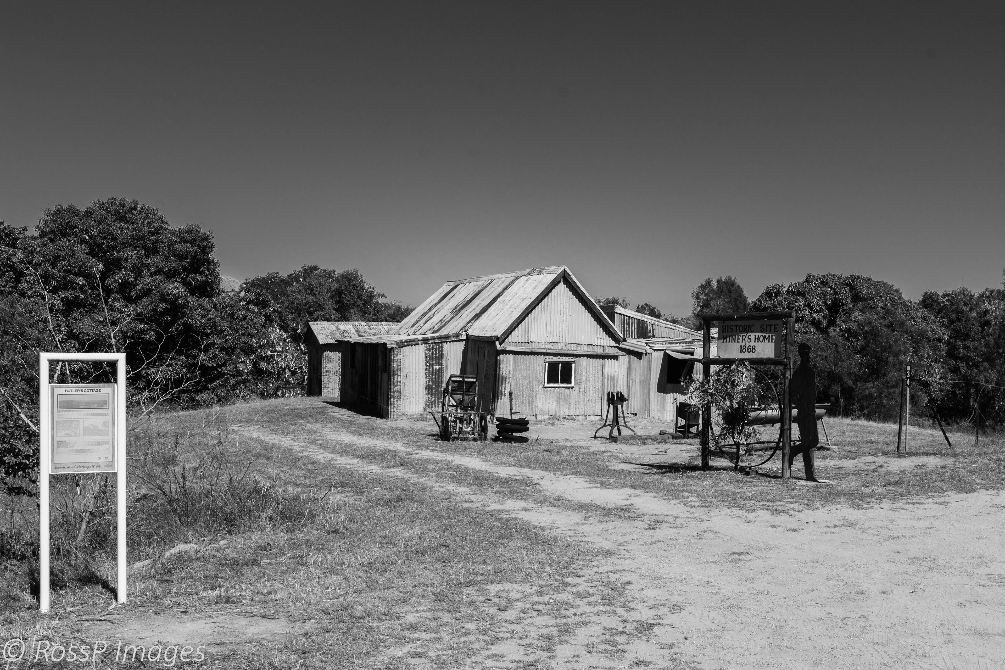
Butler's Cottage a miner's home dating back to 1868.

Inside the miner's cottage is a rudimentary affair but functional.
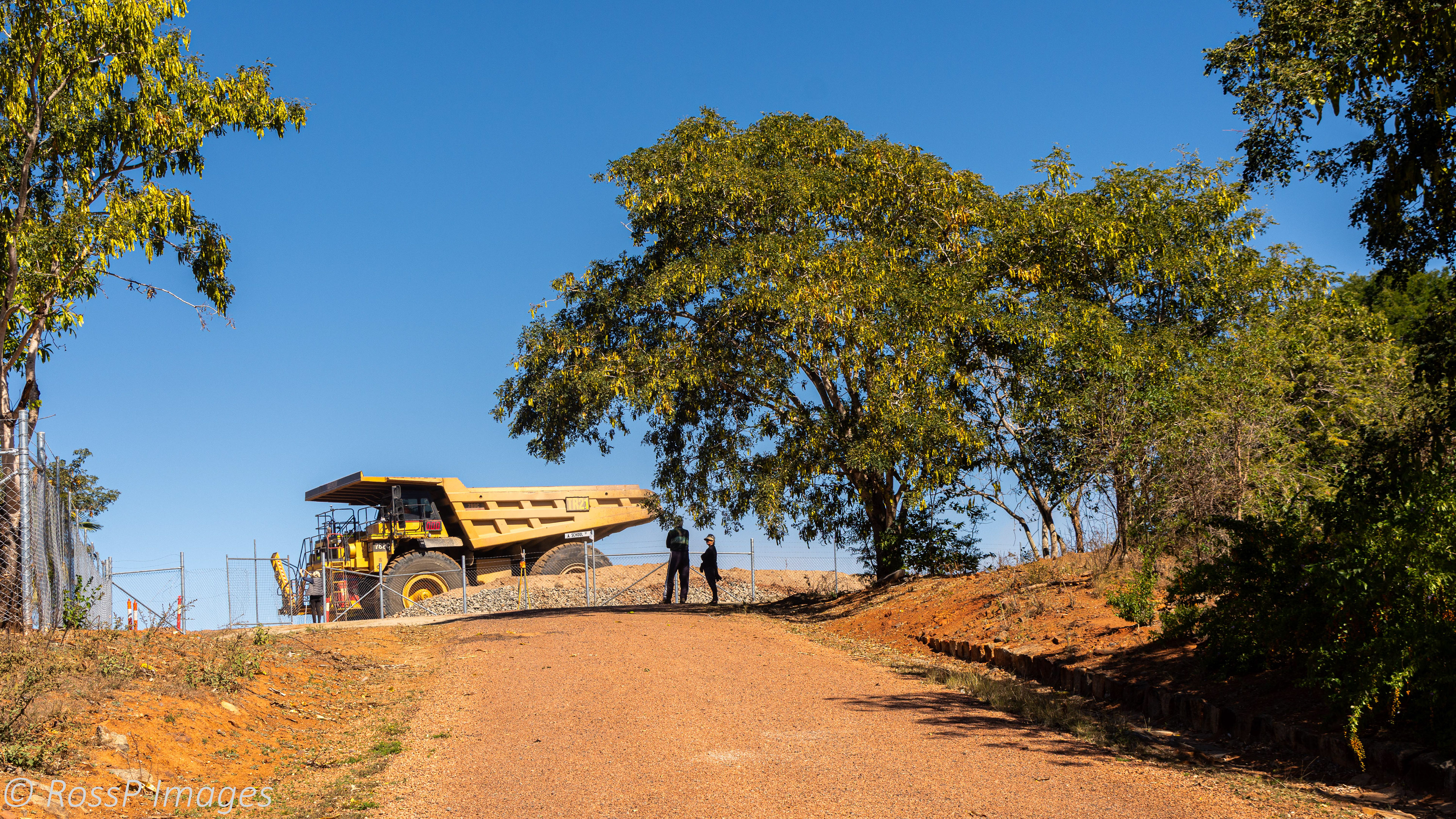
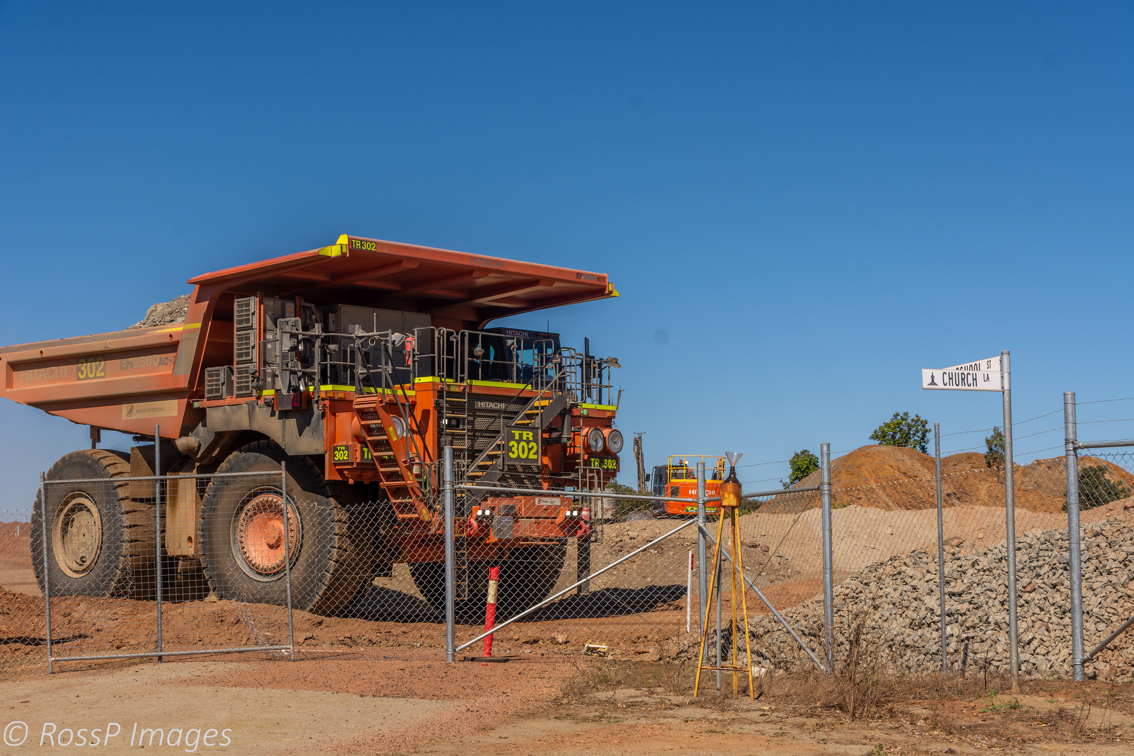
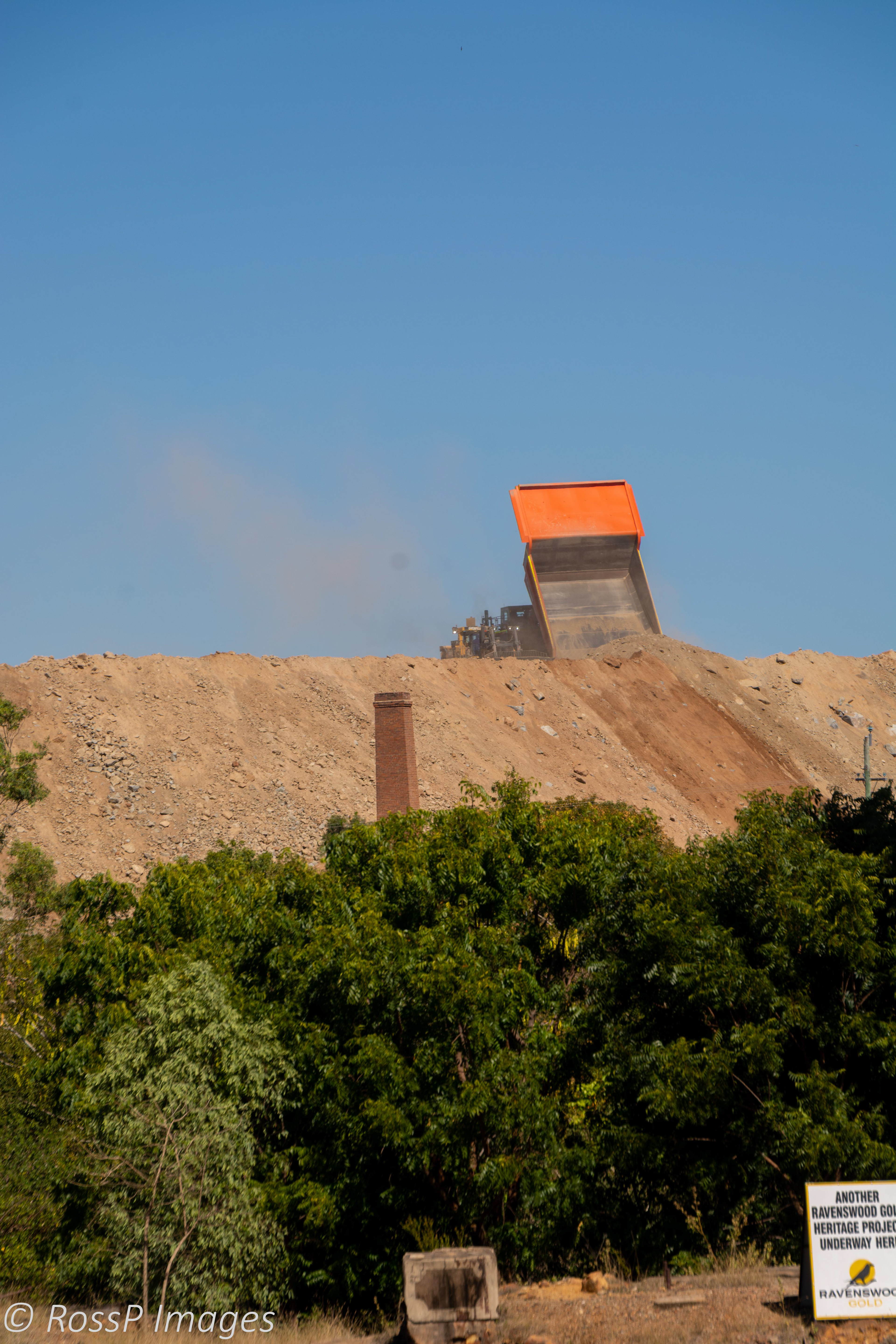
Mining operations of Carpentaria Gold's Ravenswood Expansion Project dwarf the equipment used over a century ago.
Burdekin Falls Dam (lake Dalrymple)
The Burdekin Falls Dam has an uncontrolled concrete spillway across the Burdekin River and the reservoir formed is called Lake Dalrymple. Although the dam was built for irrigation there is also a caravan park and access to the dam for recreational activities.

A panaromic view over the impounded waters of Lake Dalrymple.
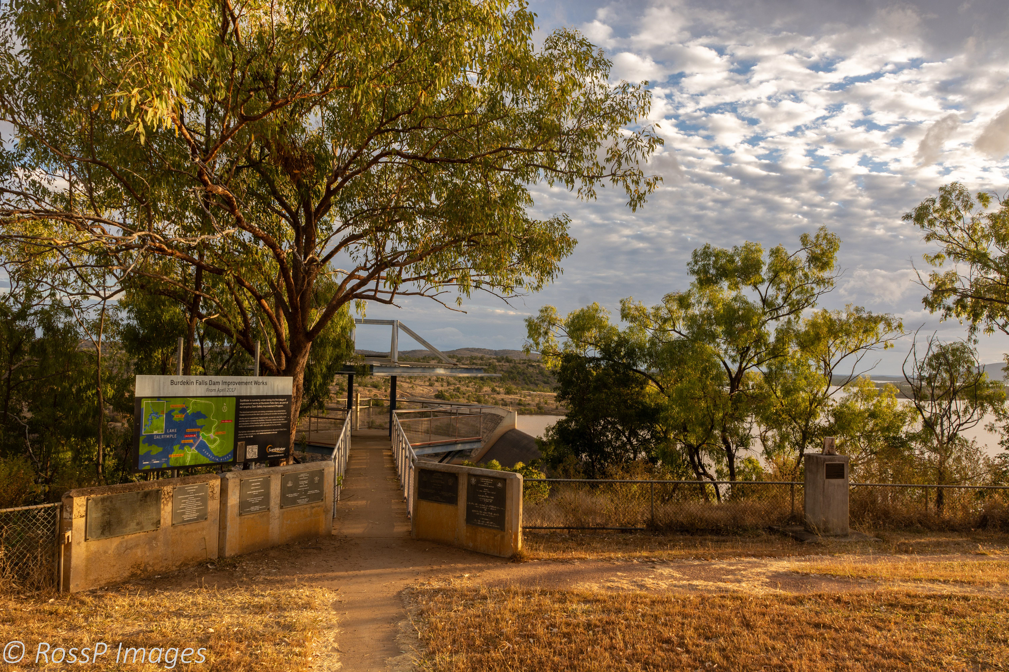
Burdekin Falls Dam lookout at the spillway.

Burdekin Falls Dam Spillway with Lake Dalrymple extending beyond.
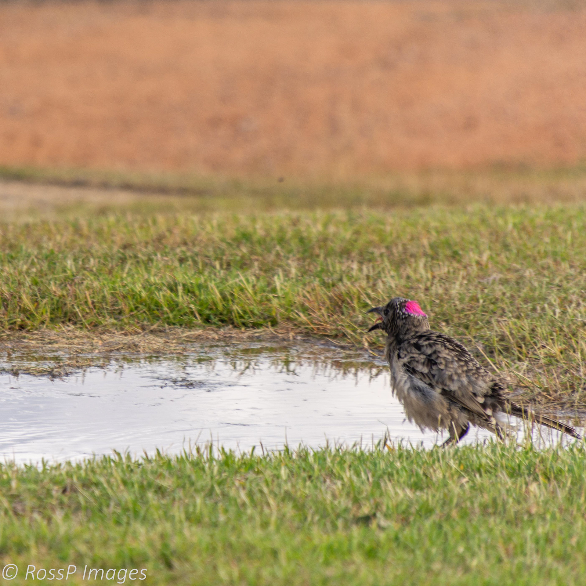
A Spotted Bowerbird displays its erectile pink crest on its nape while enjoying a bath in a puddle of water.

A juvenile Eastern Rosella comes for a drink.
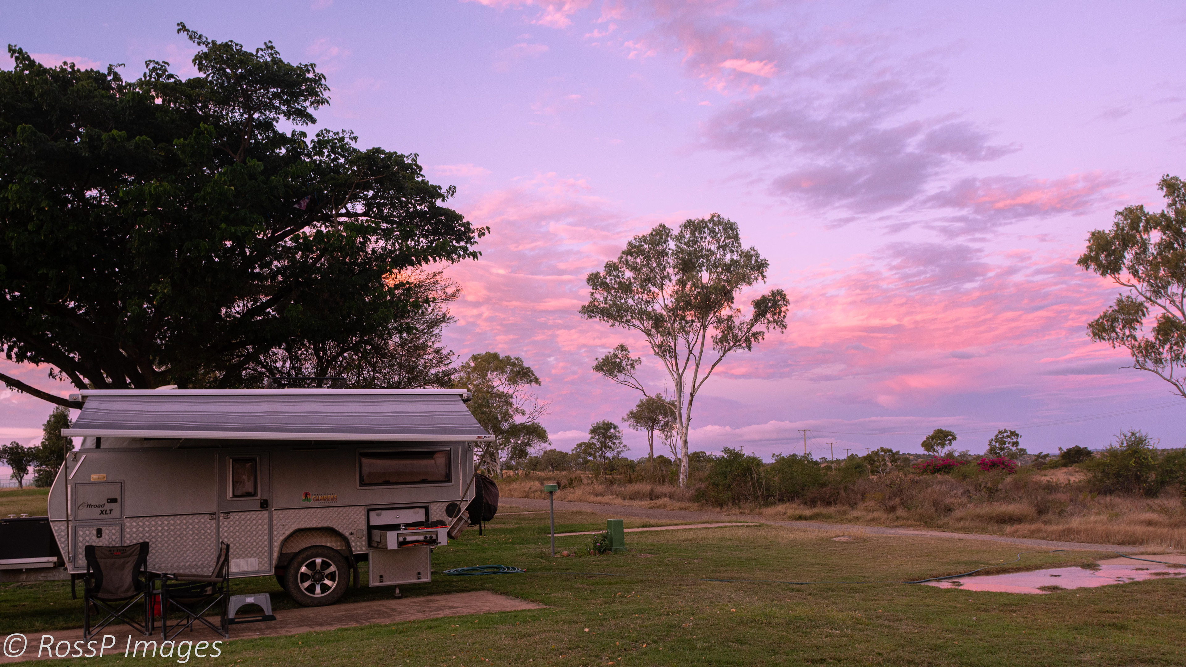
Sunset adds a tinge of pink to the clouds behind the campground.
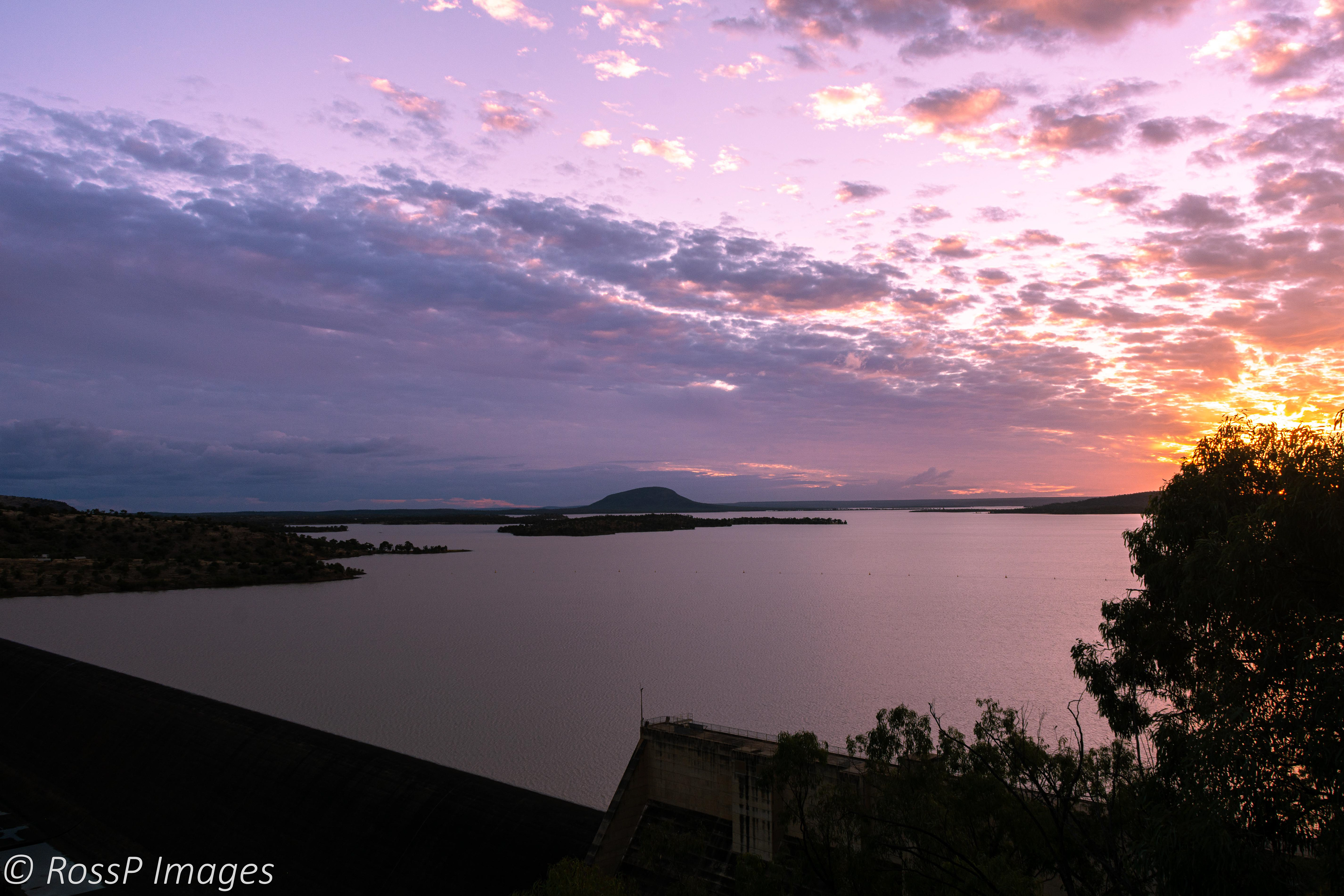
Sunset over lake Dalrymple.
Lake Proserpine (Peter Faust Dam)
Our last destination on our homeward leg of the trip is Lake Proserpine which offers unpowered 'bush camping'.
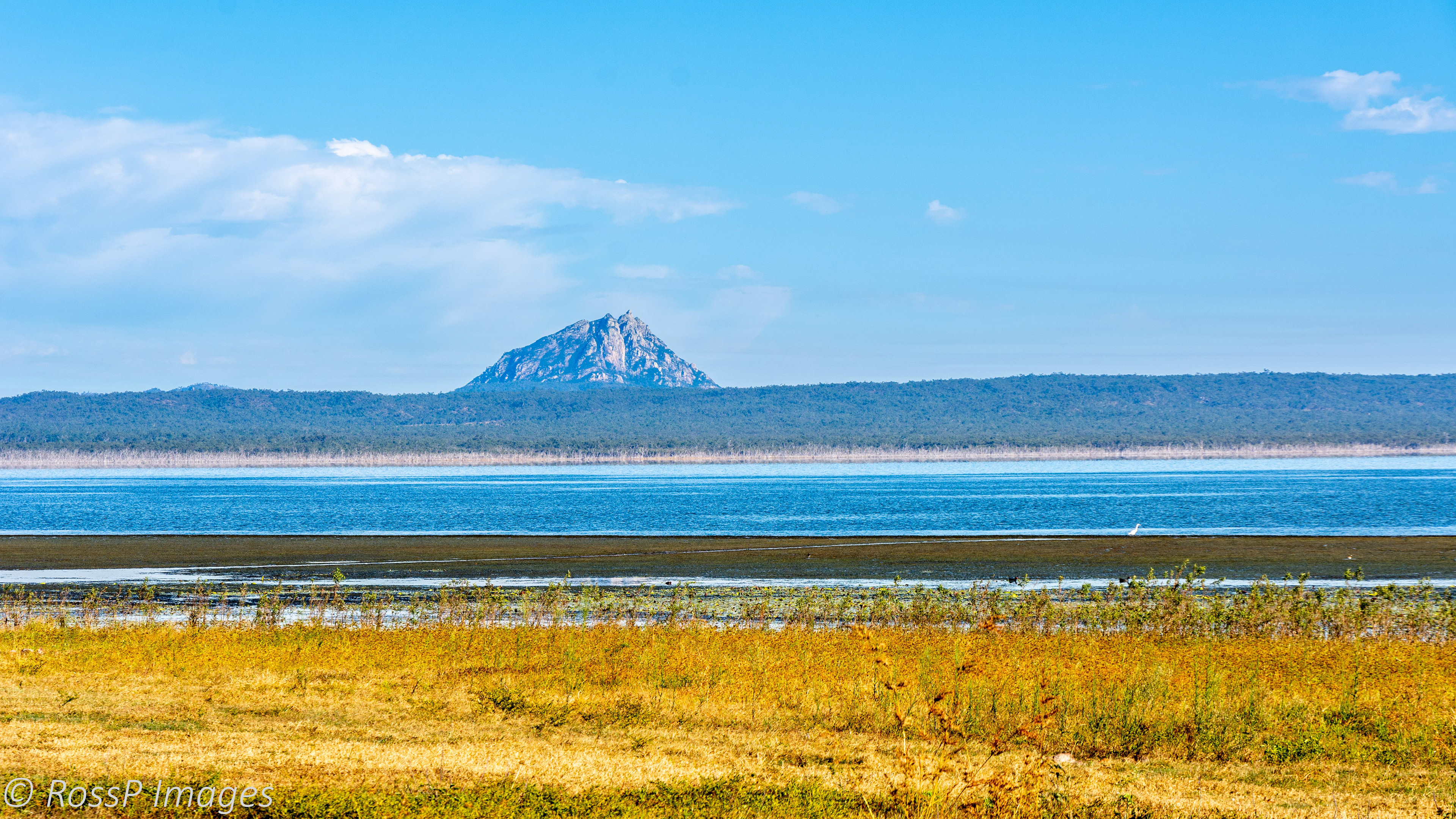
Looking west across Lake Proserpine to a weathered volcanic plug.
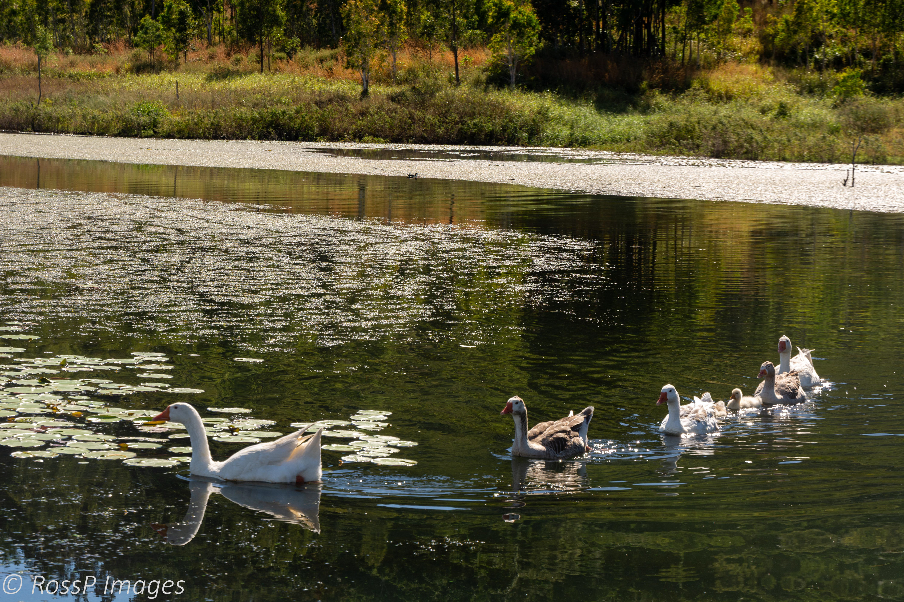
The resident family of geese take to the water in their daily ritual.
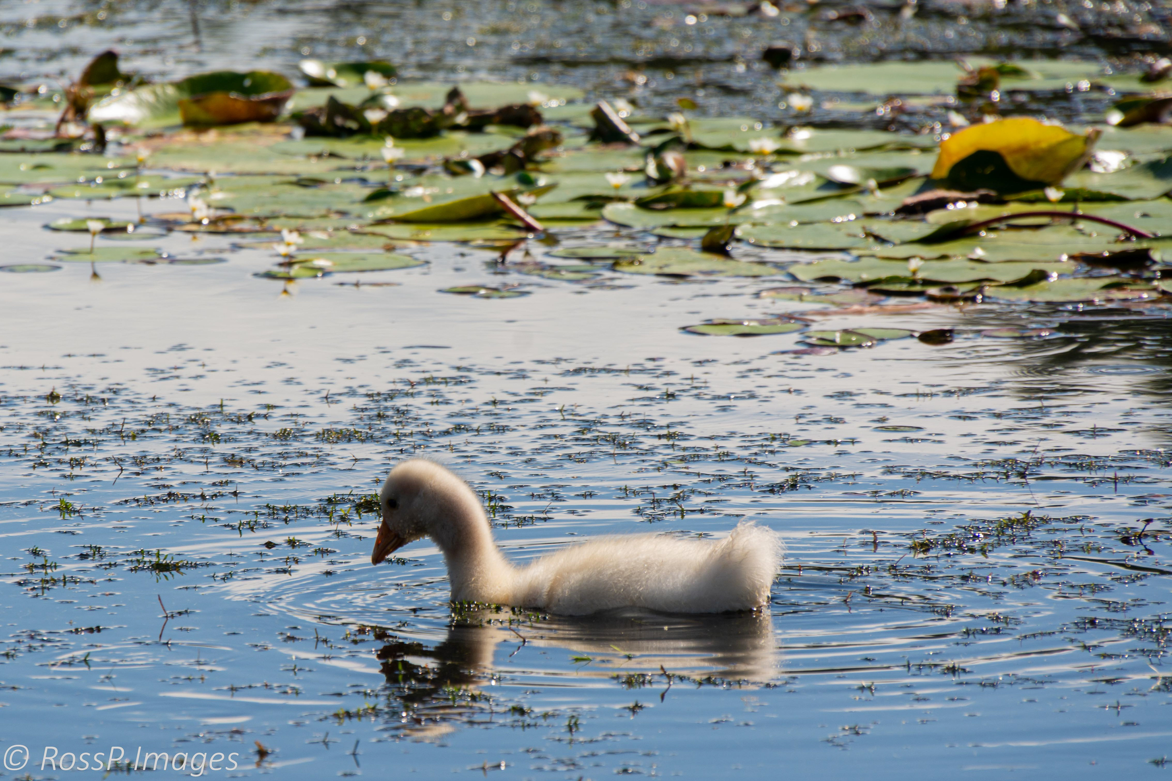
A cute, fluffy gosling bravely hunts alone.
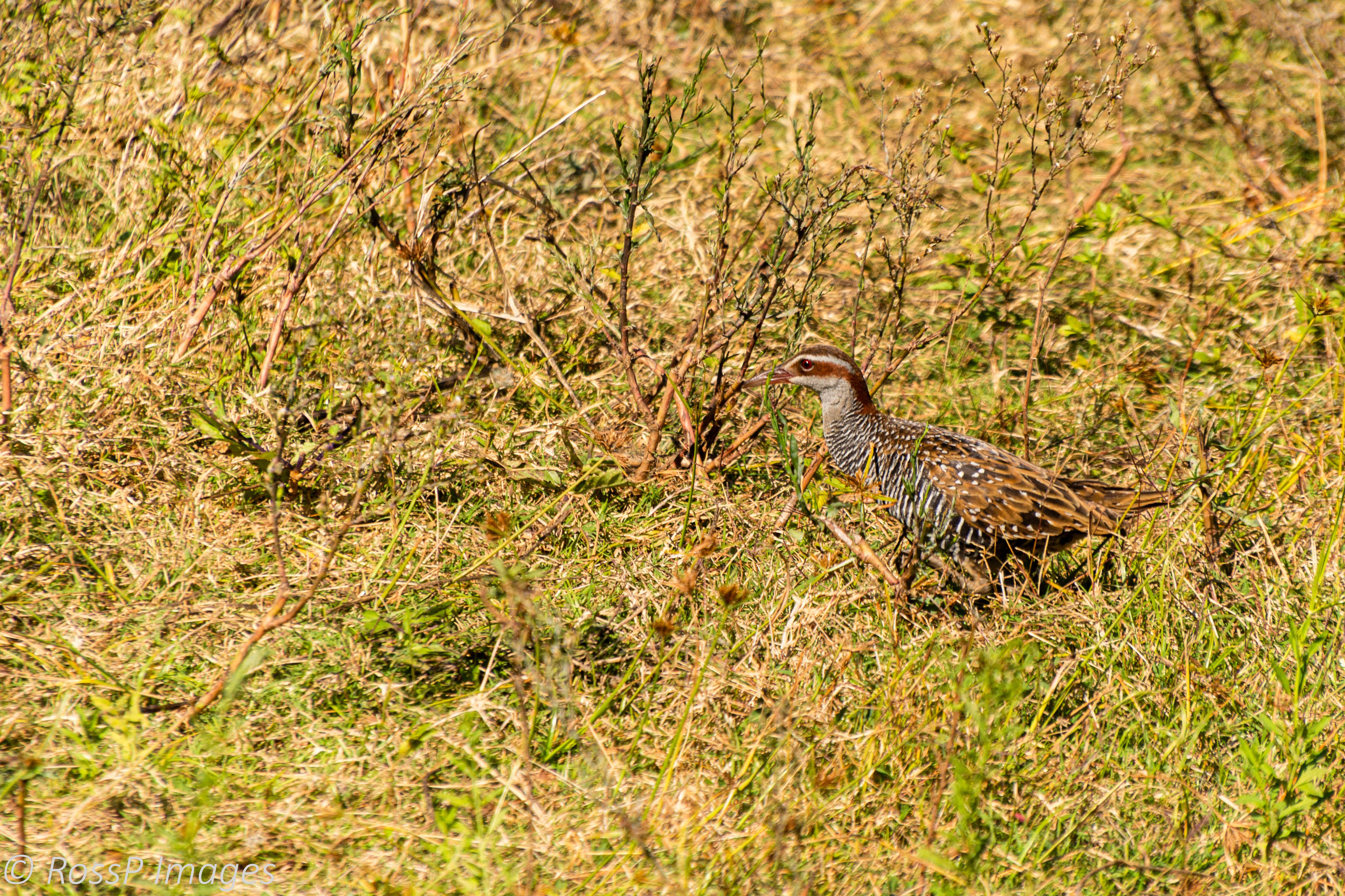
A Buff-banded Rail darts through clumps of rank grass, sedges, rushes of the overgrown wetland vegetation adjacent the lake.

This chick separated from its mother, freezes unsure of which direction to run.
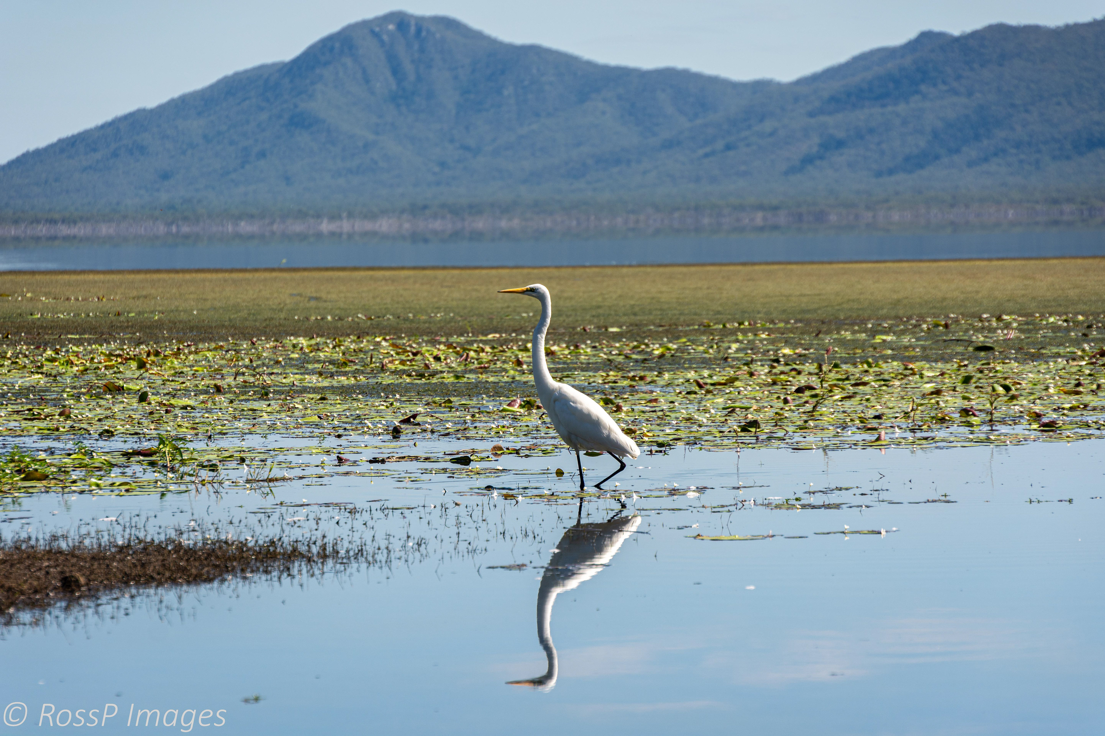
An Eastern Great Egret reflected in the mirrored surface.